|
Derventa
Derventa ( sr-cyrl, Дервента) is a city located in Republika Srpska, an entity of Bosnia and Herzegovina. It is situated in the Posavina region, northwest of the city of Doboj. As of 2013, the town has a total of 11,631 inhabitants, while the municipality has 27,404 inhabitants. Geography The Derventa municipality borders with Brod, Modriča, Doboj, Stanari, Prnjavor and Srbac, as well as Croatia across the Sava river. It has an area of . The town of Derventa lies on the river Ukrina, and roads lead from it to Brod, Kotorsko (Doboj), Prnjavor (Banja Luka) and Srbac. The town has a suburb called ''Derventski Lug'' which has grown substantially in recent years due to growth of Municipality. History From 1929 to 1939, Derventa was part of the Vrbas Banovina and from 1939 to 1941 of the Banovina of Croatia within the Kingdom of Yugoslavia. Prior to the Bosnian War, there was a significant population of ethnic Croats within Derventa, while the majority were Bosniaks. W ... [...More Info...] [...Related Items...] OR: [Wikipedia] [Google] [Baidu] |
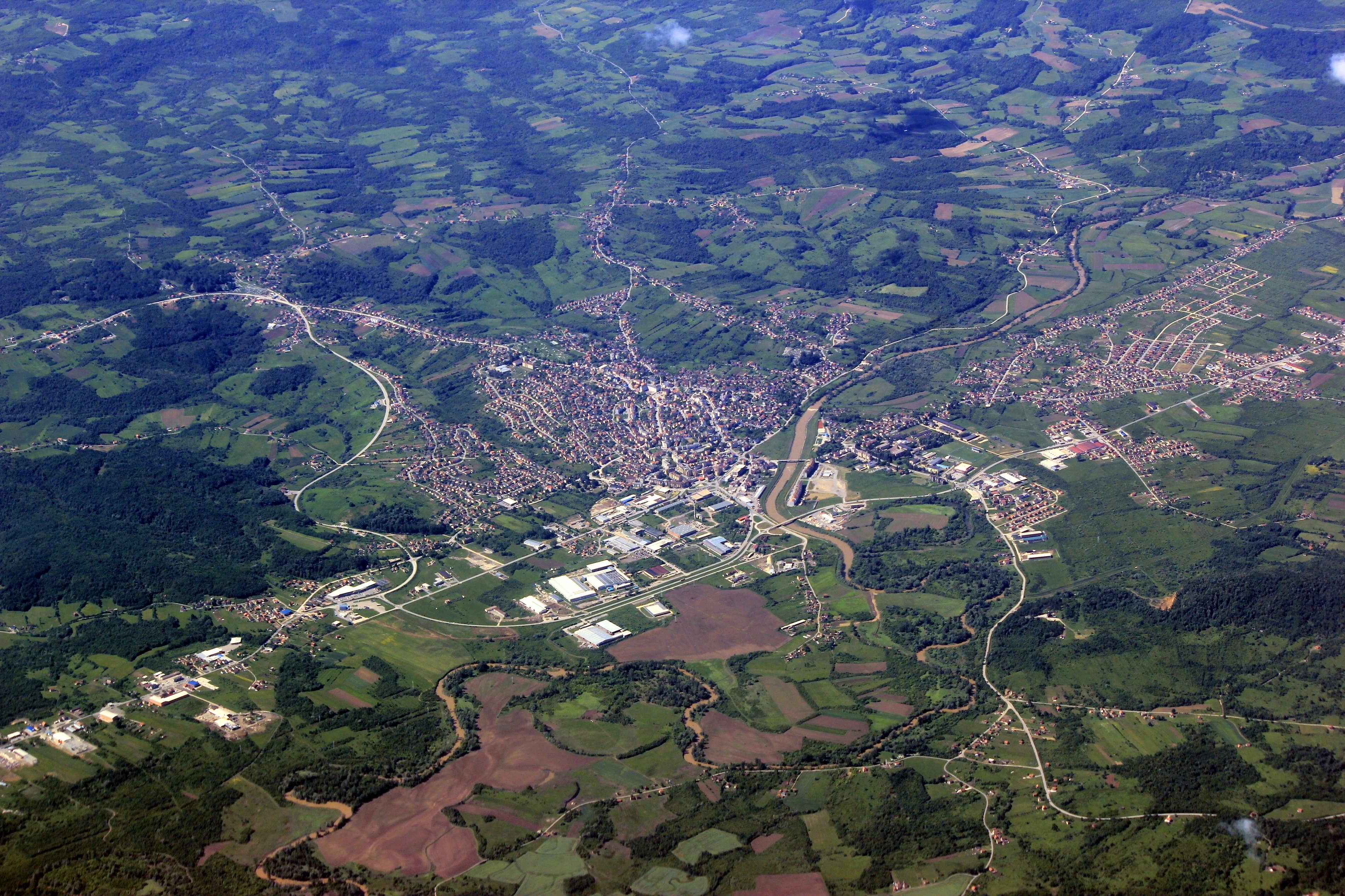
Derventa Aerial
Derventa ( sr-cyrl, Дервента) is a city located in Republika Srpska, an entity of Bosnia and Herzegovina. It is situated in the Posavina region, northwest of the city of Doboj. As of 2013, the town has a total of 11,631 inhabitants, while the municipality has 27,404 inhabitants. Geography The Derventa municipality borders with Brod, Modriča, Doboj, Stanari, Prnjavor and Srbac, as well as Croatia across the Sava river. It has an area of . The town of Derventa lies on the river Ukrina, and roads lead from it to Brod, Kotorsko (Doboj), Prnjavor (Banja Luka) and Srbac. The town has a suburb called ''Derventski Lug'' which has grown substantially in recent years due to growth of Municipality. History From 1929 to 1939, Derventa was part of the Vrbas Banovina and from 1939 to 1941 of the Banovina of Croatia within the Kingdom of Yugoslavia. Prior to the Bosnian War, there was a significant population of ethnic Croats within Derventa, while the majority were Bosniaks. When ... [...More Info...] [...Related Items...] OR: [Wikipedia] [Google] [Baidu] |
Operation Corridor 92
Operation Corridor 92 ( sh-Cyrl-Latn, Операција Коридор 92, Operacija Koridor 92) was the largest operation conducted during the Bosnian War by the Army of Republika Srpska (VRS) against the forces of the Croatian Defence Council (HVO) and the Croatian Army (HV) in the Bosanska Posavina region of northern Bosnia and Herzegovina between 24 June and 6 October 1992. The objective of the offensive was to re-establish a road link between the city of Banja Luka in the west of the country and the eastern parts of the territory controlled by the Bosnian Serbs. The offensive was prompted by the capture of Derventa by the HV and the HVO – a move that blocked the single overland road between the VRS-controlled territories. The VRS successfully captured Derventa and pushed the HVO and the HV north, capturing several towns in the process. In the second phase of the offensive, the VRS reached the Sava River, the border with Croatia, and destroyed a bridgehead held by th ... [...More Info...] [...Related Items...] OR: [Wikipedia] [Google] [Baidu] |
List Of Cities In Bosnia And Herzegovina
This is a list of city, cities and towns with over 10,000 inhabitants (or lower if the municipality has over 20,000 inhabitants) in Bosnia and Herzegovina. For the full list of populated places, see List of populated places in Bosnia and Herzegovina. Organization Apart from entities, cantons and municipalities, Bosnia and Herzegovina also has officially designated cities. Official cities have their own mayor and city council, which is a big difference to the municipalities of Bosnia and Herzegovina, which have a municipal council and mayor. Powers of city councils of official cities are between the government of municipalities and government cantons in the Federation of Bosnia and Herzegovina or a government entity in Republika Srpska. There are thirty two official cities in Bosnia and Herzegovina (as of 2022): *Banja Luka *Bijeljina''Službeni glasnik Republike Srpske br. 70/12'' *Bihać *Bosanska Krupa *Cazin *Čapljina *Derventa *Doboj *Goražde *Gračanica, Bosnia and He ... [...More Info...] [...Related Items...] OR: [Wikipedia] [Google] [Baidu] |
Vrbas Banovina
The Vrbas Banovina or Vrbas Banate ( sh-Latn-Cyrl, separator=" / ", Vrbaska banovina, Врбаска бановина), was a province ( banovina) of the Kingdom of Yugoslavia between 1929 and 1941. It was named after the Vrbas River and consisted mostly of territory in western Bosnia (part of historical and present-day Bosnia and Herzegovina) with its capital at Banja Luka. Dvor district of present-day Croatia was also part of the Vrbas Banovina. Borders According to the 1931 Constitution of the Kingdom of Yugoslavia, :''The Vrbas Banovina is bounded, from the north-eastern boundary of the district of Dvor (south-west of Kostajnica) by the river Una to the point where it flows into the Sava; it then follows the course of the Sava, which it leaves to follow the eastern boundaries of the districts of Derventa and Gračanica, as far as the river Bosna at the village of Dolac. It then continues along the south-western boundary of the district of Maglaj as far as the intersection ... [...More Info...] [...Related Items...] OR: [Wikipedia] [Google] [Baidu] |
Prnjavor, Bosnia And Herzegovina
Prnjavor ( sr-cyr, Прњавор, ) is a town and municipality located in Republika Srpska, an entity of Bosnia and Herzegovina, between cities of Banja Luka and Doboj. According to the 2013 census, the town has a population of 8,120 inhabitants, with 35,956 inhabitants in the municipality. Geography Physical geography The municipality is located in the basin of the Ukrina river and is characterized by a mostly lowland hilly terrain configuration with the highest peak of 594m (mountain Ljubić). The Municipality of Prnjavor is shielded on all sides by low mountains such as Ljubić (south) and Motajica (north). The town of Prnjavor is located at an altitude of 185m. Other thant the river Ukrina which forms in the Municipality of Prnjavor by merging of the Big and Small Ukrina near the village of Kulaši, there are also the rivers of Vijaka and Lišnja and various other streams. On the river Vijaka in the foothills of Ljubić there is a man made lake Drenova and further downst ... [...More Info...] [...Related Items...] OR: [Wikipedia] [Google] [Baidu] |
Srbac
Srbac ( sr-cyr, Србац) is a town in Republika Srpska, an entity of Bosnia and Herzegovina, located about north of Banja Luka. As of 2013, it has a population of 17,587 inhabitants, while the town of Srbac has a population of 2,707 inhabitants. Geography Physical geography The municipality of Srbac is situated at the coordinates of on the right bank of the Sava, across Davor, at the confluence of the Vrbas into Sava, and about downstream from Gradiška. The area around Srbac is mountainous woodland to the south-east (40% of the total area) and farmland to the south-west (60% of total area). The city itself is built in the Pannonian plain, which is located on the transition between low mountain areas and flat farmlands. The mountain ranges to the south-east are called Motajica and the highest peak is called Gradina at 652m above sea level. The lowest point is 89m in the small village of Vlaknica along the Sava river. Political geography The Municipality of Srbac is ... [...More Info...] [...Related Items...] OR: [Wikipedia] [Google] [Baidu] |
Stanari
Stanari ( sr-cyrl, Станари) is a village and municipality located in Republika Srpska, an entity of Bosnia and Herzegovina. It was established in 2014, after it split from Doboj municipality. As of 2013, it has a population of 6,958 inhabitants, while Stanari itself has a population of 1,015 inhabitants. Geography Physical geography The municipality is located in the basin of the Ukrina river in the area of Krnjin and is characterized by a mostly lowland hilly terrain configuration with a minimum altitude of 138 m (Brestovo) and a maximum altitude of 343 m (Radnja Donja). The municipality of Stanari has three hilly peaks with an altitude of more than 300 m, located on three different sides of the territorial unit of the municipality of Stanari. Political geography The municipality is located in the northeastern part of Republika Srpska on coordinates of eastern longitude 17°49′46″ and 44°44′50″ north latitude and borders the city of Doboj, and the municipal ... [...More Info...] [...Related Items...] OR: [Wikipedia] [Google] [Baidu] |
Banovina Of Croatia
The Banovina of Croatia or Banate of Croatia ( sh-Latn-Cyrl, separator=" / ", Banovina Hrvatska, Бановина Хрватска) was an autonomous province ( banovina) of the Kingdom of Yugoslavia between 1939 and 1941. It was formed by a merger of Sava and Littoral Banovina, Littoral Banovinas of the Kingdom of Yugoslavia, banovinas into a single autonomous entity, with small parts of the Drina Banovina, Drina, Zeta Banovina, Zeta, and Danube Banovina, Danube banovinas also included. Its capital was Zagreb and it included most of present-day Croatia along with portions of Bosnia and Herzegovina and Serbia. Its sole Ban of Croatia, Ban during this period was Ivan Šubašić. Background In the Vidovdan Constitution of 1921, the Kingdom of Serbs, Croats and Slovenes had established 33 administrative districts, each headed by a government-appointed prefect. Both the Vidovdan Constitution in general and the administrative districts in particular were part of the design of Nikola Pa ... [...More Info...] [...Related Items...] OR: [Wikipedia] [Google] [Baidu] |
Posavina
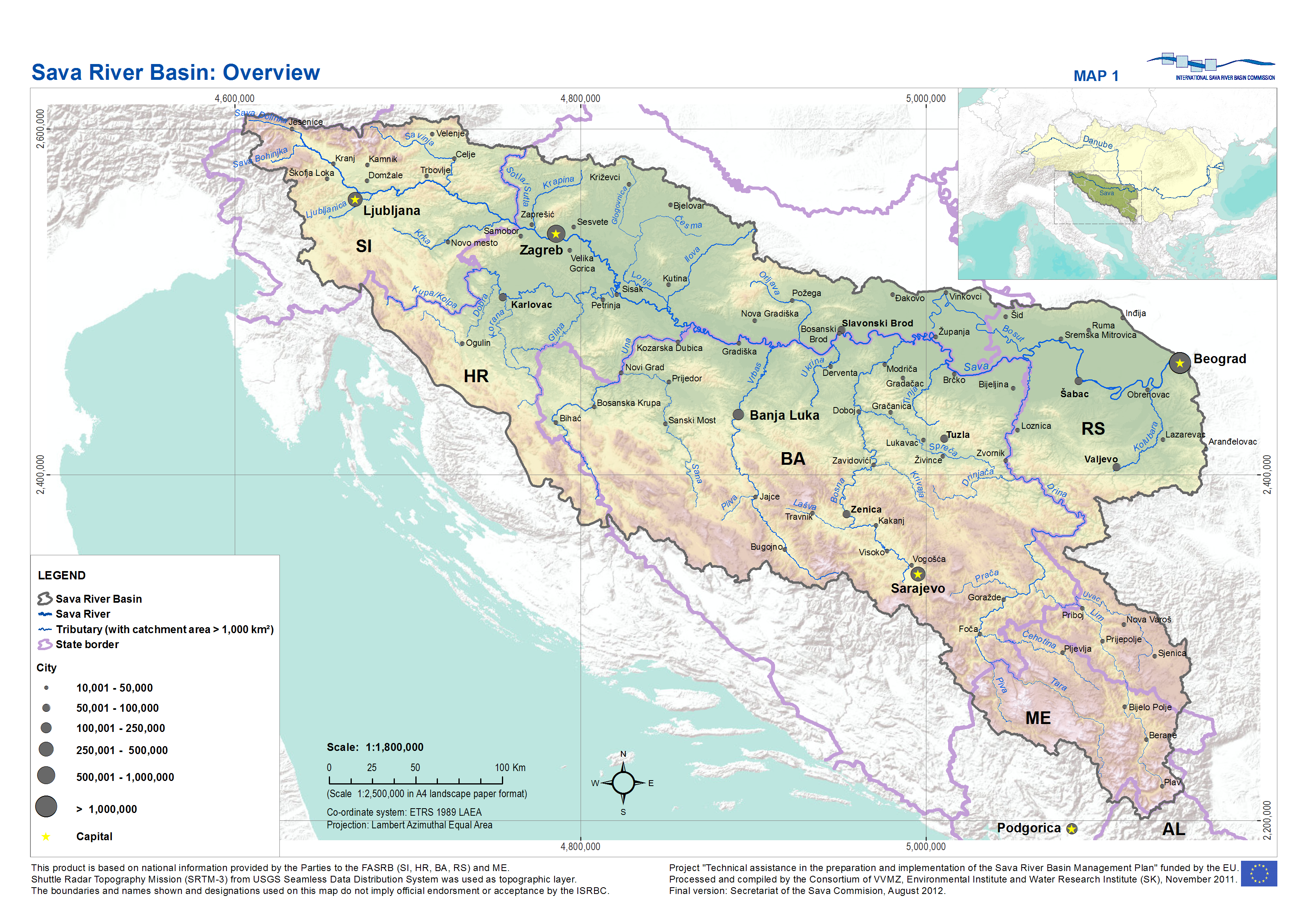
Posavina ( sr-cyr, Посавина) is a geographical region that stretches along the Sava river, encompassing only the inner areas of the Sava river basin, that are adjacent or near to the Sava river itself, namely catch region spanning from the Julian Alps in the northwest to the confluence with the Danube in the southeast. It passes through several countries of former Yugoslavia, namely Slovenia, Croatia, Bosnia and Herzegovina and Serbia. In Slovene, the term Posavina is not used to describe the parts of Slovenia that lie by the Sava river. Instead, the terms Posavje and Zasavje are used. Geography Geography of the Posavina region is defined by geological features of the central (inner) zones of the Sava river basin, that are near or adjacent to the Sava river itself. The region is stretched along the Sava river, that flows from west to east, connecting valleys and plains in transitional regions between the Dinaric Mountains and the Pannonian Plain. Geographical borders o ... [...More Info...] [...Related Items...] OR: [Wikipedia] [Google] [Baidu] |
Republika Srpska
Republika Srpska ( sr-Cyrl, Република Српска, lit=Serb Republic, also known as Republic of Srpska, ) is one of the two Political divisions of Bosnia and Herzegovina, entities of Bosnia and Herzegovina, the other being the Federation of Bosnia and Herzegovina. It is located in the north and east of the country. Its largest city and administrative centre is Banja Luka, lying on the Vrbas (river), Vrbas river. Republika Srpska was formed in 1992 at the outset of the Bosnian War with the stated intent to safeguard the interests of the Serbs of Bosnia and Herzegovina. The war saw the Ethnic cleansing in the Bosnian War, expulsion of the vast majority of Croats of Bosnia and Herzegovina, Croats and Bosniaks from the territory claimed by Republika Srpska and an inflow of Serbs expelled from Federation of Bosnia and Herzegovina. Following the Dayton Agreement of 1995, Republika Srpska achieved international recognition as an entity within Bosnia and Herzegovina. ... [...More Info...] [...Related Items...] OR: [Wikipedia] [Google] [Baidu] |
Croatian Defence Council
The Croatian Defence Council ( hr, Hrvatsko vijeće obrane or HVO) was the official military formation of the Croatian Republic of Herzeg-Bosnia, an unrecognized entity that existed in Bosnia and Herzegovina between 1991 and 1996. The HVO was the main military force of Croats of Bosnia and Herzegovina. In the initial stage of the Bosnian War, the HVO fought alongside the Army of the Republic of Bosnia and Herzegovina (ARBiH) against the Bosnian Serbs, but in the latter stage of the conflict clashed against its former ally, particularly in the Mostar area. The European Community Monitoring Mission (ECMM) estimated the strength of the HVO in the beginning of 1993 at 45,000–55,000. In July 1993, CIA estimated the HVO forces at 40,000 to 50,000 men. HVO was incorporated into the Army of the Federation of Bosnia and Herzegovina (VFBiH) in December 1995 by following agreement made after signing the Dayton Accords. In December 2005 HVO was reorganized as 1st Infantry (Guard) Reg ... [...More Info...] [...Related Items...] OR: [Wikipedia] [Google] [Baidu] |


