|
County Of Titheroo, Queensland
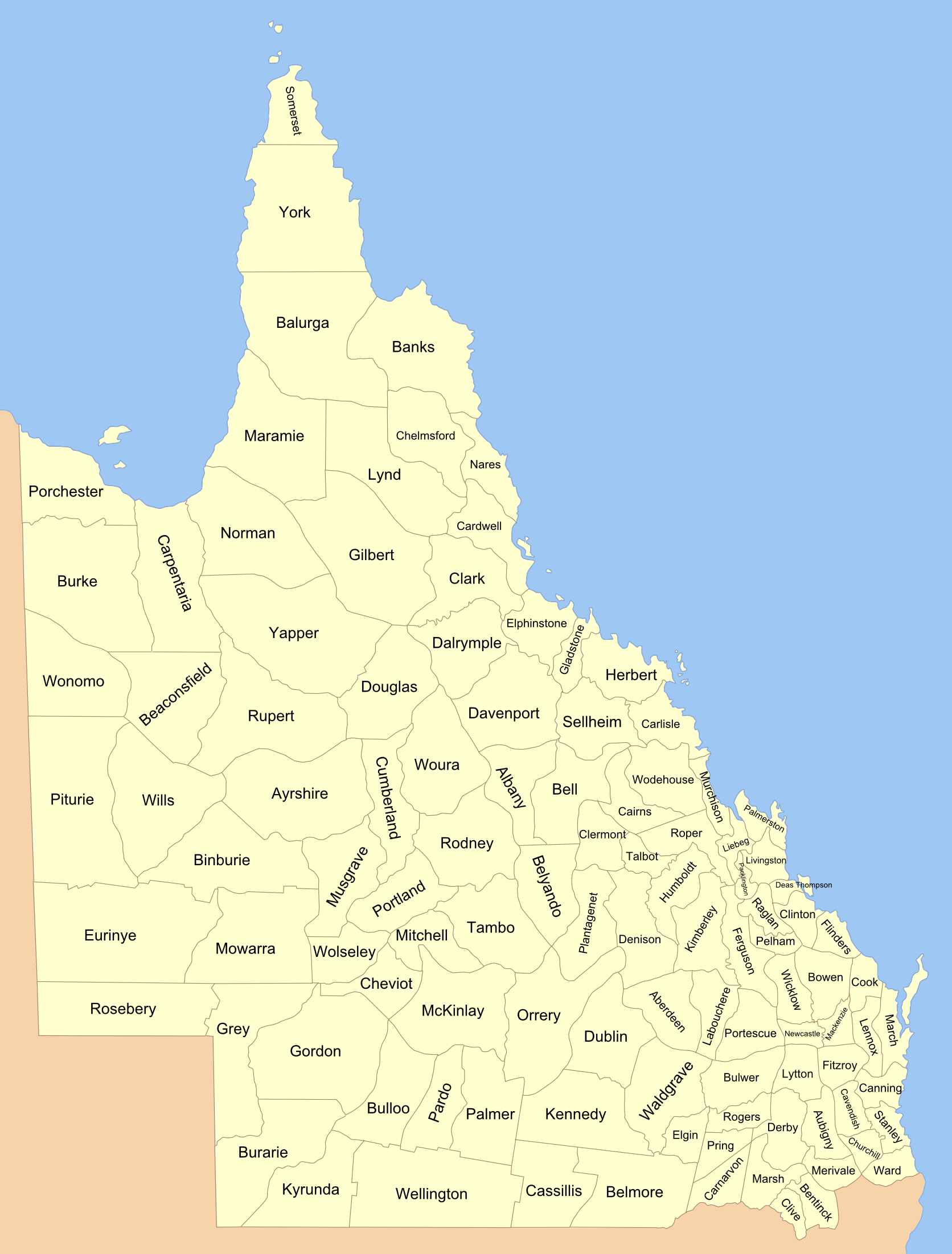
Titheroo County, Queensland is one of the 318 counties of Queensland, Australia. The county is divided into civil parishes. It is within the Lands administrative divisions of Queensland#South Gregory District, South Gregory Land District. The county was carved off from the adjoining Wellington County in 1901. The county is sparsely settled and lies on the Queensland - New South Wales border. The seat of local government is the town of Cunnamulla which lies in the adjacent Wellington County. History The original indigenous inhabitants of the area were the Karenggapa and Kunja people. The area's first European explorer was Thomas Mitchell (explorer), Thomas Mitchell who passed through the region in 1846."Cunnamulla - Queensland - Australia - Travel". ''Sydney Morning Herald''. Fairfax Media. 8 February 2004. Archived from the original on 7 November 2012. Retrieved 12 October 2010. The state border forms the southern boundary of the County and Narriearra Caryapundy Swamp Nationa ... [...More Info...] [...Related Items...] OR: [Wikipedia] [Google] [Baidu] |
Queensland Cadastral Divisions 1901
) , nickname = Sunshine State , image_map = Queensland in Australia.svg , map_caption = Location of Queensland in Australia , subdivision_type = Country , subdivision_name = Australia , established_title = Before federation , established_date = Colony of Queensland , established_title2 = Separation from New South Wales , established_date2 = 6 June 1859 , established_title3 = Federation , established_date3 = 1 January 1901 , named_for = Queen Victoria , demonym = , capital = Brisbane , largest_city = capital , coordinates = , admin_center_type = Administration , admin_center = 77 local government areas , leader_title1 = Monarch , leader_name1 = Charles III , leader_title2 = Governor , leader_name2 = Jeannette Young , leader_title3 = Premier , leader_name3 = Annastacia Palaszczuk ( ALP) , legislature = Parliament of Queensland , judiciary = Supreme Court of Queensland , national_representation = Parliament of Australia , national_representation_type1 ... [...More Info...] [...Related Items...] OR: [Wikipedia] [Google] [Baidu] |
Counties Of Queensland
A county is a geographic region of a country used for administrative or other purposesChambers Dictionary, L. Brookes (ed.), 2005, Chambers Harrap Publishers Ltd, Edinburgh in certain modern nations. The term is derived from the Old French denoting a jurisdiction under the sovereignty of a count (earl) or a viscount.The Oxford Dictionary of English Etymology, C. W. Onions (Ed.), 1966, Oxford University Press Literal equivalents in other languages, derived from the equivalent of "count", are now seldom used officially, including , , , , , , , and ''zhupa'' in Slavic languages; terms equivalent to commune/community are now often instead used. When the Normans conquered England, they brought the term with them. The Saxons had already established the districts that became the historic counties of England, calling them shires;Vision of Britai– Type details for ancient county. Retrieved 31 March 2012 many county names derive from the name of the county town (county seat) with th ... [...More Info...] [...Related Items...] OR: [Wikipedia] [Google] [Baidu] |
Australia
Australia, officially the Commonwealth of Australia, is a sovereign ''Sovereign'' is a title which can be applied to the highest leader in various categories. The word is borrowed from Old French , which is ultimately derived from the Latin , meaning 'above'. The roles of a sovereign vary from monarch, ruler or ... country comprising the mainland of the Australian continent, the island of Tasmania, and numerous smaller islands. With an area of , Australia is the largest country by area in Oceania and the world's sixth-largest country. Australia is the oldest, flattest, and driest inhabited continent, with the least fertile soils. It is a megadiverse country, and its size gives it a wide variety of landscapes and climates, with deserts in the centre, tropical Forests of Australia, rainforests in the north-east, and List of mountains in Australia, mountain ranges in the south-east. The ancestors of Aboriginal Australians began arriving from south east Asia approx ... [...More Info...] [...Related Items...] OR: [Wikipedia] [Google] [Baidu] |
Lands Administrative Divisions Of Queensland
Lands administrative divisions of Queensland refers to the divisions of Queensland used for the registration of land titles. There are 322 counties, and 5,319 parishes within the state. They are part of the Lands administrative divisions of Australia. Queensland had been divided into 109 counties in the nineteenth century, before the Land Act of 1897 subdivided many of these counties to 319. Some of the eastern counties remained the same, with most of the subdivisions occurring in the west and north. The current counties were named and bounded by the Governor in Council on 7 March 1901. In 2006, the government sought advice about a plan to abolish the counties and parishes within the state. From 30 November 2015, the government no longer referenced counties and parishes in land information systems however the Museum of Lands, Mapping and Surveying retains a record for historical purposes. Land districts Queensland was divided into districts in the mid-nineteenth century. The d ... [...More Info...] [...Related Items...] OR: [Wikipedia] [Google] [Baidu] |
Queensland
) , nickname = Sunshine State , image_map = Queensland in Australia.svg , map_caption = Location of Queensland in Australia , subdivision_type = Country , subdivision_name = Australia , established_title = Before federation , established_date = Colony of Queensland , established_title2 = Separation from New South Wales , established_date2 = 6 June 1859 , established_title3 = Federation of Australia, Federation , established_date3 = 1 January 1901 , named_for = Queen Victoria , demonym = , capital = Brisbane , largest_city = capital , coordinates = , admin_center_type = Administration , admin_center = Local government areas of Queensland, 77 local government areas , leader_title1 = Monarchy of Australia, Monarch , leader_name1 = Charles III , leader_title2 = Governor of Queensland, Governor , leader_name2 = Jeannette Young , leader_title3 = Premier of Queensland, Premier , leader_name3 = Annastacia Palaszczuk (Australian Labor Party (Queensland Branch), AL ... [...More Info...] [...Related Items...] OR: [Wikipedia] [Google] [Baidu] |
New South Wales
) , nickname = , image_map = New South Wales in Australia.svg , map_caption = Location of New South Wales in AustraliaCoordinates: , subdivision_type = Country , subdivision_name = Australia , established_title = Before federation , established_date = Colony of New South Wales , established_title2 = Establishment , established_date2 = 26 January 1788 , established_title3 = Responsible government , established_date3 = 6 June 1856 , established_title4 = Federation , established_date4 = 1 January 1901 , named_for = Wales , demonym = , capital = Sydney , largest_city = capital , coordinates = , admin_center = 128 local government areas , admin_center_type = Administration , leader_title1 = Monarch , leader_name1 = Charles III , leader_title2 = Governor , leader_name2 = Margaret Beazley , leader_title3 = Premier , leader_name3 = Dominic Perrottet ( Liberal) , national_representation = Parliament of Australia , national_representation_type1 = Sen ... [...More Info...] [...Related Items...] OR: [Wikipedia] [Google] [Baidu] |
Cunnamulla
Cunnamulla () is a town and a locality in the Shire of Paroo, Queensland, Australia. It is south of Charleville, and approximately west of the state capital, Brisbane. In the , Cunnamulla had a population of 1,140 people. Geography Cunnamulla lies on the Warrego River in South West Queensland within the Murray-Darling drainage basin. It flows from the north (Coongoola) through the town, which is in the centre of the locality, and exits to the south ( Tuen). The Mitchell Highway passes through the locality from north (Coongoola) to south (Tuen), while the Balonne Highway enters the location from the east ( Linden). The two highways intersect in the town, which is located in the centre of the locality. The Bulloo Developmental Road starts in Cunnamulla and exits the locality to the west ( Eulo). Cunnamulla is the administrative centre for the Paroo Shire, which also includes the townships of Wyandra, Yowah and Eulo, and covers an area of . Major industries of the area a ... [...More Info...] [...Related Items...] OR: [Wikipedia] [Google] [Baidu] |
Kunja People
The Kunja (Gunya) were an indigenous Australian people of the state of Queensland. Country Norman Tindale calculated Kunja lands as having spread over some of territory Warrego River from Cunnamulla north to Augathella anBurenda Their western extension lay somewhere between Cooladdi and Cheepie. Their eastern boundary lay at the present day Morven anAngellala Creek Charleville Charleville can refer to: Australia * Charleville, Queensland, a town in Australia **Charleville railway station, Queensland France * Charleville, Marne, a commune in Marne, France *Charleville-Mézières, a commune in Ardennes, France ** ... was on Kunja land. Notes Citations Sources * * {{authority control Aboriginal peoples of Queensland ... [...More Info...] [...Related Items...] OR: [Wikipedia] [Google] [Baidu] |
Thomas Mitchell (explorer)
Sir Thomas Livingstone Mitchell (15 June 1792 – 5 October 1855), surveyor and explorer of Southeastern Australia, was born at Grangemouth in Stirlingshire, Scotland. In 1827 he took up an appointment as Assistant Surveyor General of New South Wales. The following year he became Surveyor General and remained in this position until his death. Mitchell was knighted in 1839 for his contribution to the surveying of Australia. Early life Born in Scotland on 15 June 1792, he was son of John Mitchell of Carron Works and was brought up from childhood by his uncle, Thomas Livingstone of Parkhall, Stirlingshire. Peninsular War On the death of his uncle, he joined the British army in Portugal as a volunteer in the Peninsular War, at the age of sixteen. On 24 June 1811, at the age of nineteen, he received his first commission as 2nd Lieutenant in the 1st Battalion 95th Rifles (later the Rifle Brigade / Royal Green Jackets). Utilising his skills as a draughtsman of outstanding ab ... [...More Info...] [...Related Items...] OR: [Wikipedia] [Google] [Baidu] |
Narriearra Caryapundy Swamp National Park
Narriearra Caryapundy Swamp National Park is a national park in northwest New South Wales. In June 2020 the Government of New South Wales acquired , or of private land for a new national park, when it purchased Narriearra station in the state’s far north-west. The area includes “ephemeral wetlands and landscapes” that had not previously been included in the state’s conservation areas. Together with the nearby Sturt National Park, there would be a nearly contiguous conservation area of about , which is twice the size of the Australian Capital Territory. The new property lies next to the Pindera Downs Aboriginal area, which is rich in cultural artefacts of Aboriginal Australians. It is the largest ever purchase of private land for conservation in the state. The Dingo Fence on the border with Queensland forms the northern boundary of the property. The Tibooburra Local Aboriginal Land Council has been invited to suggest a name for the new park. Various ecosystems are suppo ... [...More Info...] [...Related Items...] OR: [Wikipedia] [Google] [Baidu] |


