|
Comarcas Of Region Of Murcia
There is not consensus and agreement in the demarcation of the '' comarcas'' of the region and some of them varies largely depending on the comarcas proposal. According to La Verdad newspapers’ Region of Murcia Atlas, there are three main divisions corresponding to three different authors. Most agreed ''comarcas'' The following ''comarcas'' are the most agreed in regards to its size and demarcation. They are accepted to be in the same way by most authors or their changes depending on the minor versions. Altiplano It is located in the north and is 1,580 km2 in the area. It includes the municipalities of Yecla and Jumilla. Regarding, what are present mainly in the area are mountain ranges such as Sierra del Carche, Sierra del Buey, Sierra Larga and Sierra del Molar. No rivers traverse the region, but several ''ramblas'' (dry stream beds but in rainy periods) occur in the ''comarca''. Alto Guadalentín or Comarca de Lorca This territory is located in the southeast and ha ... [...More Info...] [...Related Items...] OR: [Wikipedia] [Google] [Baidu] |
Comarcas Of Spain
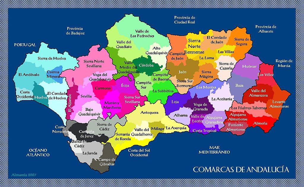
In Spain, a ''comarca'' () is either a traditional territorial division without any formal basis, or a group of municipalities of Spain, municipalities, legally defined by an autonomous communities of Spain, autonomous community for the purpose of providing common local government in Spain, local government services. In English, a comarca is equivalent to an area, county, district, or region, zone. Legally defined comarcas The large majority of legally defined comarcas are in comarques of Catalonia, Catalonia (42) and Comarcas of Aragon, Aragon (33), and are regulated by law and are governed by a comarcal council with specified powers. There are seven comarcas formally registered in Comarcas of the Basque Country, Basque Country and one, El Bierzo, in Castile and León. In Comarcas_of_Andalusia, Andalusia, Comarcas of Galicia, Galicia, Comarques of the Valencian Community, Valencia and Comarcas of Asturias, Asturias, comarcas are defined by regional law but lack any specific ... [...More Info...] [...Related Items...] OR: [Wikipedia] [Google] [Baidu] |
Campos Del Río
Campos del Río is a municipality in the autonomous region of Murcia in southeastern Spain. It covers an area of 47.3 km2 and shares borders with Ojós at its north, Villanueva del Río Segura and Alguazas at its north-east, Las Torres de Cotillas at its east, Murcia at its south-east, Mula and Albudeite at its south and west and Ricote at its north-west. Demography 6.26% of the inhabitants are foreigners – 3.79% are Africans, 1.38% are Americans and 0.936% are Asians. The table below shows the population trend by decades of the 20th and 21st centuries. Economy 27.7% of the territory was used for crop purposes in 2019, the most widely grown products are the almonds, and 44.46% of the agreements were signed by workers of the agriculture sector. See also * List of municipalities in the Region of Murcia This is a list of the 45 municipalities in the province and autonomous community of Murcia, Spain, with their land areas and their populations at the Censuses of 2001, ... [...More Info...] [...Related Items...] OR: [Wikipedia] [Google] [Baidu] |
Abanilla
Abanilla is a Spanish municipality located in the Comarca Oriental (composed by Fortuna and Abanilla) in the Autonomous Community of Murcia. It lies close to the border of the province of Alicante in the Autonomous Community of Valencia. Geography Abanilla occupies a surface area of 236.6 km2 and is situated 222 metres above sea level. It lies on a natural foundation which has been degraded by a number of aggregate and marble quarries. Paleontological Significance A karstic paleontological site is located on the southeast slope of the Sierra de Quibas in an abandoned limestone quarry. Researchers have discovered vertebrate and invertebrate fossils at this site. They collected rodent fossils and used dental patterns to identify these to be of the Muroidea subfamily Arvicolinae. Using stratigraphic and sedimentological features in the limestone, the scientists were able to date these fossils to the Early Pleistocene subepoch. Points of interest Points of interest in A ... [...More Info...] [...Related Items...] OR: [Wikipedia] [Google] [Baidu] |
Huerta De Murcia
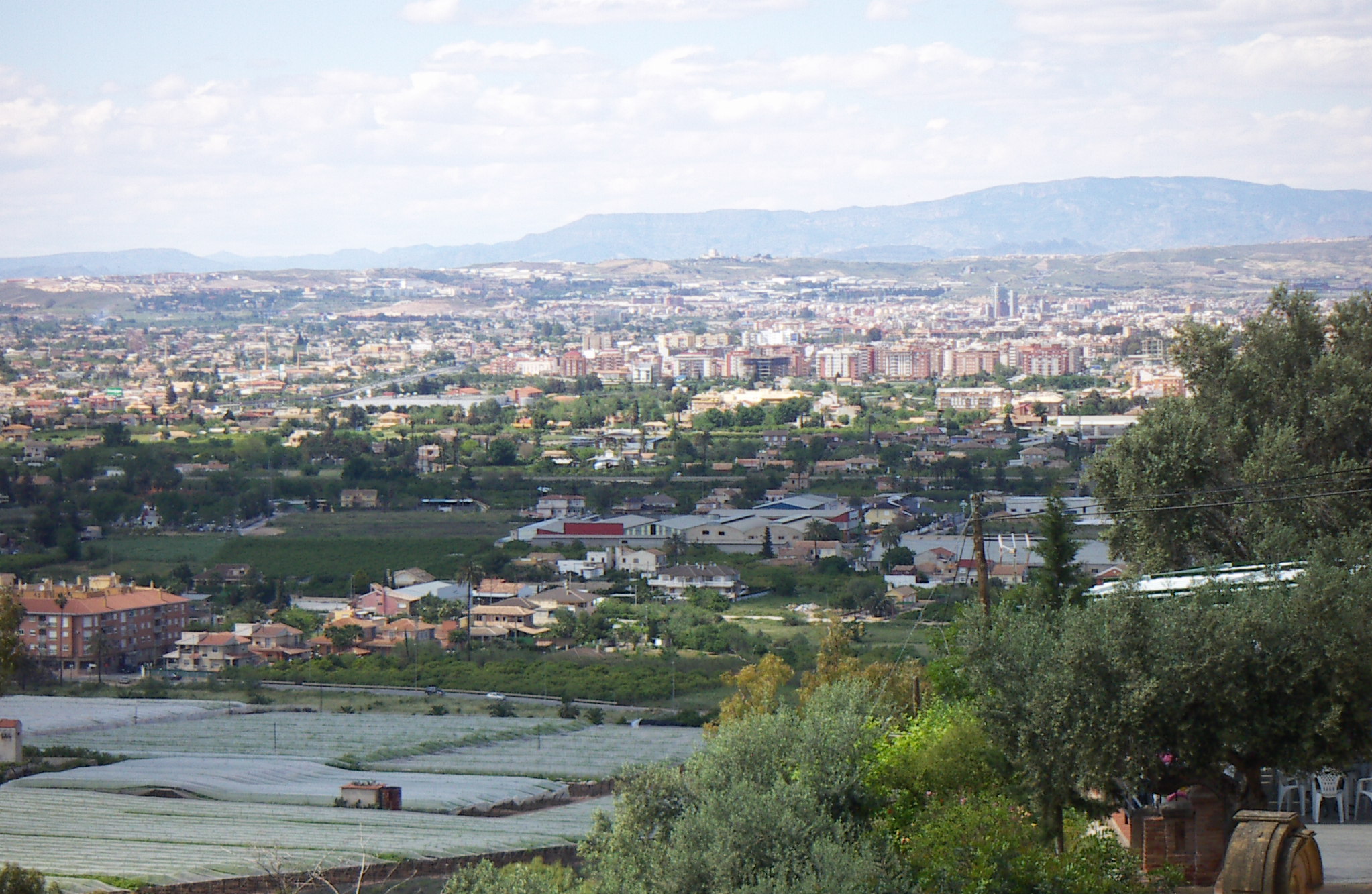
The Huerta de Murcia is an administrative division (''comarca'') in Region of Murcia, Murcia, Spain. This natural region encompasses the lands irrigated by the Segura River and its various canals, from the ''Contraparada'' weir to the boundary of the Region of Murcia with the Valencian Community. Its principal city is Murcia. Municipalities As of 2020, the comarca consists of the following municipalities: Geography The natural comarca of Huerta de Murcia is flanked to the north and south by two mountain ranges that border the Segura River's floodplain and its tributary, the Guadalentín, locally known as ''Canal del Reguerón, El Reguerón''. The comarca extends across the entire municipalities of Alcantarilla (Spain), Alcantarilla, Santomera, and Beniel, as well as most of Murcia. Several outlying districts of Murcia belong to the Campo de Murcia rather than the Huerta. Administrative Division The division of the Region of Murcia into comarcas was anticipated in the ... [...More Info...] [...Related Items...] OR: [Wikipedia] [Google] [Baidu] |
Los Alcázares
Los Alcázares () is a municipality and a coastal spa town and former fishing village on the western side of the Mar Menor in the autonomous community and province of Murcia, southeastern Spain. The Mar Menor (little sea) belongs to three other municipalities: San Javier, San Pedro del Pinatar and Cartagena and is Europe's largest saltwater lagoon. Connected to the adjacent Mediterranean sea by several channels, the Mar Menor has a surface area of almost 20 km2 and the fact that it is typically 2-4 degrees warmer than the Mediterranean, makes it a very popular destination for sailing, windsurfing, kiteboarding and other water sports enthusiasts. Los Alcazares has a resident population (2018) of 15,674 which rises to over 100,000 during the peak tourist summer holiday season. On 13 October 1983, the town was granted municipal autonomy, in respect of which it holds an annual week-long celebration featuring live music, shows, windsurfing competitions and firework displays ... [...More Info...] [...Related Items...] OR: [Wikipedia] [Google] [Baidu] |
San Javier, Murcia
San Javier () is a small town and Municipalities of Spain, municipality in the Region of Murcia, autonomous community and province of Murcia in southeastern Spain. The municipality is situated at the northern end of Murcia's Mediterranean coastline, the Costa Cálida. History There is little trace in the historical and archaeological record of early human habitation in the municipality itself. There is, however, evidence of prehistoric human presence at several nearby locations, including Cabezo Gordo hill in Torre-Pacheco and the salty coastal lagoon, the Mar Menor. San Javier was prized for its climate in History of Spain#Roman Hispania (2nd century BC – 5th century AD), Roman Hispania, and for the Mar Menor, where a Salt#Production, salt industry developed. Traces of Ancient Rome, Roman and Punics, Carthaginian presence remain. A major Roman road, the ''Via Augusta'', passes through the area and there are several underwater sites where, among other artefacts, pots and amph ... [...More Info...] [...Related Items...] OR: [Wikipedia] [Google] [Baidu] |
San Pedro Del Pinatar, Spain
San Pedro del Pinatar is a small town and municipality in the Region of Murcia, southeastern Spain. The municipality is situated at the northern end of Murcia's Mediterranean coastline, the Costa Cálida, and borders the Alicante (province), province of Alicante. It has an area of almost 22 km2, and a population of 25,167 as of 2018. History Ancient history San Pedro was an industrial territory whose salt mines were used by the Romans. They utilised the salt to produce an ancient Roman sauce called garum. Middle Ages In 711 CE, Muslim civilizations started conquering the Iberian Peninsula. A few years later they dominated a great part of it, including the current San Pedro del Pinatar. During their occupation, they built fishing structures for a specific type of fishing which are known in Spanish as . In 1243, the king Muhammad Ibn Hud offered vassalage to the Crown of Castile. In April of that year, the Treaty of Alcaraz, in which the sovereignty of Castile was recog ... [...More Info...] [...Related Items...] OR: [Wikipedia] [Google] [Baidu] |
Torre-Pacheco
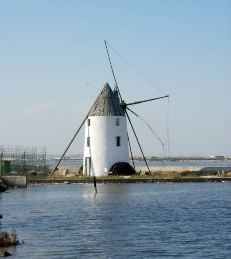
Torre-Pacheco () is a municipality in the autonomous community of Murcia in southeastern Spain. It covers an area of and its population in 2019 was 35,676. The only high ground in the municipality is Cabezo Gordo hill, the location of the protected Sima de las Palomas archeological site. The town has one secondary education institution, the I.E.S. Gerardo Molina. The municipality is known for its golf courses, and its windmills are known region wide. Grant Biddle. A British property investor who recently took ownership of the local football team EF Torre Pacheco. Former owner of https://en.m.wikipedia.org/wiki/Peterborough_Sports_F.C. Geography Physical geography Torre-Pacheco municipality is located in the Campo de Cartagena region. Cabezo Gordo is one of its highest hills, at above sea level. It has no rivers with a permanent water flow, although during rainy periods streams in several ''arroyos'' (sometimes called ''ramblas'') flow into coastal saltwater lagoon the M ... [...More Info...] [...Related Items...] OR: [Wikipedia] [Google] [Baidu] |
Sierra Minera De Cartagena-La Unión
Sierra (Spanish for "mountain range" or "mountain chain" and "saw", from Latin '' serra'') may refer to the following: Places Mountains and mountain ranges * Sierra de Juárez, a mountain range in Baja California, Mexico * Sierra de las Nieves, a mountain range in Andalusia, Spain * Sierra Madre (other), various mountain ranges ** Sierra Madre (Philippines), a mountain range in the east of Luzon, Philippines * Sierra mountains (other) * Sierra Nevada, a mountain range in the U.S. states of California and Nevada * Sierra Nevada (Spain), a mountain range in Andalusia, Spain * Sierra de San Pedro Mártir, a mountain range in Baja California, Mexico * Sierra Maestra, a mountain range in Cuba Other places Africa * Sierra Leone, a country located on the coast of West Africa Asia * Sierra Bullones, Bohol, Philippines Europe * Sierra Nevada National Park (Spain), Andalusia, Spain * Sierra Nevada Observatory, Granada, Spain North America * High Sierra Trail, Califor ... [...More Info...] [...Related Items...] OR: [Wikipedia] [Google] [Baidu] |
Campo De Cartagena
Campo de Cartagena is a natural region (comarca) located in the Region of Murcia, in Spain. For administrative purposes, it is also known as Comarca del Campo de Cartagena or Comarca de Cartagena. It is located in the southeast of the Iberian Peninsula, forming a plain which extends from the Sierra de Carrascoy to the Mediterranean. The capital city is Cartagena, the most important Naval Base of the Spanish Navy in the Mediterranean Sea. The comarca contains 393,598 inhabitants (2019) in an area of 1,481.8 km2, making up the metropolitan area of Cartagena, a center for tourism, culture, industry and nature, with more than 18,500 protected hectares, among places like the Calblanque, Monte de las Cenizas y Peña del Águila Natural Park; the Sierra de la Muela, Cabo Tiñoso and Roldán Natural Park; Salinas y Arenales de San Pedro del Pinatar or Islas e Islotes del Litoral Mediterráneo (Islands and Islets of the Mediterranean Shore), among others. Beside those places, it mu ... [...More Info...] [...Related Items...] OR: [Wikipedia] [Google] [Baidu] |
Sierra Espuña
The Sierra Espuña is a mountain range in the Region of Murcia, Spain. It is part of the Penibaetic System. The Sierra Espuña Regional Park protects 17,804 ha of the mountain range in the municipalities of Alhama de Murcia, Totana and Mula, Spain, Mula. The highest peak, also known as Espuña, is at 1,583 metres. The summit itself is a military area. It houses the 13th Air Surveillance Squadron (EVA 13) radar station, part of the Spanish Air and Space Force. By the end of the 19th century, the entire mountain range was in a poor ecological state, with the almost total loss of its tree cover and at risk of desertification. In 1889, the forest engineer Ricardo Codorníu undertook the enormous task of reforesting the entire mountain range. This reforestation task became a model for his time. In 1931 the area was declared a natural site of national interest, and in 1992 it was protected as a Regional Park. It is also listed as a Special Protection Area for birds and a place of co ... [...More Info...] [...Related Items...] OR: [Wikipedia] [Google] [Baidu] |
Mazarrón
Mazarrón is a Municipalities of Spain, municipality in the Region of Murcia, autonomous community and province of Murcia, southeastern Spain. The municipality has an area of , and a population of 31,562 inhabitants in 2019. A military fort (named C1 or ''Castillitos''-small castles) which was built between 1930 and 1936 during the reign of Alfonso XIII of Spain and the Second Spanish Republic exists as a tourist attraction on the old road between Mazarrón and Cartagena, Spain, Cartagena, and although it is accessible from the Bay of Mazarrón it is not in the municipality itself. The Bay of Mazarrón is sheltered by the last foothills of the Sierra de la Almenara, a mining area since the Carthaginian era. Over 35 km of beaches, unspoiled coves and rocky sea beds. Due to the nature of the surrounding rocks, however, the beach at Bolnuevo is of coarse grit, as are most of the beaches along this part of the coast. The Torre de los Caballos on Los Caballos peak were built for ... [...More Info...] [...Related Items...] OR: [Wikipedia] [Google] [Baidu] |


