|
Col De Prat-de-Bouc
The Col de Prat-de-Bouc is a mountain pass at an altitude of 1,392 meters located in the Mounts of Cantal, in the department of the same name, within the Massif Central. It is situated east of the Plomb du Cantal. At the foot of the pass lies the Lioran resort and the Prat de Bouc - Haute Planèze Nordic area. Geography The pass can be crossed by two slopes:''IGN maps'' available oGéoportail/ref> * from the south, coming from Paulhac (via the hamlet of Bélinay) or from Cézens (via the hamlet of la Sagnette) or from Brezons passing through the Col de la Griffoul; * from the north, coming from Murat and Albepierre-Bredons. Activities Winter Sports The Col de Prat-de-Bouc serves as one of the gateways to the Lioran ski resort. It has its own ski lifts for alpine skiing: 1 chairlift and 5 ski tows for 14 slopes, providing access to the Plomb du Cantal and the rest of the Lioran resort. It is part of the Prat de Bouc - Haute Planèze cross-country skiing area. Hiki ... [...More Info...] [...Related Items...] OR: [Wikipedia] [Google] [Baidu] |
Cantal
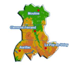
Cantal (; oc, Cantal or ) is a Departments of France, department in the Auvergne-Rhône-Alpes Regions of France, region of France, with its Prefectures in France, prefecture in Aurillac. Its other principal towns are Saint-Flour, Cantal, Saint-Flour (the episcopal see) and Mauriac, Cantal, Mauriac; its residents are known as Cantalians (french: link=no, Cantaliens / Cantaliennes or '). Cantal borders the departments of Puy-de-Dôme, Haute-Loire, Aveyron, Lot (department), Lot, Lozère and Corrèze, in the Massif Central natural region. Along with neighbouring Lozère and Creuse, Cantal is among the most sparsely populated and geographically isolated departments of France and Aurillac is the departmental capital farthest removed from a major motorway. It had a population of 144,692 in 2019,Populations légal ... [...More Info...] [...Related Items...] OR: [Wikipedia] [Google] [Baidu] |
Auvergne
Auvergne (; ; oc, label=Occitan, Auvèrnhe or ) is a former administrative region in central France, comprising the four departments of Allier, Puy-de-Dôme, Cantal and Haute-Loire. Since 1 January 2016, it has been part of the new region Auvergne-Rhône-Alpes.. The administrative region of Auvergne is larger than the historical province of Auvergne, one of the seven counties of Occitania, and includes provinces and areas that historically were not part of Auvergne. The Auvergne region is composed of the following old provinces: * Auvergne: departments of Puy-de-Dôme, Cantal, northwest of Haute-Loire, and extreme south of Allier. The province of Auvergne is entirely contained inside the Auvergne region * Bourbonnais: department of Allier. A small part of Bourbonnais lies outside Auvergne, in the neighbouring Centre-Val de Loire region (south of the department of Cher). * Velay: centre and southeast of department of Haute-Loire. Velay is entirely contained inside the Auvergne r ... [...More Info...] [...Related Items...] OR: [Wikipedia] [Google] [Baidu] |
1975 Tour De France, Stage 11 To Stage 22 , Belgium with a prologue individual time trial on 26 June, and Stage 11 occurred on 8 July with a mountainous stage from Pau, Pyrénées-Atlantiques, Pau. The race finished in Paris on 20 July.
The 1975 Tour de France was the 62nd edition of the Tour de France, one of cycling's Grand Tours. The Tour began in Charleroi Charleroi ( , , ; wa, Tchålerwè ) is a city and a municipality of Wallonia, located in the province of Hainaut, Belgium. By 1 January 2008, the total population of Charleroi was 201,593. Stage 11 8 July 1975 – Pau, Pyrénées-Atlantiques, Pau to Saint-Lary-Soulan Pla d'Adet,Stage 12 9 July 1975 – Tarbes to Albi,Stage 13 10 July 1975 – Albi to Le Lioran, Super-Lioran,Stage 14 11 July 1975 – Aurillac to Puy de Dôme ...[...More Info...] [...Related Items...] OR: [Wikipedia] [Google] [Baidu] |


