|
Coastal Forces Of The Royal New Zealand Navy
Coastal Forces was a division of the Royal Navy established during World War II. It consisted of small coastal defence craft such as motor launches, submarine chasers, air-sea rescue launches, motor gun boats and motor torpedo boats. It did not include minesweepers, naval trawlers or landing craft. This article is about the equivalent boats used in the Royal New Zealand Navy (RNZN). From 1921 until 1941 the New Zealand Navy was a Division of the Royal Navy. The RNZN was not created until 1 October 1941. Within six months of its creation the RNZN commissioned twelve Class B Fairmiles and sixteen Harbour Defence Motor Launches (HDMLs) RNZN Fairmiles On 4 April 1941 the British War Cabinet approved a proposal for a striking force of anti-submarine motor-boats, six at Auckland, four at Wellington, and two at Lyttelton. Drawings and specifications of the Fairmile anti-submarine motorboat developed by Fairmile Marine were sent from England and it was agreed that these craft coul ... [...More Info...] [...Related Items...] OR: [Wikipedia] [Google] [Baidu] |
Coastal Forces Of The Royal Navy
Coastal Forces was a division of the Royal Navy initially established during World War I, and then again in World War II under the command of Rear-Admiral, Coastal Forces. It remained active until the last Minesweeper (ship), minesweepers to wear the "HM Coastal Forces" cap tally were taken out of reserve in 1968. On 21 May 2020, Ministerial approval for the change in name from 1st Patrol Boat Squadron to Coastal Forces Squadron was given. It encompasses the Archer-class patrol vessels and the Batch 1 River-class offshore patrol vessels and are responsible for UKExclusive economic zone, EEZ Protection and Patrol. History Predecessor The Royal Navy had previously operated flotillas of small torpedo- and Depth charge, depth-charge-armed craft (coastal motor boats) during World War I (1914-1918). They operated as often in action against the enemy coast as in defence of British coastal areas. Establishment The first post WWI motor torpedo boats built for the Royal Navy were built ... [...More Info...] [...Related Items...] OR: [Wikipedia] [Google] [Baidu] |
Lyttelton, New Zealand
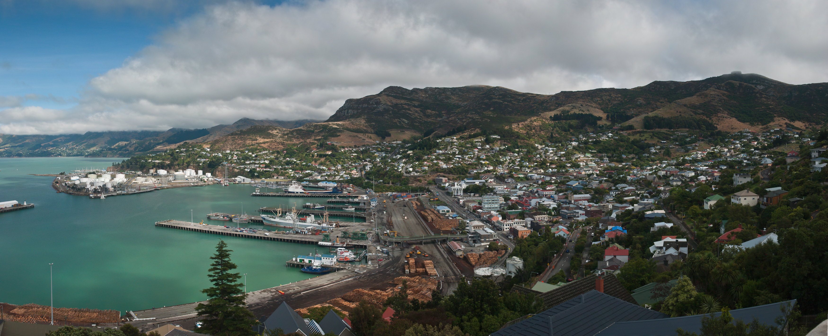
Lyttelton (Māori: ''Ōhinehou'') is a port town on the north shore of Lyttelton Harbour / Whakaraupō, at the northwestern end of Banks Peninsula and close to Christchurch, on the eastern coast of the South Island of New Zealand. As a landing point for Christchurch-bound seafarers, Lyttelton has historically been regarded as the "Gateway to Canterbury" for colonial settlers. Until the 2020 coronavirus pandemic, the port has been a regular destination for cruise ships. It is the South Island's principal goods-transport terminal, handling 34% of exports and 61% of imports by value. In 2009 Lyttelton was awarded Category I Historic Area status by the Historic Places Trust (NZHPT) defined as "an area of special or outstanding historical or cultural heritage significance or value", not long before much of the historic fabric was destroyed in the 2011 Christchurch earthquake. Location Lyttelton is the largest settlement on Lyttelton Harbour / Whakaraupō, an inlet on the northwe ... [...More Info...] [...Related Items...] OR: [Wikipedia] [Google] [Baidu] |
Waiheke
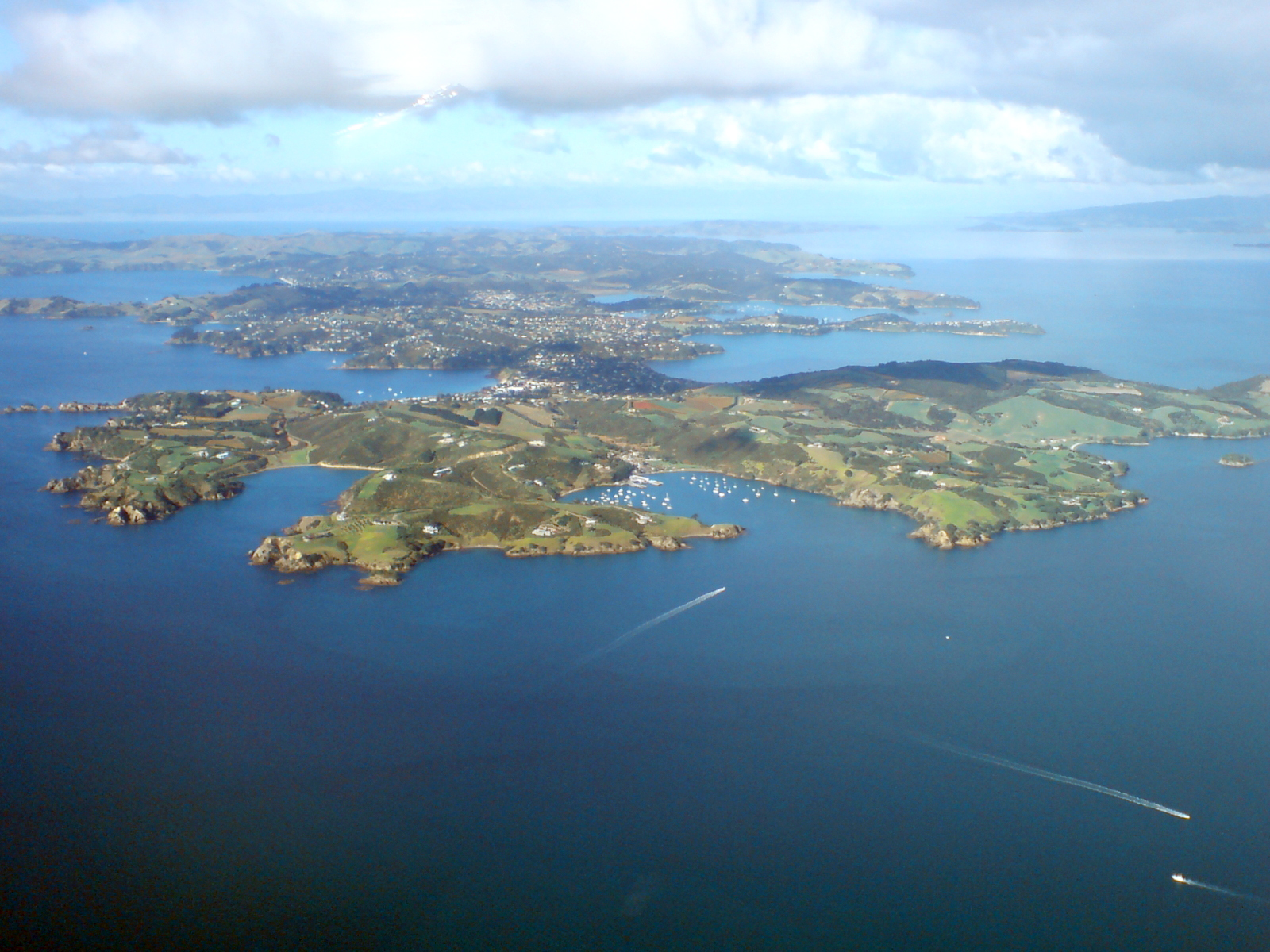
Waiheke Island (; Māori language, Māori: ) is the second-largest island (after Great Barrier Island) in the Hauraki Gulf of New Zealand. Its ferry terminal in Matiatia Bay at the western end is from the central-city terminal in Auckland. It is the most populated island in the gulf, with permanent residents. Another estimated 3,400 have second homes or holiday homes on the island. It is New Zealand's most densely populated island, and the third most populated after the North Island, North and South Islands. It is the most accessible island in the gulf, with regular passenger and Roll-on/roll-off, car-ferry services, a helicopter operator based on the island, and other air links. In November 2015, Lonely Planet rated Waiheke Island the fifth-best region in the world to visit in 2016. Geography Overview The island is off the coast of the North Island. It is in length from west to east, varies in width from , and has a surface area of . The coastline is , including of beac ... [...More Info...] [...Related Items...] OR: [Wikipedia] [Google] [Baidu] |
HMNZS Maori (P3570)
HMNZS ''Maori'' (P3570) was a Fairmile B Motor Launch of the Royal New Zealand Navy Originally commissioned on 20 December 1943 with pennant number ''Q 409'', she was part of the 80th Motor Launch Flotilla. Early in 1944 she went to the Solomon Islands where she served under the operational control of COMSOPAC. After the end of the war she was sold. In 1953 she was repurchased and recommissioned as HMNZS ''Maori'' (P3570). In 1963 she was sold again and became the Auckland-Waiheke Waiheke Island (; Māori language, Māori: ) is the second-largest island (after Great Barrier Island) in the Hauraki Gulf of New Zealand. Its ferry terminal in Matiatia Bay at the western end is from the central-city terminal in Auckland. I ... ferry ''Iris Moana''. References Further reading * See also * * New Zealand Coastal Forces of World War II Patrol vessels of the Royal New Zealand Navy 1943 ships {{Mil-ship-stub ... [...More Info...] [...Related Items...] OR: [Wikipedia] [Google] [Baidu] |
Waitomo District
Waitomo District is a territorial authority, located in the Waikato region, at the north of the King Country area in the North Island of New Zealand. A small part of the district, the locality of Tiroa, however, lies in the Manawatū-Whanganui region. The District covers the west coast from Te Maika, on Kawhia Harbour, to the north of Taharoa, to Mokau in the south and extends inland to Maniaiti / Benneydale and Mount Pureora. Demographics Waitomo District covers and had an estimated population of as of with a population density of people per km2. Waitomo District had a population of 9,303 at the 2018 New Zealand census, an increase of 396 people (4.4%) since the 2013 census, and a decrease of 135 people (−1.4%) since the 2006 census. There were 3,384 households, comprising 4,695 males and 4,605 females, giving a sex ratio of 1.02 males per female. The median age was 38.2 years (compared with 37.4 years nationally), with 2,082 people (22.4%) aged under 15 years, 1, ... [...More Info...] [...Related Items...] OR: [Wikipedia] [Google] [Baidu] |
Raglan, New Zealand
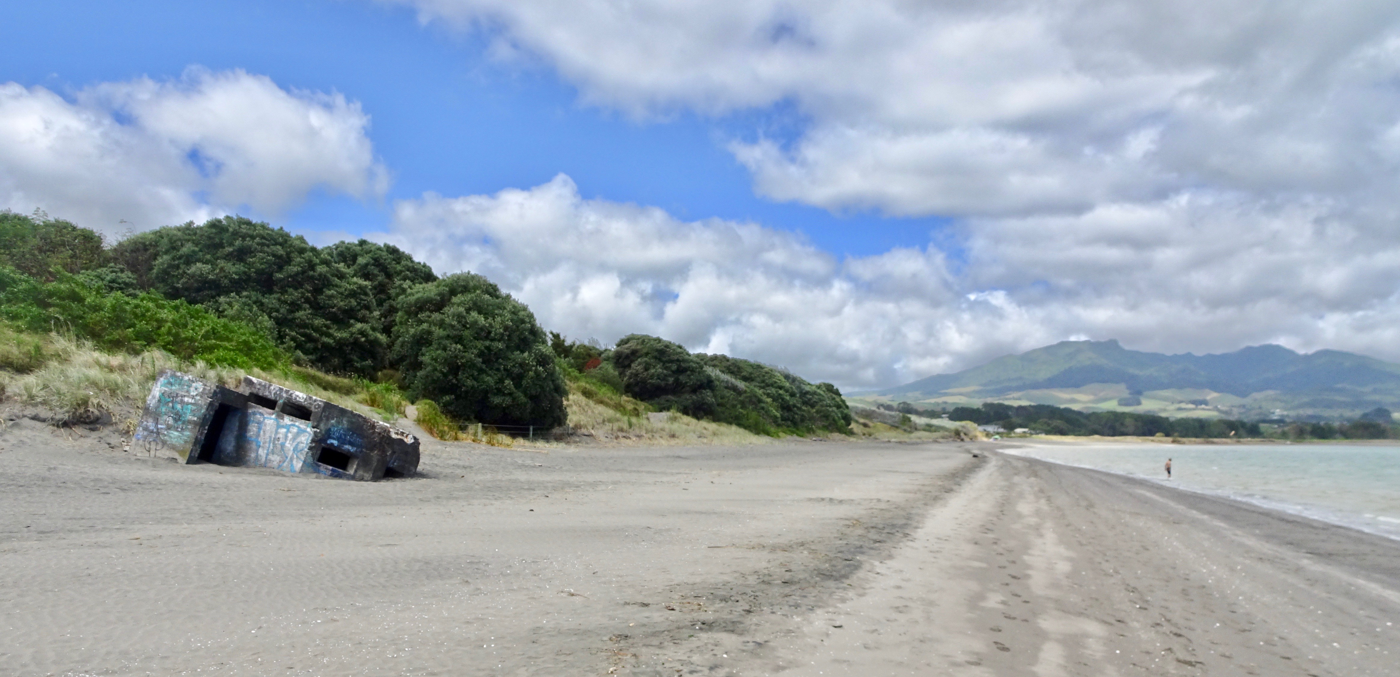
Raglan is a small beachside town located 48 km west of Hamilton, New Zealand on State Highway 23. It is known for its surfing, and volcanic black sand beaches. History The Ngāti Māhanga iwi occupied the area around Raglan in the late 18th century. There are at least 81 archaeological sites in the area, mainly near the coast. Limited radiocarbon dating puts the earliest sites at about 1400AD. The Māori people named the site ("the long pursuit"). One tradition says that Tainui priest, Rakataura, crossed Whāingaroa on his way to Kāwhia. Another says it was among the places the early Te Arawa explorer, Kahumatamomoe, with his nephew Īhenga, visited on their expedition from Maketū. The first Europeans to settle in the area, the Rev James and Mary Wallis, Wesleyan missionaries, were embraced and welcomed by local Māori in 1835. European settlement, including large scale conversion of land to pasture, began in the mid-1850s after a large sale of land by Chief Wirem ... [...More Info...] [...Related Items...] OR: [Wikipedia] [Google] [Baidu] |
Sri Lanka
Sri Lanka (, ; si, ශ්රී ලංකා, Śrī Laṅkā, translit-std=ISO (); ta, இலங்கை, Ilaṅkai, translit-std=ISO ()), formerly known as Ceylon and officially the Democratic Socialist Republic of Sri Lanka, is an island country in South Asia. It lies in the Indian Ocean, southwest of the Bay of Bengal, and southeast of the Arabian Sea; it is separated from the Indian subcontinent by the Gulf of Mannar and the Palk Strait. Sri Lanka shares a maritime border with India and Maldives. Sri Jayawardenepura Kotte is its legislative capital, and Colombo is its largest city and financial centre. Sri Lanka has a population of around 22 million (2020) and is a multinational state, home to diverse cultures, languages, and ethnicities. The Sinhalese are the majority of the nation's population. The Tamils, who are a large minority group, have also played an influential role in the island's history. Other long established groups include the Moors, the Burghers ... [...More Info...] [...Related Items...] OR: [Wikipedia] [Google] [Baidu] |
Waiheke Island
Waiheke Island (; Māori: ) is the second-largest island (after Great Barrier Island) in the Hauraki Gulf of New Zealand. Its ferry terminal in Matiatia Bay at the western end is from the central-city terminal in Auckland. It is the most populated island in the gulf, with permanent residents. Another estimated 3,400 have second homes or holiday homes on the island. It is New Zealand's most densely populated island, and the third most populated after the North and South Islands. It is the most accessible island in the gulf, with regular passenger and car-ferry services, a helicopter operator based on the island, and other air links. In November 2015, Lonely Planet rated Waiheke Island the fifth-best region in the world to visit in 2016. Geography Overview The island is off the coast of the North Island. It is in length from west to east, varies in width from , and has a surface area of . The coastline is , including of beaches. The port of Matiatia at the western end is ... [...More Info...] [...Related Items...] OR: [Wikipedia] [Google] [Baidu] |
Pendant Number
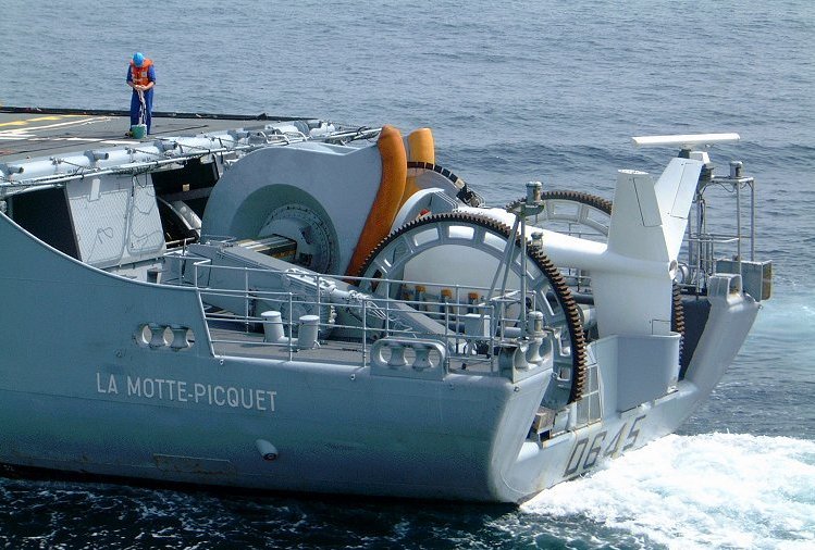
In the Royal Navy and other navies of Europe and the Commonwealth of Nations, ships are identified by pennant number (an internationalisation of ''pendant number'', which it was called before 1948). Historically, naval ships flew a flag that identified a flotilla or type of vessel. For example, the Royal Navy used a red burgee for torpedo boats and a pennant with an H for torpedo boat destroyers. Adding a number to the type-identifying flag uniquely identified each ship. In the current system, a letter prefix, called a ''flag superior'', identifies the type of ship, and numerical suffix, called a flag inferior, uniquely identifies an individual ship. Not all pennant numbers have a flag superior. Royal Navy systems The Royal Navy first used pennants to distinguish its ships in 1661 with a proclamation that all of his majesty's ships must fly a union pennant. This distinction was further strengthened by a proclamation in 1674 which forbade merchant vessels from flying any pennan ... [...More Info...] [...Related Items...] OR: [Wikipedia] [Google] [Baidu] |
Kauri
''Agathis'', commonly known as kauri or dammara, is a genus of 22 species of evergreen tree. The genus is part of the ancient conifer family Araucariaceae, a group once widespread during the Jurassic and Cretaceous periods, but now largely restricted to the Southern Hemisphere except for a number of extant Malesian ''Agathis''.de Laubenfels, David J. 1988. Coniferales. P. 337–453 in Flora Malesiana, Series I, Vol. 10. Dordrecht: Kluwer Academic. Description Mature kauri trees have characteristically large trunks, with little or no branching below the crown. In contrast, young trees are normally conical in shape, forming a more rounded or irregularly shaped crown as they achieve maturity.Whitmore, T.C. 1977. ''A first look at Agathis''. Tropical Forestry Papers No. 11. University of Oxford Commonwealth Forestry Institute. The bark is smooth and light grey to grey-brown, usually peeling into irregular flakes that become thicker on more mature trees. The branch structu ... [...More Info...] [...Related Items...] OR: [Wikipedia] [Google] [Baidu] |
Sonar
Sonar (sound navigation and ranging or sonic navigation and ranging) is a technique that uses sound propagation (usually underwater, as in submarine navigation) to navigation, navigate, measure distances (ranging), communicate with or detect objects on or under the surface of the water, such as other vessels. "Sonar" can refer to one of two types of technology: ''passive'' sonar means listening for the sound made by vessels; ''active'' sonar means emitting pulses of sounds and listening for echoes. Sonar may be used as a means of acoustic location and of measurement of the echo characteristics of "targets" in the water. Acoustic location in air was used before the introduction of radar. Sonar may also be used for robot navigation, and SODAR (an upward-looking in-air sonar) is used for atmospheric investigations. The term ''sonar'' is also used for the equipment used to generate and receive the sound. The acoustic frequencies used in sonar systems vary from very low (infrasonic ... [...More Info...] [...Related Items...] OR: [Wikipedia] [Google] [Baidu] |
Depth Charge
A depth charge is an anti-submarine warfare (ASW) weapon. It is intended to destroy a submarine by being dropped into the water nearby and detonating, subjecting the target to a powerful and destructive Shock factor, hydraulic shock. Most depth charges use explosive, high explosive charges and a fuze set to detonate the charge, typically at a specific depth. Depth charges can be dropped by ships, patrol aircraft, and helicopters. Depth charges were developed during World War I, and were one of the first viable methods of attacking a submarine underwater. They were widely used in World War I and World War II, and remained part of the anti-submarine arsenals of many navies during the Cold War, during which they were supplemented, and later largely replaced, by anti-submarine homing torpedoes. A depth charge fitted with a nuclear warhead is also known as a "nuclear depth bomb". These were designed to be dropped from a patrol plane or deployed by an anti-submarine missile from a s ... [...More Info...] [...Related Items...] OR: [Wikipedia] [Google] [Baidu] |


