|
Climate Change In The Marshall Islands
Climate change in the Marshall Islands is a major issue for the country. As with many countries made up of low-lying islands, the Marshall Islands is highly vulnerable to sea level rise and other impacts of climate change. The atoll and capital city of Majuro are particularly vulnerable, and the issue poses significant implications for the country's population. These threats have prompted Marshallese political leaders to make climate change a key diplomatic issue, who have responded with initiatives such as the Majuro Declaration. The Human Rights Measurement Initiative finds that the climate crisis has worsened human rights conditions in the Marshall Islands greatly (5.0 out of 6). Human rights experts reported that the climate crisis has negatively impacted the economy, increased rates of unemployment, and lead to relocations to higher areas or migrations to other countries. Effects on the natural environment The Marshall Islands is a collection of low-lying islands and atoll ... [...More Info...] [...Related Items...] OR: [Wikipedia] [Google] [Baidu] |
Majuro (40325945)
Majuro (; Marshallese: ' ) is the capital and largest city of the Marshall Islands. It is also a large coral atoll of 64 islands in the Pacific Ocean. It forms a legislative district of the Ratak (Sunrise) Chain of the Marshall Islands. The atoll has a land area of and encloses a lagoon of . As with other atolls in the Marshall Islands, Majuro consists of narrow land masses. It has a tropical trade wind climate, with an average temperature of . Majuro has been inhabited by humans for at least 2,000 years and was first settled by the Austronesian ancestors of the modern day Marshallese people. Majuro was the site of a Protestant mission and several copra trading stations in the 1870s, before the German Empire annexed the atoll as part of the German Protectorate of the Marshall Islands in 1885. The city was later under Japanese and American administration. After the Marshall Islands broke away from the Federated States of Micronesia in 1978 to form the Republic of the Marshall I ... [...More Info...] [...Related Items...] OR: [Wikipedia] [Google] [Baidu] |
David Kabua
David Kabua (born May 26, 1951) is a Marshall Islands, Marshallese politician who has served as President of the Marshall Islands since 13 January 2020. He has represented Wotho Atoll in the Legislature of the Marshall Islands since 2008 and served terms as Minister of Health and Internal Affairs. Early life Kabua was born in Majuro in 1951 as the fourth children and second son of the first President of the Marshall Islands, Amata Kabua, and his wife, former First Lady Emlain Kabua. He was educated in Xavier High School, Micronesia, Xavier High School in Chuuk State, Federated States of Micronesia where he graduated in 1971 and later studied at the University of Hawaii. Kabua subsequently worked as teacher aid, student liaison officer and general manager of the Marshall Islands Development Authority. He was the consul general of the Marshall Islands in Orange County, California, United States, for four years. He also worked as a private business owner for a decade. Political caree ... [...More Info...] [...Related Items...] OR: [Wikipedia] [Google] [Baidu] |
Climate Change By Country
Climate is the long-term weather pattern in an area, typically averaged over 30 years. More rigorously, it is the mean and variability of meteorological variables over a time spanning from months to millions of years. Some of the meteorological variables that are commonly measured are temperature, humidity, atmospheric pressure, wind, and precipitation. In a broader sense, climate is the state of the components of the climate system, including the atmosphere, hydrosphere, cryosphere, lithosphere and biosphere and the interactions between them. The climate of a location is affected by its latitude/longitude, terrain, altitude, land use and nearby water bodies and their currents. Climates can be classified according to the average and typical variables, most commonly temperature and precipitation. The most widely used classification scheme was the Köppen climate classification. The Thornthwaite system, in use since 1948, incorporates evapotranspiration along with temperature an ... [...More Info...] [...Related Items...] OR: [Wikipedia] [Google] [Baidu] |
Environment Of The Marshall Islands
Environment most often refers to: __NOTOC__ * Natural environment, all living and non-living things occurring naturally * Biophysical environment, the physical and biological factors along with their chemical interactions that affect an organism or a group of organisms Other physical and cultural environments *Ecology, the branch of ethology that deals with the relations of organisms to one another and to their physical surroundings *Environment (systems), the surroundings of a physical system that may interact with the system by exchanging mass, energy, or other properties *Built environment, constructed surroundings that provide the setting for human activity, ranging from the large-scale civic surroundings to the personal places *Social environment, the culture that an individual lives in, and the people and institutions with whom they interact *Market environment, business term Arts, entertainment and publishing * ''Environment'' (magazine), a peer-reviewed, popular enviro ... [...More Info...] [...Related Items...] OR: [Wikipedia] [Google] [Baidu] |
Dear Matafele Peinem
"Dear Matafele Peinem" () is a poem by the Marshallese poet Kathy Jetn̄il-Kijiner. Written in English, the poem is a letter to her then seven month old daughter, Matafele Peinem. The poem is most notable for its having been read aloud by Jetn̄il-Kijiner at the opening ceremony of the 2014 UN Climate Summit, held at the United Nations headquarters in New York in September 2014; it received a standing ovation from the gathered delegates which lasted over one minute. The poem's content primarily deals with the global climate crisis which, via rising sea levels, threatens to inundate the Marshall Islands. In the poem, Jetn̄il-Kijiner promises that she will protect her daughter from the crisis, and assures her, and her descendants, the ability to live in the Marshall Islands. The poem, however, also recognizes the failure to avoid the relocation of the Carteret Islanders, and promises that "We are drawing the line now" Commenting on the poem in his retrospective documentary ''The ... [...More Info...] [...Related Items...] OR: [Wikipedia] [Google] [Baidu] |
Pacific Islands Forum
The Pacific Islands Forum (PIF) is an inter-governmental organization that aims to enhance cooperation between countries and territories of Oceania, including formation of a trade bloc and regional peacekeeping operations. It was founded in 1971 as the South Pacific Forum (SPF), and changed its name in 1999 to "Pacific Islands Forum", so as to be more inclusive of the Forum's Oceania-spanning membership of both north and south Pacific island countries, including Australia. It is a United Nations General Assembly observer. The mission of the Pacific Islands Forum is "to work in support of Forum member governments, to enhance the economic and social well-being of the people of the South Pacific by fostering cooperation between governments and between international agencies, and by representing the interests of Forum members in ways agreed by the Forum". Its decisions are implemented by the ''Pacific Islands Forum Secretariat'' (PIFS), which grew out of the ''South Pacific Bureau f ... [...More Info...] [...Related Items...] OR: [Wikipedia] [Google] [Baidu] |
Springdale, Arkansas
Springdale is the List of cities and towns in Arkansas, fourth-largest city in Arkansas, United States. It is located in both Washington County, Arkansas, Washington and Benton County, Arkansas, Benton counties in Northwest Arkansas. Located on the Springfield Plateau deep in the Ozarks, Ozark Mountains, Springdale has long been an important industrial city for the region. In addition to several trucking companies, the city is home to the world headquarters of Tyson Foods, the world's largest meat producing company. Originally named Shiloh, the city changed its name to Springdale when applying for a post office in 1872. The four-county Northwest Arkansas, Northwest Arkansas Metropolitan Statistical Area is ranked 109th in terms of population in the United States with 463,204 in 2010 according to the United States Census Bureau. The city had a population of 69,797 at the 2010 Census. Springdale has been experiencing a population boom in recent years, as indicated by a 133% growth in ... [...More Info...] [...Related Items...] OR: [Wikipedia] [Google] [Baidu] |
King Tide
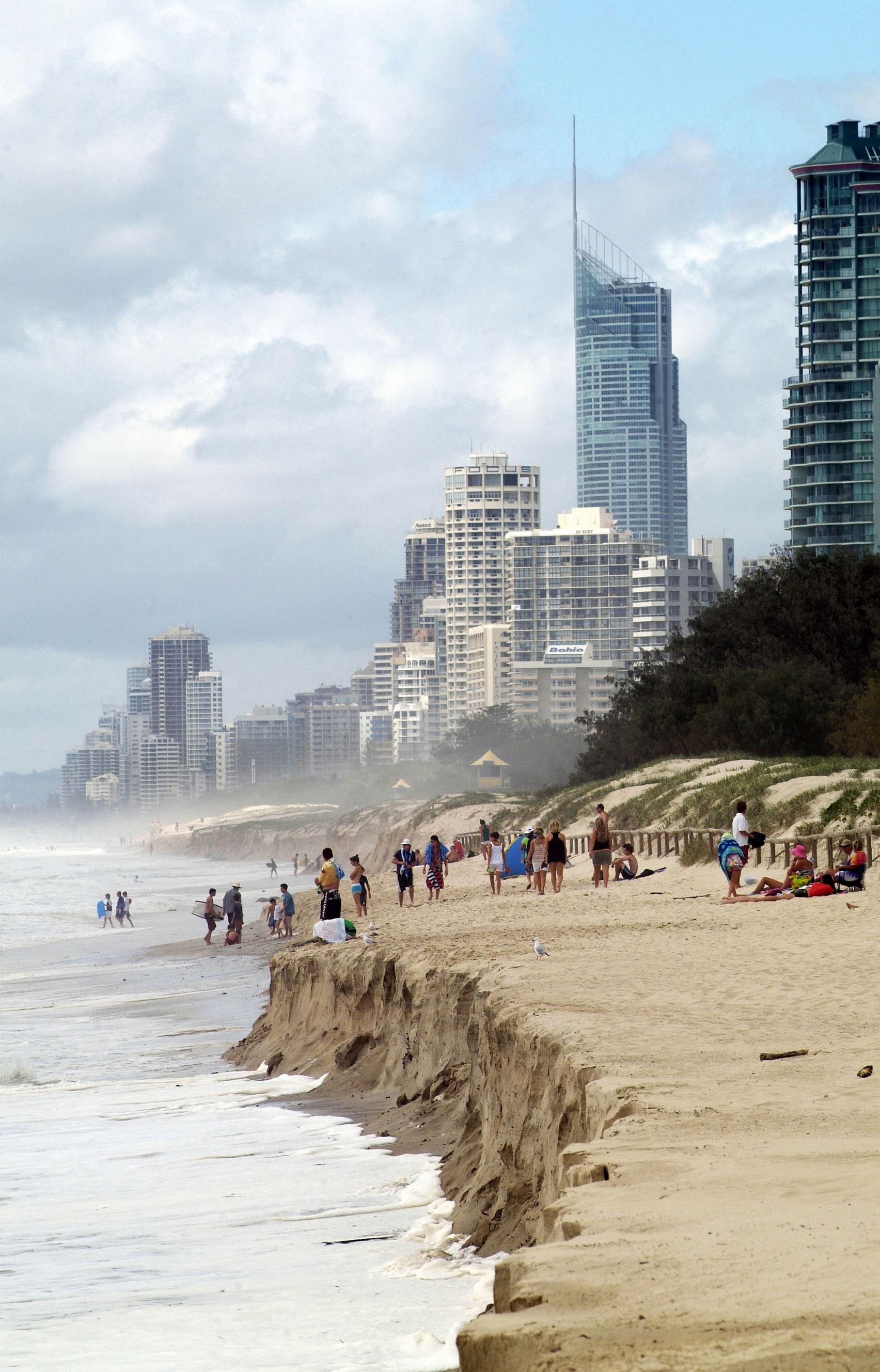
A king tide is an especially high spring tide, especially the perigean spring tides which occur three or four times a year. King tide is not a scientific term, nor is it used in a scientific context. The expression originated in Australia, New Zealand and other Pacific nations to describe especially high tides that occur a few times per year. It is now used in North America as well, particularly in low-lying South Florida, where king tides can cause tidal flooding. In Vancouver, Canada, king tides are a growing problem along its seawall. Definition King tides are the highest tides. They are naturally occurring, predictable events. Tides are the movement of water across Earth's surface caused by the combined effects of the gravitational forces exerted by the Moon, Sun, and the rotation of Earth which manifest in the local rise and fall of sea levels. Tides are driven by the relative positions of the Earth, Sun, Moon, land formations, and relative location on Earth. In th ... [...More Info...] [...Related Items...] OR: [Wikipedia] [Google] [Baidu] |
Republic Of The Marshall Islands
The Marshall Islands ( mh, Ṃajeḷ), officially the Republic of the Marshall Islands ( mh, Aolepān Aorōkin Ṃajeḷ),'' () is an independent island country and microstate near the Equator in the Pacific Ocean, slightly west of the International Date Line. Geographically, the country is part of the larger island group of Micronesia. The country's population of 58,413 people (at the 2018 World Bank Census) is spread out over five islands and 29 coral atolls, comprising 1,156 individual islands and islets. The capital and largest city is Majuro. It has the largest portion of its territory composed of water of any sovereign state, at 97.87%. The islands share maritime boundaries with Wake Island to the north, Kiribati to the southeast, Nauru to the south, and Federated States of Micronesia to the west. About 52.3% of Marshall Islanders (27,797 at the 2011 Census) live on Majuro. In 2016, 73.3% of the population were defined as being "urban". The UN also indicates a population den ... [...More Info...] [...Related Items...] OR: [Wikipedia] [Google] [Baidu] |
Largest Emission Producers
This is a list of countries by total greenhouse gas (GHG) annual emissions in 2016. It is based on data for carbon dioxide, methane (), nitrous oxide (), perfluorocarbons (PFCs), sulfur hexafluoride (SF6) and hydrofluorocarbons (HFCs) emissions compiled by the World Resources Institute (WRI).Climate Analysis Indicators Tool (CAIT), Climate Watch. 2018. Washington, DC: World Resources Institute (2019).Historical GHG Emissions. www.climatewatchdata.org. Retrieved 2020-11-08. The CAIT dataset is briefly describehere and in more detaihere Its data sources are the Carbon Dioxide Information Analysis Center (CDIAC), the International Energy Agency (IEA), the United States Environmental Protection Agency (EPA), the United Nations Food and Agriculture Organization (FAO), and the United States Energy Information Administration (EIA). It does not use countries’ official inventories reported to the UNFCCC, in order to emphasize comparability of data across countries. The sectors covered ... [...More Info...] [...Related Items...] OR: [Wikipedia] [Google] [Baidu] |
Christopher Loeak
Christopher Jorebon Loeak (born 11 November 1952) is a Marshallese politician who was the President of the Marshall Islands from 2012 to 2016. He was elected by parliament as President in January 2012, following the 2011 general election. Personal life Loeak was born on the Ailinglaplap Atoll on 11 November 1952. He attended Marshall Islands High School before traveling to the United States to study at the Hawaii Pacific College and Gonzaga University School of Law. Loeak is a native speaker of Marshallese and also speaks English. He is married to Anono Lieom Loeak and has three children and eight grandchildren. Political career Loeak was first elected to the ''Nitijela'' in 1985 when he represented the Ailinglaplap Atoll. He served in the cabinet of President Amata Kabua as Minister of Justice from 1988 to 1992. He became Minister of Social Services in 1992 and held that post until 1996 when Kunio Lemari became acting president on the death of Kabua and Loeak became Ministe ... [...More Info...] [...Related Items...] OR: [Wikipedia] [Google] [Baidu] |
Bikini Atoll
Bikini Atoll ( or ; Marshallese: , , meaning "coconut place"), sometimes known as Eschscholtz Atoll between the 1800s and 1946 is a coral reef in the Marshall Islands consisting of 23 islands surrounding a central lagoon. After the Second World War, the atoll's inhabitants were forcibly relocated in 1946, after which the islands and lagoon were the site of 23 nuclear tests by the United States until 1958. The atoll is at the northern end of the Ralik Chain, approximately northwest of the capital Majuro. Three families were resettled on Bikini island in 1970, totaling about 100 residents, but scientists found dangerously high levels of strontium-90 in well water in May 1977, and the residents were carrying abnormally high concentrations of caesium-137 in their bodies. They were evacuated again in 1980. The atoll is occasionally visited today by divers and a few scientists, and is occupied by a handful of caretakers. Etymology The island's English name is derived from t ... [...More Info...] [...Related Items...] OR: [Wikipedia] [Google] [Baidu] |


