|
Caroline Street (other) , United States
{{disambiguation, road ...
Caroline Street may refer to: * Caroline Street (Hamilton, Ontario), Canada * Caroline Street (Cardiff), Wales * Caroline Street (Baltimore), United States ** Caroline Street Line *Caroline Street (Key West) Caroline Street is an iconic and historically significant local road on the island of Key West, Florida. It extends approximately northeastward to Grinnell Street from Whitehead Street at its southwest end. One of the oldest roads on the island, ... [...More Info...] [...Related Items...] OR: [Wikipedia] [Google] [Baidu] |
Caroline Street (Hamilton, Ontario)
This is a List of streets in Hamilton, Ontario, many of which were named after the Loyalist families who arrived to Hamilton after the British lost the American Revolutionary War. These names include Hess, Hughson, Herkimer, Land, Beasley, Gage, Doan, Davis, Mills, Carpenter, and Brant. The Loyalists were the pioneers of Hamilton and area. Many of the street names in Hamilton have changed over the years. James Street south of King was called Jarvis, Jackson Street was Maiden Lane, John Street was Mountain Street, Main Street east of James was Brougham Street, Hunter Street east of James was called Peel Street, Charlton Avenue West was Anderson Street, Charlton Avenue was Hannah Street, Park Street was Bond Street, Bay Street South was Bowry Street, Cannon Street was known as Henry Street, Barton Street West was Concession and Upper James Street on the mountain was known as Caledonia Road. Lower City (below Escarpment) * 50 Road * Aberdeen Avenue, named after Lord Aberdee ... [...More Info...] [...Related Items...] OR: [Wikipedia] [Google] [Baidu] |
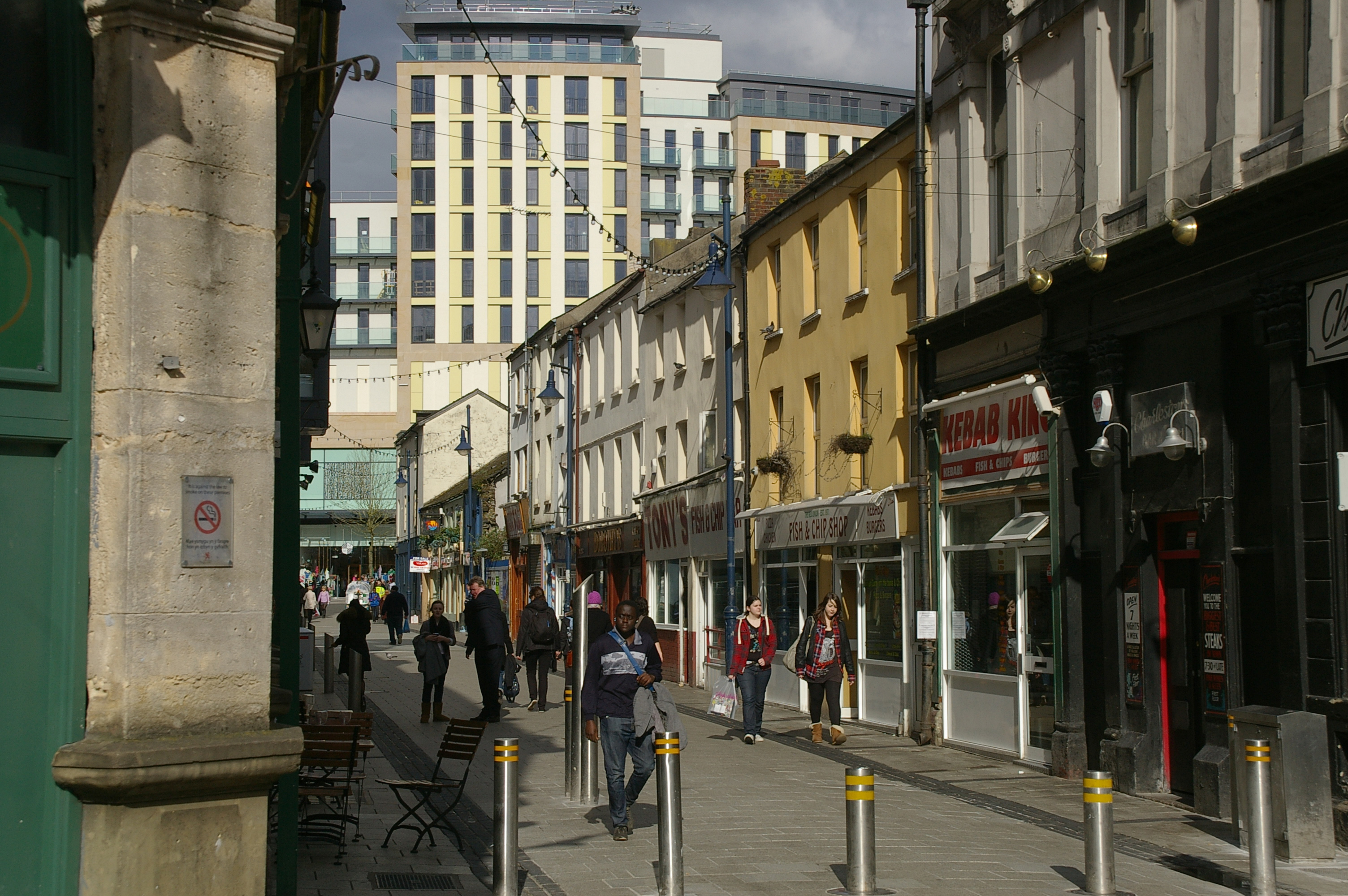
Caroline Street (Cardiff)
Caroline Street ( cy, Stryd Caroline) is a pedestrianised street running east–west in the lower part of Cardiff city centre, located between The Hayes and St. Mary's Street, Cardiff, St. Mary's Street. Due to the density of Fast food restaurant, fast food shops along the street, it is colloquially referred to as Chip Alley, or Chippy Lane. History Located within the original Cardiff town walls, town walls of Cardiff, and just south of the original Cardiff Gaol, much as though its modern form caters for the eating needs of the public, a number of buildings in Caroline Street have listed building status. Caroline Street was renamed in the Victorian era after Caroline of Brunswick, the wife of King George IV. The next street south is Charlotte Street, named after their daughter Princess Charlotte of Wales (1796–1817), Princess Charlotte of Wales. In 1857, the same year that the last public execution took place in Cardiff, records show that 150 died as a result of an outbreak of s ... [...More Info...] [...Related Items...] OR: [Wikipedia] [Google] [Baidu] |
Caroline Street (Baltimore)
This is a list of notable streets in the city of Baltimore, Maryland, United States. A B C D E F G H Heath St. Route 64. (MTA Maryland) K L M N O P R Ramsay st S U W Y Numbered streets In Baltimore, numbered streets are found in the north-central part of the city, mostly in the communities of Charles Village, Hampden, and Waverly. The numbered streets, which run west–east, start with 20th Street (excluding 19½ Street, a short alley crossing Howard Street), which runs parallel to and one block north of North Avenue. The highest numbered street in Baltimore is 43rd Street, which runs from York Road several block east to Marble Hall Road near Cold Spring Lane. The numbered streets correspond with the first two digits in address numbers on north–south streets in this part of the city. See also *List of roads in Baltimore County, Maryland References {{DEFAULTSORT:List Of Streets In Baltimore, Maryland Baltimore Str ... [...More Info...] [...Related Items...] OR: [Wikipedia] [Google] [Baidu] |
Caroline Street Line
Route 21 is a bus route operated by the Maryland Transit Administration in Baltimore. The line currently runs from the Mondawmin Metro Subway Station to Fells Point, serving the corridors of Gilmor Street, Preston/Biddle Streets, and Caroline Street, and the communities of Sandtown-Winchester, Mt. Royal, and Butcher's Hill. The bus route is the successor to the 21 Preston Street–Caroline Street and Dolphin Street streetcar lines. History Route 21 was electrified in 1895 as a streetcar line along Preston and Caroline Streets. In 1938, the line was converted to a rubber tire bus service. In 1957, the line was extended along Carey Street to the current loop at Cumberland and Carey Streets. The line did not have any routing changes until February 8, 2009, when it was extended north to the Mondawmin Metro Subway Station along Pennsylvania Avenue. References *1929 Baltimore Streetcar map, provided by Baltimore Streetcar Museum The Baltimore Streetcar Museum (BSM) is a 50 ... [...More Info...] [...Related Items...] OR: [Wikipedia] [Google] [Baidu] |
