|
Blagoveshchensk
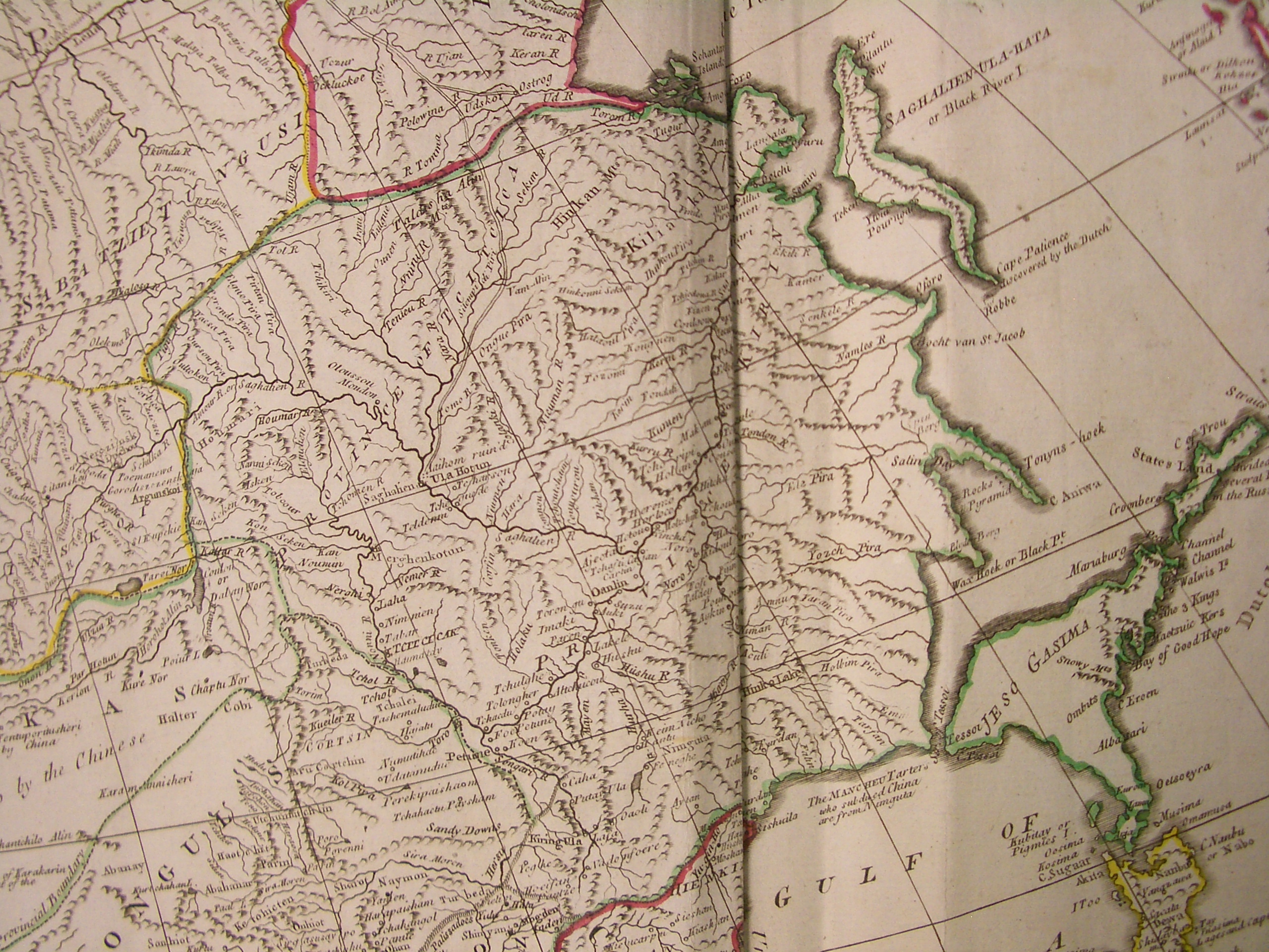
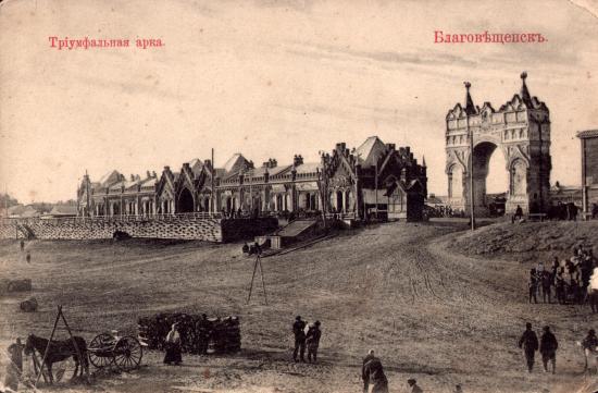
Blagoveshchensk ( rus, Благове́щенск, p=bləgɐˈvʲeɕːɪnsk, meaning ''City of the Annunciation'') is a city and the administrative center of Amur Oblast, Russia. It is located at the confluence of the Amur and the Zeya Rivers, opposite to the Chinese city of Heihe. Population: The Amur has formed Russia's border with China since the 1858 Aigun Treaty and the 1860 Treaty of Peking. The area north of the Amur belonged to the Manchu Qing dynasty by the Treaty of Nerchinsk of 1689 until it was ceded to Russia by the Aigun Treaty in 1858. History Early history of the region The early residents of both sides of the Amur in the region of today's Blagoveshchensk were the Daurs and Duchers. An early settlement in the area of today's Blagoveshchensk was the Ducher town whose name was reported by the Russian explorer Yerofey Khabarov as Aytyun in 1652, as Aigun from 1683 to 1685, and as Aigun Old Town from 1685 until the massacre in 1900, which known to Russian archaeolo ... [...More Info...] [...Related Items...] OR: [Wikipedia] [Google] [Baidu] |
Blagoveshchensk City Duma
Blagoveshchensk ( rus, Благове́щенск, p=bləgɐˈvʲeɕːɪnsk, meaning ''City of the Annunciation'') is a types of inhabited localities in Russia, city and the administrative center of Amur Oblast, Russia. It is located at the confluence of the Amur River, Amur and the Zeya Rivers, opposite to the Chinese city of Heihe. Population: The Amur has formed China–Russia border, Russia's border with China since the 1858 Aigun Treaty and the 1860 Treaty of Peking. The area north of the Amur belonged to the Manchu Qing dynasty by the Treaty of Nerchinsk of 1689 until it was ceded to Russia by the Aigun Treaty in 1858. History Early history of the region The early residents of both sides of the Amur in the region of today's Blagoveshchensk were the Daur people, Daurs and Duchers. An early settlement in the area of today's Blagoveshchensk was the Ducher town whose name was reported by the Russian explorer Yerofey Khabarov as Aytyun in 1652, as Aigun from 1683 to 1685, and a ... [...More Info...] [...Related Items...] OR: [Wikipedia] [Google] [Baidu] |
Blagoveshchensky District, Amur Oblast
Blagoveshchensky District (russian: Благове́щенский райо́н) is an administrativeLaw #127-OZ and municipalLaw #51-OZ district (raion), one of the administrative divisions of Amur Oblast, twenty in Amur Oblast, Russia. The area of the district is . Its administrative center is the types of inhabited localities in Russia, city of BlagoveshchenskAccording to Law #127-OZ, the administrative-territorial structure of Amur Oblast matches its municipal structure. The laws dealing with the structure of the municipal districts serve as the registries of the inhabited localities of the administrative districts and list their administrative centers. For Blagoveshchensky District, Law #51-OZ is used. (which is not administratively a part of the district). Population: 18,673 (Russian Census (2002), 2002 Census); Administrative and municipal status Within the subdivisions of Russia#Administrative divisions, framework of administrative divisions, Blagoveshchensky District i ... [...More Info...] [...Related Items...] OR: [Wikipedia] [Google] [Baidu] |
1900 Amur Anti-Chinese Pogroms
The 1900 Amur anti-Chinese pogroms () were a series of killings and reprisals undertaken by the Russian Empire against subjects of the Qing dynasty of various ethnicities, including Manchu people, Manchu, Daur people, Daur, and Han Chinese, Han peoples. They took place in Blagoveshchensk and in the Sixty-Four Villages East of the River in the Amur Oblast, Amur region, during the same time as the Boxer Rebellion in China. The events ultimately resulted in thousands of deaths, the loss of residency for Chinese subjects living in the Sixty-Four Villages East of the River, and increased Russian control over the region. The Russian justification for the pogroms were attacks made on Russian infrastructure outside Blagoveshchensk by Boxers (group), Chinese Boxers, which was then responded to by Russian force. The pogroms themselves occurred between 4–8 July (Old Style, O.S.; 17–21, New Style or N.S.), 1900. Name The name for the killings and reprisals that occurred in Amur is not s ... [...More Info...] [...Related Items...] OR: [Wikipedia] [Google] [Baidu] |
Heihe
Heihe (; ; Russian: Хэйхэ) is a prefecture-level city of northern Heilongjiang province, China, located on the Russian border, on the south bank of the Amur (Heilong) River, across the river from Blagoveshchensk. At the 2020 census, 1,286,401 people lived in the prefecture-level city of whom 223,832 lived in the built-up area (''or metro'') made of Aihui District. Heihe marks the northeast terminus of the diagonal Heihe–Tengchong Line, which is sometimes used to divide China into east and west. History Heihe, formerly Aihui or Aigun, is one of the five oldest cities in Heilongjiang, along with Tsitsihar, Yilan, Acheng and Hulan. Human beings started to settle in Heihe region as early as the Paleolithic Age.Амурская область: Истори ... [...More Info...] [...Related Items...] OR: [Wikipedia] [Google] [Baidu] |
Amur Oblast
Amur Oblast ( rus, Аму́рская о́бласть, r=Amurskaya oblast, p=ɐˈmurskəjə ˈobləsʲtʲ) is a federal subject of Russia (an oblast), located on the banks of the Amur and Zeya Rivers in the Russian Far East. The administrative center of the oblast, the city of Blagoveshchensk, is one of the oldest settlements in the Russian Far East, founded in 1856. It is a traditional center of trade and gold mining. The territory is accessed by two railways: the Trans-Siberian Railway and the Baikal–Amur Mainline. As of the 2010 Census, the oblast's population was 830,103. Amur Krai () or Priamurye () were unofficial names for the Russian territories by the Amur River used in the late Russian Empire that approximately correspond to modern Amur Oblast. Geography Amur Oblast is located in the southeast of Russia, between Stanovoy Range in the north and the Amur River in the south, and borders with the Sakha Republic in the north, Khabarovsk Krai and the Jewish Auto ... [...More Info...] [...Related Items...] OR: [Wikipedia] [Google] [Baidu] |
Grodekovo, Amur Oblast
Grodekovo (russian: Гродеково) is a rural locality (a selo) and the administrative center of Grodekovsky Selsoviet of Blagoveshchensky District, Amur Oblast, Russia. The population was 523 as of 2018. There are 10 streets. Geography Grodekovo is located on the left bank of the Amur River, 36 km south of Blagoveshchensk Blagoveshchensk ( rus, Благове́щенск, p=bləgɐˈvʲeɕːɪnsk, meaning ''City of the Annunciation'') is a city and the administrative center of Amur Oblast, Russia. It is located at the confluence of the Amur and the Zeya Rivers, opp ... (the district's administrative centre) by road. Nikolayevka is the nearest rural locality. References Rural localities in Blagoveshchensky District, Amur Oblast {{AmurOblast-geo-stub ... [...More Info...] [...Related Items...] OR: [Wikipedia] [Google] [Baidu] |
Zeya River
The Zeya (russian: Зе́я; from indigenous Evenki word "djee" (blade); zh, 结雅; mnc, m= , Mölendroff: jingkiri bira) is a northern, left tributary of the Amur in Amur Oblast, Russia. It is long, and has a drainage basin of . The average flow of the river is . History The first Russian documented to enter the area was Vassili Poyarkov. Course It rises in the Toko-Stanovik mountain ridge, a part of the Stanovoy Range. The Zeya flows through the Zeya Reservoir, at the junction of the Tukuringra Range and Dzhagdy Range, and joins the Amur near Blagoveshchensk, at the border with China. Regulation of river discharge by Zeya Dam mitigates extremities of river flow down to 5000 m³/s. The Zeya contributes around 16% of both the average and maximum flow of de Amur because of the flow regulations. In the past, the Zeya could have contributed up to almost 50% of the Amur's maximum flow of approximately 30,000 m³/s. The main tributaries of the Zeya are Tok, Mulmuga, Bryanta ... [...More Info...] [...Related Items...] OR: [Wikipedia] [Google] [Baidu] |
Amur River
The Amur (russian: река́ Аму́р, ), or Heilong Jiang (, "Black Dragon River", ), is the world's List of longest rivers, tenth longest river, forming the border between the Russian Far East and Northeast China, Northeastern China (Inner Manchuria). The Amur proper is long, and has a drainage basin of . ''mizu'' ("water") in Japanese. The name "Amur" may have evolved from a root word for water, coupled with a size modifier for "Big Water". Its ancient Chinese names were ''Yushui'', ''Wanshui'' and ''Heishui'', formed from variants to ''shui'', meaning "water".The fishes of the Amur River:updated check-list and zoogeography'' The modern Chinese name for the river, ''Heilong Jiang'' means "Cardinal_directions#Cultural_variations, Black Dragon River", while the Manchurian language, Manchurian name ''Sahaliyan Ula'', the Mongolian names " Amar mörön " (Cyrillic: Амар мөрөн) originates from the name " Amar " meaning to rest and ''Khar mörön'' (Cyrillic: Хар � ... [...More Info...] [...Related Items...] OR: [Wikipedia] [Google] [Baidu] |
Ducher
The Duchers (russian: дючеры or дучеры) was the Russian name of the people populating the shores of the middle course of the Amur River, approximately from the mouth of the Zeya down to the mouth of the Ussuri, and possibly even somewhat further downstream. ''dyucher'' etymology as well, as one of three possible options, but considers it unlikely. Another view, expressed by A.A. Burykin, is that Russian "дючер" (''Dyucher'') may have come from Manchu The Manchus (; ) are a Tungusic East Asian ethnic group native to Manchuria in Northeast Asia. They are an officially recognized ethnic minority in China and the people from whom Manchuria derives its name. The Later Jin (1616–1636) and ... , , meaning "guards along the river". References {{Tungusic peoples Historical ethnic groups of Russia Ethnic groups in China History of Manchuria Tungusic peoples ... [...More Info...] [...Related Items...] OR: [Wikipedia] [Google] [Baidu] |
Daur People
The Daur people (Khalkha Mongolian: Дагуур, ''Daguur''; ) are a Mongolic people in Northeast China. The Daur form one of the 56 ethnic groups officially recognised in the People's Republic of China. They numbered 131,992 according to the latest census (2010) and most of them live in Morin Dawa Daur Autonomous Banner in Hulun Buir, Inner Mongolia and Meilisi Daur District in Qiqihar, Heilongjiang of China. There are also some near Tacheng in Xinjiang, where their ancestors were moved during the Qing dynasty. Language The Dagur language is a Mongolic language. There is a Latin-based orthography which has been devised by a native Daur scholar. The Dagur language retains some Khitan substratal features, including a number of lexemes not found in other Mongolic languages. It is made up of three dialects: Batgan, Hailar, Qiqihar. During Qing rule, some Daur spoke and wrote Manchu as a second language. History Genetically, the Daurs are descendants of the Khitan, as ... [...More Info...] [...Related Items...] OR: [Wikipedia] [Google] [Baidu] |
Mudanjiang River
Mudanjiang (; Manchu: ''Mudan bira''), alternately romanized as Mutankiang, is a prefecture-level city in the southeast part of Heilongjiang province, People's Republic of China. It was called ''Botankou'' under Japanese occupation. It serves as a regional transport hub with a railway junction and an international airport connecting with several major Chinese cities as well as Incheon International Airport serving Seoul. Mudanjiang is located from Vladivostok, Russia. In 2011, Mudanjiang had a GDP of RMB 93.48 billion with a 15.1% growth rate. In 2015, Mudanjiang had a GDP of RMB 118.63 billion. Its population was 2,290,208 as the 2020 census whom 930,051 lived (965,154 in 2010) in the built-up area made of 4 urban districts. In 2007, the city is named China's top ten livable cities by Chinese Cities Brand Value Report, which was released at 2007 Beijing Summit of China Cities Forum. Administrative divisions History File:Mudanjiang Old Station.jpg, Mudanjiang Railway Statio ... [...More Info...] [...Related Items...] OR: [Wikipedia] [Google] [Baidu] |


.jpg)


