|
Beddgelert
Beddgelert () is a village and community in the Snowdonia area of Gwynedd, Wales. The population of the community taken at the 2011 census was 455, and includes Nantmor and Nant Gwynant. It is reputed to be named after the legendary hound Gelert. The community is large and sparsely populated and covers 86 square kilometres. Location The village stands in a valley at the confluence of the River Glaslyn and the River Colwyn. Just above the confluence of the rivers, in the centre of the village, is an old stone bridge with two arches. The River Gwynant also exists in the area, coinciding with the River Colwyn under what locals know as ‘Pont Bren’, creating the River Glaslyn. Many of the houses and hotels are built of local dark stone. To the west is Moel Hebog and its neighbours to the north and a series of hills rising to the top of Snowdon. A lane of the A4085 between Caernarfon (13 miles north) and Porthmadog (8 miles south) runs through the village. The outdoor e ... [...More Info...] [...Related Items...] OR: [Wikipedia] [Google] [Baidu] |
Beddgelert - 1
Beddgelert () is a village and community in the Snowdonia area of Gwynedd, Wales. The population of the community taken at the 2011 census was 455, and includes Nantmor and Nant Gwynant. It is reputed to be named after the legendary hound Gelert. The community is large and sparsely populated and covers 86 square kilometres. Location The village stands in a valley at the confluence of the River Glaslyn and the River Colwyn. Just above the confluence of the rivers, in the centre of the village, is an old stone bridge with two arches. The River Gwynant also exists in the area, coinciding with the River Colwyn under what locals know as ‘Pont Bren’, creating the River Glaslyn. Many of the houses and hotels are built of local dark stone. To the west is Moel Hebog and its neighbours to the north and a series of hills rising to the top of Snowdon. A lane of the A4085 between Caernarfon (13 miles north) and Porthmadog (8 miles south) runs through the village. The outdoor eq ... [...More Info...] [...Related Items...] OR: [Wikipedia] [Google] [Baidu] |
The Priory And Parish Church Of Saint Mary (Beddgelert)
The Priory and Parish Church of Saint Mary is in Beddgelert, in the Snowdonia area of Gwynedd, Wales. It is a Grade II* listed building, on the site of one of the oldest Christian establishments in Wales. An early Christian community was established there in the 6th century AD which is mentioned by Gerald of Wales. An Augustinian priory was founded there in the 13th century and in the Middle Ages it grew substantially thanks to the support of important Welsh nobles including Prince Llewelyn. The priory and many of its records were destroyed in 1283 or 1284 by a fire. As of the early 16th century it was Sir John Wynn (ancestor of the Barons Newborough who owned the priory in addition to Bardsey Island. In the 16th century, as part of the dissolution of the monasteries, the priory was closed in October 1535 and became a simple parish church. Remnants of the church's medieval past include transept arches and some of the stonework around the lancet windows. The Victorian era brought ... [...More Info...] [...Related Items...] OR: [Wikipedia] [Google] [Baidu] |
Saint Gelert
Saint Gelert, also known as Celer, Celert or Kellarth (see below), was an early Celtic saint. Several locations in Wales are believed to bear his name. They include Beddgelert ("Gelert's grave") and the surrounding Gelert Valley and Llangeler ("Gelert's church") where there is a church dedicated to him. Through the promotional efforts of an innkeeper in the early 1790s, St. Gelert, the human, has become much conflated with the legend of a saintly dog putatively from the same region, Gelert.The Story of Beddgelert: real tragedy or urban myth? accessed March 9, 2011. Name The name "Gelert" is a cymricized variant of Celert or Cilert (also written ''Cylart'',[...More Info...] [...Related Items...] OR: [Wikipedia] [Google] [Baidu] |
A4085 Road
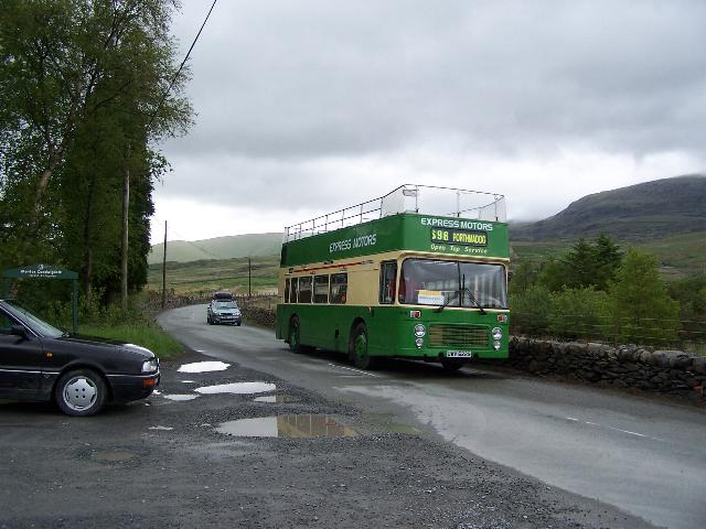
The A4085 is a 20-mile road between Caernarfon and Penrhyndeudraeth in North Wales that runs through the scenic Aberglaslyn Pass. There are several locations where the road is of substandard width. The road begins at the southern apex of a triangular one-way system in Caernarfon on the A487. It heads south, signposted for Beddgelert. As it leaves Caernarfon it passes the site of the Roman legionary fort Segontium and later crosses the Afon Seiont and the course of the Caernarfon-to-Llanberis railway. After 1.5 miles it crosses a roundabout at Caeathro. The road as far as Waunfawr is reputed to be a Roman road and is fairly straight. After Waunfawr the road joins the Gwyrfai Valley, a glaciated U-shaped valley along the west side of Snowdon. At four places along the valley it crosses and recrosses the Welsh Highland Railway. The road passes along the east shore of Llyn Cwellyn (Caernarfon's water supply), before climbing to a summit just south of Rhyd Ddu. The summit of the pas ... [...More Info...] [...Related Items...] OR: [Wikipedia] [Google] [Baidu] |
Gelert
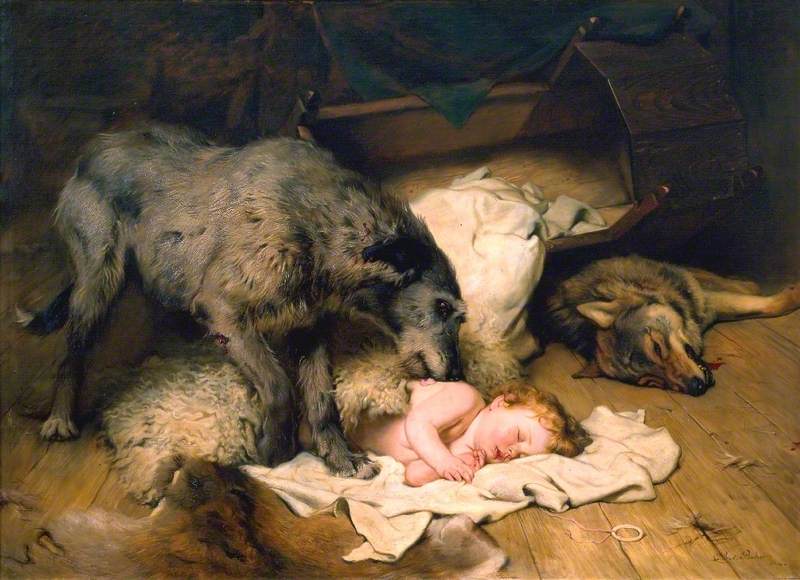
Gelert () is a legendary wolfhound associated with the village of Beddgelert (whose name means "Gelert's Grave") in Gwynedd, north-west Wales. In the legend, Llywelyn the Great returns from hunting to find his baby missing, the cradle overturned, and Gelert with a blood-smeared mouth. Believing the dog had savaged the child, Llywelyn draws his sword and kills Gelert. After the dog's dying yelp, Llywelyn hears the cries of the baby, unharmed under the cradle, along with a dead wolf which had attacked the child and been killed by Gelert. Llywelyn is overcome with remorse and buries the dog with great ceremony, but can still hear its dying yelp. After that day, Llywelyn never smiles again. The story is a variation on the '' "Faithful Hound" folk-tale motif'', which lives on as an urban legend. It is classified as Aarne–Thompson type 178A. Poems and other interpretations This story formed the basis for several English poems, among which are "Beth Gêlert; or, the Grave of the ... [...More Info...] [...Related Items...] OR: [Wikipedia] [Google] [Baidu] |
River Colwyn
The Afon Colwyn ( en, River Colwyn, italic=yes) is a small river in Gwynedd, north-west Wales, a tributary of the Afon Glaslyn. It has its source on the south-western flank of Snowdon. It first flows west to cross the A4085 Caernarfon to Beddgelert road at Pont Cae'r Gors just south of Rhyd Ddu, then flows south parallel to the A4085 to Beddgelert. On the way it is joined by two tributaries, Afon Cwm-du and Afon Meillionen. At Beddgelert it joins the Glaslyn, to then flow south to Tremadog Bay near Porthmadog. The Colwyn is a short and fast-flowing river. It generally carries less water than the Glaslyn, but water levels can rise very rapidly when there is heavy rain. Thriver is popular with whitewater kayakersand anglers. References {{Authority control Colwyn Colwyn Colwyn was a local government district with borough status from 1974 to 1996, being one of six districts in the county of Clwyd, north-east Wales. History The borough was created on 1 April 1974, ... [...More Info...] [...Related Items...] OR: [Wikipedia] [Google] [Baidu] |
Snowdon
Snowdon () or (), is the highest mountain in Wales, at an elevation of above sea level, and the highest point in the British Isles outside the Scottish Highlands. It is located in Snowdonia National Park (') in Gwynedd (historic county of Caernarfonshire). On 17 November 2022, the Snowdonia National Park Authority announced they are to use the Welsh name ''Yr Wyddfa'' for ''Snowdon'' and ''Eryri'' for ''Snowdonia'' in all circumstances and capacities, in English and Welsh. It is the busiest mountain in the United Kingdom and the third most visited attraction in Wales; in 2019 it was visited by 590,984 walkers, with an additional 140,000 people taking the train. It is designated as a national nature reserve (United Kingdom), national nature reserve for its rare flora and fauna. The rocks that form Snowdon were produced by volcanoes in the Ordovician period, and the massif has been extensively sculpted by glaciation, forming the pyramidal peak of Snowdon and the ar ... [...More Info...] [...Related Items...] OR: [Wikipedia] [Google] [Baidu] |
Moel Hebog
Moel Hebog (Welsh for ''Bare Hill of the Hawk'') is a mountain in Snowdonia, north Wales which dominates the view west from the village of Beddgelert. It gives name to a whole range of peaks in the north-western corner of Snowdonia, which include the Nantlle Ridge and Mynydd Mawr. From that side, Moel Hebog has a rocky face with a distinctive pointed summit, although from other sides, it appears more rounded. The exposed rock means that it is often visited by students of geology. Much of the mountain consists of welded, fiamme rich rhyolitic tuff. It is often climbed from Beddgelert and it can be combined with the nearby mountains of Moel yr Ogof and Moel Lefn for a longer walk. This route, however, does involve some easy scrambling. On Moel yr Ogof can be found Owain Glyndŵr's Cave. The view of Moel Hebog and Llyn Gwynant from the north near Snowdon is one of the most photographed in Snowdonia. A late Bronze Age shield was found in a bog near Moel Hebog in 1784. I ... [...More Info...] [...Related Items...] OR: [Wikipedia] [Google] [Baidu] |
Nant Gwynant
Nant Gwynant (also spelt Nantgwynant) is a valley in northern Wales. The A498 road descends into the valley in about two miles (3 km) from Pen-y-Gwryd; it follows the Nant Cynnyd, the Afon Glaslyn and alongside Llyn Gwynant, then beside the Nant Gwynant river to Llyn Dinas and passing below Dinas Emrys to Beddgelert. The road continues through the Aberglaslyn Pass to Porthmadog. History and geography Early references The earliest contemporary reference to a route down the valley comes from John Leland, antiquarian to King Henry VIII, who travelled to Wales in 1538. In describing Nant Gwynant, he wrote: "The trees were so thick that a man on a white horse could not be seen from Llyn y Dinas to Pen y Gwryd." In 1802 Williams Williams described it as “a road, or rather a mere right of passage”. He continued: "Through this charming valley, like all other mountainous unimproved roads, the road is very bad, circuitous, and winding, and absolutely impassable when the floods ... [...More Info...] [...Related Items...] OR: [Wikipedia] [Google] [Baidu] |
Porthmadog
Porthmadog (; ), originally Portmadoc until 1974 and locally as "Port", is a Welsh coastal town and community in the Eifionydd area of Gwynedd and the historic county of Caernarfonshire. It lies east of Criccieth, south-west of Blaenau Ffestiniog, north of Dolgellau and south of Caernarfon. The community population of 4,185 in the 2011 census was put at 4,134 in 2019. It grew in the 19th century as a port for local slate, but as the trade declined, it continued as a shopping and tourism centre, being close to Snowdonia National Park and the Ffestiniog Railway. The 1987 National Eisteddfod was held there. It includes nearby Borth-y-Gest, Morfa Bychan and Tremadog. History Porthmadog came about after William Madocks built a sea wall, the ''Cob'', in 1808–1811 to reclaim much of Traeth Mawr from the sea for farming use. Diversion of the Afon Glaslyn caused it to scour out a new natural harbour deep enough for small ocean-going sailing ships,John Dobson and Roy Woods, ''Ffe ... [...More Info...] [...Related Items...] OR: [Wikipedia] [Google] [Baidu] |
Snowdonia
Snowdonia or Eryri (), is a mountainous region in northwestern Wales and a national park of in area. It was the first to be designated of the three national parks in Wales, in 1951. Name and extent It was a commonly held belief that the name is derived from ("eagle"), and thus means "the abode/land of eagles", but recent evidence is that it means ''highlands'', and is related to the Latin (to rise) as leading Welsh scholar Sir proved. The term first appeared in a manuscript in the 9th-century , in an account of the downfall of the semi-legendary 5th-century king (Vortigern). In the Middle Ages, the title ''Prince of Wales and Lord of Snowdonia'' () was used by ; his grandfather used the title ''Prince of north Wales and Lord of Snowdonia.'' The name ''Snowdonia'' derives from '' Snowdon'', the highest mountain in the area and the highest mountain in Wales at . Before the boundaries of the national park were designated, "Snowdonia" was generally used to refer to a sm ... [...More Info...] [...Related Items...] OR: [Wikipedia] [Google] [Baidu] |
Nantmor
Nantmor is a hamlet which lies about 1½ miles to the south of the village of Beddgelert in Gwynedd, Wales. The current spelling of the name Nantmor is more modernmost old documentfrom the 16th to the 18th century record the name as Nanmor. It lies close to the scenic Aberglaslyn Pass and the Welsh Highland Railway. Nantmor station has re-opened, following a 2007 vote in its favour by local residents. A car park run by the National Trust is a popular starting point for walks up Cwm Bychan or along the Aberglaslyn. The village is perhaps most famous for being the home of Dafydd Nanmor, a renowned 15th century bard (died c. 1490), who took his name from the hamlet, as did Rhys Nanmor after him. Dafydd Nanmor himself was possibly a bardic student of Rhys Goch, who lived at neighbouring Hafod Garegog. Filmed in Nantmor in 1957 the ''Inn of the Sixth Happiness'' is a 1958 British 20th Century Fox film based on the true story of Gladys Aylward, a tenacious British maid, who ... [...More Info...] [...Related Items...] OR: [Wikipedia] [Google] [Baidu] |


.jpg)

