|
Bälmeten
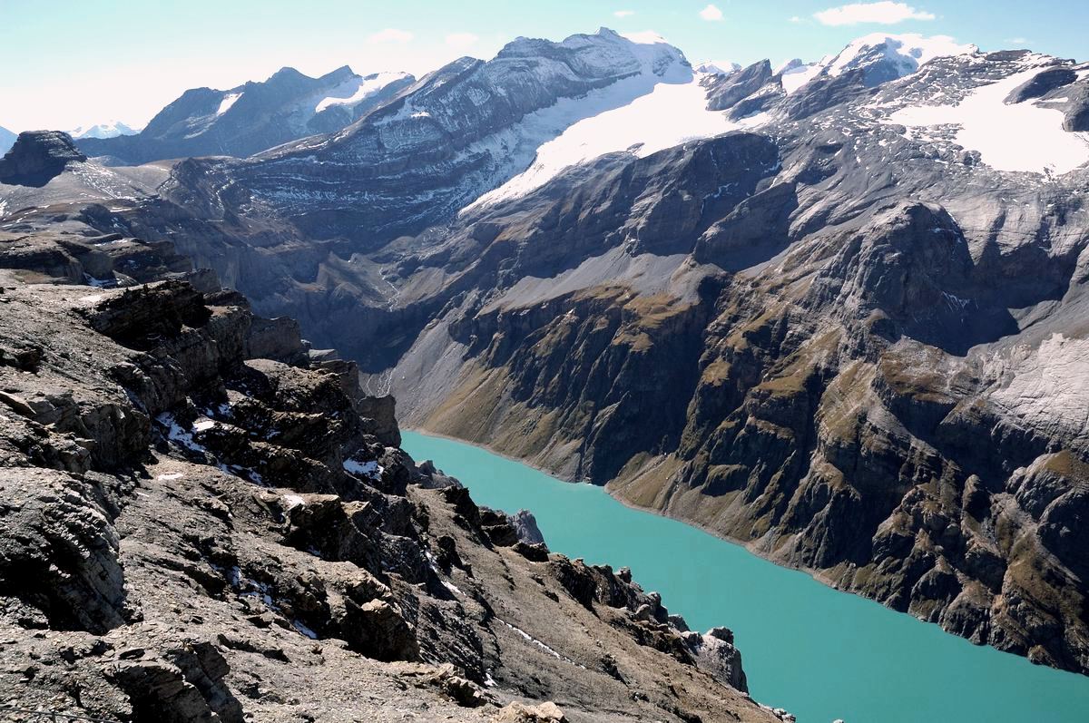
The Bälmeten (2,416 m) is a mountain of the Glarus Alps, overlooking Erstfeld in the canton of Uri. It lies west of the Hoch Fulen, in the group north-west of the Gross Windgällen The Gross Windgällen is a 3,187 m high mountain in the Glarus Alps, overlooking the valley of the Reuss in the canton of Uri. The name Gross Windgällen derives from Gälle or gellen, meaning as much as wailing, shrilling or whistling. G .... References External linksBälmeten on Hikr Mountains of Switzerland Mountains of the canton of Uri Mountains of the Alps {{Uri-mountain-stub ... [...More Info...] [...Related Items...] OR: [Wikipedia] [Google] [Baidu] |
Hoch Fulen
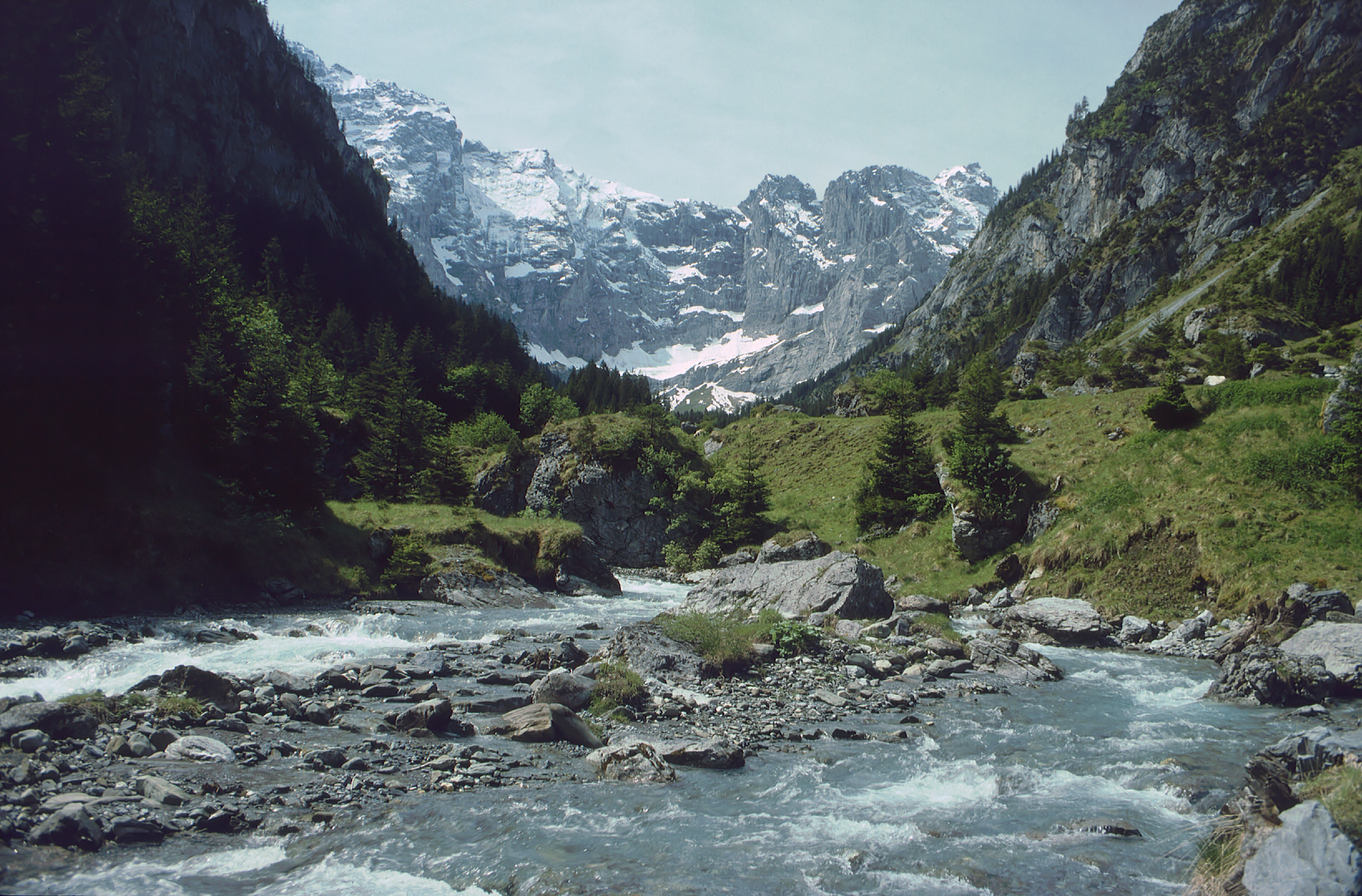
The Hoch Fulen is a mountain of the Glarus Alps, located east of Erstfeld in the Uri. It lies in the group north-west of the Gross Windgällen, between the Reuss Reuss may refer to: *Reuss (surname) *Reuss (river) in Switzerland *Reuss (state) or Reuß, several former states or countries in present-day Germany, and the Republic of Reuss *Reuss Elder Line and Reuss Younger Line (House of Reuss), members incl ... valley and the Schächental. References External linksHoch Fulen on Hikr Mountains of Switzerland Mountains of the canton of Uri Mountains of the Alps {{Uri-mountain-stub ... [...More Info...] [...Related Items...] OR: [Wikipedia] [Google] [Baidu] |
Swisstopo
Swisstopo is the official name for the Swiss Federal Office of Topography (in German language, German: ''Bundesamt für Landestopografie''; French language, French: ''Office fédéral de topographie''; Italian language, Italian: ''Ufficio federale di topografia''; Romansh language, Romansh: ''Uffizi federal da topografia''), Switzerland's national mapping agency. The current name was made official in 2002. It had been in use as the domain name for the institute's homepage, swisstopo.ch, since 1997. Maps The main class of products produced by Swisstopo are topographical maps on seven different Scale (map), scales. Swiss maps have been praised for their accuracy and quality. Regular maps * 1:25.000. This is the most detailed map, useful for many purposes. Those are popular with tourists, especially for famous areas like Zermatt and St. Moritz. These maps cost CHF 13.50 each (2004). 208 maps on this scale are published at regular intervals. The first map published on this scale ... [...More Info...] [...Related Items...] OR: [Wikipedia] [Google] [Baidu] |
Canton Of Uri
The canton of Uri (german: Kanton Uri rm, Chantun Uri; french: Canton d'Uri; it, Canton Uri) is one of the 26 cantons of Switzerland and a founding member of the Swiss Confederation. It is located in Central Switzerland. The canton's territory covers the valley of the Reuss between the St. Gotthard Pass and Lake Lucerne. The official language of Uri is (the Swiss variety of Standard) German, but the main spoken dialect is the Alemannic Swiss German called . Uri was once the only canton whose children in school had to learn Italian as their first foreign language, but in the school year of 2005/2006, that was changed to English, as in other Central and Northeastern Swiss cantons. The canton's population is about 35,000, of which 3,046 (or 8.7%) are foreigners. The legendary William Tell is said to have hailed from Uri. The historical landmark Rütli lies within the canton of Uri. Name The name of the valley is first mentioned in the 8th or 9th century, in the Latinized f ... [...More Info...] [...Related Items...] OR: [Wikipedia] [Google] [Baidu] |
Switzerland
). Swiss law does not designate a ''capital'' as such, but the federal parliament and government are installed in Bern, while other federal institutions, such as the federal courts, are in other cities (Bellinzona, Lausanne, Luzern, Neuchâtel, St. Gallen a.o.). , coordinates = , largest_city = Zürich , official_languages = , englishmotto = "One for all, all for one" , religion_year = 2020 , religion_ref = , religion = , demonym = , german: Schweizer/Schweizerin, french: Suisse/Suissesse, it, svizzero/svizzera or , rm, Svizzer/Svizra , government_type = Federalism, Federal assembly-independent Directorial system, directorial republic with elements of a direct democracy , leader_title1 = Federal Council (Switzerland), Federal Council , leader_name1 = , leader_title2 = , leader_name2 = Walter Thurnherr , legislature = Fe ... [...More Info...] [...Related Items...] OR: [Wikipedia] [Google] [Baidu] |
Glarus Alps
The Glarus Alps (german: Glarner Alpen) are a mountain range in central Switzerland. They are bordered by the Uri Alps and the Schwyz Alps to the west, the Lepontine Alps to the south, the Appenzell Alps to the northeast. The eastern part of the Glarus Alps contains a major thrust fault that was declared a geologic UNESCO World Heritage Site (the Swiss Tectonic Arena Sardona). The Glarus Alps extend well beyond the canton of Glarus, including parts of the cantons of Uri, Graubünden, and St Gallen. Conversely, not all the mountains in the canton of Glarus are part of the Glarus Alps, with those to the north of the Urner Boden and to the west of the valley of the river Linth considered to be part of the Schwyz Alps. Geography The main chain of the Glarus Alps can be divided into six minor groups, separated from each other by passes, the lowest of which exceeds 7,500 ft. The westernmost of these is the Crispalt, a rugged range including many peaks of nearly equal heigh ... [...More Info...] [...Related Items...] OR: [Wikipedia] [Google] [Baidu] |
Mountain
A mountain is an elevated portion of the Earth's crust, generally with steep sides that show significant exposed bedrock. Although definitions vary, a mountain may differ from a plateau in having a limited Summit (topography), summit area, and is usually higher than a hill, typically rising at least 300 metres (1,000 feet) above the surrounding land. A few mountains are Monadnock, isolated summits, but most occur in mountain ranges. Mountain formation, Mountains are formed through Tectonic plate, tectonic forces, erosion, or volcanism, which act on time scales of up to tens of millions of years. Once mountain building ceases, mountains are slowly leveled through the action of weathering, through Slump (geology), slumping and other forms of mass wasting, as well as through erosion by rivers and glaciers. High elevations on mountains produce Alpine climate, colder climates than at sea level at similar latitude. These colder climates strongly affect the Montane ecosystems, ecosys ... [...More Info...] [...Related Items...] OR: [Wikipedia] [Google] [Baidu] |
Erstfeld
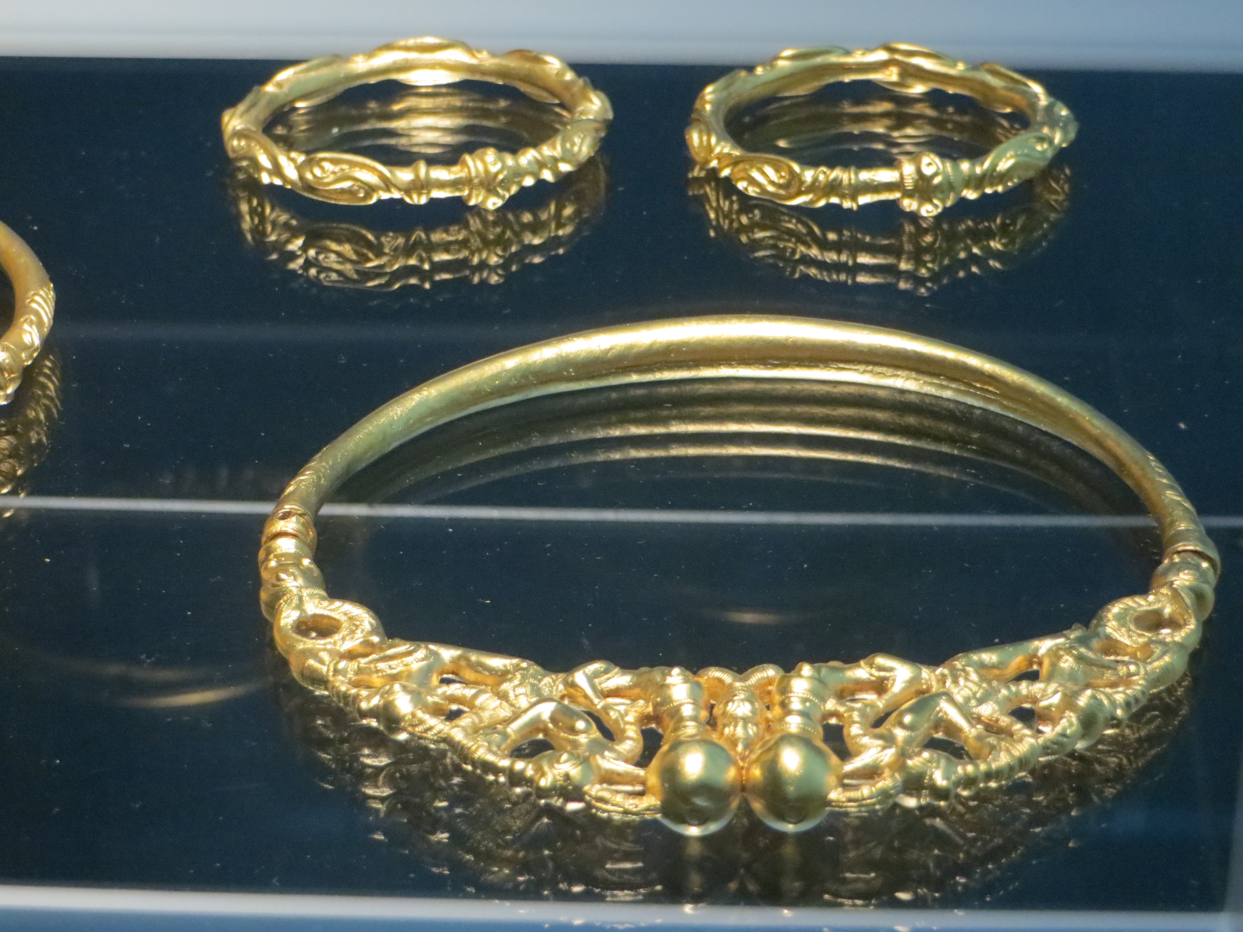
Erstfeld is a municipality in the canton of Uri in Switzerland. History In 1962 a collection of four gold torques and three gold arm rings were discovered near Erstfeld. While the exact origin date is unknown, they are likely from the 4th century BC. The nearly pure gold rings were discovered under of land slide debris. The rings show celtic motifs and designs and display a high level of skill. While their purpose is unknown, one theory is that they were offerings made to celebrate safely crossing the Alps. Erstfeld is first mentioned in 1258 as ''Ourzcvelt''. In 1638, it was listed under the Latin name ''in Protocampis''. In 1831, it was known as ''Hirschfelden''. Geography Erstfeld has an area, , of . Of this area, 11.7% is used for agricultural purposes, while 29.2% is forested. Of the rest of the land, 2.8% is settled (buildings or roads) and the remainder (56.2%) is non-productive (rivers, glaciers or mountains). , 19.8% of the total land area was heavily forested, whi ... [...More Info...] [...Related Items...] OR: [Wikipedia] [Google] [Baidu] |
Gross Windgällen
The Gross Windgällen is a 3,187 m high mountain in the Glarus Alps, overlooking the valley of the Reuss in the canton of Uri. The name Gross Windgällen derives from Gälle or gellen, meaning as much as wailing, shrilling or whistling. Geography The massif of the Gross Wingällen lies between two parallel valleys, the Schächental on the north side and the Maderanertal on the south side, both converging to the Reuss on the west at approximately 500 metres above sea level or 2,700 m below the summit. On the north side, the massif encloses a small valley, the Brunnital, which belong to the Schächental, thus forming an amphitheatre of several summits above 3,000 m, including the Gross Ruchen on the east; the north wall of the Gross Ruchen being connected with that of the Gross Windgällen. Several glaciers can be found on the southern side of the mountain, among which the Stäfelfirn, located east of the summit. The north-west face is very steep and has no glacie ... [...More Info...] [...Related Items...] OR: [Wikipedia] [Google] [Baidu] |
Mountains Of Switzerland
This article contains a sortable table of many of the major mountains and hills of Switzerland. The table only includes those summits that have a topographic prominence of at least above other points, and ranks them by height and prominence. Therefore it only includes mountains that might generally be regarded as 'independent' and covers most of the country, even lower areas. For a fuller list of mountains, including subsidiary points, see List of mountains of Switzerland above 3000 m and List of mountains of Switzerland above 3600 m. For a list of just the most isolated mountains, see List of most isolated mountains of Switzerland. Along with the lakes, mountains constitute a major natural feature of Switzerland with most of the cantons having summits exceeding and three of them having summits exceeding . The two main mountain ranges are the Alps (south and east) and the Jura (north and west), separated by the Swiss Plateau which also includes a large number of hills. Topo ... [...More Info...] [...Related Items...] OR: [Wikipedia] [Google] [Baidu] |
Mountains Of The Canton Of Uri
A mountain is an elevated portion of the Earth's crust, generally with steep sides that show significant exposed bedrock. Although definitions vary, a mountain may differ from a plateau in having a limited summit area, and is usually higher than a hill, typically rising at least 300 metres (1,000 feet) above the surrounding land. A few mountains are isolated summits, but most occur in mountain ranges. Mountains are formed through tectonic forces, erosion, or volcanism, which act on time scales of up to tens of millions of years. Once mountain building ceases, mountains are slowly leveled through the action of weathering, through slumping and other forms of mass wasting, as well as through erosion by rivers and glaciers. High elevations on mountains produce colder climates than at sea level at similar latitude. These colder climates strongly affect the ecosystems of mountains: different elevations have different plants and animals. Because of the less hospitable terrain and ... [...More Info...] [...Related Items...] OR: [Wikipedia] [Google] [Baidu] |


