|
Bystry, Chukotka Autonomous Okrug
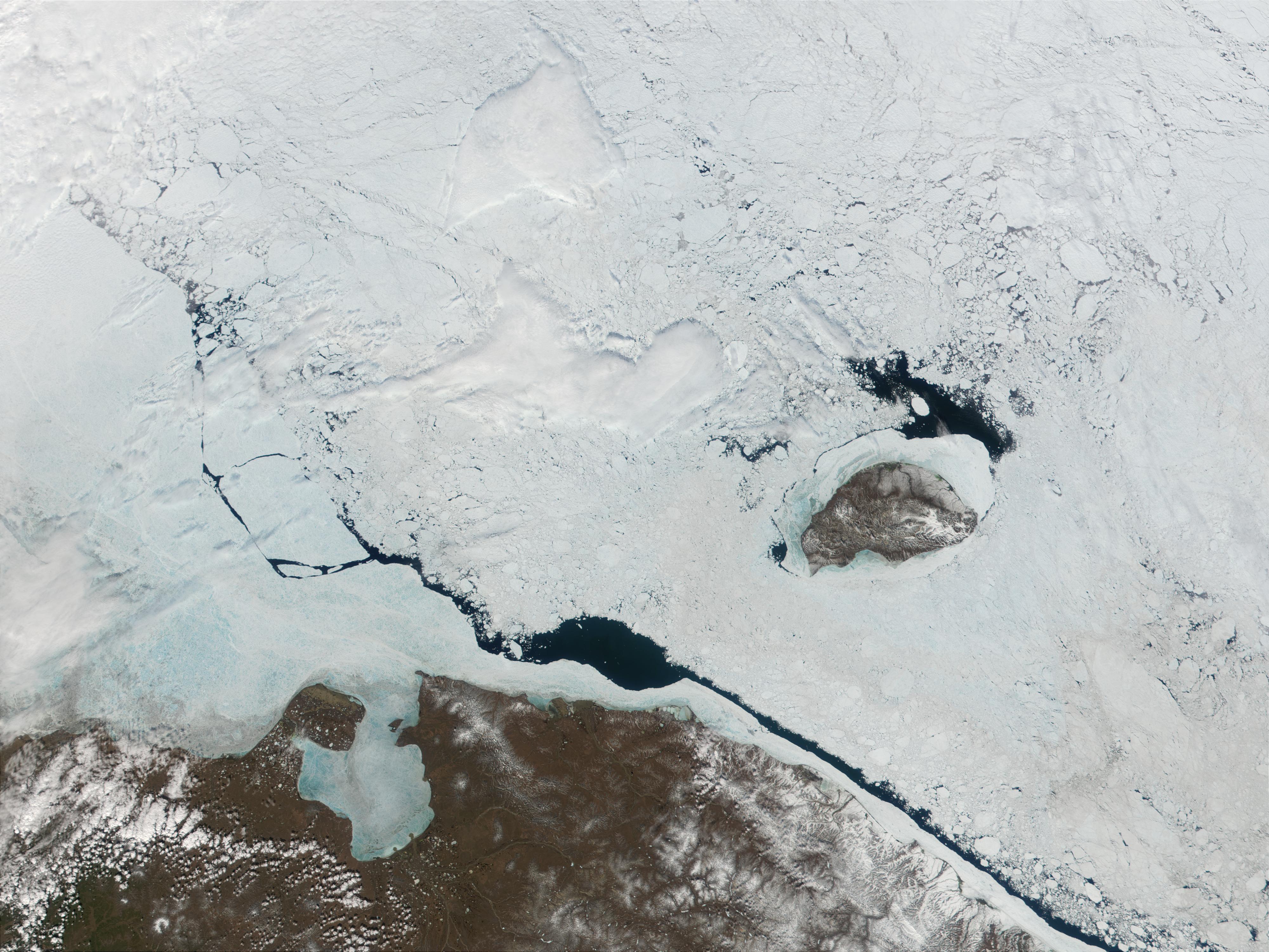
Bystry (russian: Бы́стрый, lit. ''quick'') was an urban locality (a work settlement) in Chaunsky District of Chukotka Autonomous Okrug, Russia, located northwest of Komsomolsky. The settlement was abandoned as a result of the extraction of gold no longer being economically viable and as of 2008 was in the process of being officially liquidated. History The mines were declared unprofitable and that there was no possibility of developing any other form of economy in 1999 and the settlement was closed along with a number of others in Chukotka.Постановление Пра� ... [...More Info...] [...Related Items...] OR: [Wikipedia] [Google] [Baidu] |
Chukotka Autonomous Okrug
Chukotka (russian: Чуко́тка), officially the Chukotka Autonomous Okrug,, ''Čukotkakèn avtonomnykèn okrug'', is the easternmost federal subjects of Russia, federal subject of Russia. It is an autonomous okrug situated in the Russian Far East, and shares a border with the Sakha, Sakha Republic to the west, Magadan Oblast to the south-west, and Kamchatka Krai to the south. Anadyr (town), Anadyr is the largest types of inhabited localities in Russia, town and the administrative center, capital, and the easternmost settlement to have town status in Russia. Chukotka is primarily populated by ethnic Russians, Chukchi people, Chukchi, and other Indigenous peoples of Siberia, indigenous peoples. It is the only autonomous okrug in Russia that is not included in, or subordinate to, another federal subject, having separated from Magadan Oblast in 1992. It is home to Lake Elgygytgyn, an impact crater lake, and Anyuyskiy, an extinct volcano. The village of Uelen is the easternmos ... [...More Info...] [...Related Items...] OR: [Wikipedia] [Google] [Baidu] |
Chaunsky District
Chaunsky District (russian: Ча́унский райо́н; Chukchi language, Chukchi: , ''Čaan rajon'') is an administrativeLaw #33-OZ and municipalLaw #46-OZ district (raion), one of the administrative divisions of Chukotka Autonomous Okrug, six in Chukotka Autonomous Okrug, Russia. It is located on the northern shore of the autonomous okrug and borders with Iultinsky District in the northeast, Anadyrsky District in the southeast, and with Bilibinsky District in the south and west. The area of the district is . Its administrative center is the types of inhabited localities in Russia, town of Pevek. Population: The population of Pevek accounts for 80.8% of the district's total population. Chaunsky District is flat compared to other districts in the autonomous okrug. The land within the current boundaries was first discovered by non-indigenous people in the 18th century, and now the indigenous people of the district are a minority as ethnic Russians came to the area following a g ... [...More Info...] [...Related Items...] OR: [Wikipedia] [Google] [Baidu] |
Types Of Inhabited Localities In Russia
The classification system of inhabited localities in Russia and some other post-Soviet states has certain peculiarities compared with those in other countries. Classes During the Soviet time, each of the republics of the Soviet Union, including the Russian SFSR, had its own legislative documents dealing with classification of inhabited localities. After the dissolution of the Soviet Union, the task of developing and maintaining such classification in Russia was delegated to the federal subjects.Articles 71 and 72 of the Constitution of Russia do not name issues of the administrative and territorial structure among the tasks handled on the federal level or jointly with the governments of the federal subjects. As such, all federal subjects pass their own laws establishing the system of the administrative-territorial divisions on their territories. While currently there are certain peculiarities to classifications used in many federal subjects, they are all still largely ba ... [...More Info...] [...Related Items...] OR: [Wikipedia] [Google] [Baidu] |
Urban-type Settlement
Urban-type settlementrussian: посёлок городско́го ти́па, translit=posyolok gorodskogo tipa, abbreviated: russian: п.г.т., translit=p.g.t.; ua, селище міського типу, translit=selyshche mis'koho typu, abbreviated: uk, с.м.т., translit=s.m.t.; be, пасёлак гарадскога тыпу, translit=pasiolak haradskoha typu; pl, osiedle typu miejskiego; bg, селище от градски тип, translit=selishte ot gradski tip; ro, așezare de tip orășenesc. is an official designation for a semi-urban settlement (previously called a "town A town is a human settlement. Towns are generally larger than villages and smaller than cities, though the criteria to distinguish between them vary considerably in different parts of the world. Origin and use The word "town" shares an ori ..."), used in several Eastern European countries. The term was historically used in Bulgaria, Poland, and the Soviet Union, and remains in use ... [...More Info...] [...Related Items...] OR: [Wikipedia] [Google] [Baidu] |
Russia
Russia (, , ), or the Russian Federation, is a List of transcontinental countries, transcontinental country spanning Eastern Europe and North Asia, Northern Asia. It is the List of countries and dependencies by area, largest country in the world, with its internationally recognised territory covering , and encompassing one-eighth of Earth's inhabitable landmass. Russia extends across Time in Russia, eleven time zones and shares Borders of Russia, land boundaries with fourteen countries, more than List of countries and territories by land borders, any other country but China. It is the List of countries and dependencies by population, world's ninth-most populous country and List of European countries by population, Europe's most populous country, with a population of 146 million people. The country's capital and List of cities and towns in Russia by population, largest city is Moscow, the List of European cities by population within city limits, largest city entirely within E ... [...More Info...] [...Related Items...] OR: [Wikipedia] [Google] [Baidu] |
Komsomolsky, Chukotka Autonomous Okrug
Komsomolsky (russian: Комсомо́льский) is an inhabited locality (an urban-type settlement) in Chaunsky District of Chukotka Autonomous Okrug, Russia, located about south-west of Pevek, the administrative centre of the district. Population: According to an environmental impact report produced for the Kupol Gold Project, by 2005 the population had fallen further to just 508. Geography Komsomolsky is located at the base of the Ichuvuveyem Hills, on the banks of the Ichuveyem River. The river's name is from the Chukchi for "river with rich pastures", an increasingly ironic derivation considering that the main economic driver in the area is now gold mining which is destroying the reindeer's pastures. History Soviet Period Komsomolsky is one of a number of inhabited localities of varying size throughout the former Soviet Union named after the Komsomol, the Soviet youth movement. Indeed, it was members of the Komsomol who were the first settlers in the area, who all v ... [...More Info...] [...Related Items...] OR: [Wikipedia] [Google] [Baidu] |
Pevek
Pevek (russian: Певе́к; Chukchi: , ''Pèèkin'' / ''Pèèk'') is an Arctic port town and the administrative center of Chaunsky District in Chukotka Autonomous Okrug, Russia, located on Chaunskaya Bay (part of the East Siberian Sea) on a peninsula on the eastern side of the bay facing the Routan Islands, above the Arctic Circle, about northwest of Anadyr, the administrative center of the autonomous okrug. Population: Pevek is a modern settlement established after World War I to provide a port for the export of minerals as part of the expanding Northern Sea Route. During the 1940s and 1950s, the area surrounding Pevek was the site of several gulags where prisoners mined uranium. In recent years, many of the mines became unprofitable and have closed, causing many residents to move to more central regions in Russia and the port infrastructure to decay. Pevek is the present location of the Akademik Lomonosov floating nuclear power plant, which carries two marine-type KLT-40S nu ... [...More Info...] [...Related Items...] OR: [Wikipedia] [Google] [Baidu] |
Krasnoarmeysky, Chukotka Autonomous Okrug
Krasnoarmeysky (russian: Красноармейский, literally ''Red Army''; ckt, Пырӄаӄай, ''Pyrḳaḳaj'') was an inhabited locality (an urban-type settlement) in Chaunsky District of Chukotka Autonomous Okrug, Russia. Population: 0 ( 2002 Census); History The settlement was founded in March 1940 on the banks of the Pyrkanayvaam River, 100 km from Pevek to house the miners and administrative workers from the Pyrkakay (russian: Пыркакай) tin mine, with the name being changed to Krasnoarmeysky in January 1942 to honour the victories of the Red Army. It was given settlement status in 1953, but was determined to no longer be economically viable in 1998. As of 2009, Krasnoarmeysky is included in the list of settlements currently in the process of being liquidated.Law #33, Article 14.2 Population The mines were declared unprofitable and that there was no possibility of developing any other form of economy in 1999 and the settlement was closed along ... [...More Info...] [...Related Items...] OR: [Wikipedia] [Google] [Baidu] |
Komsomol
The All-Union Leninist Young Communist League (russian: link=no, Всесоюзный ленинский коммунистический союз молодёжи (ВЛКСМ), ), usually known as Komsomol (; russian: Комсомол, links=no ()), a syllabic abbreviation of the Russian ), was a political youth organization in the Soviet Union. It is sometimes described as the youth division of the Communist Party of the Soviet Union (CPSU), although it was officially independent and referred to as "the helper and the reserve of the CPSU". The Komsomol in its earliest form was established in urban areas in 1918. During the early years, it was a Russian organization, known as the Russian Young Communist League, or RKSM. During 1922, with the unification of the USSR, it was reformed into an all-union agency, the youth division of the All-Union Communist Party. It was the final stage of three youth organizations with members up to age 28, graduated at 14 from the Young Pioneer ... [...More Info...] [...Related Items...] OR: [Wikipedia] [Google] [Baidu] |
Tundra
In physical geography, tundra () is a type of biome where tree growth is hindered by frigid temperatures and short growing seasons. The term ''tundra'' comes through Russian (') from the Kildin Sámi word (') meaning "uplands", "treeless mountain tract". There are three regions and associated types of tundra: Arctic tundra, alpine tundra, and Antarctic tundra. Tundra vegetation is composed of dwarf shrubs, sedges, grasses, mosses, and lichens. Scattered trees grow in some tundra regions. The ecotone (or ecological boundary region) between the tundra and the forest is known as the tree line or timberline. The tundra soil is rich in nitrogen and phosphorus. The soil also contains large amounts of biomass and decomposed biomass that has been stored as methane and carbon dioxide in the permafrost, making the tundra soil a carbon sink. As global warming heats the ecosystem and causes soil thawing, the permafrost carbon cycle accelerates and releases much of these soil-contained g ... [...More Info...] [...Related Items...] OR: [Wikipedia] [Google] [Baidu] |


