|
Bureya River
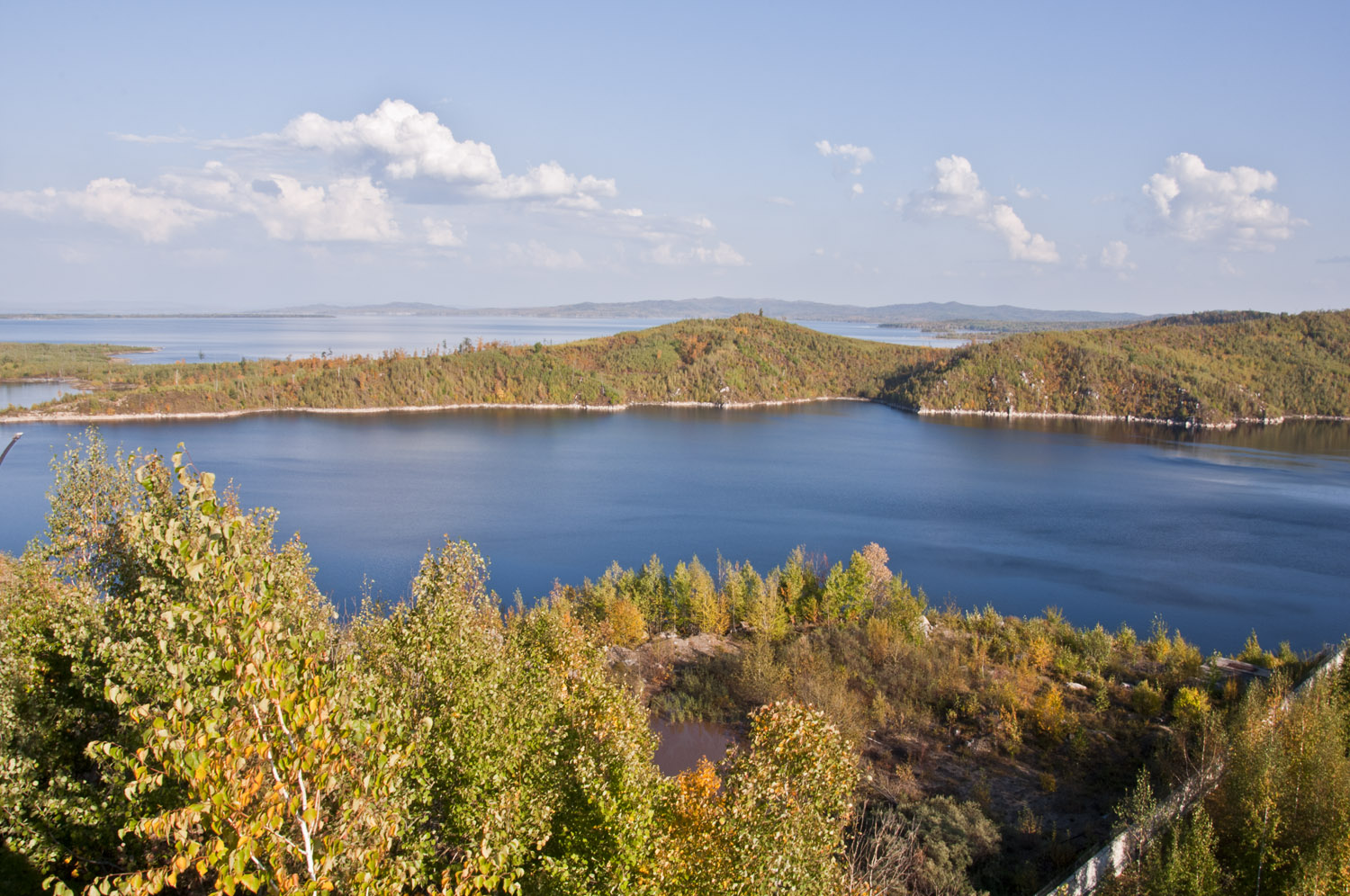
The Bureya () is a south-flowing, left tributary of the Amur, Amur river in Russia. It is long, and has a drainage basin of . Its name comes from the Evenk language, Evenk word ''birija'', meaning river. Course The Bureya is formed from the junction of the Pravaya (right) Bureya and the Levaya (left) Bureya. Geography Its basin is bounded in the west by the Turan Range and the river Zeya River, Zeya, to the south by the Amur, to the east by the Bureya Range, the rivers Urmi (river), Urmi and Amgun, and to the north by the Ezop Range and several rivers that flow northeastwards into the Sea of Okhotsk. There are no cities on the river, the largest settlements on the river are Novy Urgal on the Baikal Amur Mainline and, Novobureysky and Bureya, Russia, Bureya, both on the Trans-Siberian Railway. The Tyrma is a left tributary that crosses the railway south from Novy Urgal at the town of Tyrma. The Chegdomyn coal fields are north of Novy Urgal. The Bureya Dam, Bureya hydro power pla ... [...More Info...] [...Related Items...] OR: [Wikipedia] [Google] [Baidu] |
Russia
Russia (, , ), or the Russian Federation, is a List of transcontinental countries, transcontinental country spanning Eastern Europe and North Asia, Northern Asia. It is the List of countries and dependencies by area, largest country in the world, with its internationally recognised territory covering , and encompassing one-eighth of Earth's inhabitable landmass. Russia extends across Time in Russia, eleven time zones and shares Borders of Russia, land boundaries with fourteen countries, more than List of countries and territories by land borders, any other country but China. It is the List of countries and dependencies by population, world's ninth-most populous country and List of European countries by population, Europe's most populous country, with a population of 146 million people. The country's capital and List of cities and towns in Russia by population, largest city is Moscow, the List of European cities by population within city limits, largest city entirely within E ... [...More Info...] [...Related Items...] OR: [Wikipedia] [Google] [Baidu] |
Baikal Amur Mainline
Lake Baikal (, russian: Oзеро Байкал, Ozero Baykal ); mn, Байгал нуур, Baigal nuur) is a rift lake in Russia. It is situated in southern Siberia, between the Federal subjects of Russia, federal subjects of Irkutsk Oblast, Irkutsk Oblasts of Russia, Oblast to the northwest and the Republic of Buryatia to the southeast. With of water, Lake Baikal is the world's List of lakes by volume, largest freshwater lake by volume, containing 22–23% of the world's fresh surface water, more than all of the North American Great Lakes combined. It is also the world's List of lakes by depth, deepest lake, with a maximum depth of , and the world's ancient lake, oldest lake, at 25–30 million years. At —slightly larger than Belgium—Lake Baikal is the world's List of lakes by area, seventh-largest lake by surface area. It is among the world's clearest lakes. Lake Baikal is home to thousands of species of Plant, plants and animals, many of them endemic to the region. ... [...More Info...] [...Related Items...] OR: [Wikipedia] [Google] [Baidu] |
Great Soviet Encyclopedia
The ''Great Soviet Encyclopedia'' (GSE; ) is one of the largest Russian-language encyclopedias, published in the Soviet Union from 1926 to 1990. After 2002, the encyclopedia's data was partially included into the later ''Bolshaya rossiyskaya entsiklopediya'' (or '' Great Russian Encyclopedia'') in an updated and revised form. The GSE claimed to be "the first Marxist–Leninist general-purpose encyclopedia". Origins The idea of the ''Great Soviet Encyclopedia'' emerged in 1923 on the initiative of Otto Schmidt, a member of the Russian Academy of Sciences. In early 1924 Schmidt worked with a group which included Mikhail Pokrovsky, (rector of the Institute of Red Professors), Nikolai Meshcheryakov (Former head of the Glavit, the State Administration of Publishing Affairs), Valery Bryusov (poet), Veniamin Kagan (mathematician) and Konstantin Kuzminsky to draw up a proposal which was agreed to in April 1924. Also involved was Anatoly Lunacharsky, People's Commissar of Education ... [...More Info...] [...Related Items...] OR: [Wikipedia] [Google] [Baidu] |
List Of Rivers Of Russia
Russia can be divided into a European and an Asian part. The dividing line is generally considered to be the Ural Mountains. The European part is drained into the Arctic Ocean, Baltic Sea, Black Sea, and Caspian Sea. The Asian part is drained into the Arctic Ocean and the Pacific Ocean. Notable rivers of Russia in Europe are Volga (which is the longest river in Europe), Pechora, Don, Kama, Oka and the Northern Dvina, while several other rivers originate in Russia but flow into other countries, such as the Dnieper and the Western Dvina. In Asia, important rivers are the Ob, the Irtysh, the Yenisei, the Angara, the Lena, the Amur, the Yana, the Indigirka, and the Kolyma. In the list below, the rivers are grouped by the seas or oceans into which they flow. Rivers that flow into other rivers are ordered by the proximity of their point of confluence to the mouth of the main river, i.e., the lower in the list, the more upstream. There is an alphabetical list of rivers at the end of ... [...More Info...] [...Related Items...] OR: [Wikipedia] [Google] [Baidu] |
M58 Highway (Russia)
The Russian route R297 or the Amur Highway (so named after the nearby Amur River) is a Russian federal highway, federal highway in Russia, part of the Trans-Siberian Highway. With a length of , it is the longest segment, from Chita, Zabaykalsky Krai, Chita to Khabarovsk, connecting the paved roads of Siberia with those of the Russian Far East. The construction of the road united the Russian federal highways into a single system stretching from Saint Petersburg to Vladivostok. Before completion of the road, the Russian Pacific coast was connected to the rest of the country only by airlines, the Trans-Siberian Railway, and the Baikal–Amur Mainline.Vince, Austin; Bloom, Louis et al. (2006) ''Mondo Enduro''. Ripping Yarns.com. . For most of its route, the highway parallels the China–Russia border at a distance of . , it still included unpaved sections. It traverses the sparsely populated regions of Zabaykalsky Krai, Amur Oblast, Jewish Autonomous Oblast, and Khabarovsk Krai. Early ... [...More Info...] [...Related Items...] OR: [Wikipedia] [Google] [Baidu] |
Bureya Dam
The Bureya Dam (locally referred to as Bureyskaya, russian: Бурейская ГЭС) is a hydroelectric dam on the Bureya River in the Russian Far East. History Bureya hydroelectric power station was built by Bureyagesstroy. Construction started in 1976, but was halted until 1999. In 1999, RAO UES restarted the project. The dam was completed and the first unit was launched in 2003. The construction of the whole complex was completed in 2009. The reservoir reached its specified level during the summer-autumn monsoon season of 2009. It was accompanied with first use of spillways during planned tests. Despite the fact that all primary construction works on power station was completed, it was officially commenced for exploitation by government commission in 2011. Therefore, officially, the complex is still under construction. Description Bureya Dam is a gravity dam with height of and crest length of . The power station has an installed capacity of , the full capacity ... [...More Info...] [...Related Items...] OR: [Wikipedia] [Google] [Baidu] |
Chegdomyn
Chegdomyn (russian: Чегдомын) is an urban locality (a work settlement) and the administrative center of Verkhnebureinsky District of Khabarovsk Krai, Russia. Population: History Chegdomyn was founded in 1939, with the beginning of black coal mining in the area. At the same time, construction of a branch line from the Trans-Siberian Railway at Isvestkovaya to Chegdomyn was begun, although it was dismantled during World War II and its tracks reused in construction projects closer to the front. After the end of the war, the railway was rebuilt, opening in 1951. Coal mining resumed in 1948, and Chegdomyn was granted urban-type settlement status in 1949. Geography The settlement is situated in the Bureya River basin, just north of the Baikal-Amur Mainline (BAM). A branch line connects Chegdomyn to Novy Urgal on the BAM. It is located in the valley of the Chegdomyn River, near its confluence with the Urgal. Chegdomyn is located about northwest of the krai's administrat ... [...More Info...] [...Related Items...] OR: [Wikipedia] [Google] [Baidu] |
Trans-Siberian Railway
The Trans-Siberian Railway (TSR; , , ) connects European Russia to the Russian Far East. Spanning a length of over , it is the longest railway line in the world. It runs from the city of Moscow in the west to the city of Vladivostok in the east. During the period of the Russian Empire, government ministers—personally appointed by Alexander III and his son Nicholas II—supervised the building of the railway network between 1891 and 1916. Even before its completion, the line attracted travelers who documented their experiences. Since 1916, the Trans-Siberian Railway has directly connected Moscow with Vladivostok. , expansion projects remain underway, with connections being built to Russia's neighbors (namely Mongolia, China, and North Korea). Additionally, there have been proposals and talks to expand the network to Tokyo, Japan, with new bridges that would connect the mainland railway through the Russian island of Sakhalin and the Japanese island of Hokkaido. Route descrip ... [...More Info...] [...Related Items...] OR: [Wikipedia] [Google] [Baidu] |
Bureya, Russia
Bureya (russian: Бурея) is an urban locality (a work settlement) in Bureysky District of Amur Oblast, Russia Russia (, , ), or the Russian Federation, is a List of transcontinental countries, transcontinental country spanning Eastern Europe and North Asia, Northern Asia. It is the List of countries and dependencies by area, largest country in the .... Population: References Notes Sources * * {{Use mdy dates, date=April 2013 Urban-type settlements in Amur Oblast ... [...More Info...] [...Related Items...] OR: [Wikipedia] [Google] [Baidu] |
Novobureysky
Novobureysky (russian: Новобурейский) is an urban locality (a work settlement) and the administrative center of Bureysky District of Amur Oblast, Russia Russia (, , ), or the Russian Federation, is a transcontinental country spanning Eastern Europe and Northern Asia. It is the largest country in the world, with its internationally recognised territory covering , and encompassing one-eig .... Population: References Notes Sources * * {{Use mdy dates, date=April 2013 Urban-type settlements in Amur Oblast ... [...More Info...] [...Related Items...] OR: [Wikipedia] [Google] [Baidu] |


