|
Burbong Railway Station
Burbong is a former railway station which was located on the Bombala railway line, that leaves the Main Southern railway line at Joppa Junction. It served the Burbong and the surrounding area, which is part of the locality of Carwoola to the east of Queanbeyan in the Monaro Region of New South Wales, Australia. History The station opened as "Molonglo" on 8 September 1887, being just west of the crossing of the Molonglo River. It was renamed "Burbong" on 1 January 1890. The station was closed on 20 January 1975. The station building is on the northern side of the railway line, close to the Australian Capital Territory. It is in New South Wales, because the Territory-State border runs along the northern edge of the railway land at this point, not along the railway as is sometimes assumed. The boundary was drawn to ensure that all of the Bombala railway remained part of New South Wales. On 21 March 1979, a woman was killed and her son injured in an accident at the lev ... [...More Info...] [...Related Items...] OR: [Wikipedia] [Google] [Baidu] |
Bombala Railway Line
The Bombala railway line is a branch railway line in the south of New South Wales, Australia. The northern part of it forms part of the main line from Sydney to Canberra, but the southern part is closed. It branches off the Main South line at Joppa Junction, south of Goulburn. The line is used by NSW TrainLink Xplorer services running between Sydney Central and Canberra station. History The line was opened in stages to Tarago (January 1884), Bungendore (March 1885), Queanbeyan (September 1887), Michelago (December 1887), Cooma (May 1889), Nimmitabel (April 1912) and Bombala (November 1921). Queanbeyan The section of the line, between Bungendore and Queanbeyan, was the most challenging to construct, with three tunnels, a major sideling embankment along the Molonglo River gorge (also known as 'Pine Valley'), and two major bridges, across the Molonglo and Queanbeyan Rivers. The construction contract for the line from Bungendore to Michelago was awarded to Johnstone and Co. ... [...More Info...] [...Related Items...] OR: [Wikipedia] [Google] [Baidu] |
Railway Accidents In New South Wales
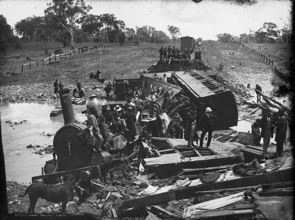
The railways of New South Wales, Australia have had many incidents and accidents since their formation in 1831. There are close to 1000 names associated with rail-related deaths in NSW on the walls of the Australian Railway Monument in Werris Creek. Those killed were all employees of various NSW railways. The details below include deaths of employees and the general public. Accidents involving loss of life Locomotive No.1, 1858 This locomotive, built in 1855 by Robert Stephenson with three others for the first real railway line in New South Wales, was involved in two fatal accidents. The first occurred as a derailment on 10 July 1858. The locomotive was pulling two open third-class carriages, a first- and a second-class carriage between Sydney and Parramatta. Near Homebush, the two third-class compartments left the rails and toppled down an embankment. There were thirty people in the two carriages, of whom two were killed, one a solicitor, the other a market gardener. In the ensuin ... [...More Info...] [...Related Items...] OR: [Wikipedia] [Google] [Baidu] |
Railway Stations In Australia Opened In 1887
Rail transport (also known as train transport) is a means of transport that transfers passengers and goods on wheeled vehicles running on rails, which are incorporated in tracks. In contrast to road transport, where the vehicles run on a prepared flat surface, rail vehicles (rolling stock) are directionally guided by the tracks on which they run. Tracks usually consist of steel rails, installed on sleepers (ties) set in ballast, on which the rolling stock, usually fitted with metal wheels, moves. Other variations are also possible, such as "slab track", in which the rails are fastened to a concrete foundation resting on a prepared subsurface. Rolling stock in a rail transport system generally encounters lower frictional resistance than rubber-tyred road vehicles, so passenger and freight cars (carriages and wagons) can be coupled into longer trains. The operation is carried out by a railway company, providing transport between train stations or freight customer facilit ... [...More Info...] [...Related Items...] OR: [Wikipedia] [Google] [Baidu] |
Central Railway Station, Sydney
Central is a heritage-listed railway station located in the centre of Sydney, New South Wales, Australia. The station is the largest and busiest railway station in Australia and serves as a major transport interchange for NSW TrainLink inter-city rail services, Sydney Trains commuter rail services, Sydney light rail services, bus services, and private coach transport services. The station is also known as Sydney Terminal (Platforms 1 to 12). The property was added to the New South Wales State Heritage Register on 2 April 1999. Material was copied from this source, which is available under Creative Commons Attribution 4.0 International License It recorded 85.4 million passenger movements in 2018. Central station occupies a large city block separating , and the central business district, bounded by Railway Square and Pitt Street in the west, Eddy Avenue in the north, Elizabeth Street in the east and the Devonshire Street Tunnel in the south. Parts of the station and ... [...More Info...] [...Related Items...] OR: [Wikipedia] [Google] [Baidu] |
Goulburn
Goulburn ( ) is a regional city in the Southern Tablelands of the Australian state of New South Wales, approximately south-west of Sydney, and north-east of Canberra. It was proclaimed as Australia's first inland city through letters patent by Queen Victoria in 1863. Goulburn had a population of 23,835 at June 2018. Goulburn is the seat of Goulburn Mulwaree Council. Goulburn is a railhead on the Main Southern line, a service centre for the surrounding pastoral industry, and also stopover for those traveling on the Hume Highway. It has a central park and many historic buildings. It is also home to the monument the Big Merino, a sculpture that is the world's largest concrete-constructed sheep. History Goulburn was named by surveyor James Meehan after Henry Goulburn, Under-Secretary for War and the Colonies, and the name was ratified by Governor Lachlan Macquarie. The colonial government made land grants to free settlers such as Hamilton Hume in the Goulburn area from ... [...More Info...] [...Related Items...] OR: [Wikipedia] [Google] [Baidu] |
Australian Aboriginal
Aboriginal Australians are the various Indigenous peoples of the Australian mainland and many of its islands, such as Tasmania, Fraser Island, Hinchinbrook Island, the Tiwi Islands, and Groote Eylandt, but excluding the Torres Strait Islands. The term Indigenous Australians refers to Aboriginal Australians and Torres Strait Islanders collectively. It is generally used when both groups are included in the topic being addressed. Torres Strait Islanders are ethnically and culturally distinct, despite extensive cultural exchange with some of the Aboriginal groups. The Torres Strait Islands are mostly part of Queensland but have a separate governmental status. Aboriginal Australians comprise many distinct peoples who have developed across Australia for over 50,000 years. These peoples have a broadly shared, though complex, genetic history, but only in the last 200 years have they been defined and started to self-identify as a single group. Australian Aboriginal identity has cha ... [...More Info...] [...Related Items...] OR: [Wikipedia] [Google] [Baidu] |
Kings Highway, Australia
Kings Highway is an interstate highway located within the Australian Capital Territory and New South Wales, Australia. The highway connects Canberra with Batemans Bay on the South Coast. It is designated route B52. Route West to east, it starts at the interchange with Monaro Highway, Canberra Avenue and Ipswich Street on the northern border of Symonston in the Australian Capital Territory and continues in a westerly direction along Canberra Avenue, crosses over the border into New South Wales near Queanbeyan, passes through Queanbeyan itself, Carwoola, briefly crosses back into the Kowen district of ACT and then back into NSW heading south-east to Batemans Bay via Bungendore, Braidwood and Nelligen. Kings Highway links Monaro Highway in Canberra to Princes Highway in Batemans Bay, and provides access for residents of Canberra to the NSW South Coast and its beaches. The highway is often busy on weekends, especially during summer. The highway also experiences a high number of ... [...More Info...] [...Related Items...] OR: [Wikipedia] [Google] [Baidu] |
Level Crossing
A level crossing is an intersection where a railway line crosses a road, Trail, path, or (in rare situations) airport runway, at the same level, as opposed to the railway line crossing over or under using an Overpass#Railway, overpass or tunnel. The term also applies when a light rail line with separate Right-of-way (railroad), right-of-way or reserved track crosses a road in the same fashion. Other names include railway level crossing, railway crossing (chiefly international), grade crossing or railroad crossing (chiefly American), road through railroad, criss-cross, train crossing, and RXR (abbreviated). There are more than 100,000 level crossings in Europe and more than 200,000 in North America. History The history of level crossings depends on the location, but often early level crossings had a Flagman (rail), flagman in a nearby booth who would, on the approach of a train, wave a red flag or lantern to stop all traffic and clear the tracks. Gated crossings bec ... [...More Info...] [...Related Items...] OR: [Wikipedia] [Google] [Baidu] |
Australian Capital Territory
The Australian Capital Territory (commonly abbreviated as ACT), known as the Federal Capital Territory (FCT) until 1938, is a landlocked federal territory of Australia containing the national capital Canberra and some surrounding townships. It is located in southeastern Australian mainland as an enclave completely within the state of New South Wales. Founded after Federation as the seat of government for the new nation, the territory hosts the headquarters of all important institutions of the Australian Government. On 1 January 1901, federation of the colonies of Australia was achieved. Section 125 of the new Australian Constitution provided that land, situated in New South Wales and at least from Sydney, would be ceded to the new federal government. Following discussion and exploration of various areas within New South Wales, the ''Seat of Government Act 1908'' was passed in 1908 which specified a capital in the Yass-Canberra region. The territory was transferred to the ... [...More Info...] [...Related Items...] OR: [Wikipedia] [Google] [Baidu] |
Canberra Railway Station
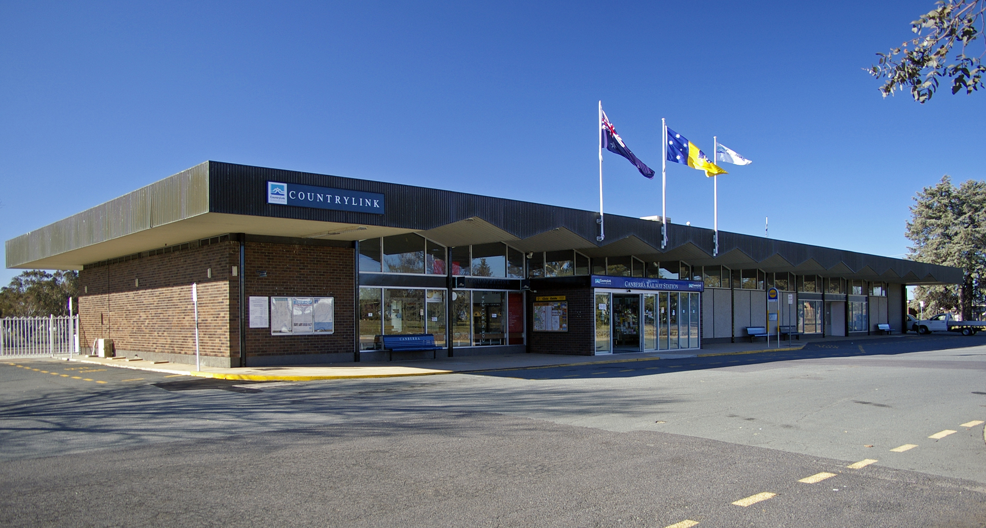
Canberra railway station is located on thNSW TrainLink Regional Southern Linein the Australian Capital Territory, Australia. It is located in the Canberra suburb of Kingston. History In March 1913, work began on a new 8.5 kilometre rail link from Queanbeyan to the Capital, with a new branch of on the Bombala line. The line was constructed, managed, and operated by the New South Wales Public Works Department on behalf of the Government of Australia. It came under the control of the Commonwealth Railways in 1927. The station building opened on 21 April 1924. Passenger services had run between the Kingston Powerhouse and Queanbeyan for around six months prior to the station opening. In October 1926 the Great White Train visited Canberra station, attracting nearly 2,500 people. The train was established by the Australian-made Preference League as a traveling exhibition to promote Australian made goods and represented around thirty manufacturers from across New South Wales. The ... [...More Info...] [...Related Items...] OR: [Wikipedia] [Google] [Baidu] |
Molonglo River
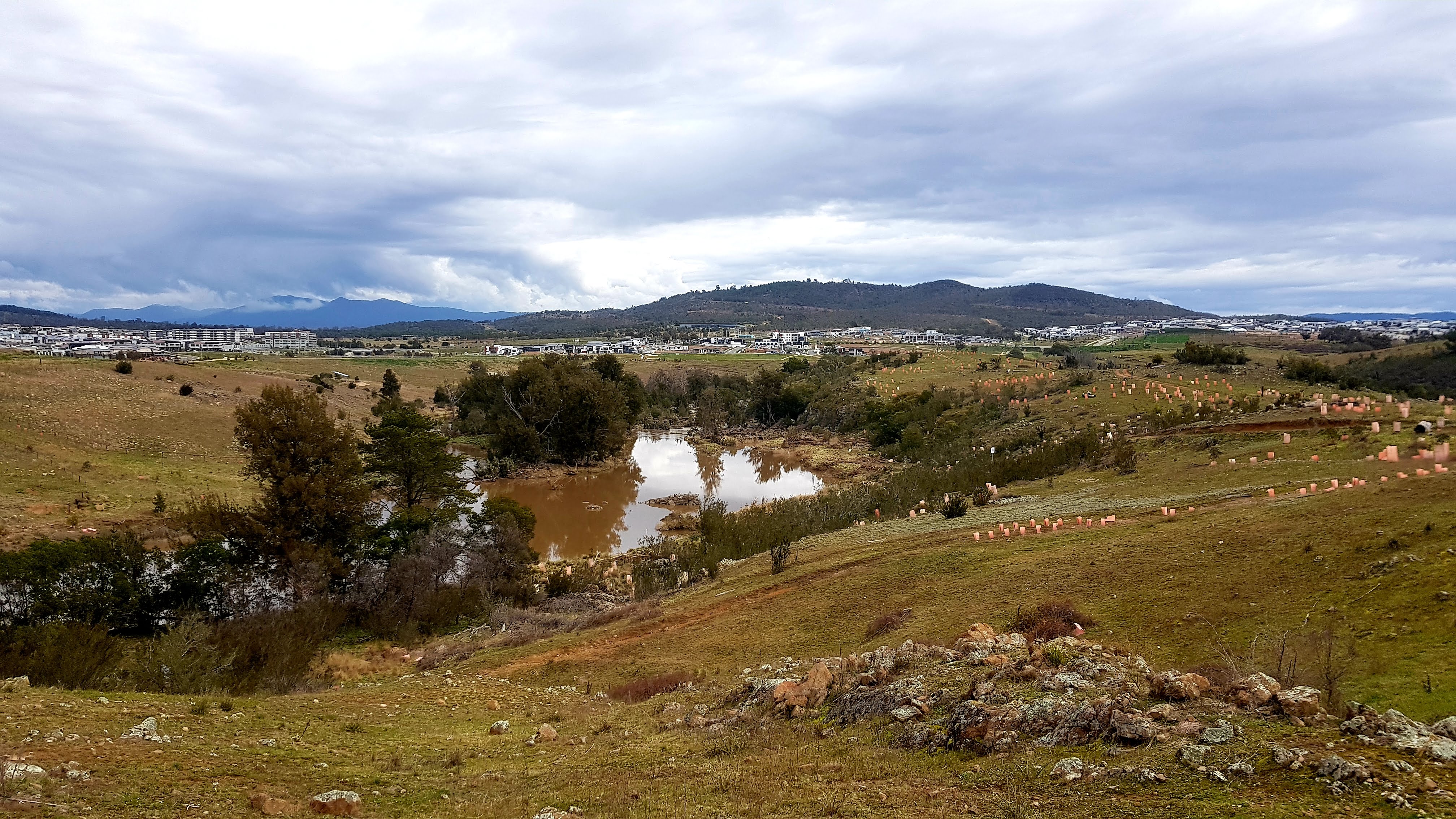
The Molonglo River, a perennial river that is part of the Murrumbidgee catchment within the Murray–Darling basin, is located in the Monaro and Capital Country regions of New South Wales and the Australian Capital Territory, in Australia. Location and features The river rises on the western side of the Great Dividing Range, in Tallaganda State Forest at and flows generally from south to north before turning northwest, through Carwoola and the outskirts of Queanbeyan, where it has confluence with its major tributary, the Queanbeyan River, and then continues through Canberra, where it has been dammed by the Scrivener Dam to form Lake Burley Griffin. The river then flows to its mouth with the Murrumbidgee River, near Uriarra Crossing. Over its course the Molonglo River alternates between long broad floodplains and narrow rocky gorges several times. One of these floodplains is called the Molonglo Plain. From source to mouth, the river is traversed by the Captains Flat Road at ... [...More Info...] [...Related Items...] OR: [Wikipedia] [Google] [Baidu] |
Queanbeyan Railway Bridges Over Queanbeyan And Molonglo Rivers
The Queanbeyan railway bridges over Queanbeyan and Molonglo Rivers are two heritage-listed railway bridges that carry the Bombala railway line in the Queanbeyan-Palerang Region local government area of New South Wales, Australia. Both bridges were built between 1926 and 1927. The westernmost bridge crosses the Queanbeyan River from Queanbeyan to Queanbeyan East at , while the easternmost bridge (approximately to the east) crosses the Molonglo River at Burbong (now Carwoola) at . The two railway bridges are owned by Transport Asset Holding Entity, an agency of the Government of New South Wales. Together, the two bridges were added to the New South Wales State Heritage Register on 2 April 1999. History The bridges were first built by contractors Johnston & Co. in 1885–87 along with the extension of the railway from Bungendore to Michelago through Queanbeyan. The Molonglo River bridge was completed in May 1886 and the Queanbeyan River bridge in July 1887, both openi ... [...More Info...] [...Related Items...] OR: [Wikipedia] [Google] [Baidu] |


.jpg)


