|
Buldana
Buldhana is the district headquarters and a Municipal Council in the Buldhana District of Amravati division in the Indian State of Maharashtra. Climate Demographics As of the 2011 India census, Buldhana had a population of 67,431. Males constitute 52% of the population and females 48%. Buldhana has an average literacy rate of 82%, higher than the national average of 59.5%, with male literacy at 82% and female literacy at 72%. 13% of the population is under six years of age. Languages and Culture The most common language spoken in Buldhana is the Marathi language. More than 98 percent of cities population speak Marathi as first language. Marathi is a compulsory subject taught in English and Hindi Medium school. Hindi is spoken by 1 percent of population. All Hindi speakers in Buldhana can speak fluent Marathi due to its commercial status. Transport There is a Maharashtra State Road Transport Corporation bus stand in the city. There are State Transport bus depots at Buldhan ... [...More Info...] [...Related Items...] OR: [Wikipedia] [Google] [Baidu] |
Chikhli, Maharashtra
Chikhli is a city and a municipal council in Buldana district in Vidarbha Region of Maharashtra state, India. It is located on the Pune-Nagpur highway. It is situated at the westernmost border of Vidarbha region of Maharashtra and is 500 km from the state capital, Mumbai. Chikhli has the largest population in buldhana district and is the biggest taluka. Chikhli is situated on the border of the Marathwada Region and Vidarbha Regions of Maharashtra. Chikhli is the nearest municipal council to the district place, Buldana, approximately 25 km only. Also in addition, there is a cotton factory in Chikhli which provides employment to many people who comes in this city for employment purpose. MIDC is located on Nagpur-Pune highway where many small scale, middle scale and some large scale firms of automotive, chemical, fibres and plastic, iron casting and other sectors are situated. Textile park was sanctioned near city and land acquisition and other government processes are goin ... [...More Info...] [...Related Items...] OR: [Wikipedia] [Google] [Baidu] |
Buldhana District
Buldhana district (Marathi pronunciation: ulɖʰaːɳa is located in the Amravati division of Maharashtra, India. It is situated at the western border of Vidarbha region and is 500 km away from the state capital, Mumbai. The district has towns and cities like Shegaon, Jalgaon Jamod, Malkapur, Khamgaon, Lonar, Mehkar, and Chikhli. It is surrounded by Madhya Pradesh in the north, Akola, Washim, and Amravati districts on the east, Jalna district on the south, and Jalgaon and Aurangabad districts on the west. Khamgaon is the largest city in the district. Latitudes are 19.51° to 21.17° N and longitudes are 75.57° to 76.59° E. Buldhana district holds religious significance as it is the site of the Shri Gajanan Maharaj Temple, Shegaon. Lonarkar Top (about 923 meters) is highest altitude in Buldhana District placed in Ambabarwa Wildlife Sanctuary. History The name of the district is probably derived from ''Bhil Thana'' (place of Bhils, a tribal group). Buldhana, along wi ... [...More Info...] [...Related Items...] OR: [Wikipedia] [Google] [Baidu] |
Buldhana
Buldhana is the district headquarters and a Municipal Council in the Buldhana District of Amravati division in the Indian State of Maharashtra. Climate Demographics As of the 2011 India census, Buldhana had a population of 67,431. Males constitute 52% of the population and females 48%. Buldhana has an average literacy rate of 82%, higher than the national average of 59.5%, with male literacy at 82% and female literacy at 72%. 13% of the population is under six years of age. Languages and Culture The most common language spoken in Buldhana is the Marathi language. More than 98 percent of cities population speak Marathi as first language. Marathi is a compulsory subject taught in English and Hindi Medium school. Hindi is spoken by 1 percent of population. All Hindi speakers in Buldhana can speak fluent Marathi due to its commercial status. Transport There is a Maharashtra State Road Transport Corporation bus stand in the city. There are State Transport bus depots at Buldhan ... [...More Info...] [...Related Items...] OR: [Wikipedia] [Google] [Baidu] |
Aurangabad District, Maharashtra
Aurangabad district (Marathi pronunciation: �u̯ɾəŋɡaːbaːd̪ Urdu pronunciation: �ːɾəŋɡaːbaːd̪ is one of the 36 districts of the state of Maharashtra in western India. It borders the districts of Nashik to the west, Jalgaon to the north, Jalna to the east, and Ahmednagar to the south. The city of Aurangabad houses the district's administrative headquarters. The district has an area of 10,100 km, of which 37.55% is urban and the rest is rural. Aurangabad District is a major tourism region in Marathwada. Officer Members of Parliament *Imtiyaz Jaleel ( MIM) *Raosaheb Danve (BJP) Guardian Minister list of Guardian Minister District Magistrate/Collector list of District Magistrate / Collector Geography Aurangabad District is located mainly in the Godavari River Basin and partly in the Tapti River Basin. The district is located between 19 and 20 degrees north longitude and between 74 and 76 degrees east latitude, covering an area of ... [...More Info...] [...Related Items...] OR: [Wikipedia] [Google] [Baidu] |
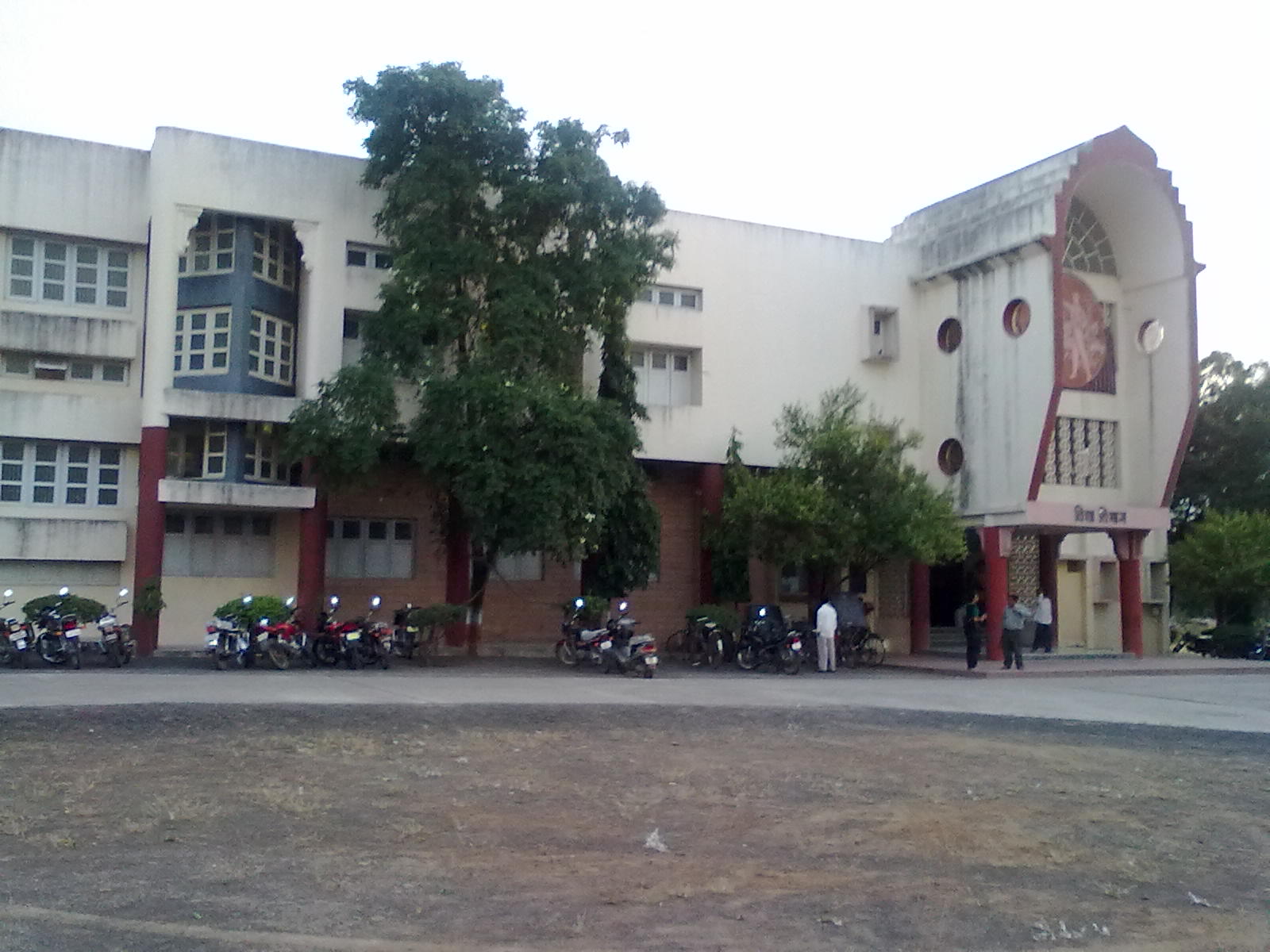
Buldhana Road By Hrushikesh Kulkarni
Buldhana is the district headquarters and a Municipal Council in the Buldhana District of Amravati division in the Indian State of Maharashtra. Climate Demographics As of the 2011 India census, Buldhana had a population of 67,431. Males constitute 52% of the population and females 48%. Buldhana has an average literacy rate of 82%, higher than the national average of 59.5%, with male literacy at 82% and female literacy at 72%. 13% of the population is under six years of age. Languages and Culture The most common language spoken in Buldhana is the Marathi language. More than 98 percent of cities population speak Marathi as first language. Marathi is a compulsory subject taught in English and Hindi Medium school. Hindi is spoken by 1 percent of population. All Hindi speakers in Buldhana can speak fluent Marathi due to its commercial status. Transport There is a Maharashtra State Road Transport Corporation bus stand in the city. There are State Transport bus depots at Buldha ... [...More Info...] [...Related Items...] OR: [Wikipedia] [Google] [Baidu] |
Buldhana (Lok Sabha Constituency)
Buldhana Lok Sabha constituency (formerly, Buldana Lok Sabha constituency) is one of the 48 Lok Sabha (parliamentary) constituencies of Maharashtra state in western India. This constituency largely represents Buldhana district in the Lok Sabha of Indian parliament, except Malkapur Assembly constituency, which is part of Raver Lok Sabha constituency from Jalgaon district of Khandesh region. Assembly segments Presently, after the implementation of the President of India, Presidential notification on delimitation on 19 February 2008, Buldhana Lok Sabha constituency comprises six Vidhan Sabha (legislative assembly) segments. These segments with constituency numbers and reservation (if any) are: Members of Parliament ^ - bypoll NCJ Election results General elections 2019 General elections 2014 General elections 2009 See also * Buldhana district * Akola Lok Sabha constituency (1951 elections as Buldhana Akola Lok Sabha constituency electing two ... [...More Info...] [...Related Items...] OR: [Wikipedia] [Google] [Baidu] |
Shegaon
Shegaon is a city and municipal council in the Buldhana district in the Indian state of Maharashtra. Shegaon has become a pilgrimage centre due to the influence of Shri Sant Gajanan Maharaj, who is considered a saint by Hindus. Transportation Shegaon is located west of Nagpur and east of Mumbai. It is connected by Hajira–Dhule–Howrah National Highway 6 to Khamgaon, Balapur, Malkapur and Akola. Shegaon Railway station is located on the Howrah–Nagpur–Mumbai line of the Central Railway of Indian Railways. It has direct train connectivity to Mumbai CST, Lokmanya Tilak Terminus Mumbai, Delhi, Chennai, Secunderabad, Pune, Akola, Tatanagar, Ahmedabad, Okha, Kolhapur, Amravati, Wardha, Nanded, Nagpur, Gondia, Bilaspur, Howrah Station, Shalimar Station, Chandrapur railway station, and Chennai Central. Several Mumbai trains stop at Shegaon, including the Gitanjali Express, Vidarbha Express, Amravati Superfast Express, Mumbai–Howrah Mail and Express, Sewagram Express, ... [...More Info...] [...Related Items...] OR: [Wikipedia] [Google] [Baidu] |
Motala
Motala () is a locality and the seat of Motala Municipality, Östergötland County, Sweden with 29,823 inhabitants (41,956 in the entire municipality) in 2010. It is the third largest city of Östergötland, following Linköping and Norrköping. Motala is situated on the eastern shore of Lake Vättern and is regarded as the main centre of both the Göta Canal and the surrounding lake region. History Motala Church dates from the 13th century. For several centuries, Motala remained a small village, mainly regarded as a stopping post on the road to the nearby town of Vadstena, one of the cultural centres of medieval Sweden. However, King Gustav Vasa had a manor house built at Motala and later Queen Kristina had a summer residence built at the spa resort of Medevi, 20 km north of the town. When the Göta Canal was built in the early 19th century, Motala became an important town for the trade on the canal. The builder of the canal, Baltzar von Platen, has his grave beside it ... [...More Info...] [...Related Items...] OR: [Wikipedia] [Google] [Baidu] |
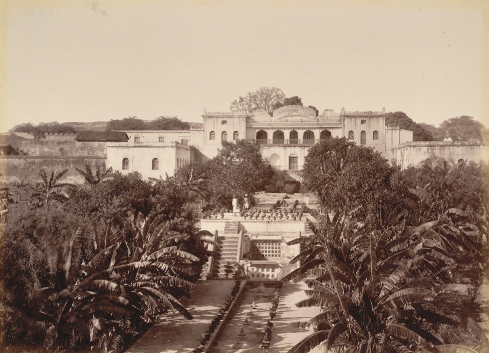
Aurangabad, Maharashtra
Aurangabad ( is a city in the Indian state of Maharashtra. It is the administrative headquarters of Aurangabad district, Maharashtra, Aurangabad district and is the largest city in the Marathwada region. Located on a hilly upland terrain in the Deccan Traps, Aurangabad is the fifth-most populous urban area in Maharashtra with a population of 1,175,116. The city is known as a major production center of cotton textile and artistic silk fabrics. Several prominent educational institutions, including Dr. Babasaheb Ambedkar Marathwada University, are located in the city. The city is also a popular tourism hub, with tourist destinations like the Ajanta Caves, Ajanta and Ellora Caves, Ellora caves lying on its outskirts, both of which have been designated as UNESCO World Heritage Sites since 1983. Other tourist attractions include the Aurangabad Caves, Daulatabad Fort, Devagiri Fort, Grishneshwar Temple, Jama Mosque, Aurangabad, Jama Mosque, Bibi Ka Maqbara, Himayat Bagh, Panchakki and S ... [...More Info...] [...Related Items...] OR: [Wikipedia] [Google] [Baidu] |
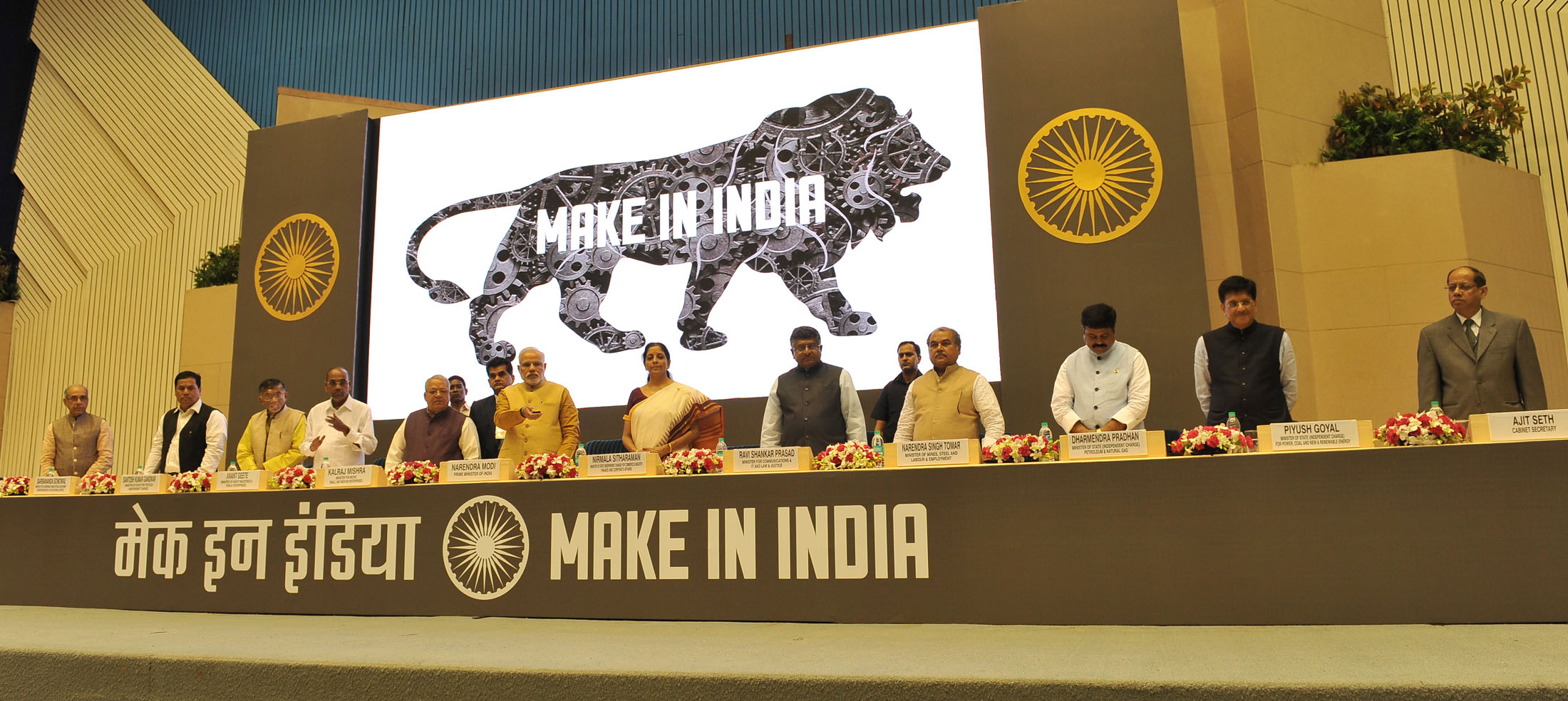
Make In Maharashtra
Make in India is an initiative by the Government of India to create and encourage companies to develop, manufacture and assemble products made in India and incentivize dedicated investments into manufacturing. The policy approach was to create a conducive environment for investments, develop a modern and efficient infrastructure, and open up new sectors for foreign capital. The initiative targeted 25 economic sectors for job creation and skill enhancement, and aimed "to transform India into a global design and manufacturing export hub." "Make in India" had three stated objectives: # to increase the manufacturing sector's growth rate to 12-14% per annum; # to create 100 million additional manufacturing jobs in the economy by 2022; # to ensure that the manufacturing sector's contribution to GDP is increased to 25% by 2022 (later revised to 2025). After the launch, India gave investment commitments worth and investment inquiries worth of between September 2014 to February 201 ... [...More Info...] [...Related Items...] OR: [Wikipedia] [Google] [Baidu] |
States And Union Territories Of India
India is a federal union comprising 28 states and 8 union territories, with a total of 36 entities. The states and union territories are further subdivided into districts and smaller administrative divisions. History Pre-independence The Indian subcontinent has been ruled by many different ethnic groups throughout its history, each instituting their own policies of administrative division in the region. The British Raj mostly retained the administrative structure of the preceding Mughal Empire. India was divided into provinces (also called Presidencies), directly governed by the British, and princely states, which were nominally controlled by a local prince or raja loyal to the British Empire, which held ''de facto'' sovereignty ( suzerainty) over the princely states. 1947–1950 Between 1947 and 1950 the territories of the princely states were politically integrated into the Indian union. Most were merged into existing provinces; others were organised into ... [...More Info...] [...Related Items...] OR: [Wikipedia] [Google] [Baidu] |
Malkapur, Buldhana
Malkapur is a city and municipality in the Buldhana district of Maharashtra, India. Malkapur is one of the largest cotton producers in the area. In the British era, it was known as the "White gold of Vidarbha". Malkapur has a vast paper industry and the primary paper suppliers to Mumbai are in Malkapur. Malkapur has many Dal mills, and a major agricultural industry specializing in Mahyco and Ankur seeds, chemical plants, and a fruit ripening chamber. Malkapur is a well-known grain and cloth market due to its proximity to Madhya Pradesh. It is one of the major producers of red chilli. Demographics According to the 2011 census, Malkapur Municipal Council has a population of 67,740. In which 34,693 are males and 33,047 females . Malkapur has an average literacy rate of 82%, higher than the national average of 75%. The male literacy is 89% and female literacy is 75%. In Malkapur, 20% of the population is under 6 years of age. Transport Malkapur is located on the Hajira - Kol ... [...More Info...] [...Related Items...] OR: [Wikipedia] [Google] [Baidu] |


