|
Bukkulla, New South Wales
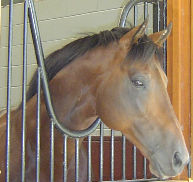
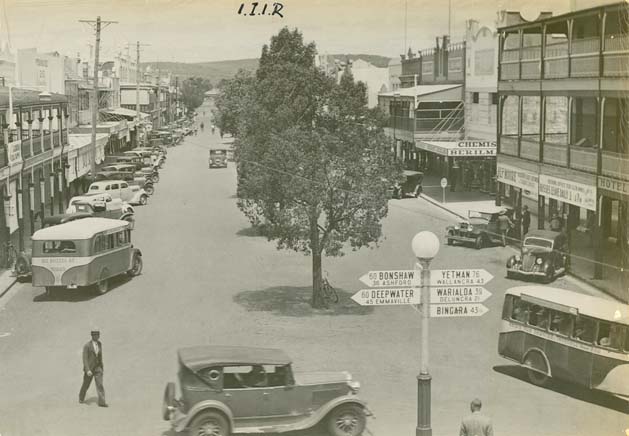
Bukkulla is a hamlet about north of Inverell and north-east of Bannockburn on the Ashford Road. This hamlet is within the boundaries of Arrawatta County and Inverell Shire, New South Wales, Australia. The village is at an elevation of about 580 metres. In the , there were 145 persons usually resident in the Bukkulla area. History Bukkulla was the name of the property of George Wyndham (1801–1870) and means 'place of leopard tree' or a ‘high black stump’.Keith R. Binney, Horsemen of the First Frontier (1788-1900) and the Serpents Legacy, Volcanic Productions, Sydney, 2005, xxxii + 542 pages; Wyndham was the first official licensee when he held the Macintyre River property in 1839. The 1841 census recorded Bukkulla as having 3 free males, 1 convict there. Wyndham started a vineyard there along with a Thoroughbred horse stud which bred some good horses. The Bukkulla stud also produced some good stockhorses and horses for the India India, officially the Republic ... [...More Info...] [...Related Items...] OR: [Wikipedia] [Google] [Baidu] |
Arrawatta County
Arrawatta County, New South Wales is one of the 141 Cadastral divisions of New South Wales For lands administrative purposes, New South Wales is divided into 141 counties, which are further divided into parishes. The counties were first set down in the Colony of New South Wales, which later became the Australian state of New Sou .... It includes Ashford. The name ''Arrawatta'' is thought to be derived from a local aboriginal word for the area that includes Arrawatta County. Parishes A full list of parishes found within this county; their current LGA and mapping coordinates to the approximate centre of each location is as follows: References {{Counties of New South Wales Counties of New South Wales ... [...More Info...] [...Related Items...] OR: [Wikipedia] [Google] [Baidu] |
New South Wales
) , nickname = , image_map = New South Wales in Australia.svg , map_caption = Location of New South Wales in AustraliaCoordinates: , subdivision_type = Country , subdivision_name = Australia , established_title = Before federation , established_date = Colony of New South Wales , established_title2 = Establishment , established_date2 = 26 January 1788 , established_title3 = Responsible government , established_date3 = 6 June 1856 , established_title4 = Federation of Australia, Federation , established_date4 = 1 January 1901 , named_for = Wales , demonym = , capital = Sydney , largest_city = capital , coordinates = , admin_center = Local government areas of New South Wales, 128 local government areas , admin_center_type = Administration , leader_title1 = Monarchy of Australia, Monarch , leader_name1 = Charles III , leader_title2 = Governor of New South Wales, Governor , leader_name2 = Margaret Beazley , leader_title3 = Premier of New South Wales, Premie ... [...More Info...] [...Related Items...] OR: [Wikipedia] [Google] [Baidu] |
Towns In New South Wales
A town is a human settlement. Towns are generally larger than villages and smaller than cities, though the criteria to distinguish between them vary considerably in different parts of the world. Origin and use The word "town" shares an origin with the German word , the Dutch word , and the Old Norse . The original Proto-Germanic word, *''tūnan'', is thought to be an early borrowing from Proto-Celtic *''dūnom'' (cf. Old Irish , Welsh ). The original sense of the word in both Germanic and Celtic was that of a fortress or an enclosure. Cognates of ''town'' in many modern Germanic languages designate a fence or a hedge. In English and Dutch, the meaning of the word took on the sense of the space which these fences enclosed, and through which a track must run. In England, a town was a small community that could not afford or was not allowed to build walls or other larger fortifications, and built a palisade or stockade instead. In the Netherlands, this space was a garden, mor ... [...More Info...] [...Related Items...] OR: [Wikipedia] [Google] [Baidu] |
India
India, officially the Republic of India (Hindi: ), is a country in South Asia. It is the seventh-largest country by area, the second-most populous country, and the most populous democracy in the world. Bounded by the Indian Ocean on the south, the Arabian Sea on the southwest, and the Bay of Bengal on the southeast, it shares land borders with Pakistan to the west; China, Nepal, and Bhutan to the north; and Bangladesh and Myanmar to the east. In the Indian Ocean, India is in the vicinity of Sri Lanka and the Maldives; its Andaman and Nicobar Islands share a maritime border with Thailand, Myanmar, and Indonesia. Modern humans arrived on the Indian subcontinent from Africa no later than 55,000 years ago., "Y-Chromosome and Mt-DNA data support the colonization of South Asia by modern humans originating in Africa. ... Coalescence dates for most non-European populations average to between 73–55 ka.", "Modern human beings—''Homo sapiens''—originated in Africa. Then, interm ... [...More Info...] [...Related Items...] OR: [Wikipedia] [Google] [Baidu] |
Thoroughbred
The Thoroughbred is a horse breed best known for its use in horse racing. Although the word ''thoroughbred'' is sometimes used to refer to any breed of purebred horse, it technically refers only to the Thoroughbred breed. Thoroughbreds are considered " hot-blooded" horses that are known for their agility, speed, and spirit. The Thoroughbred, as it is known today, was developed in 17th- and 18th-century England, when native mares were crossbred with imported Oriental stallions of Arabian, Barb, and Turkoman breeding. All modern Thoroughbreds can trace their pedigrees to three stallions originally imported into England in the 17th and 18th centuries, and to a larger number of foundation mares of mostly English breeding. During the 18th and 19th centuries, the Thoroughbred breed spread throughout the world; they were imported into North America starting in 1730 and into Australia, Europe, Japan and South America during the 19th century. Millions of Thoroughbreds exist today ... [...More Info...] [...Related Items...] OR: [Wikipedia] [Google] [Baidu] |
George Wyndham (cricketer)
George Wyndham (20 June 1801 – 24 December 1870) was an English farmer, wine-grower and pastoralist; he is famous for having established the Wyndham wineries and his estate Dalwood in the Hunter Valley, where he planted Australia's first commercial Shiraz vineyard. He played first-class cricket in England in his youth. Early life Born in 1801 in Dinton, Wiltshire England, Wyndham was the third son of William Wyndham and Letitia, née Popham. He was educated at Harrow School and Trinity College, Cambridge with the goal to enter the Church of England. He is recorded as playing first-class cricket for Cambridge University in two matches in 1820 and 1821, totalling 12 runs with a highest score of 6 and taking 7 wickets. In 1824 Wyndham emigrated to Canada, traveling with John Galt the secretary of the Canada Company. While travelling through Paris, Marseilles, Nice, Genoa, Florence, Rome and Naples he studied viticulture to learn how to make wine. He reached Malta where illn ... [...More Info...] [...Related Items...] OR: [Wikipedia] [Google] [Baidu] |
Australia
Australia, officially the Commonwealth of Australia, is a Sovereign state, sovereign country comprising the mainland of the Australia (continent), Australian continent, the island of Tasmania, and numerous List of islands of Australia, smaller islands. With an area of , Australia is the largest country by area in Oceania and the world's List of countries and dependencies by area, sixth-largest country. Australia is the oldest, flattest, and driest inhabited continent, with the least fertile soils. It is a Megadiverse countries, megadiverse country, and its size gives it a wide variety of landscapes and climates, with Deserts of Australia, deserts in the centre, tropical Forests of Australia, rainforests in the north-east, and List of mountains in Australia, mountain ranges in the south-east. The ancestors of Aboriginal Australians began arriving from south east Asia approximately Early human migrations#Nearby Oceania, 65,000 years ago, during the Last Glacial Period, last i ... [...More Info...] [...Related Items...] OR: [Wikipedia] [Google] [Baidu] |
Inverell Shire
'' Inverell Shire is a local government area in the North West Slopes region of New South Wales, Australia adjacent to the Macintyre River and the Gwydir Highway. The Mayor of Inverell Shire Council is Cr. Paul Harmon, who is unaligned with any political party. History Inverell Shire was created on 1 July 1979 from the amalgamation of the Municipality of Inverell with Ashford Shire and Macintyre Shire. Formerly part of Armidale Region, on 1 July 2019, Tingha was transferred to the Inverell Shire. Main towns and villages The shire includes the town of Inverell and small towns and villages including Gilgai, Stannifer, Elsmore, Bukkulla, Ashford, Bonshaw, Yetman, Wallangra, Graman, Oakwood, Delungra, Mount Russell and Tingha. The locality of Myall Creek is split being Inverell Shire and Gwydir Shire. Demographics At the , there were people in the Inverell local government area, of these 49.1 per cent were male and 50.9 per cent were female. Aborigi ... [...More Info...] [...Related Items...] OR: [Wikipedia] [Google] [Baidu] |
Electoral District Of Northern Tablelands
Northern Tablelands is an electoral district of the Legislative Assembly in the Australian state of New South Wales. It is currently held by Adam Marshall representing the National Party, following a by-election triggered by the resignation of independent member Richard Torbay. The electorate currently includes Uralla Shire, Armidale Regional Council, Glen Innes Severn, Inverell Shire, Gwydir Shire and Moree Plains Shire. History Northern Tablelands was originally created in 1920, with the introduction of proportional representation, replacing Armidale, Gough and Tenterfield, and elected three members. It was held by the same three members throughout its first incarnation: inaugural Country Party leader Michael Bruxner, state Minister for Education David Drummond, and Labor MP Alfred McClelland, grandfather of former federal Attorney-General Robert McClelland. In 1927, it was divided into the single-member electorates of Armidale and Tenterfield. It was recreated in 19 ... [...More Info...] [...Related Items...] OR: [Wikipedia] [Google] [Baidu] |
Ashford, New South Wales
Ashford is a small village situated in the north-west on the Northern Tablelands of the state of New South Wales. The New England rural village of Ashford lies within the broad sunlit lands 748 km north of Sydney, 500 km south west of Brisbane, close to the Queensland border. Ashford is 430 metres above sea level and located 56 km north of Inverell on a major arterial road, connecting the Gwydir and Bruxner highways through to the Queensland border. History "Frazer's Creek" Post Office was established in 1853 and renamed Ashford in 1863. The first police station was opened in 1864 and the first school in 1868. Fred Ward a bushranger, known as "Captain Thunderbolt" rode in the area in 1867. Primary industries in the town over the years included tobacco farming and a local coal mine though each of these have ceased. Today, the surrounding areas are used for sheep and cattle farming. Today Ashford is a small community with a K-12 public school, basic shops, church ... [...More Info...] [...Related Items...] OR: [Wikipedia] [Google] [Baidu] |
Inverell, New South Wales
Inverell is a large town in northern New South Wales, Australia, situated on the Macintyre River, close to the Queensland border. It is also the centre of Inverell Shire. Inverell is located on the Gwydir Highway on the western slopes of the Northern Tablelands. It has a temperate climate. In the , the population of Inverell was 12,057 and the Inverell Shire population was 17,853. History Prior to white settlement, the Gamilaraay Nation (commonly known as Kamilaroi) of Aboriginal peoples lived in and occupied this region. In 1848, Alexander Campbell held the Inverell Station on the Macintyre River. The name derives from the name of Mr. MacIntyre's estate. The word is of Gaelic origin, and signifies "meeting place of the swans"; from "Inver", a meeting place, and "Ell", a swan. The MacIntyre River and Swanbrook Creek join here. The area was also known as "Green Swamp" in the 1850s. Wheat growers, Colin and Rosanna Ross established a store there in 1853, when he asked that ... [...More Info...] [...Related Items...] OR: [Wikipedia] [Google] [Baidu] |

.jpg)

