|
Brynglas Tunnels
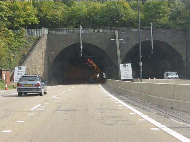
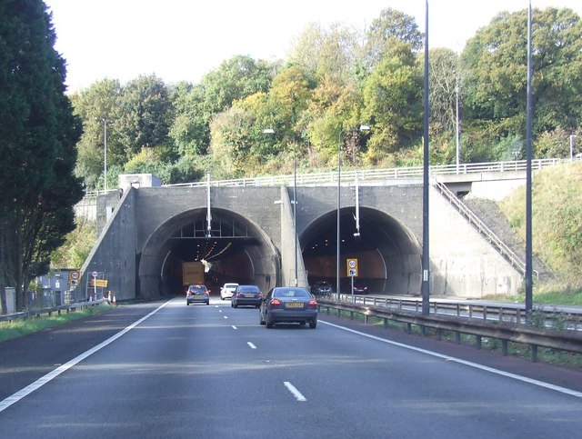
The Brynglas Tunnels carry the M4 under Brynglas Hill in Newport, Wales. The tunnels are the first and only twin–bored tunnels in the UK motorway network. The tunnels and adjacent M4 motorway Usk bridge were originally planned by Newport Corporation in August 1959 in a plan submitted to the Ministry of Transport. Work started on the £3m tunnels project - led by engineer Sir Owen Williams on 10 September 1962. Both structures were complete and open to traffic on 5 May 1967. During the construction several houses on Brynglas Road (where the modern Newport Lodge Hotel now stands) had to be demolished due to structural weaknesses caused by the tunnelling and prompting questions in the House of Commons. Traffic congestion Almost as soon as the M4 Newport bypass (junctions 24-28) had opened, the traffic levels had grown to such a degree that the road had to be widened to three lanes in each direction. This was finished in 1982 but with the exception of the tunnels and Usk brid ... [...More Info...] [...Related Items...] OR: [Wikipedia] [Google] [Baidu] |
Newport, Wales
Newport ( cy, Casnewydd; ) is a city and Local government in Wales#Principal areas, county borough in Wales, situated on the River Usk close to its confluence with the Severn Estuary, northeast of Cardiff. With a population of 145,700 at the 2011 census, Newport is the third-largest authority with City status in the United Kingdom, city status in Wales, and seventh List of Welsh principal areas, most populous overall. Newport became a unitary authority in 1996 and forms part of the Cardiff-Newport metropolitan area. Newport was the site of the last large-scale armed insurrection in Great Britain, the Newport Rising of 1839. Newport has been a port since medieval times when the first Newport Castle was built by the Normans. The town outgrew the earlier Roman Britain, Roman town of Caerleon, immediately upstream and now part of the borough. Newport gained its first Municipal charter, charter in 1314. It grew significantly in the 19th century when its port became the focus of Coa ... [...More Info...] [...Related Items...] OR: [Wikipedia] [Google] [Baidu] |
Bottleneck (traffic)
A traffic bottleneck is a localized disruption of vehicular traffic on a street, road, or highway. As opposed to a traffic jam, a bottleneck is a result of a specific physical condition, often the design of the road, badly timed traffic lights, or sharp curves. They can also be caused by temporary situations, such as vehicular accidents. Bottlenecks can also occur in other methods of transportation. Capacity bottlenecks are the most vulnerable points in a network and are very often the subject of offensive or defensive military actions. Capacity bottlenecks of strategic importance - such as the Panama Canal where traffic is limited by the infrastructure - are normally referred to as choke points; capacity bottlenecks of tactical value are referred to as mobility corridors. Causes Traffic bottlenecks are caused by a wide variety of things: * Construction zones where one or more existing lanes become unavailable (as depicted in the diagram on the right) * Accident sites that t ... [...More Info...] [...Related Items...] OR: [Wikipedia] [Google] [Baidu] |
Tunnels Completed In 1982
A tunnel is an underground passageway, dug through surrounding soil, earth or rock, and enclosed except for the entrance and exit, commonly at each end. A pipeline is not a tunnel, though some recent tunnels have used immersed tube construction techniques rather than traditional tunnel boring methods. A tunnel may be for foot or vehicular road traffic, for rail traffic, or for a canal. The central portions of a rapid transit network are usually in the tunnel. Some tunnels are used as sewers or aqueducts to supply water for consumption or for hydroelectric stations. Utility tunnels are used for routing steam, chilled water, electrical power or telecommunication cables, as well as connecting buildings for convenient passage of people and equipment. Secret tunnels are built for military purposes, or by civilians for smuggling of weapons, contraband, or people. Special tunnels, such as wildlife crossings, are built to allow wildlife to cross human-made barriers safely. Tu ... [...More Info...] [...Related Items...] OR: [Wikipedia] [Google] [Baidu] |
Landmarks In Newport, Wales
A landmark is a recognizable natural or artificial feature used for navigation, a feature that stands out from its near environment and is often visible from long distances. In modern use, the term can also be applied to smaller structures or features, that have become local or national symbols. Etymology In old English the word ''landmearc'' (from ''land'' + ''mearc'' (mark)) was used to describe a boundary marker, an "object set up to mark the boundaries of a kingdom, estate, etc.". Starting from approx. 1560, this understanding of landmark was replaced by a more general one. A landmark became a "conspicuous object in a landscape". A ''landmark'' literally meant a geographic feature used by explorers and others to find their way back or through an area. For example, the Table Mountain near Cape Town, South Africa is used as the landmark to help sailors to navigate around southern tip of Africa during the Age of Exploration. Artificial structures are also sometimes built to a ... [...More Info...] [...Related Items...] OR: [Wikipedia] [Google] [Baidu] |
Motorways In Wales
A controlled-access highway is a type of highway that has been designed for high-speed vehicular traffic, with all traffic flow—ingress and egress—regulated. Common English terms are freeway, motorway and expressway. Other similar terms include ''throughway'' and ''parkway''. Some of these may be limited-access highways, although this term can also refer to a class of highways with somewhat less isolation from other traffic. In countries following the Vienna convention, the motorway qualification implies that walking and parking are forbidden. A fully controlled-access highway provides an unhindered flow of traffic, with no traffic signals, intersections or property access. They are free of any at-grade crossings with other roads, railways, or pedestrian paths, which are instead carried by overpasses and underpasses. Entrances and exits to the highway are provided at interchanges by slip roads (ramps), which allow for speed changes between the highway and arterials a ... [...More Info...] [...Related Items...] OR: [Wikipedia] [Google] [Baidu] |
Transport In Newport, Wales
Transport (in British English), or transportation (in American English), is the intentional movement of humans, animals, and goods from one location to another. Modes of transport include air, land (rail and road), water, cable, pipeline, and space. The field can be divided into infrastructure, vehicles, and operations. Transport enables human trade, which is essential for the development of civilizations. Transport infrastructure consists of both fixed installations, including roads, railways, airways, waterways, canals, and pipelines, and terminals such as airports, railway stations, bus stations, warehouses, trucking terminals, refueling depots (including fueling docks and fuel stations), and seaports. Terminals may be used both for interchange of passengers and cargo and for maintenance. Means of transport are any of the different kinds of transport facilities used to carry people or cargo. They may include vehicles, riding animals, and pack animals. Vehicles may inc ... [...More Info...] [...Related Items...] OR: [Wikipedia] [Google] [Baidu] |
Buildings And Structures In Newport, Wales
A building, or edifice, is an enclosed structure with a roof and walls standing more or less permanently in one place, such as a house or factory (although there's also portable buildings). Buildings come in a variety of sizes, shapes, and functions, and have been adapted throughout history for a wide number of factors, from building materials available, to weather conditions, land prices, ground conditions, specific uses, prestige, and aesthetic reasons. To better understand the term ''building'' compare the list of nonbuilding structures. Buildings serve several societal needs – primarily as shelter from weather, security, living space, privacy, to store belongings, and to comfortably live and work. A building as a shelter represents a physical division of the human habitat (a place of comfort and safety) and the ''outside'' (a place that at times may be harsh and harmful). Ever since the first cave paintings, buildings have also become objects or canvasses of much artis ... [...More Info...] [...Related Items...] OR: [Wikipedia] [Google] [Baidu] |
Dual Carriageway
A dual carriageway ( BE) or divided highway ( AE) is a class of highway with carriageways for traffic travelling in opposite directions separated by a central reservation (BrE) or median (AmE). Roads with two or more carriageways which are designed to higher standards with controlled access are generally classed as motorways, freeways, etc., rather than dual carriageways. A road without a central reservation is a single carriageway regardless of the number of lanes. Dual carriageways have improved road traffic safety over single carriageways and typically have higher speed limits as a result. In some places, express lanes and local/collector lanes are used within a local-express-lane system to provide more capacity and to smooth traffic flows for longer-distance travel. History A very early (perhaps the first) example of a dual carriageway was the ''Via Portuensis'', built in the first century by the Roman emperor Claudius between Rome and its port Ostia at the mouth of t ... [...More Info...] [...Related Items...] OR: [Wikipedia] [Google] [Baidu] |
Southern Distributor Road
The Southern Distributor Road (SDR) is a principal distributor road in Newport that runs from the Coldra roundabout ( M4 junction 24) in the east of Newport to Tredegar Park M4 Junction 28) in the west of Newport and includes City Bridge, a bow-string arch bridge spanning the River Usk. Combined with the M4 in the north, the SDR forms the southern part of a ring road for the city. The new road completed in 2004 encompassed Ringland Way, Spytty Road, East Dock Road, Usk Way and Docks Way. The eastern section (Ringland Way) and the western section (Docks Way) were originally built with reserved land to one side for eventual widening. The SDR plans were drawn up to make use of this land and to join the two sections together across the river to form a continuous dual carriageway from one side of the city to the other. On completion it assumed the number A48 replacing the Chepstow Road/Cardiff Road corridor which was downgraded to B4237. The urban regeneration company Newport Unli ... [...More Info...] [...Related Items...] OR: [Wikipedia] [Google] [Baidu] |
A48 Road
The A48 is a trunk road in Great Britain running from the A40 at Highnam, west of Gloucester, England, to the A40 at Carmarthen, Wales. Before the Severn Bridge opened on 8 September 1966, it was a major route between England and South Wales. For most of its route, it runs almost parallel to the M4 motorway. During times of high winds at the Severn Bridge, the A48 is used as part of the diversion route and is still marked as a Holiday Route. From Gloucester, the A48 runs through the villages of Minsterworth, Westbury-on-Severn, connects to a link road to Cinderford in the Forest of Dean then through Newnham, Blakeney and since 1995, bypassing Lydney on the west bank of the River Severn. It crosses the England–Wales border at Chepstow and continues westwards close to the South Wales coast passing Newport, Cardiff, Cowbridge, Bridgend, Pyle, Port Talbot, Neath and Swansea, before terminating at the junction with the A40 near the centre of Carmarthen. There is a motorwa ... [...More Info...] [...Related Items...] OR: [Wikipedia] [Google] [Baidu] |
National Assembly For Wales
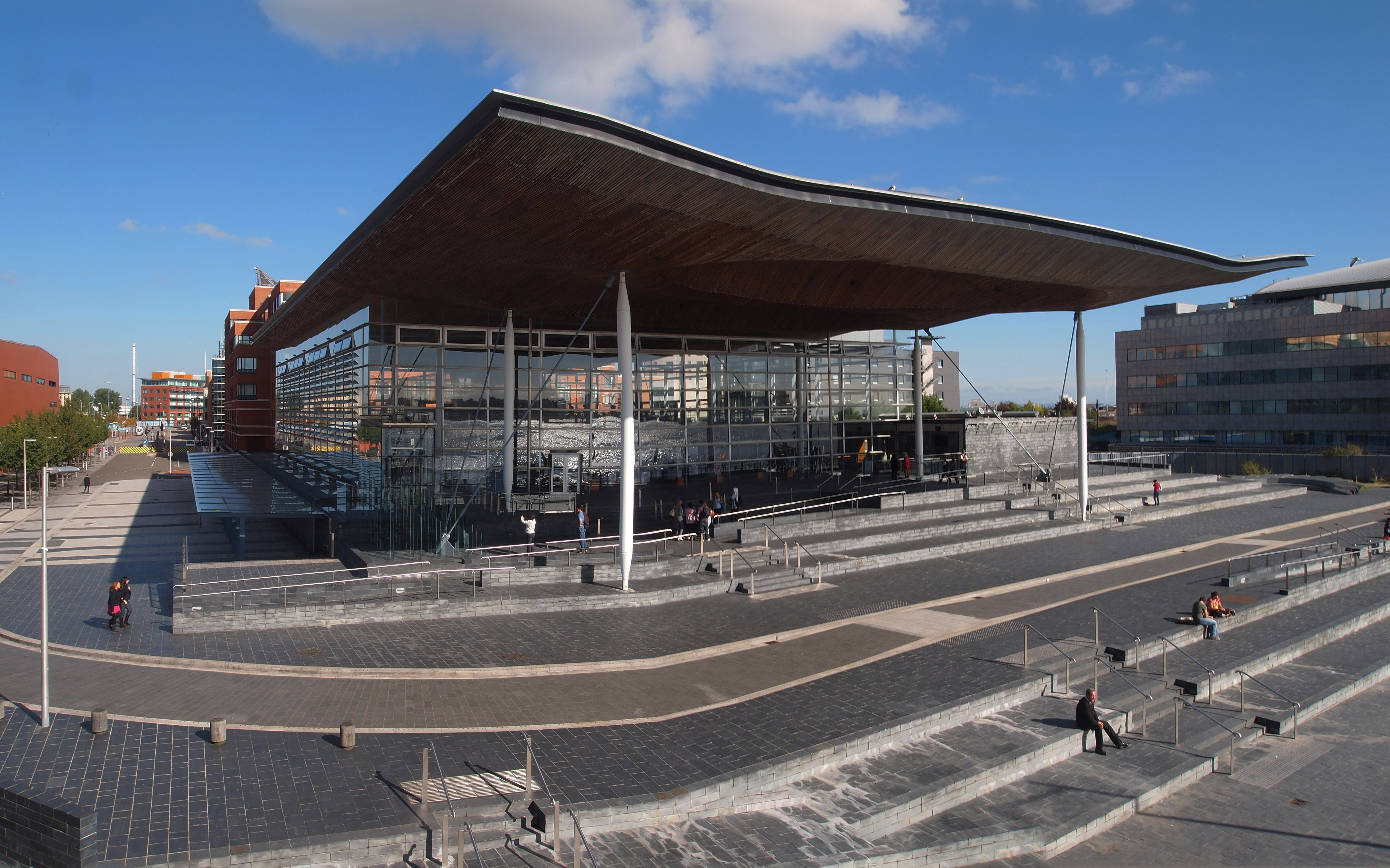
The Senedd (; ), officially known as the Welsh Parliament in English language, English and () in Welsh language, Welsh, is the Devolution in the United Kingdom, devolved, unicameral legislature of Wales. A democratically elected body, it makes laws for Wales, agrees certain taxes and scrutinises the Welsh Government. It is a bilingual institution, with both Welsh language, Welsh and English language, English being the official languages of its business. From its creation in May 1999 until May 2020, the Senedd was known as the National Assembly for Wales ( cy, Cynulliad Cenedlaethol Cymru, lang, link=no). The Senedd comprises 60 members who are known as Member of the Senedd, Members of the Senedd (), abbreviated as "MS" (). Since 2011, members are elected for a five-year term of office under an additional member system, in which 40 MSs represent smaller geographical divisions known as Senedd constituencies and electoral regions, "constituencies" and are elected by first-past-the ... [...More Info...] [...Related Items...] OR: [Wikipedia] [Google] [Baidu] |
M4 Relief Road
The M4 relief road, also known as M4 Corridor around Newport (M4CaN), was a proposed motorway, south of the city of Newport, South Wales, intended to relieve traffic congestion on the M4 motorway. Originally proposed by the Welsh Office in 1991, it was not pursued by the Conservative Major Government. Following devolution in 1999 the project was again drawn up by Welsh Government economic and transport minister Andrew Davies in 2004 but this was withdrawn in 2009 when the cost estimates had risen by £660m, to a total of £1 billion. In April 2013, the Conservative-led coalition offered the Welsh Government a £830m interest-payable loan for the construction of the road. In July 2014 Welsh Transport Minister Edwina Hart stated that, despite political opposition, the scheme would go ahead. Demand for investment grew in 2017 following a manifesto pledge by Theresa May which removed the Severn road tolls. The increased road use led to vehicle use increasing of 20% over t ... [...More Info...] [...Related Items...] OR: [Wikipedia] [Google] [Baidu] |


_1.jpg)


