|
Bruravik–Brimnes Ferry
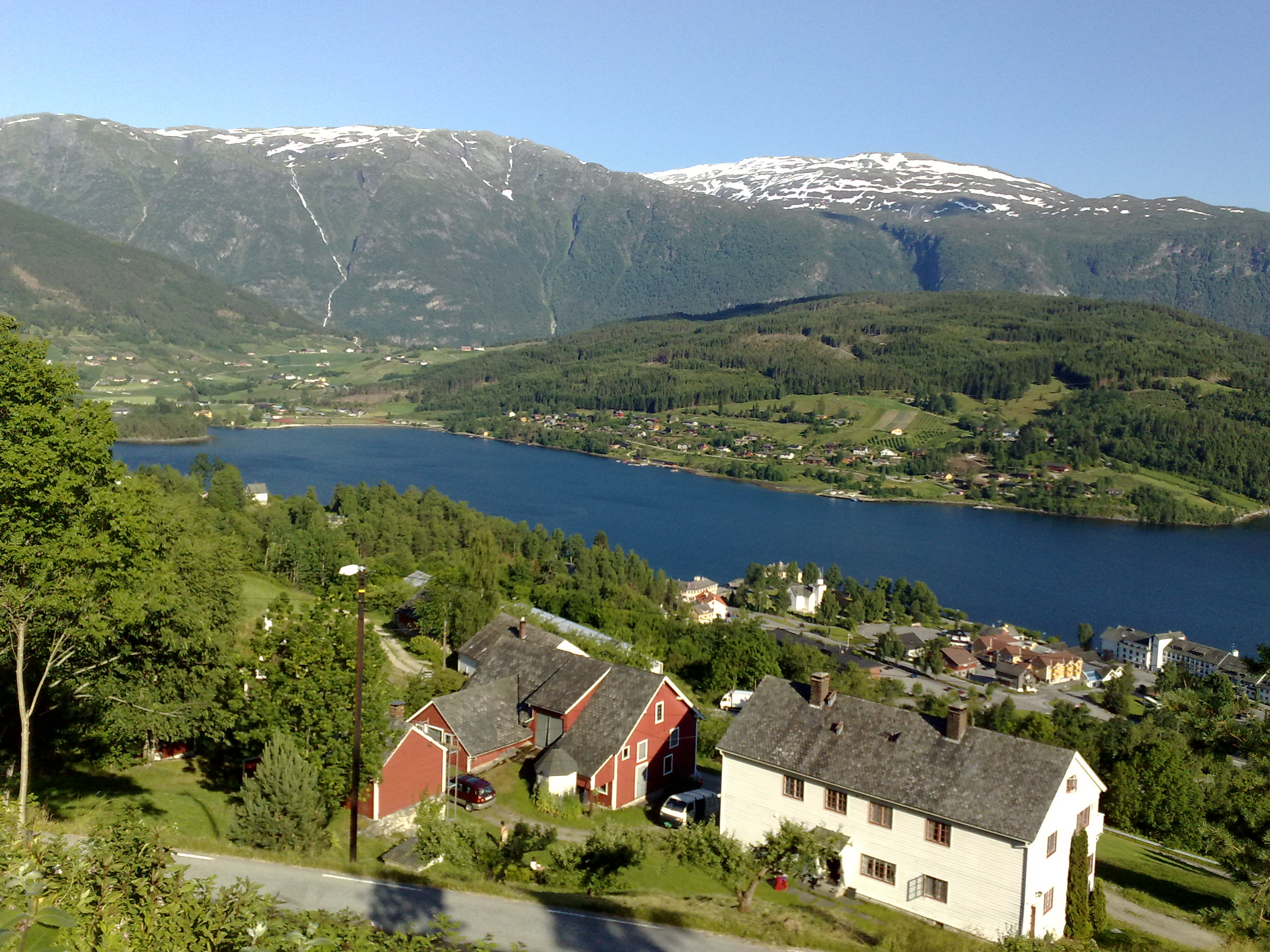
The Bruravik–Brimnes Ferry was a Norwegian ferry connection across the Hardanger Fjord between Bruravik in the municipality of Ulvik and Brimnes in the municipality of Eidfjord. The ferry connected Norwegian County Road 7 and Norwegian National Road 13, and before it was discontinued it was operated by the company Fjord1 and served by MF ''Sogn'' with up to three departures per hour. The crossing lasted about 12 minutes. In the summer of 2013 the route was also served by MF ''Sognefjord''. History The route was served by HSD (later Tide Sjø) from its opening in 1934 until 2011. In 2011, Fjord 1 won a tender and took over the ferry route. In 2013 the ferry connection was replaced by the Hardanger Bridge, which opened on August 17 that year. From the 1930s onward, road construction in the inner Hardanger Fjord progressively reduced the distance covered by the ferry: * 1934–1937: the ferry connected Ulvik and Ringøy Ringøy is a small village in the municipality of Eidf ... [...More Info...] [...Related Items...] OR: [Wikipedia] [Google] [Baidu] |
Norway Brimnes
Norway, officially the Kingdom of Norway, is a Nordic country in Northern Europe, the mainland territory of which comprises the western and northernmost portion of the Scandinavian Peninsula. The remote Arctic island of Jan Mayen and the archipelago of Svalbard also form part of Norway. Bouvet Island, located in the Subantarctic, is a dependency of Norway; it also lays claims to the Antarctic territories of Peter I Island and Queen Maud Land. The capital and largest city in Norway is Oslo. Norway has a total area of and had a population of 5,425,270 in January 2022. The country shares a long eastern border with Sweden at a length of . It is bordered by Finland and Russia to the northeast and the Skagerrak strait to the south, on the other side of which are Denmark and the United Kingdom. Norway has an extensive coastline, facing the North Atlantic Ocean and the Barents Sea. The maritime influence dominates Norway's climate, with mild lowland temperatures on the sea ... [...More Info...] [...Related Items...] OR: [Wikipedia] [Google] [Baidu] |
Norwegian National Road 13
National Road 13 ( no, Riksvei 13, ) is a national road which runs from the town of Stavanger in Rogaland county to the village of Sogndalsfjøra in Vestland county. The route is long and runs south–north through Rogaland and Vestland counties, following a more inland path than the European route E39 highway. Prior to 2019, the northern terminus of the road was at the village of Balestrand, but in 2019, the section of Norwegian County Road 55 from Balestrand to Sogndalsfjøra was added to National Road 13, extending it all the way to Sogndalsfjøra. In 2020, a new tunnel was opened between Stavanger and Tau, Ryfylke Tunnel, the world's deepest public road tunnel. National Road 13 was then rerouted through this tunnel, making it end in Stavanger instead of Sandnes. The road between Tau and Sandnes which has a ferry crossing (Oanes to Lauvika across the Høgsfjorden) became county roads. Route description Historically, Rv13 also included the road between the village of Bal ... [...More Info...] [...Related Items...] OR: [Wikipedia] [Google] [Baidu] |
Car Ferry Lines In Vestland
A car or automobile is a motor vehicle with wheels. Most definitions of ''cars'' say that they run primarily on roads, seat one to eight people, have four wheels, and mainly transport people instead of goods. The year 1886 is regarded as the birth year of the car, when German inventor Carl Benz patented his Benz Patent-Motorwagen. Cars became widely available during the 20th century. One of the first cars affordable by the masses was the 1908 Model T, an American car manufactured by the Ford Motor Company. Cars were rapidly adopted in the US, where they replaced animal-drawn carriages and carts. In Europe and other parts of the world, demand for automobiles did not increase until after World War II. The car is considered an essential part of the developed economy. Cars have controls for driving, parking, passenger comfort, and a variety of lights. Over the decades, additional features and controls have been added to vehicles, making them progressively more complex. Th ... [...More Info...] [...Related Items...] OR: [Wikipedia] [Google] [Baidu] |
Ringøy
Ringøy is a small village in the municipality of Eidfjord in Hordaland county, Norway. The settlement lies on the south side of the Eid Fjord, an inner branch of the Hardanger Fjord. The ferry quay at Ringøy served the ferry connection to Ulvik until 1938, when the quay on the south side of the fjord was relocated to Brimnes Brimnes is a small village in the municipality of Eidfjord in Vestland county, Norway. Geography The settlement lies on the south side of the Eid Fjord, an inner branch of the Hardanger Fjord. The ferry quay at Brimnes formerly served the ferry .... Ringøy lies about north of the village of Kinsarvik, the municipal seat, and about east of Eidfjord in the municipality of Eidfjord. Norwegian National Road 13 passes through Ringøy. There is a campsite next to the fjord in the village. References {{DEFAULTSORT:Ringoy Ullensvang ... [...More Info...] [...Related Items...] OR: [Wikipedia] [Google] [Baidu] |
Ulvik (village)
Ulvik is a village in the municipality of Ulvik which is located in Vestland county, Norway. The village sits at the end of the Ulvikafjorden, a side arm off of the main Hardangerfjord. The village lies about north of the Hardanger Bridge and about east of the village of Vossevangen. The village has a population (2019) of 534 and a population density of . The centre of the village is called "Brakanes" and it is located at the mouth of the river Tysso. This is the downtown part of the village and it includes most of the commercial areas including a cinema as well as Ulvik Church, the only church in the municipality. Brakanes School is a primary and lower secondary school (and the only school in Ulvik). The school has about 150 students that attend there. History The village centre of Ulvik was burned by the Germans , native_name_lang = de , region1 = , pop1 = 72,650,269 , region2 = , pop2 = 534,000 , region3 ... [...More Info...] [...Related Items...] OR: [Wikipedia] [Google] [Baidu] |
Hardanger Bridge
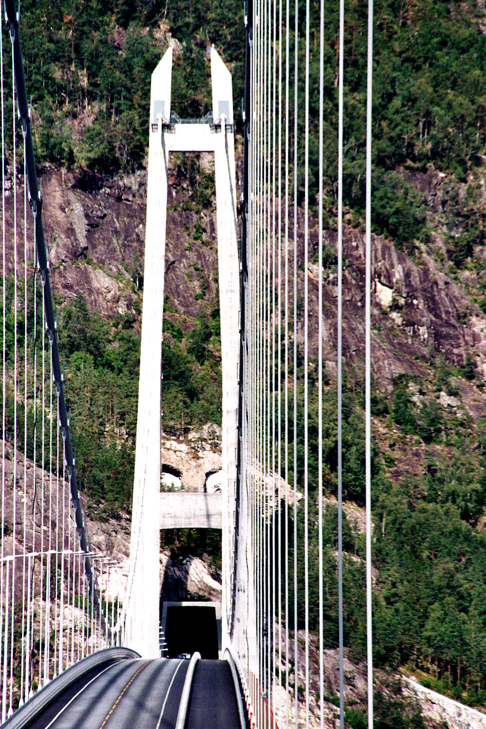
The Hardanger Bridge ( no, Hardangerbrua) is a suspension bridge across the Eidfjorden branch off of the main Hardangerfjorden in Vestland county, Norway. The bridge connects the municipalities of Ullensvang and Ulvik. It replaced a ferry connection between Bruravik and Brimnes, and thereby shortens the driving time between Oslo and Bergen. It is the longest suspension bridge in Norway. Construction The bridge was approved for building by the Norwegian Parliament on February 28, 2006, and construction began on February 26, 2009. While the bridge was engineered by the Norwegian Public Roads Administration, the construction was done by MT Højgaard. The project had a budget of () and more than half of this will be paid by toll and saved ferry subsidies. The Administration is considering a different route over a future bridge as the main connection between East and West.Nikolaisen, Per-Ivar .Hardangerbrua åpnet for 18 måneder siden. Nå vil Vegvesenet bygge ny ''Teknisk Ukeblad ... [...More Info...] [...Related Items...] OR: [Wikipedia] [Google] [Baidu] |
Hardanger Sunnhordlandske Dampskipsselskap
Hardanger Sunnhordlandske Dampskipsselskap (HSD), founded in 1880, was one of Norway's largest privately held public transportation providers. Its bus operation HSD Buss AS was founded in 1999, and serviced 15 million passengers annually in large parts of western Norway, predominantly in Vestland. It also had a ferry service, HSD Sjø AS, transporting passengers along the west coast of Norway. The fleet consisted of 31 ferries and 10 catamarans as of 2006. In 2006 the company merged with Gaia Trafikk forming the new company Tide Tides are the rise and fall of sea levels caused by the combined effects of the gravity, gravitational forces exerted by the Moon (and to a much lesser extent, the Sun) and are also caused by the Earth and Moon orbiting one another. Tide t .... Vessels Some of the vessels owned and operated by HSD. * (1913) * (1931) * MS ''Sunnhordland'' (1947) * MS ''Stord'' (1970) * MS ''Tysnes'' (1970) * (1999) References * * Defunct bus companie ... [...More Info...] [...Related Items...] OR: [Wikipedia] [Google] [Baidu] |
Fjord1
Fjord1 ASA is a Norwegian transport conglomerate, one of the largest in the Norwegian transport sector. Formed in 2001, company headquarters are in Florø, with the headquarters of the ferry division in Molde. It operates a fleet of environmentally friendly vessels in the Norwegian fjords. Formation Nordvestlandske was formed in 2001 by the merger of the county council-owned ferry companies Møre og Romsdal Fylkesbåtar and Fylkesbaatane i Sogn og Fjordane, becoming Fjord1 in December 2002. The fact that the merged company headquarters were located in Sogn og Fjordane made the merger unpopular in Møre og Romsdal county. The choice of name, Fjord1, was also not well-accepted among the local population. These strains on public relations, amongst other things, resulted in talks intended to further the merger process breaking down during the winter and spring of 2004. Fjord1 ASA was listed on the main list on the Oslo Stock Exchange on 15 August 2017. In 2021, US investment firm Vi ... [...More Info...] [...Related Items...] OR: [Wikipedia] [Google] [Baidu] |
Norwegian County Road 7
County Road 7 ( no, Fylkesvei 7) is a road in Vestland county, Norway. The road runs from Trengereid in the municipality of Bergen to Kollanes in the municipality of Voss. The route branches off from European route E16 and passes through the Trengereid Valley to Samnanger before crossing mountainous territory east to Norheimsund. It then continues along the north side of the Hardanger Fjord through Øystese and Ålvik and the north side of the Granvin Fjord before meeting Norwegian National Road 13 in the municipality of Voss. History The section of the road through the Toka Gorge was laid out around 1890; construction began on it in 1903 and it was opened in 1907. Large parts of the road were carved out by hand while the workers hung on ropes against the sheer mountainside. This method was used because the road lacks any natural foundation. A new route with four tunnels was opened in the 1960s. These are the Snauhaugen Tunnel (), Hansagjel Tunnel (), Tokagjel Tunnel (), an ... [...More Info...] [...Related Items...] OR: [Wikipedia] [Google] [Baidu] |
Brimnes
Brimnes is a small village in the municipality of Eidfjord in Vestland county, Norway. Geography The settlement lies on the south side of the Eid Fjord, an inner branch of the Hardanger Fjord. The ferry quay at Brimnes formerly served the ferry connection to Bruravik in the municipality of Ulvik. The ferry was part of the Fylkesbåtene company. The ferry service was discontinued after the construction of the Hardanger Bridge. Brimnes lies about from the village of Eidfjord and about from Kinsarvik in the municipality of Ullensvang Ullensvang is a municipality in Vestland county, Norway. It is located in the traditional district of Hardanger. The administrative centre is the town of Odda. Some of the notable villages in the municipality include Lofthus, Utne, Vikebygd .... Name The name of the village was standardized as ''Brimnes'' in 1990. The folklorist Halldor O. Opedal argued that the name ''Brimnes'' is incorrect, and that the correct form of the name should b ... [...More Info...] [...Related Items...] OR: [Wikipedia] [Google] [Baidu] |
Eidfjord
Eidfjord is a municipality in Vestland county, Norway. The municipality is located in the traditional district of Hardanger. The administrative centre of the municipality is the village of Eidfjord, where the majority of the municipal population lives. The other major population centre in the municipality is the village of Øvre Eidfjord. Eidfjord is situated at the end of the Eid Fjord, an inner branch of the large Hardangerfjorden. The village of Eidfjord is a major cruise ship port of call. Eidfjord has several tourist sites, like the Sima Power Plant which is built into the mountain itself, the Måbødalen valley, and the Vøringsfossen waterfall which has a free fall of . Large parts of the Hardangervidda (Europe's largest mountain plateau) are located in Eidfjord. The Hardangervidda Natursenter, a visitors centre and museum for Hardangervidda National Park, is located in Øvre Eidfjord. The municipality is the 57th largest by area out of the 356 municipalities in Nor ... [...More Info...] [...Related Items...] OR: [Wikipedia] [Google] [Baidu] |
Ulvik
Ulvik is a municipality in Vestland county, Norway. The municipality stretches from the Hardangerfjord to the mountains that reach above sea level. The administrative centre of the municipality is the village of Ulvik. The villages of Osa and Finse are also located in Ulvik municipality. The municipality is the 158th largest by area out of the 356 municipalities in Norway. Ulvik is the 331st most populous municipality in Norway with a population of 1,051. The municipality's population density is and its population has decreased by 5.5% over the previous 10-year period. Of the municipality's total population, nearly half live in the village of Ulvik at the end of the Ulvikafjorden. The vast majority of those who do not live in the village of Ulvik live on the farms surrounding the village or at the end of the Osa Fjord in the village of Osa. In 2016, the chief of police for Vestlandet formally suggested a reconfiguration of police districts and stations. He proposed that the ... [...More Info...] [...Related Items...] OR: [Wikipedia] [Google] [Baidu] |


