|
Bromford
Bromford is an industrial and residential area of Birmingham, situated between Ward End, Alum Rock, Hodge Hill, Washwood Heath, Shard End, Stechford, Castle Bromwich and Tyburn. The industrial area is predominantly situated on the north side of the M6 motorway, including The Bromford Gate industrial park, Fort Shopping Park, and Fort Dunlop, with one industrial site sitting east of the M6 called Bromford Central. The residential area sits adjacent to the East of the M6 comprising two neighbourhoods, Bromford (formally referred to as Bromford Bridge) built along Bromford Drive, and The Firs built along Chipperfield Road. The industrial and residential areas have increasingly become two separate distinguishable places, and not recognised locally as joined or one. This is signified by the M6 & River Tame dividing the two areas, poor public transport links between the two areas, and the areas sitting within three different local authority wards (industrial being split between Gravel ... [...More Info...] [...Related Items...] OR: [Wikipedia] [Google] [Baidu] |
Bromford Location
Bromford is an industrial and residential area of Birmingham, situated between Ward End, Alum Rock, Hodge Hill, Washwood Heath, Shard End, Stechford, Castle Bromwich and Tyburn. The industrial area is predominantly situated on the north side of the M6 motorway, including The Bromford Gate industrial park, Fort Shopping Park, and Fort Dunlop, with one industrial site sitting east of the M6 called Bromford Central. The residential area sits adjacent to the East of the M6 comprising two neighbourhoods, Bromford (formally referred to as Bromford Bridge) built along Bromford Drive, and The Firs built along Chipperfield Road. The industrial and residential areas have increasingly become two separate distinguishable places, and not recognised locally as joined or one. This is signified by the M6 & River Tame dividing the two areas, poor public transport links between the two areas, and the areas sitting within three different local authority wards (industrial being split between Gravel ... [...More Info...] [...Related Items...] OR: [Wikipedia] [Google] [Baidu] |
Bromford Bridge Railway Station
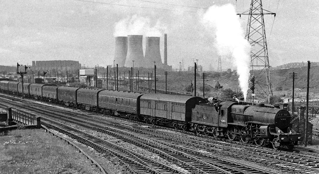
Bromford Bridge railway station was a railway station in Birmingham opened by the Midland Railway in 1896. It was built on the site of the previous Bromford Forge railway station which had been opened by the Birmingham and Derby Junction Railway on its new line to Lawley Street railway station in 1842. It was on the line from Water Orton and was reopened in 1896, the line by then being connected to Birmingham New Street. It was only used to serve the nearby racecourse, the platforms being on the goods lines to which the "specials" could be brought, clear of the running lines. It closed in 1965 when the racecourse closed. The name "Bromford Bridge" comes from the bridge over the River Tame, before which the river was crossed by a ford, hence "Bromford". The original station, Bromford Forge, was on the same level as the road, which crossed the railway on the level. At that time the track was just double. It was quadrupled later. As traffic increased, the level crossing became ... [...More Info...] [...Related Items...] OR: [Wikipedia] [Google] [Baidu] |
Bromford Bridge Racecourse
Bromford Bridge Racecourse was a racecourse in the Bromford area of Birmingham, England. Its official name was 'Birmingham'. It staged flat and national hunt racing. History The earliest recorded horse-race in Birmingham according to Chris Pitt and Chas Hammond took place in May 1747 but it is not known where that race took place. At various times racing took place at Smethwick, Handsworth, Sparkbrook, Hall Green and Four Oaks; but as Birmingham spread outwards the open ground needed for horse racing became scarcer. Bromford Bridge was an exception as it was well placed between the city and the countryside. The Bromford Bridge racecourse was opened in 1894 by brothers John and Stanley Ford. The lease of the land (measuring ) was supported by a company owned by the Earl of Aylesford. The first recorded meeting was on Friday 14 June and Saturday 15 June 1895. The first race, the Midland Welter Handicap, over a mile and a quarter, was won by Philology owned by Mr G F Fawcett. ... [...More Info...] [...Related Items...] OR: [Wikipedia] [Google] [Baidu] |
Birmingham Racecourse
Bromford Bridge Racecourse was a racecourse in the Bromford area of Birmingham, England. Its official name was 'Birmingham'. It staged flat and national hunt racing. History The earliest recorded horse-race in Birmingham according to Chris Pitt and Chas Hammond took place in May 1747 but it is not known where that race took place. At various times racing took place at Smethwick, Handsworth, Sparkbrook, Hall Green and Four Oaks; but as Birmingham spread outwards the open ground needed for horse racing became scarcer. Bromford Bridge was an exception as it was well placed between the city and the countryside. The Bromford Bridge racecourse was opened in 1894 by brothers John and Stanley Ford. The lease of the land (measuring ) was supported by a company owned by the Earl of Aylesford. The first recorded meeting was on Friday 14 June and Saturday 15 June 1895. The first race, the Midland Welter Handicap, over a mile and a quarter, was won by Philology owned by Mr G F Fawcett. ... [...More Info...] [...Related Items...] OR: [Wikipedia] [Google] [Baidu] |
Washwood Heath
Washwood Heath is a ward in Birmingham, within the formal district of Hodge Hill, roughly two miles north-east of Birmingham city centre, England. Washwood Heath covers the areas of Birmingham that lie between Nechells, Bordesley Green, Stechford and Hodge Hill. Geography Saltley on the south-western side and Ward End on the north-eastern side of Washwood Heath are the two areas that cover the entire ward, though some parts near Nechells and Hodge Hill do not come under either of these and are simply headed under "Washwood Heath". One of the area's major employers was the railway works owned by Metropolitan-Cammell (later Alstom), but it closed in 2005. In the 2020s, Washwood Heath railway depot was to be constructed as part of the High Speed 2 project - to service and maintain the high speed trains. Demographics According to the 2001 Population Census, there were 27,822 people living in the ward with a population density of 5,335 people per km2 compared with 3,649 peo ... [...More Info...] [...Related Items...] OR: [Wikipedia] [Google] [Baidu] |
Tyburn, West Midlands
Tyburn is a ward in Birmingham, England formerly known as Kingsbury. It is part of the Erdington formal district and comprises Castle Vale, Fort Parkway in Castle Bromwich, the Pype Hayes area of Erdington, Birches Green and Tyburn Road. The significant landmarks in the area include Jaguar Cars' Castle Bromwich Assembly factory, Fort Dunlop and Pype Hayes Park. The Castle Vale Library, built in 2006, serves the area. The library was designed by Birmingham-based Associated Architects and built by the Castle Vale Housing Action Trust. Geography of the area Tyburn covers the municipal housing estates of Birches Green, Pype Hayes and Castle Vale as well as Erdington Hall, a residential area. The housing estates of Pype Hayes and Castle Vale have witnessed significant regeneration in recent times. Entire estates in Pype Hayes were cleared and replaced with modern housing by Birmingham City Council. Castle Vale was home to one of Europe's largest urban regeneration projects which res ... [...More Info...] [...Related Items...] OR: [Wikipedia] [Google] [Baidu] |
River Tame, West Midlands
The River Tame is a river in the West Midlands of England, and one of the principal tributaries of the River Trent. The Tame is about long from the source at Oldbury to its confluence with the Trent near Alrewas, but the main river length of the entire catchment, i.e. the Tame and its main tributaries, is about . It forms part of the Severn-Trent flyway, a route used by migratory birds to cross Great Britain. Etymology The name derives from the Celtic language, although it may have even earlier roots. It is usually thought to mean "dark", by analogy with the Sanskrit word ''tamas'' meaning darkness. Other possibilities are "slow-moving" or "flowing", although the precise meaning is uncertain. The name is shared with the River Tame, Greater Manchester, and it is likely that the River Thame, the River Thames, the River Teme, the River Team, and the River Tamar all share the derivation. Historic significance Birmingham and the parishes in the centre and north of the modern ... [...More Info...] [...Related Items...] OR: [Wikipedia] [Google] [Baidu] |
Birmingham Erdington (UK Parliament Constituency)
Birmingham Erdington is a parliamentary constituency in Birmingham, England, represented in the House of Commons of the Parliament of the United Kingdom since 2022 by Paulette Hamilton of the Labour Party. Members of Parliament MPs 1918–1955 MPs since 1974 Constituency profile The constituency is predominantly white working class and very deprived, has quite considerable social housing and has a high proportion of adults of working age in a low income bracket when compared to the West Midlands as a whole. Since the seat was recreated in 1974, only Labour MPs have been elected, although Conservative candidates reduced the majority to three figures in 1979 and 1983; both of which resulted in victories for the party as a whole nationwide. In the 2016 United Kingdom European Union membership referendum, 63% of people voted to leave the EU whilst 37% voted to remain. Boundaries 2010–: The City of Birmingham wards of Erdington, Kingstanding, Stockland Green, and Tyburn. ... [...More Info...] [...Related Items...] OR: [Wikipedia] [Google] [Baidu] |
Birmingham
Birmingham ( ) is a city and metropolitan borough in the metropolitan county of West Midlands in England. It is the second-largest city in the United Kingdom with a population of 1.145 million in the city proper, 2.92 million in the West Midlands metropolitan county, and approximately 4.3 million in the wider metropolitan area. It is the largest UK metropolitan area outside of London. Birmingham is known as the second city of the United Kingdom. Located in the West Midlands region of England, approximately from London, Birmingham is considered to be the social, cultural, financial and commercial centre of the Midlands. Distinctively, Birmingham only has small rivers flowing through it, mainly the River Tame and its tributaries River Rea and River Cole – one of the closest main rivers is the Severn, approximately west of the city centre. Historically a market town in Warwickshire in the medieval period, Birmingham grew during the 18th century during the Midla ... [...More Info...] [...Related Items...] OR: [Wikipedia] [Google] [Baidu] |
Castle Bromwich
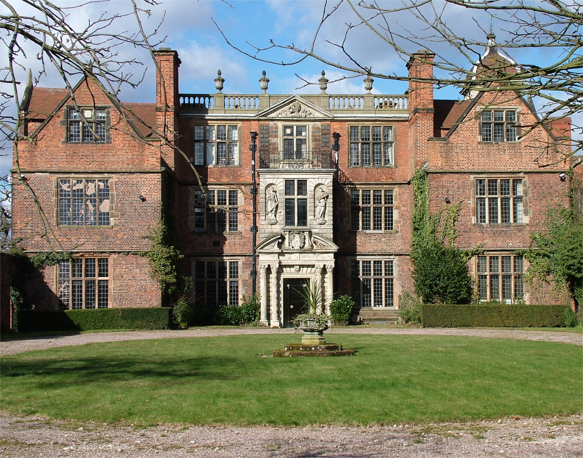
Castle Bromwich () is a large suburban village situated within the Metropolitan Borough of Solihull in the English county of the West Midlands. It is bordered by the rest of the borough to the south east; also Sutton Coldfield to the east and north east, Shard End to the south west, Castle Vale, Erdington and Minworth to the north and Hodge Hill to the west – all areas of the City of Birmingham. It constitutes a civil parish, which had a population of 11,857 according to the 2001 census, falling to 11,217 at the 2011 census. The population has remained quite stable since then; the 2017 population estimate was 12,309. It was a civil parish within the Meriden Rural District of Warwickshire until the Local Government Act 1972 came into force in 1974, when it became part of the Metropolitan Borough of Solihull. In 1861, the population was 613. This rose to just over 1,000 in the 1920s, when half of the original parish was ceded to the City of Birmingham for the construction ... [...More Info...] [...Related Items...] OR: [Wikipedia] [Google] [Baidu] |
Paper Mill
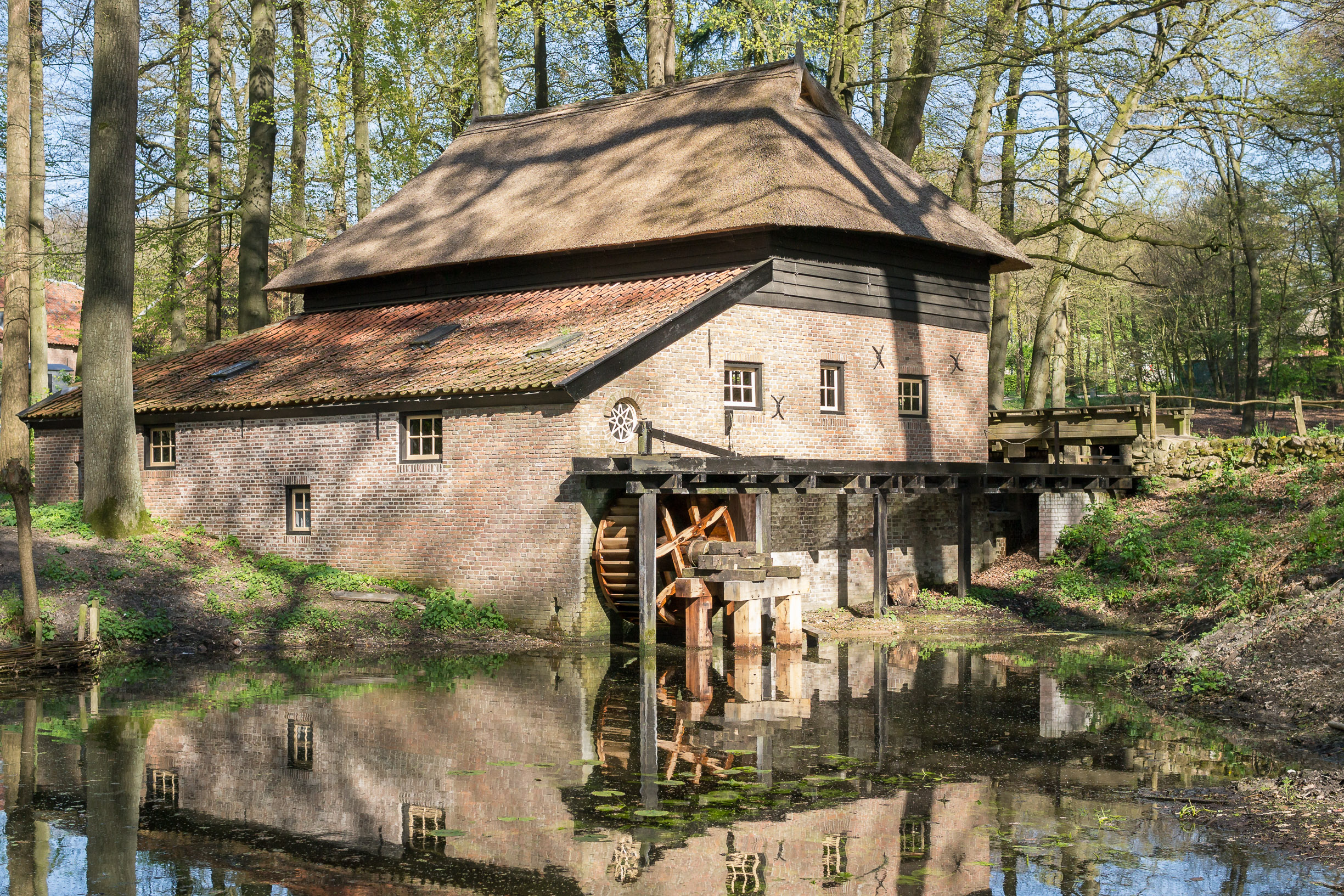
A paper mill is a factory devoted to making paper from vegetable fibres such as wood pulp, old rags, and other ingredients. Prior to the invention and adoption of the Fourdrinier machine and other types of paper machine that use an endless belt, all paper in a paper mill was made by hand, one sheet at a time, by specialized laborers. History Historical investigations into the origin of the paper mill are complicated by differing definitions and loose terminology from modern authors: Many modern scholars use the term to refer indiscriminately to all kinds of mills, whether powered by humans, by animals or by water. Their propensity to refer to any ancient paper manufacturing center as a "mill", without further specifying its exact power source, has increased the difficulty of identifying the particularly efficient and historically important water-powered type. Human and animal-powered mills The use of human and animal powered mills was known to Muslim and Chinese paperma ... [...More Info...] [...Related Items...] OR: [Wikipedia] [Google] [Baidu] |
Birmingham Hodge Hill (UK Parliament Constituency)
Birmingham Hodge Hill is a constituency of part of the city of Birmingham represented in the House of Commons since 2004 by Liam Byrne, a member of the Labour Party. Constituency profile The constituency covers a diverse area of east Birmingham, including the predominantly Asian inner-city area of Washwood Heath and the mostly white area of Shard End on the city's eastern boundary, as well as Hodge Hill itself. Residents have low incomes and there is roughly a three-way split of social housing, privately rented and privately owned homes, leading to one of highest Indices of Multiple Deprivation in the West Midlands for its central area. Members of Parliament The current Member of Parliament is Liam Byrne of the Labour Party, who was elected in the 2004 by-election. He succeeded Terry Davis, who had held the seat since its creation in the 1983 general election. For the four years from the 1979 general election Davis held the largely predecessor constituency to the area, B ... [...More Info...] [...Related Items...] OR: [Wikipedia] [Google] [Baidu] |


