|
Broad Run (conservation Area)
Broad Run, a wildland in the George Washington and Jefferson National Forests of western Virginia, has been recognized by the Wilderness Society as a special place worthy of protection from logging and road construction. The Wilderness Society has designated the area as a "Mountain Treasure".Virginia's Mountain Treasures, report issued by The Wilderness Society, May, 1999, page=17 Close to New Castle, yet considered a remote area, the site features a pristine, low-elevation stream and three mountains separated by steep drainages. The area is part of the ''Craig Creek Cluster''. Location and access The area is located in the Appalachian Mountains of Southwestern Virginia, about 4 miles east of New Castle, Virginia. It is between Va 614 on the west and Va 666 on the east. Trails into the area include: *Ferrier Trail, Forest Trail 189, 2.34 miles *Lick Branch Trail, Forest Trail 262, 5.21 miles *North Mountain Trail, Forest Trail 263, 13.2 miles *Lees Creek Trail, Forest Trail ... [...More Info...] [...Related Items...] OR: [Wikipedia] [Google] [Baidu] |
Craig County, Virginia
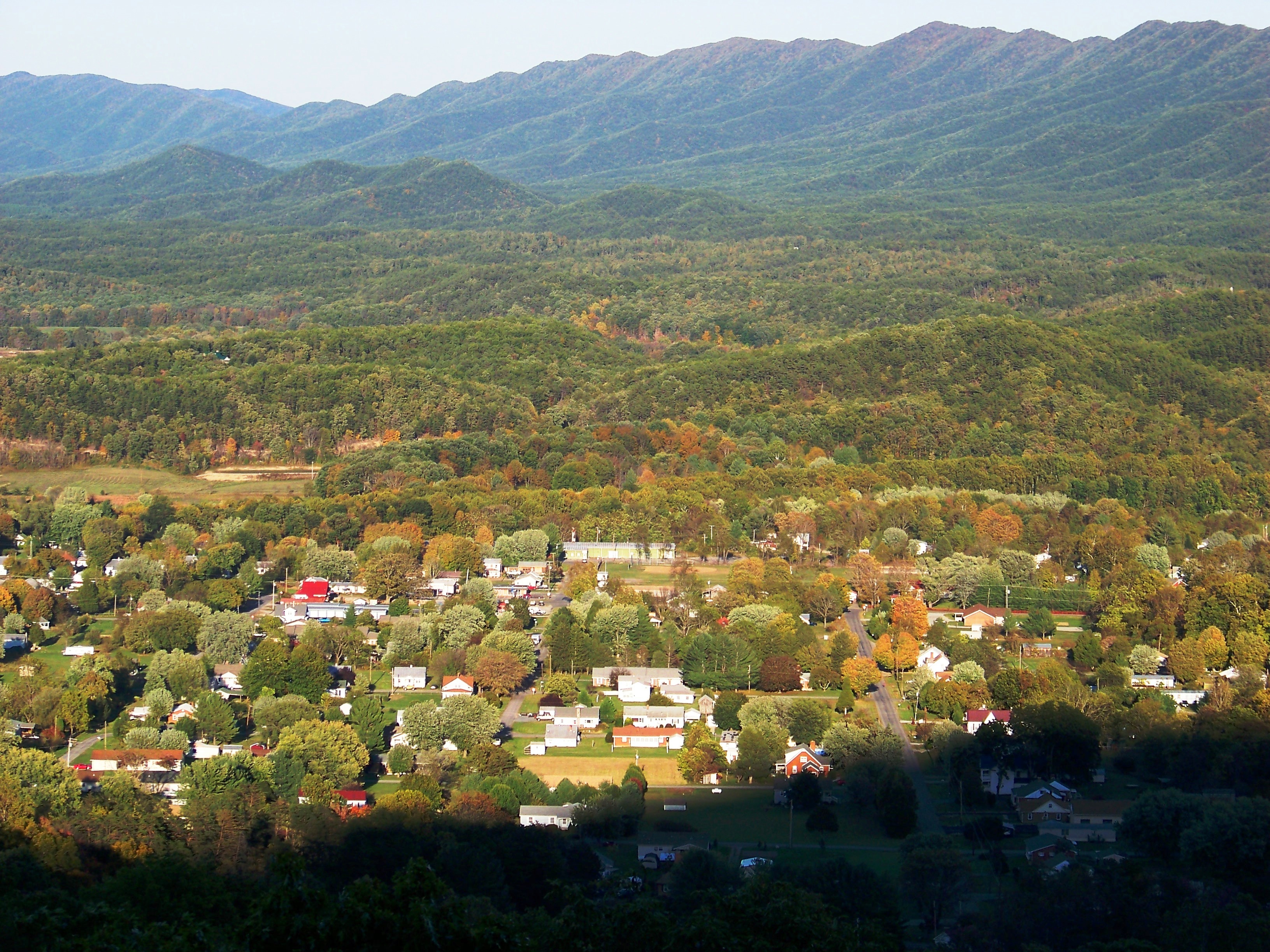
Craig County is a county located in the Commonwealth of Virginia. As of the 2020 census, the population was 4,892. Its county seat is New Castle. Craig County is part of the Roanoke, VA Metropolitan Statistical Area. History Nestled in the mountains of Southwest Virginia, Craig County was named for Robert Craig, a 19th-century Virginia congressman. The initial outpost in the area was called "Craig's Camp," and it is claimed that George Washington visited it in 1756 during his travels to the frontier. Formed from parts of Botetourt, Roanoke, Giles, and Monroe (in present-day West Virginia) counties in 1851, Craig was later enlarged with several subsequent additions from neighboring counties. The secluded, mountainous New Castle community, the county seat, has one of the commonwealth's antebellum court complexes, including a porticoed courthouse built in 1851. Craig Healing Springs, a collection of well-preserved early-20th-century resort buildings representative of the ar ... [...More Info...] [...Related Items...] OR: [Wikipedia] [Google] [Baidu] |
Botetourt County, Virginia
Botetourt County ( ) is a US county that lies in the Roanoke Region of the Commonwealth of Virginia. Located in the mountainous portion of the state, the county is bordered by two major ranges, the Blue Ridge Mountains and the Appalachian Mountains. Botetourt County was created in 1770 from part of Augusta County and was named for Norborne Berkeley, known as Lord Botetourt. It originally comprised a vast area, which included the southern portion of present-day West Virginia and all of Kentucky. Portions were set off to form new counties beginning in 1772, until the current borders were established in 1851. Botetourt County is part of the Roanoke Virginia Metropolitan Statistical Area, and the county seat is the town of Fincastle. As of the 2020 census, the county population was 33,596. History First proposed in the House of Burgesses in 1767, Botetourt County was created in 1770 from Augusta County. The county is named for Norborne Berkeley, Baron de Botetourt, more c ... [...More Info...] [...Related Items...] OR: [Wikipedia] [Google] [Baidu] |
George Washington And Jefferson National Forests
The George Washington and Jefferson National Forests is an administrative entity combining two U.S. National Forests into one of the largest areas of public land in the Eastern United States. The forests cover of land in the Appalachian Mountains of Virginia, West Virginia, and Kentucky. Approximately of the forest are remote and undeveloped and have been designated as wilderness areas, which prohibits future development. History George Washington National Forest was established on May 16, 1918, as the Shenandoah National Forest. The forest was renamed after the first President on June 28, 1932. Natural Bridge National Forest was added on July 22, 1933. Jefferson National Forest was formed on April 21, 1936, by combining portions of the Unaka and George Washington National Forests with other land. In 1995, the George Washington and Jefferson National Forests were administratively combined. The border between the two forests roughly follows the James River. The combine ... [...More Info...] [...Related Items...] OR: [Wikipedia] [Google] [Baidu] |
The Wilderness Society (United States)
The Wilderness Society is an American non-profit land conservation organization that is dedicated to protecting natural areas and federal public lands in the United States. They advocate for the designation of federal wilderness areas and other protective designations, such as for national monuments. They support balanced uses of public lands, and advocate for federal politicians to enact various land conservation and balanced land use proposals. The Wilderness Society also engages in a number of ancillary activities, including education and outreach, and hosts one of the most valuable collections of Ansel Adams photographs at their headquarters in Washington, D.C. The Wilderness Society specializes in issues involving lands under the management of federal agencies; such lands include national parks, national forests, national wildlife refuges, and areas overseen by the Bureau of Land Management. In the early 21st century, the society has been active in fighting recent politic ... [...More Info...] [...Related Items...] OR: [Wikipedia] [Google] [Baidu] |
Craig Creek Cluster
The Craig Creek Cluster is a region recognized by The Wilderness Society for its unique high elevation mountains, vistas, trout streams and wildlife habitat. The cluster contains wildlands and wilderness areas along Craig Creek, a 65-mile long creek with headwaters at the Brush Mountain Wilderness near Blacksburg. Popular for hiking, canoeing, mountain biking, hunting, horseback riding, and fishing, the area offers an opportunity for secluded recreation. During the summer months the area is an escape from other public lands that are busy with visitors. Description The Craig Creek Wilderness Cluster contains wilderness areas and wildlands recognized by the Wilderness Society as “Mountain Treasures”, areas that are worthy of protection from logging and road construction. The areas in the cluster are: *Wilderness Areas **Brush Mountain Wilderness ** Brush Mountain East Wilderness *Wildareas recognized by the Wilderness Society as “Mountain Treasures” ** Patterson Mountai ... [...More Info...] [...Related Items...] OR: [Wikipedia] [Google] [Baidu] |
Appalachian Mountains
The Appalachian Mountains, often called the Appalachians, (french: Appalaches), are a system of mountains in eastern to northeastern North America. The Appalachians first formed roughly 480 million years ago during the Ordovician Period. They once reached elevations similar to those of the Alps and the Rocky Mountains before experiencing natural erosion. The Appalachian chain is a barrier to east–west travel, as it forms a series of alternating ridgelines and valleys oriented in opposition to most highways and railroads running east–west. Definitions vary on the precise boundaries of the Appalachians. The United States Geological Survey (USGS) defines the ''Appalachian Highlands'' physiographic division as consisting of 13 provinces: the Atlantic Coast Uplands, Eastern Newfoundland Atlantic, Maritime Acadian Highlands, Maritime Plain, Notre Dame and Mégantic Mountains, Western Newfoundland Mountains, Piedmont, Blue Ridge, Valley and Ridge, St. Lawrence Valley, Appalac ... [...More Info...] [...Related Items...] OR: [Wikipedia] [Google] [Baidu] |
New Castle, Virginia
New Castle (historically spelled as one word; "Newcastle") is the only town in Craig County, Virginia, United States. The population was 125 at the 2020 census.https://www.census.gov/search-results.html?searchType=web&cssp=SERP&q=New%20Castle%20town,%20Virginia It is the county seat of Craig County. The junctions of State Route 311 and State Route 42 and State Route 311 and State Route 615 are in New Castle. New Castle is part of the Roanoke Metropolitan Statistical Area. Geography New Castle is located at (37.500746, -80.110798). According to the United States Census Bureau, the town has a total area of 0.2 square miles (0.4 km2), all of it land. Two notable geophysical features of the town are the high cliffs just west of the city (which keeps the New River watershed flowing north away from New Castle) and Johns Creek gorge featuring some challenging whitewater (James River watershed). Due to an old land charter however, paddling Johns Creek was disputed as t ... [...More Info...] [...Related Items...] OR: [Wikipedia] [Google] [Baidu] |
Boundary Of The Broad Run Wildland As Identified By The Wilderness Society
Boundary or Boundaries may refer to: * Border, in political geography Entertainment * ''Boundaries'' (2016 film), a 2016 Canadian film * ''Boundaries'' (2018 film), a 2018 American-Canadian road trip film *Boundary (cricket), the edge of the playing field, or a scoring shot where the ball is hit to or beyond that point *Boundary (sports), the sidelines of a field Mathematics and physics *Boundary (topology), the closure minus the interior of a subset of a topological space; an edge in the topology of manifolds, as in the case of a 'manifold with boundary' *Boundary (graph theory), the vertices of edges between a subgraph and the rest of a graph *Boundary (chain complex), its abstractization in chain complexes *Boundary value problem, a differential equation together with a set of additional restraints called the boundary conditions * Boundary (thermodynamics), the edge of a thermodynamic system across which heat, mass, or work can flow Psychology and sociology *Personal boundari ... [...More Info...] [...Related Items...] OR: [Wikipedia] [Google] [Baidu] |
United States Geological Survey
The United States Geological Survey (USGS), formerly simply known as the Geological Survey, is a scientific agency of the United States government. The scientists of the USGS study the landscape of the United States, its natural resources, and the natural hazards that threaten it. The organization's work spans the disciplines of biology, geography, geology, and hydrology. The USGS is a fact-finding research organization with no regulatory responsibility. The agency was founded on March 3, 1879. The USGS is a bureau of the United States Department of the Interior; it is that department's sole scientific agency. The USGS employs approximately 8,670 people and is headquartered in Reston, Virginia. The USGS also has major offices near Lakewood, Colorado, at the Denver Federal Center, and Menlo Park, California. The current motto of the USGS, in use since August 1997, is "science for a changing world". The agency's previous slogan, adopted on the occasion of its hundredt ... [...More Info...] [...Related Items...] OR: [Wikipedia] [Google] [Baidu] |
Clematis Coactilis
''Clematis coactilis'', common name Virginia white-hair leather flower, is a plant species endemic to the western part of the US State of Virginia. It is reported from only Botetourt County, Virginia, Botetourt, Roanoke County, Virginia, Roanoke, Craig County, Virginia, Craig, Montgomery County, Virginia, Montgomery, Giles County, Virginia, Giles, Wythe County, Virginia, Wythe, and Pulaski County, Virginia, Pulaski Counties. It is usually found on soils formed from shale, less often Dolomite (rock), dolomite, limestone or sandstone. ''Clematis coactilis'' is a shrub, not a vine like many of the other members of the genus. It is erect, up to 45 cm tall with silky, bristly or woolly hairs. Leaves are thick and leathery, simple but sometimes lobed, up to 12 cm long. Flowers are bell—shaped, borne one at a time at the tips of branches, pale yellow sometimes with a purplish tinge. Achenes are hairy, with a feathery beak up to 6 cm long.Gleason, H. A. & A.J. Cronquist ... [...More Info...] [...Related Items...] OR: [Wikipedia] [Google] [Baidu] |
Inventoried Roadless Area
Inventoried Roadless Areas are a group of United States Forest Service lands that have been identified by government reviews as lands without existing roads that could be suitable for roadless area conservation as wilderness or other non-standard protections. The Inventoried Roadless areas include approximately of land in 40 states and Puerto Rico. Most of these lands are in the western portion of the lower 48 states and Alaska.Maps of inventoried roadless areasUS Forest Service Maps Idaho alone contains over of inventoried roadless areas. The inventoried roadless areas range from large areas with wilderness characteristics to small tracts of land that are immediately adjacent to wilderness areas, parks and other protected lands. Roadless Area Review and Evaluations (RARE) The first review of Forest Service roadless lands was started in 1967 after the creation of the Wilderness Act by Congress in 1964. This effort was called the “Roadless Area Review and Evaluation” or “ ... [...More Info...] [...Related Items...] OR: [Wikipedia] [Google] [Baidu] |
Roadless Area Conservation
Roadless area conservation is a conservation policy limiting road construction and the resulting environmental impact on designated areas of public land. In the United States, roadless area conservation has centered on U.S. Forest Service areas known as inventoried roadless areas. The most significant effort to support the conservation of these efforts was the Forest Service 2001 Roadless Area Conservation Rule (Roadless Rule). Concept Access roads provide convenient access for industry as well as for a variety of recreational activities, such as sightseeing, fishing, hunting, and off-roading. However, these activities can cause erosion, pollution, species loss, and loss of aesthetic appeal. In addition, the building of roads can lead to further development of "splinter roads" that take off from them, and the encroachment of human settlement and development in sensitive areas. In the United States, about 30%, of National Forest lands in 38 states and Puerto Rico are roadless a ... [...More Info...] [...Related Items...] OR: [Wikipedia] [Google] [Baidu] |


