|
Brizlee Tower
Brizlee Tower (sometimes Brislee Tower) is a Grade 1 listed folly set atop a hill in Hulne Park, the walled home park of the Duke of Northumberland in Alnwick, Northumberland. The tower was erected in 1781 for Hugh Percy, 1st Duke of Northumberland, and commands extensive views over North Northumberland and the Borders. The tower Brizlee Tower is a 26-metre-high elaborately ornamental tower in dressed stone set at the edge of the northern escarpment of Brizlee Hill, overlooking Hulne Park, the "home park" of Alnwick Castle. The hill's relative elevation (about 177 metres above sea-level, in comparison with the valley floor's 44 metres) makes the tower's site a natural vantage point with all-encompassing views to the west, north and east – including the vale of Whittingham, through which the River Aln flows; the sites of numerous country seats past and present, such as at Eslington, Bolton, Callaly, Shawdon, Broomepark, and Lemington; Hulne Priory within the park walls; ... [...More Info...] [...Related Items...] OR: [Wikipedia] [Google] [Baidu] |
Listed Building
In the United Kingdom, a listed building or listed structure is one that has been placed on one of the four statutory lists maintained by Historic England in England, Historic Environment Scotland in Scotland, in Wales, and the Northern Ireland Environment Agency in Northern Ireland. The term has also been used in the Republic of Ireland, where buildings are protected under the Planning and Development Act 2000. The statutory term in Ireland is " protected structure". A listed building may not be demolished, extended, or altered without special permission from the local planning authority, which typically consults the relevant central government agency, particularly for significant alterations to the more notable listed buildings. In England and Wales, a national amenity society must be notified of any work to a listed building which involves any element of demolition. Exemption from secular listed building control is provided for some buildings in current use for worship, ... [...More Info...] [...Related Items...] OR: [Wikipedia] [Google] [Baidu] |
English Country House
An English country house is a large house or mansion in the English countryside. Such houses were often owned by individuals who also owned a town house. This allowed them to spend time in the country and in the city—hence, for these people, the term distinguished between town and country. However, the term also encompasses houses that were, and often still are, the full-time residence for the landed gentry who ruled rural Britain until the Reform Act 1832. Frequently, the formal business of the counties was transacted in these country houses, having functional antecedents in manor houses. With large numbers of indoor and outdoor staff, country houses were important as places of employment for many rural communities. In turn, until the agricultural depressions of the 1870s, the estates, of which country houses were the hub, provided their owners with incomes. However, the late 19th and early 20th centuries were the swansong of the traditional English country house lifest ... [...More Info...] [...Related Items...] OR: [Wikipedia] [Google] [Baidu] |
Elizabeth Percy, Duchess Of Northumberland
Elizabeth Percy, Duchess of Northumberland ( née ''Seymour''; 26 November 1716 – 5 December 1776), also ''suo jure'' 2nd Baroness Percy, was a British peer. Life Percy was the only daughter of Algernon Seymour, 7th Duke of Somerset, and his wife, Frances, daughter of Henry Thynne. On 16 July 1740, she married Sir Hugh Smithson, Bt, and they had two sons, Hugh (1742–1817) and Algernon (1750–1830). On her father's death in 1750, she inherited his barony of Percy and her husband acquired from her father his earldom of Northumberland by special remainder and changed his family name from Smithson to Percy that year. Sir Hugh's illegitimate son James Smithson, otherwise Jacques Louis Macie, born in about 1764 to one of Elizabeth's cousins, bequeathed the fortune which established the Smithsonian Institution. In 1761, Percy became a Lady of the Bedchamber to Queen Charlotte, a post she held until 1770. She became a duchess in 1766 when her husband was created Duke of ... [...More Info...] [...Related Items...] OR: [Wikipedia] [Google] [Baidu] |
Warkworth Castle
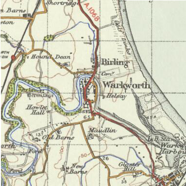
Warkworth Castle is a ruined medieval castle in Warkworth in the English county of Northumberland. The village and castle occupy a loop of the River Coquet, less than a mile from England's north-east coast. When the castle was founded is uncertain: traditionally its construction has been ascribed to Prince Henry of Scotland, Earl of Northumbria, in the mid-12th century, but it may have been built by King Henry II of England when he took control of England's northern counties. Warkworth Castle was first documented in a charter of 1157–1164 when Henry II granted it to Roger fitz Richard. The timber castle was considered "feeble", and was left undefended when the Scots invaded in 1173. Roger's son Robert inherited and improved the castle. Robert was a favourite of King John, and hosted him at Warkworth Castle in 1213. The castle remained in the family line, with periods of guardianship when heirs were too young to control their estates. King Edward I sta ... [...More Info...] [...Related Items...] OR: [Wikipedia] [Google] [Baidu] |
Dunstanburgh Castle
Dunstanburgh Castle is a 14th-century fortification on the coast of Northumberland in northern England, between the villages of Craster and Embleton. The castle was built by Earl Thomas of Lancaster between 1313 and 1322, taking advantage of the site's natural defences and the existing earthworks of an Iron Age fort. Thomas was a leader of a baronial faction opposed to King Edward II, and probably intended Dunstanburgh to act as a secure refuge, should the political situation in southern England deteriorate. The castle also served as a statement of the earl's wealth and influence and would have invited comparisons with the neighbouring royal castle of Bamburgh. Thomas probably only visited his new castle once, before being captured at the Battle of Boroughbridge as he attempted to flee royal forces for the safety of Dunstanburgh. Thomas was executed, and the castle became the property of the Crown before passing into the Duchy of Lancaster. Dunstanburgh's defences were expanded ... [...More Info...] [...Related Items...] OR: [Wikipedia] [Google] [Baidu] |
Bamburgh Castle
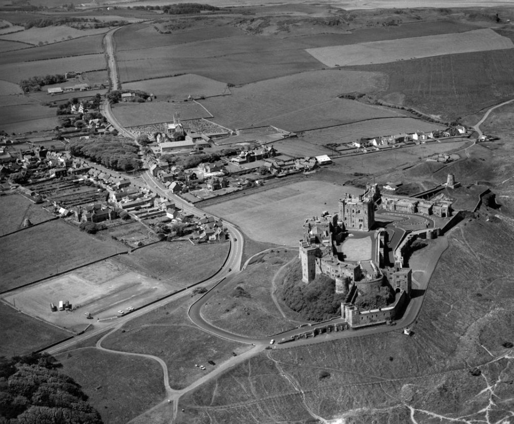
Bamburgh Castle is a castle on the northeast coast of England, by the village of Bamburgh in Northumberland. It is a Grade I listed building. The site was originally the location of a Celtic Brittonic fort known as ''Din Guarie'' and may have been the capital of the kingdom of Bernicia from its foundation in 420 to 547. In that latter year, it was captured by King Ida of Bernicia. After passing between the Britons and the Anglo-Saxons three times, the fort came under Anglo-Saxon control in 590. The fort was destroyed by Vikings in 993, and the Normans later built a new castle on the site, which forms the core of the present one. After a revolt in 1095 supported by the castle's owner, it became the property of the English monarch. In the 17th century, financial difficulties led to the castle deteriorating, but it was restored by various owners during the 18th and 19th centuries. It was finally bought by the Victorian era industrialist William Armstrong, who completed its resto ... [...More Info...] [...Related Items...] OR: [Wikipedia] [Google] [Baidu] |
Coquet Island, England
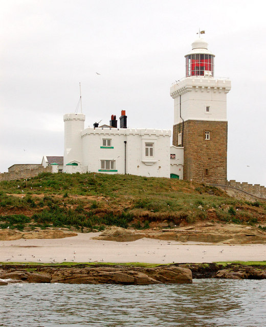
Coquet Island is a small island of about , situated off Amble on the Northumberland coast, northeast England. It is included in the civil parish of Hauxley. Bird reserve The island is owned by the Duke of Northumberland. The Royal Society for the Protection of Birds manages the island as a bird reserve, for its important seabird colonies. The most numerous species is the puffin, with over 18,000 pairs nesting in 2002, but the island is most important for the largest colony of the endangered roseate tern in Britain, which, thanks to conservation measures including the provision of nestboxes to protect the nests from gulls and bad weather, has risen to 118 pairs in 2018. Other nesting birds include sandwich tern, common tern, Arctic tern, black-legged kittiwake, fulmar, three other gull species, and eider duck. The island is uninhabited in winter, but seasonal wardens are present throughout the summer to protect the nesting birds. Landing on Coquet Island for the gene ... [...More Info...] [...Related Items...] OR: [Wikipedia] [Google] [Baidu] |
Farne Islands
The Farne Islands are a group of islands off the coast of Northumberland, England. The group has between 15 and 20 islands depending on the level of the tide.e travel guide to Northumbria. "There are between 15 and 20 islands in number, depending upon the tide". They form an archipelago, divided into the Inner Group and the Outer Group. The main islands in the Inner Group are Inner Farne, Knoxes Reef, the East and West Wideopens (all joined on very low tides), and (somewhat separated) the Megstone; the main islands in the Outer Group are , Brownsman, North and South Wamses, Big Harcar, and Longstone. The two groups are separated by Staple Sound. The highest point, on Inner Far ... [...More Info...] [...Related Items...] OR: [Wikipedia] [Google] [Baidu] |
Northumberland Coast
The Northumberland Coast is a designated Area of Outstanding Natural Beauty (AONB) covering of coastline from Berwick-Upon-Tweed to the River Coquet estuary in the Northeast of England. Features include: Alnmouth, Bamburgh, Beadnell, Budle Bay, Cocklawburn Beach, Craster, Dunstanburgh Castle, the Farne Islands, Lindisfarne and Seahouses. It lies within the natural region of the North Northumberland Coastal Plain. Geography The coastal area is situated to the east of the A1 road (Great Britain), A1 road. It is sparsely populated and includes sandy beaches, sand dunes, rugged cliffs and isolated islands. It includes two National Nature Reserves. Fortresses and peel towers along the coast are evidence of past conflicts between the English and Scots in this border area. Coal fields are nearby and 'sea coal' is washed up on the beaches. See also * Northumberland * Northeast England External links Northumberland Coast - Area of Outstanding Natural Beauty (AONB)The Northumberland Coas ... [...More Info...] [...Related Items...] OR: [Wikipedia] [Google] [Baidu] |
Flodden
The Battle of Flodden, Flodden Field, or occasionally Branxton, (Brainston Moor) was a battle fought on 9 September 1513 during the War of the League of Cambrai between the Kingdom of England and the Kingdom of Scotland, resulting in an English victory. The battle was fought near Branxton in the county of Northumberland in northern England, between an invading Scots army under King James IV and an English army commanded by the Earl of Surrey. In terms of troop numbers, it was the largest battle fought between the two kingdoms."The Seventy Greatest Battles of All Time". Published by Thames & Hudson Ltd. 2005. Edited by Jeremy Black. Pages 95 to 97.. After besieging and capturing several English border castles, James encamped his invading army on a commanding hilltop position at Flodden and awaited the English force which had been sent against him, declining a challenge to fight in an open field. Surrey's army therefore carried out a circuitous march to position themselves in the ... [...More Info...] [...Related Items...] OR: [Wikipedia] [Google] [Baidu] |
Teviotdale
Roxburghshire or the County of Roxburgh ( gd, Siorrachd Rosbroig) is a historic county and registration county in the Southern Uplands of Scotland. It borders Dumfriesshire to the west, Selkirkshire and Midlothian to the north-west, and Berwickshire to the north. To the south-west it borders Cumberland and to the south-east Northumberland, both in England. It was named after the Royal Burgh of Roxburgh, a town which declined markedly in the 15th century and is no longer in existence. Latterly, the county town of Roxburghshire was Jedburgh. The county has much the same area as Teviotdale, the basin drained by the River Teviot and tributaries, together with the adjacent stretch of the Tweed into which it flows. The term is often treated as synonymous with Roxburghshire, but may omit Liddesdale as Liddel Water drains to the west coast.Ordnance Gazetteer of Scotland, by, Francis Groome, publ. 2nd edition 1896. Article on Roxburghshire History The county appears to have or ... [...More Info...] [...Related Items...] OR: [Wikipedia] [Google] [Baidu] |
The Cheviot
The Cheviot () is an extinct volcano and the highest summit in the Cheviot Hills and in the county of Northumberland. Located in the extreme north of England, it is a walk from the Scottish border and, with a height of above sea-level, is located on the northernmost few miles of the Pennine Way, before the descent into Kirk Yetholm. The Cheviot was formed when melting in the crust over 390 million years ago gave rise to volcanic activity, and it has subsequently sustained intense erosion. Several watercourses radiate from The Cheviot. How this tranquil part of the North East is far from the madding crowd . Chronicle Live. Retrieved November 28, 2021. Etymology The name ''Cheviot'', which was first documented in 1181 as ''Chiuiet'', is probably of[...More Info...] [...Related Items...] OR: [Wikipedia] [Google] [Baidu] |


.jpg)


