|
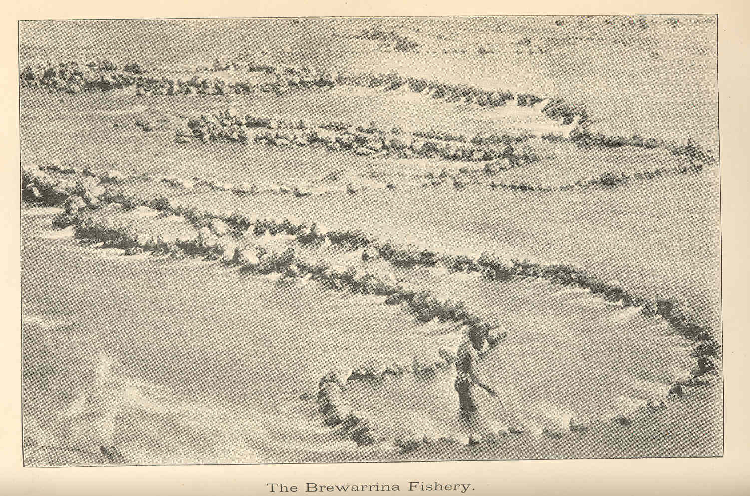
Brewarrina Fish Traps
Brewarrina Aboriginal Fish Traps are heritage-listed Indigenous Australians, Australian Aboriginal fish traps on the Barwon River (New South Wales), Barwon River at Brewarrina, New South Wales, Brewarrina, Brewarrina Shire, New South Wales, Australia. They are also known as Baiame's Ngunnhu, Nonah, or Nyemba Fish Traps. The Brewarrina Aboriginal Cultural Museum, opened in 1988, adjoins the site. The fish traps were added to the New South Wales State Heritage Register on 11 August 2000 and to the Australian National Heritage List on 3 June 2005. Genevieve Bell has suggested that these fish traps may be the oldest human construction in the world. The age of the fish traps is currently unknown. History Aboriginal land The Traditional owners, traditional custodians of the fish traps are the Wailwan, Ngemba Wayilwan (or Wailwan) people. Nearby Aboriginal groups include the Barranbinya, Baranbinja, Morowari, Kula tribe (Australia), Kula, Naualko, Ualarai, Weilwan, Kamilaroi, Kamu ... [...More Info...] [...Related Items...] OR: [Wikipedia] [Google] [Baidu] |
Brewarrina, New South Wales
Brewarrina (pronounced 'bree-warren-ah'; locally known as "Bre") is a town in north-west New South Wales, Australia on the banks of the Barwon River (New South Wales), Barwon River in Brewarrina Shire. The name Brewarrina is derived from 'burru waranha', a Weilwan name for a species of Acacia, Cassia tree, "Acacia clumps", "a native standing" or "place where wild gooseberry grows". It is east of Bourke, New South Wales, Bourke and west of Walgett, New South Wales, Walgett on the Kamilaroi Highway, and 787km from Sydney. The population of Brewarrina in 2016 was 1,143. Other towns and villages in the Brewarrina district include: Goodooga, New South Wales, Goodooga, Gongolgon, Weilmoringle and Angledool, New South Wales, Angledool. History The town is located amid the traditional lands of the Muruwari, Ngemba, Weilwan and Yualwarri peoples. The area has a long Indigenous Australian history and was once the meeting ground for over 5,000 people. The first settlers arrived in the d ... [...More Info...] [...Related Items...] OR: [Wikipedia] [Google] [Baidu] |
Charles Sturt
Charles Napier Sturt (28 April 1795 – 16 June 1869) was a British officer and explorer of Australia, and part of the European exploration of Australia. He led several expeditions into the interior of the continent, starting from Sydney and later from Adelaide. His expeditions traced several of the westward-flowing rivers, establishing that they all merged into the Murray River, which flows into the Southern Ocean. He was searching to prove his own passionately held belief that an " inland sea" was located at the centre of the continent. He reached the rank of Captain, served in several appointed posts, and on the Legislative Council. Born to British parents in Bengal, British India, Sturt was educated in England for a time as a child and youth. He was placed in the British Army because his father was not wealthy enough to pay for Cambridge. After assignments in North America, Sturt was assigned to accompany a ship of convicts to Australia in 1827. Finding the place to his lik ... [...More Info...] [...Related Items...] OR: [Wikipedia] [Google] [Baidu] |
Walgett, New South Wales
Walgett is a town in northern New South Wales, Australia, and the seat of Walgett Shire. It is near the junctions of the Barwon and Namoi Rivers and the Kamilaroi and Castlereagh Highways. In 2016, Walgett had a population of 2,145. In the 2016 Census, there were 6,107 people in the Walgett Local Government Area. Of these 52.9% were male and 47.1% were female. Aboriginal and/or Torres Strait Islander people made up 29.4% of the population. Walgett takes its name from an Aboriginal word meaning 'the meeting place of two rivers'. The town was listed as one of the most socially disadvantaged areas in the State according to the 2015 Dropping Off The Edge report. History The area was inhabited by the Gamilaroi (also spelt Kamilaroi) Nation of Indigenous peoples before European settlement. Yuwaalayaay (also known as ''Yuwalyai, Euahlayi, Yuwaaliyaay, Gamilaraay, Kamilaroi, Yuwaaliyaayi'') is an Australian Aboriginal language spoken on Yuwaalayaay country. It is closely related ... [...More Info...] [...Related Items...] OR: [Wikipedia] [Google] [Baidu] |
Cumborah
Cumborah is a town in north-western New South Wales, Australia. The town is in the Walgett Shire local government area, near the opal fields of Lightning Ridge. Cumborah is about off the Castlereagh Highway and is served by the commercial centres of Lightning Ridge and Walgett Walgett is a town in northern New South Wales, Australia, and the seat of Walgett Shire. It is near the junctions of the Barwon and Namoi Rivers and the Kamilaroi and Castlereagh Highways. In 2016, Walgett had a population of 2,145. In the 2 ..., to the south-east. The road through Cumborah is the main route to the nearby Glengarry, Grawin and Sheepyard opal fields. Other prospectors also search nearby for agate, fossils, petrified wood, topaz and other semi-precious stones. The village is almost surrounded by mulga and cypress scrubland. Population In the Cumborah and the surrounding region had a population of 492 persons, 63.6% were males and 36.4% were females, including 33 indigenous persons ... [...More Info...] [...Related Items...] OR: [Wikipedia] [Google] [Baidu] |

.jpg)
