|
Braemar
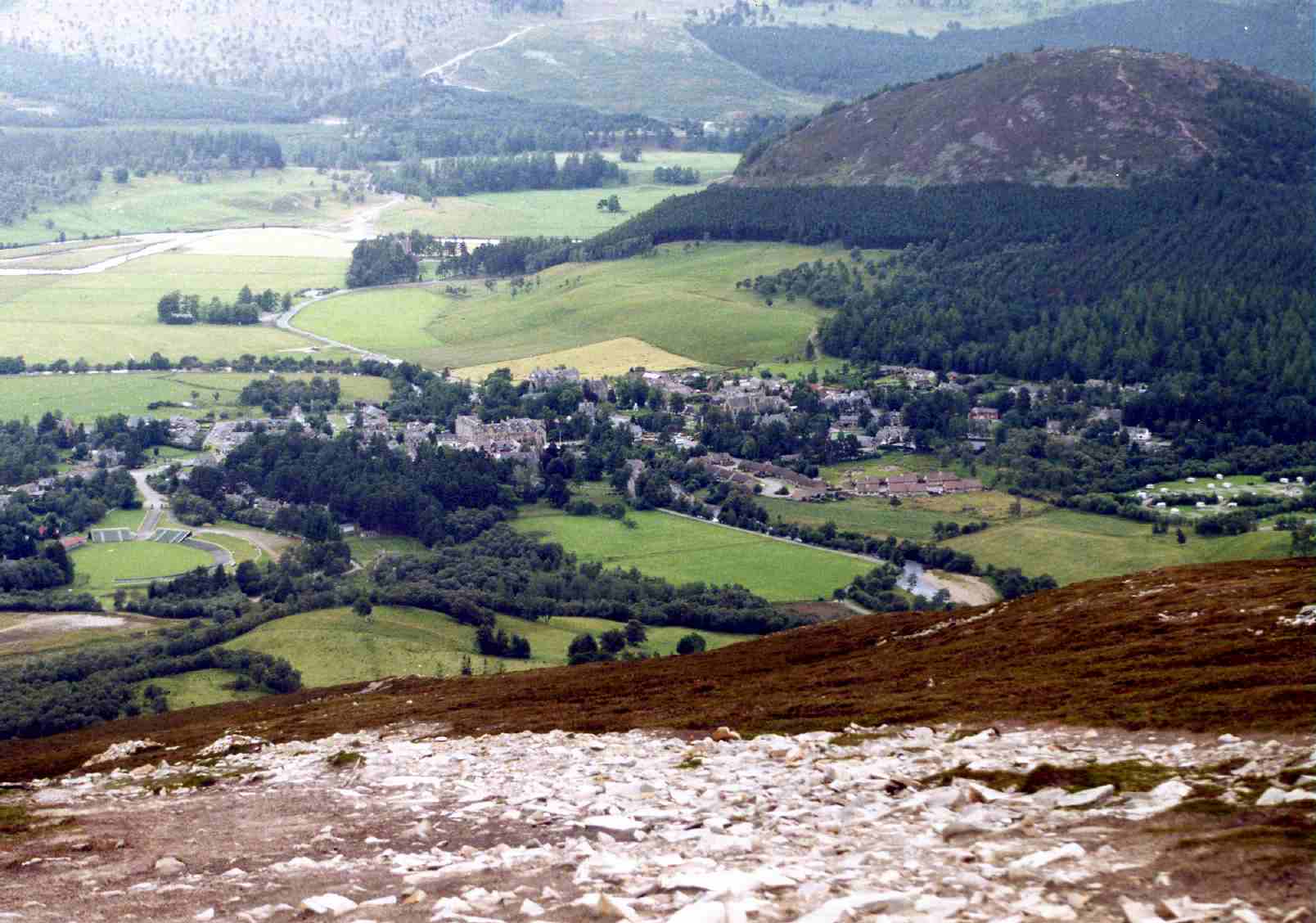
Braemar is a village in Aberdeenshire, Scotland, around west of Aberdeen in the Highlands. It is the closest significantly-sized settlement to the upper course of the River Dee sitting at an elevation of . The Gaelic ''Bràigh Mhàrr'' properly refers to the area of upper Marr (as it literally means), i.e. the area of Marr to the west of Aboyne, the village itself being Castleton of Braemar (''Baile a' Chaisteil''). The village used to be known as ''Cinn Drochaid'' (bridge end); ''Baile a' Chaisteil'' referred to only the part of the village on the east bank of the river, the part on the west bank being known as ''Ach an Droighinn'' (thorn field). Geography Braemar is approached from the South on the A93 from Glen Clunie and the Cairnwell Pass and from the East also on the A93 from Deeside. Braemar can be approached on foot from the West through Glen Tilt, Glen Feshie, Glen Dee (by the Lairig Ghru), and Glen Derry (by the Lairig an Laoigh). Braemar is within a one- ... [...More Info...] [...Related Items...] OR: [Wikipedia] [Google] [Baidu] |
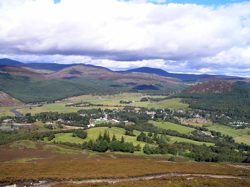
Braemar From Morrone 01SEP06
Braemar is a village in Aberdeenshire, Scotland, around west of Aberdeen in the Highlands. It is the closest significantly-sized settlement to the upper course of the River Dee sitting at an elevation of . The Gaelic ''Bràigh Mhàrr'' properly refers to the area of upper Marr (as it literally means), i.e. the area of Marr to the west of Aboyne, the village itself being Castleton of Braemar (''Baile a' Chaisteil''). The village used to be known as ''Cinn Drochaid'' (bridge end); ''Baile a' Chaisteil'' referred to only the part of the village on the east bank of the river, the part on the west bank being known as ''Ach an Droighinn'' (thorn field). Geography Braemar is approached from the South on the A93 from Glen Clunie and the Cairnwell Pass and from the East also on the A93 from Deeside. Braemar can be approached on foot from the West through Glen Tilt, Glen Feshie, Glen Dee (by the Lairig Ghru), and Glen Derry (by the Lairig an Laoigh). Braemar is within a one-and-a ... [...More Info...] [...Related Items...] OR: [Wikipedia] [Google] [Baidu] |
River Dee, Aberdeenshire
The River Dee ( gd, Uisge Dhè) is a river in Aberdeenshire, Scotland. It rises in the Cairngorms and flows through southern Aberdeenshire to reach the North Sea at Aberdeen. The area it passes through is known as Deeside, or Royal Deeside in the region between Braemar and Banchory because Queen Victoria came for a visit there in 1848 and greatly enjoyed herself. She and her husband, Prince Albert, built Balmoral Castle there which replaced an older castle. Deeside is a popular area for tourists, due to the combination of scenic beauty and historic and royal associations. It is part of the Cairngorms National Park, and the Deeside and Lochnagar National Scenic Area. The Dee is popular with anglers and is one of the most famous salmon fishing rivers in the world. The New Statistical Account of Scotland attributed the name Dee as having been used as early as the second century AD in the work of the Alexandrian geographer Claudius Ptolemy, as ''Δηοῦα'' (=Deva), meaning 'g ... [...More Info...] [...Related Items...] OR: [Wikipedia] [Google] [Baidu] |
Morrone
Morrone ( gd, Mór Bheinn, or Mór Shròn) is a Scottish hill immediately southwest of the village of Braemar in Aberdeenshire. Geography and topography The hill reaches a height of 859 metres (2818 feet) and qualifies as a Corbett and a Marilyn, although with a topographic prominence of 155 metres, Wikipedia - List of Marilyns in Southern Highlands. Gives prominence as 155 metres. it only just meets the prominence criterion for these categories. Morrone very much belongs to the village of Braemar from which it is usually climbed, and with a starting elevation of 330 metres, it is an easy ascent and a unique one, being the only significant mountain climb in Scotland to start from the centre of a village."Climbing the Corbetts" Pages 150 (No mountain walk starts from a town). Morrone is used for the Braemar Gathering hill race every September, and is a popular venue for paragliding and hang-gliding. The hill is occasionally referred to as Morven and it is given both n ... [...More Info...] [...Related Items...] OR: [Wikipedia] [Google] [Baidu] |
A93 Road
The A93 is a major road in Scotland and the highest public road in the United Kingdom. It runs north from Perth through Blairgowrie and Rattray, then through the Grampian Mountains by way of Glenshee, the Cairnwell Pass and Glen Clunie to Braemar in Aberdeenshire. At Braemar, the road then switches east down the strath of the River Dee before crossing the A90 and terminating in Aberdeen. Route Leaving Perth it passes Scone Palace, ancient coronation site of Scottish kings and now home to Britain's most northerly racecourse, continues through the planned 19th-century village of Guildtown before crossing the River Isla and passing the famous Meikleour Beech Hedge, planted to commemorate the 1715 Jacobite Rebellion and now the tallest hedge in the world. Five miles north lies Blairgowrie and Rattray, the largest town in Perthshire, where the road crosses the River Ericht. 6 miles up Glenericht it reaches the little village of Bridge of Cally and begins the long climb up into Gle ... [...More Info...] [...Related Items...] OR: [Wikipedia] [Google] [Baidu] |
Clunie Water
Clunie Water is a river of Aberdeenshire, Scotland. It is a tributary of the River Dee, joining the river at Braemar, among grey stone buildings. Callater Burn is a tributary of the Clunie; the confluence is at Auchallater. The river flows alongside the A93 road. Bridges and pathways Further south of Auchallater in the Glen of Clunie is Fraser's Bridge, a long segmented arch bridge, measuring 15 ft 4 inches between its parapets. A Grade B listed building, it was completed in around 1749. On a 1776 Taylor and Skinner Map it was labelled "East Bridge". In June 2010, a new link path opened, leading from Highland Society Bridge over Clunie Water to the Glenshee Road. Fishing During the fishing season, from March to September, permits are granted for fishing brown trout The brown trout (''Salmo trutta'') is a European species of salmonid fish that has been widely introduced into suitable environments globally. It includes purely freshwater populations, referred to as the ... [...More Info...] [...Related Items...] OR: [Wikipedia] [Google] [Baidu] |
Lairig Ghru
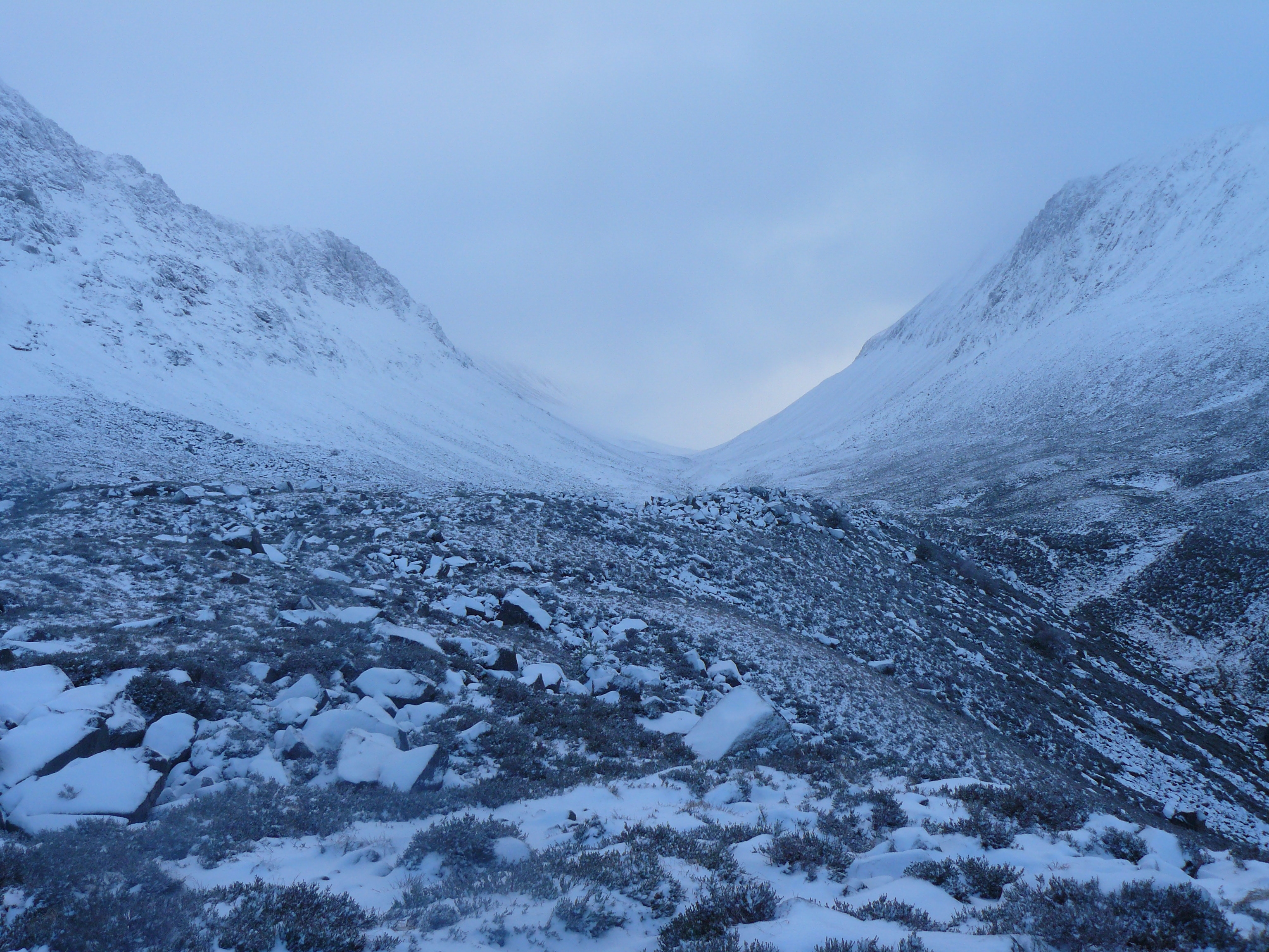
The Lairig Ghru ( gd, Làirig Dhrù) is one of the mountain passes through the Cairngorms of Scotland. The route and mountain pass partially lies on the Mar Lodge Estate. Like many traditional routes, the ends of the route through the Lairig Ghru are like the ends of a frayed rope. From the south the Lairig Ghru can be approached from Braemar though Glen Lui, or Glen Dee, and from Blair Atholl through Glen Tilt. From the north the Lairig Ghru can be approached from Glenmore Forest Park, Glenmore through the Chalamain Gap, and from Aviemore through the Rothiemurchus Forest by way of the ''Crossroads'' above Allt Drùidh. Name Watson gives the place name "Làirig Dhrù", meaning ''pass of Dhru or Druie'', with the local pronunciation "Laarig Groo". He suggests the "probable" derivation as from ''Drùdhadh'' meaning oozing. Any visitor to the summit of the Lairig Ghru would accept that as a possible derivation because two watercourses, one on each side of the summit, appear to "ooz ... [...More Info...] [...Related Items...] OR: [Wikipedia] [Google] [Baidu] |
Lairig An Laoigh
The Lairig an Laoigh ( ; gd, Làirig Laoigh) is a mountain pass through the Highlands of Scotland. In speech and sometimes in writing the name is reduced to "Lairig Laoigh". It is of glacial origin, dissecting the Cairngorm plateau, and it runs roughly north–south from Speyside to Deeside at one time being used as a drove road. Between the public road in the Abernethy Forest and the one at Linn of Dee the trekking distance is . General situation Derry Burn (''Uisge an Doire''), looking north The name Lairig an Laoigh means "pass of Lui" or possibly "pass of the calves". In its southerly part it lies in the Mar Lodge Estate, owned by the National Trust for Scotland where Derry Burn flows into Lui Water, a tributary of the River Dee. The northern part is in the Abernethy Estate, owned by the Royal Society for the Protection of Birds where the River Nethy flows north to the River Spey. The whole area is in the Cairngorms National Park. The Lairig an Laoigh runs ro ... [...More Info...] [...Related Items...] OR: [Wikipedia] [Google] [Baidu] |
Cairnwell Pass
The Cairnwell Pass ( gd, Càrn a' Bhailg) is a mountain pass on the A93 road between Glen Shee, Perthshire, and Braemar, Aberdeenshire, in the Scottish Highlands. The border between the two counties crosses the summit of the pass. With a summit altitude of 670 m (2199 ft), the Cairnwell Pass is the highest main road in the United Kingdom, and at the summit is the Glenshee Ski Centre, Scotland's largest and oldest ski centre. Historically, the pass was a drover's route from the Lowlands to the Highlands. The road is often blocked by snow in the winter, with snow gates at Braemar, at the summit (south of the Ski Centre), and at the Spittal of Glenshee. south of the summit is the Devil's Elbow, a notorious double-hairpin bend. The often-quoted gradient of 33 percent (1 in 3) is a myth: in reality it is no more than 1 in 6 (17%). The double bend can be seen clearly on Taylor & Skinner's map of 1776, with the 1749 military road already bypassed.A. Graham, "The Military Road ... [...More Info...] [...Related Items...] OR: [Wikipedia] [Google] [Baidu] |
West Aberdeenshire And Kincardine (UK Parliament Constituency)
West Aberdeenshire and Kincardine is a county constituency of the House of Commons of the Parliament of the United Kingdom of Great Britain and Northern Ireland (Westminster), which elects one Member of Parliament (MP) by the first past the post system of election. It was first used in the 1997 general election, but has undergone boundary changes since that date. There was also a Holyrood constituency of West Aberdeenshire and Kincardine, a constituency of the Scottish Parliament, created in 1999 with the same boundaries as the Westminster constituency at that time. Boundaries 1997–2005: Kincardine and Deeside District, and the Gordon District electoral divisions of Donside and South Gordon. 2005–present: The area of the Aberdeenshire Council other than those parts in the Banff and Buchan County Constituency and the Gordon County Constituency. The constituency covers a southern portion of the Aberdeenshire council area. As redefined by the Fifth Periodical Revi ... [...More Info...] [...Related Items...] OR: [Wikipedia] [Google] [Baidu] |
Leadhills
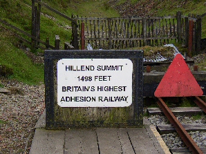
Leadhills, originally settled for the accommodation of miners, is a village in South Lanarkshire, Scotland, WSW of Elvanfoot. The population in 1901 was 835. It was originally known as Waterhead. It is the second highest village in Scotland, the highest being neighbouring Wanlockhead, south. It is near the source of Glengonnar Water, a tributary of the River Clyde. Local attractions Library The Leadhills Miners' Library (also known as the Allan Ramsay Library or the Leadhills Reading Society), founded in 1741 by 21 miners, the local schoolteacher and the local minister, specifically to purchase a collection of books for its members’ mutual improvement — its membership was not restricted to the miners; several non-miners, such as William Symington, John Brown (author of ''Rab and his Friends'') and James Braid, were also full members — houses an extensive antiquarian book collection, local relics, mining records and minerals. The library is the oldest subscription ... [...More Info...] [...Related Items...] OR: [Wikipedia] [Google] [Baidu] |
Dalwhinnie
Dalwhinnie ( ; Scottish Gaelic: ''Dail Chuinnidh'' "meeting place") is a small village in the Scottish Highlands. Dalwhinnie is located at the head of Glen Truim and the north-east end of Loch Ericht, on the western edge of the Cairngorms National Park. Location Dalwhinnie sits at an altitude of . It is one of the coldest villages in the UK, having an average annual temperature of , making it suitable for winter walking and mountaineering. It is north of Drumochter, just off the A9 road from Perth to Inverness and has been bypassed since 1975. It is about 75 miles (120 km) from both Edinburgh and Glasgow, 25 miles (40 km) from Aviemore, 13 miles (21 km) from Newtonmore and 17 miles (27 km) from Kingussie. Dalwhinnie railway station lies on the Highland Main Line from Perth to Inverness. Tourism The area is walking destination along the River Truim and in Cairngorm and Monadhliath Mountains in the Cairngorm National Park. Dalwhinnie is on the Sustrans N ... [...More Info...] [...Related Items...] OR: [Wikipedia] [Google] [Baidu] |
Aboyne
Aboyne ( sco, Abyne, gd, Abèidh) is a village on the edge of the Highlands in Aberdeenshire, Scotland, on the River Dee, approximately west of Aberdeen. It has a swimming pool at Aboyne Academy, all-weather tennis courts, a bowling green and is home to the oldest 18 hole golf course on Royal Deeside. Aboyne Castle and the Loch of Aboyne are nearby. Aboyne has many businesses, including a supermarket (Co-op), one bank, several hairdressers, a butcher, a newsagent, an Indian restaurant and a post office. Originally, there was a railway station in the village, but it was closed on 18 June 1966. The station now contains some shops and the tunnel running under the village is now home to a firearms club. The market-day in Aboyne was known as ''Fèill Mhìcheil'' (Scottish Gaelic for "Michael's Fair"). History The name “Aboyne” is derived from “Oboyne”, first recorded in 1260, in turn derived from the Gaelic words “abh”, “bo”, and “fionn”, meaning “lace by ... [...More Info...] [...Related Items...] OR: [Wikipedia] [Google] [Baidu] |



.jpg)