|
Bowmansville, Pennsylvania
Bowmansville is an unincorporated community and census-designated place (CDP) in Brecknock Township, Lancaster County, Pennsylvania, United States. Bowmansville is home to a Pennsylvania Turnpike service plaza. The population was 2,077 as of the 2010 census. History Bowmansville was named for Samuel Bowman, an early settler. The Bowmansville Roller Mill and John B. Good House are listed on the National Register of Historic Places. Geography Bowmansville is in northeastern Lancaster County, near the center of Brecknock Township. The Pennsylvania Turnpike (Interstate 76) passes through the community, but with no direct access. The closest access is at Exit 286 (Reading, to the west near Swartzville. The Morgantown interchange (Exit 293) is to the east. Pennsylvania Route 625 (Reading Road) passes through the center of Bowmansville, leading north to Reading and south to East Earl. Lancaster, the county seat, is to the southwest. According to the U.S. Census Bureau, the ... [...More Info...] [...Related Items...] OR: [Wikipedia] [Google] [Baidu] |
Census-designated Place
A census-designated place (CDP) is a concentration of population defined by the United States Census Bureau for statistical purposes only. CDPs have been used in each decennial census since 1980 as the counterparts of incorporated places, such as self-governing cities, towns, and villages, for the purposes of gathering and correlating statistical data. CDPs are populated areas that generally include one officially designated but currently unincorporated community, for which the CDP is named, plus surrounding inhabited countryside of varying dimensions and, occasionally, other, smaller unincorporated communities as well. CDPs include small rural communities, edge cities, colonias located along the Mexico–United States border, and unincorporated resort and retirement communities and their environs. The boundaries of any CDP may change from decade to decade, and the Census Bureau may de-establish a CDP after a period of study, then re-establish it some decades later. Most unin ... [...More Info...] [...Related Items...] OR: [Wikipedia] [Google] [Baidu] |
Reading Eagle
The ''Reading Eagle'' is the major daily newspaper in Reading, Pennsylvania. A family-owned newspaper until the spring of 2019, its reported circulation is 37,000 (daily) and 50,000 (Sundays). It serves the Reading and Berks County region of Pennsylvania. After celebrating its sesquicentennial of local ownership and editorial control in 2018, the ''Reading Eagle'' was acquired by the Denver, Colorado-based MediaNews Group (also known as Digital First Media) in May 2019. History The newspaper was founded on January 28, 1868. Initially an afternoon paper, it was published Monday through Saturday with a Sunday-morning edition added later. In 1940, the ''Eagle'' acquired the ''Reading Times'', which was a morning paper, but they remained separate papers. The staff of the two papers was combined in 1982. In June 2002, the ''Reading Times'' ceased publication, and the ''Eagle'' became a morning paper. Both papers had been publishing a joint Saturday-morning edition since 1988. ... [...More Info...] [...Related Items...] OR: [Wikipedia] [Google] [Baidu] |
Susquehanna River
The Susquehanna River (; Lenape: Siskëwahane) is a major river located in the Mid-Atlantic region of the United States, overlapping between the lower Northeast and the Upland South. At long, it is the longest river on the East Coast of the United States. By watershed area, it is the 16th-largest river in the United States,Susquehanna River Trail Pennsylvania Fish and Boat Commission, accessed March 25, 2010.Susquehanna River , Green Works Radio, accessed March 25, 2010. and also the longest river in ... [...More Info...] [...Related Items...] OR: [Wikipedia] [Google] [Baidu] |
Conestoga River
The Conestoga River, also referred to as Conestoga Creek, is a U.S. Geological Survey. National Hydrography Dataset high-resolution flowline dataThe National Map, accessed August 8, 2011 tributary of the Susquehanna River flowing through the center of Lancaster County, Pennsylvania, United States. Geography Its headwaters rise mostly in southern Berks County and northeastern Lancaster County, in an area known as "Bortz's Swamp" or "Penngall Field" (a small area rises in Chester County). The East Branch and West Branch of the Conestoga join to form the main river just north of Morgantown, and the stream flows from northeast to southwest for more than , passing close to the center of Lancaster and ending at Safe Harbor along the Susquehanna River, approximately north of the Pennsylvania-Maryland state line. The principal tributaries of the Conestoga River are Cocalico Creek, Mill Creek, and Little Conestoga Creek; they drain into the Conestoga River watershed in the order ... [...More Info...] [...Related Items...] OR: [Wikipedia] [Google] [Baidu] |
County Seat
A county seat is an administrative center, seat of government, or capital city of a county or civil parish. The term is in use in Canada, China, Hungary, Romania, Taiwan, and the United States. The equivalent term shire town is used in the US state of Vermont and in some other English-speaking jurisdictions. County towns have a similar function in the Republic of Ireland and the United Kingdom, as well as historically in Jamaica. Function In most of the United States, counties are the political subdivisions of a state. The city, town, or populated place that houses county government is known as the seat of its respective county. Generally, the county legislature, county courthouse, sheriff's department headquarters, hall of records, jail and correctional facility are located in the county seat, though some functions (such as highway maintenance, which usually requires a large garage for vehicles, along with asphalt and salt storage facilities) may also be located or conducted ... [...More Info...] [...Related Items...] OR: [Wikipedia] [Google] [Baidu] |
Lancaster, Pennsylvania
Lancaster, ( ; pdc, Lengeschder) is a city in and the county seat of Lancaster County, Pennsylvania. It is one of the oldest inland cities in the United States. With a population at the 2020 census of 58,039, it ranks 11th in population among Pennsylvania's municipalities. The Lancaster metropolitan area population is 507,766, making it the 104th-largest metropolitan area in the U.S. and second-largest in the South Central Pennsylvania area. The city's primary industries include healthcare, tourism, public administration, manufacturing, and both professional and semi-professional services. Lancaster is a hub of Pennsylvania's Dutch Country. Lancaster is located southwest of Allentown and west of Philadelphia. History Originally called Hickory Town, the city was renamed after the English city of Lancaster by native John Wright. Its symbol, the red rose, is from the House of Lancaster. Lancaster was part of the 1681 Penn's Woods Charter of William Penn, and was laid ... [...More Info...] [...Related Items...] OR: [Wikipedia] [Google] [Baidu] |
East Earl, Pennsylvania
East Earl is an unincorporated community and census-designated place (CDP) in East Earl Township, Lancaster County, Pennsylvania, United States. As of the 2010 census it had a population of 1,144. Geography East Earl is in northeastern Lancaster County, in the south-central part of East Earl Township. It is bordered to the northwest by Blue Ball. U.S. Route 322 (Division Highway) passes through East Earl, leading northwest to Ephrata and southeast to Downingtown. Pennsylvania Route 897 (Springville Road) leads south to Gap and north to Swartzville. Lancaster, the county seat, is to the southwest. According to the U.S. Census Bureau, the East Earl CDP has a total area of , of which , or 0.27%, are water. The community drains northeast and northwest to the Conestoga River The Conestoga River, also referred to as Conestoga Creek, is a U.S. Geological Survey. National Hydrography Dataset high-resolution flowline dataThe National Map, accessed August 8, 2011 tributary of ... [...More Info...] [...Related Items...] OR: [Wikipedia] [Google] [Baidu] |
Pennsylvania Route 625
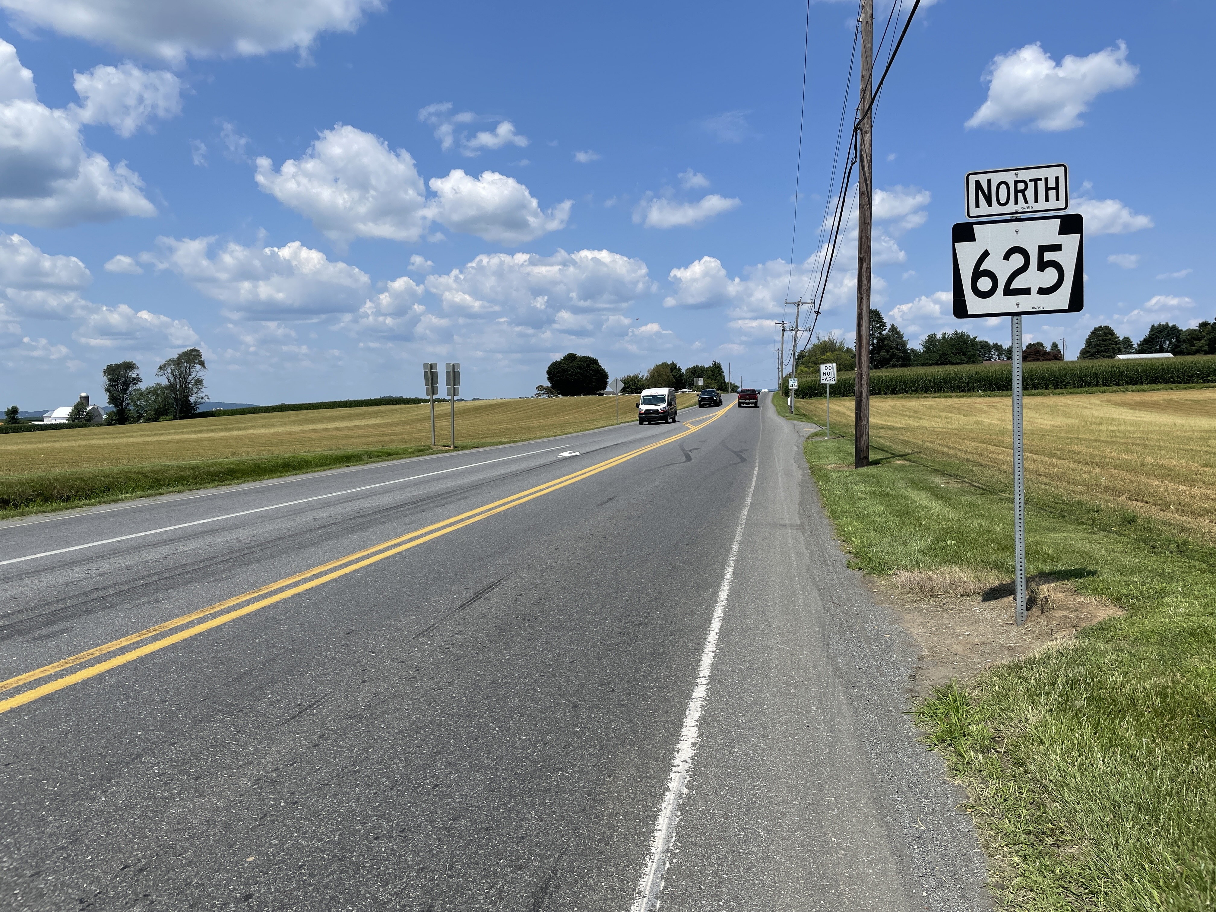
Pennsylvania Route 625 (PA 625) is a state route in east central Pennsylvania, United States. The southern terminus is at PA 23 in East Earl Township. The northern terminus is U.S. Route 222 Business (US 222 Bus.) in Reading. PA 625 is a two-lane undivided road its entire length. The route runs through rural areas in the Pennsylvania Dutch Country of northeastern Lancaster County, passing through Bowmansville. PA 625 continues into Berks County and runs through more rural areas, intersecting PA 568 in Knauers before coming to a junction with PA 724. Past this intersection, the route heads into developed areas and passes through Kenhorst before coming to its northern terminus. The route was designated as the westernmost of segment of PA 73 in 1928, which continued past Reading to Philadelphia. By 1940, the entire length of PA 73 between Blue Ball and Reading was completely paved. PA 625 was designated onto its current alignment by 1966 following the rerouting of PA 73 to i ... [...More Info...] [...Related Items...] OR: [Wikipedia] [Google] [Baidu] |
Morgantown, Pennsylvania
Morgantown is a census-designated place in Caernarvon Township, located in southern Berks County, Pennsylvania. It is located partially in Caernarvon Township in Lancaster County. As of the 2010 census, the population was 826 residents. History Morgantown was named after Colonel Jacob Morgan, who laid out the town around 1770. His father, Thomas Morgan, had been a native of Wales, a captain in the French and Indian War, and owner of a large tract of choice land in Caernarvon Township. Jacob Morgan settled in this area around 1765, building a large stone house, which still stands on Hartz Road between Mineview Drive and Shiloh Road. It is rumored to have housed George Washington during a brief overnight visit. The house has been restored by its owners. Morgantown was, until the arrival of the Pennsylvania Turnpike, a mostly agriculture-based settlement. Now it is much larger and busier with the settlement of several manufacturing companies, including Timet, Morgan Corp. Stol ... [...More Info...] [...Related Items...] OR: [Wikipedia] [Google] [Baidu] |
Swartzville, Pennsylvania
Swartzville is an unincorporated community and census-designated place (CDP) in East Cocalico Township, Lancaster County, Pennsylvania, United States. As of the 2010 census the population was 2,283. Geography Swartzville is in northeastern Lancaster County, in the northeast part of East Cocalico Township. It is bordered to the northeast by the borough of Adamstown, to the southeast by the U.S. Route 222 freeway, and to the southwest by Interstate 76, the Pennsylvania Turnpike. Pennsylvania Route 272 (North Reading Road) passes through the community, leading northeast through Adamstown to US-222 and southwest to Ephrata. Pennsylvania Route 897 (Swartzville Road) crosses PA 272 in the center of Swartzville, leading northwest to Reinholds and south to Terre Hill. Via US 222, Lancaster, the county seat, is to the southwest and Reading is to the northeast. Exit 266 on the Pennsylvania Turnpike is south of Swartzville. According to the U.S. Census Bureau, the Swartzville C ... [...More Info...] [...Related Items...] OR: [Wikipedia] [Google] [Baidu] |
Reading, Pennsylvania
Reading ( ; Pennsylvania Dutch: ''Reddin'') is a city in and the county seat of Berks County, Pennsylvania, United States. The city had a population of 95,112 as of the 2020 census and is the fourth-largest city in Pennsylvania after Philadelphia, Pittsburgh, and Allentown. Reading is located in the southeastern part of the state and is the principal city of the Greater Reading Area, which had 420,152 residents as of 2020. Reading is part of the Delaware Valley, also known as the Philadelphia metropolitan area, a region that also includes Philadelphia, Upper Darby Township, Pennsylvania, Camden, and other suburban Philadelphia cities and regions. With a 2020 population of 6,228,601, the Delaware Valley is the seventh largest metropolitan region in the nation. Reading's name was drawn from the now-defunct Reading Company, widely known as the Reading Railroad and since acquired by Conrail, that played a vital role in transporting anthracite coal from the Pennsylvania's ... [...More Info...] [...Related Items...] OR: [Wikipedia] [Google] [Baidu] |
Interstate 76 In Pennsylvania
The Dwight D. Eisenhower National System of Interstate and Defense Highways, commonly known as the Interstate Highway System, is a network of controlled-access highways that forms part of the National Highway System in the United States. The system extends throughout the contiguous United States and has routes in Hawaii, Alaska, and Puerto Rico. The U.S. federal government first funded roadways through the Federal Aid Road Act of 1916, and began an effort to construct a national road grid with the passage of the Federal Aid Highway Act of 1921. In 1926, the United States Numbered Highway System was established, creating the first national road numbering system for cross-country travel. The roads were still state-funded and maintained, however, and there was little in the way of national standards for road design. U.S. Highways could be anything from a two-lane country road to a major multi-lane freeway. After Dwight D. Eisenhower became president in 1953, his administration ... [...More Info...] [...Related Items...] OR: [Wikipedia] [Google] [Baidu] |


