|
Bow River Pathway
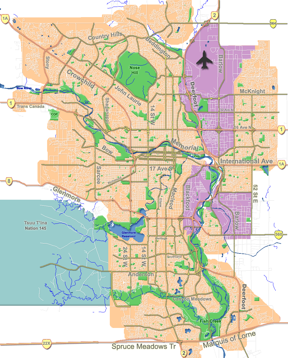
The Bow River pathway is a pathway system developed along the banks of the Bow River in the city of Calgary. It contains a network of pedestrian and bicycle paths connecting parks on both sides of the river. The pathway is used for cycling, hiking, jogging, as well as rollerblading and skateboarding. The paths are connected with a system that extends along the Elbow River and other areas of the city. The network spans from Bearspaw Dam to Fish Creek Provincial Park, connecting major parks and green areas in Calgary. Construction of the Bow River Pathways started in 1975 to mark the city's centenary. The project was funded by the City of Calgary, the Province of Alberta and the Devonian Group of Charitable Foundations. It was dedicated on June 25, 1977. Recreation areas Recreation areas connected by the pathway include: See also *List of attractions and landmarks in Calgary The city of Calgary is located in Alberta Alberta ( ) is one of the thirteen pro ... [...More Info...] [...Related Items...] OR: [Wikipedia] [Google] [Baidu] |
Trail
A trail, also known as a path or track, is an unpaved lane or small road usually passing through a natural area. In the United Kingdom and the Republic of Ireland, a path or footpath is the preferred term for a pedestrian or hiking trail. The term is also applied in North America to routes along rivers, and sometimes to highways. In the US, the term was historically used for a route into or through wild territory used by explorers and migrants (e.g. the Oregon Trail). In the United States, "trace" is a synonym for trail, as in Natchez Trace. Some trails are dedicated only for walking, cycling, horse riding, snowshoeing or cross-country skiing, but not more than one use; others, as in the case of a bridleway in the UK, are multi-use and can be used by walkers, cyclists and equestrians alike. There are also unpaved trails used by dirt bikes and other off-road vehicles, and in some places, like the Alps, trails are used for moving cattle and other livestock. Usage In Austra ... [...More Info...] [...Related Items...] OR: [Wikipedia] [Google] [Baidu] |
Bearspaw Dam , First Nations people in Alberta, Canada
{{disambig ...
Bearspaw (from Bear and Paw) can refer to: *Bearspaw, Alberta, a hamlet in Alberta, Canada *Bearspaw, Edmonton, a neighbourhood in Edmonton, Alberta, Canada *Bearspaw First Nation Stoney Nakoda First Nation ( sto, Îyârhe Nakoda) is a Nakoda First Nations band government Alberta, Canada. It is located West of Calgary, in the foot of the Rocky Mountains. Stoney Nakoda First Nation comprises three Nakoda Tribes: * Bearspaw ... [...More Info...] [...Related Items...] OR: [Wikipedia] [Google] [Baidu] |
Pearce Estate Wetland
Pearce Estate Park is a city park located in Calgary, Alberta. The park occupies along the Bow River to the east of downtown Calgary. The park contains Pearce Estate Wetland, described as "constructed wetlands filled with native plants and animals". The land was donated to the city around 1929 by then prominent Calgarian William Pearce. The park is located east of the Calgary Zoo and the neighborhood of Inglewood, at the eastern end of International Avenue, inside a bend of the Bow River. An interpretative trail was opened to the public in 2004. Location The main parking lot for the park is located at 1440 17A St. S.E. Calgary, to the west of the neighborhood of Inglewood. It is west of the Calgary Zoo, at the eastern end of International Avenue, inside a bend of the Bow River. Background William Pearce (1848–1930), who served as the Inspector of Dominion Lands Agencies, where he oversaw the "development and allocation of all land, forests, mineral and water resour ... [...More Info...] [...Related Items...] OR: [Wikipedia] [Google] [Baidu] |
Calgary Zoo
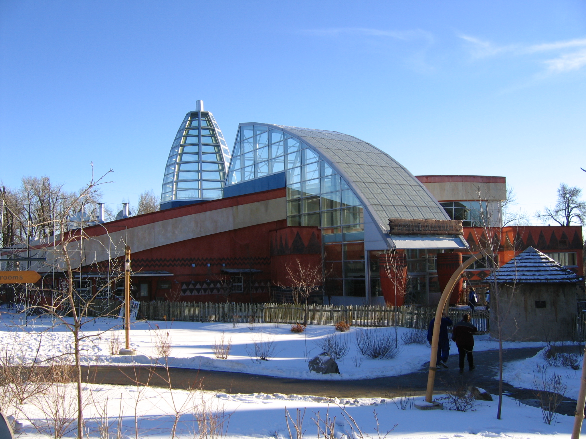
The Calgary Zoo is located in Bridgeland, Calgary, Alberta, Canada, just east of the city's downtown and adjacent to the Inglewood and East Village neighborhoods. It is accessible via Calgary's C-Train light rail system, by car via Memorial Drive, and by bicycle and footpath via the Bow River pathway. A large portion of the zoo is located on St. George's Island in the Bow River. The zoo is operated by the Calgary Zoological Society, an independent not-for-profit organization that is Alberta's oldest registered charity. The AZA, WAZA, and CAZA accredited zoo was among the first in Canada to be accredited by all three associations. It is home to over 1,000 animals, excluding individual fish and insects, and 272 different species. The 120-acre zoo is organized by into seven distinct zones: Destination Africa, Canadian Wilds, Penguin Plunge, Dorothy Harvie Botanical Gardens and ENMAX Conservatory, TransAlta Rainforest, Eurasia, and Prehistoric Park. The zoo is open every day ex ... [...More Info...] [...Related Items...] OR: [Wikipedia] [Google] [Baidu] |
Downtown East Village, Calgary
Downtown East Village more commonly known as simply East Village, is a mixed-use neighbourhood within the eastern portions of downtown Calgary, Alberta, Canada. It is contained within the city's Rivers District. Containing the earliest-settled land in the Calgary area - Fort Calgary - East Village was for years a mixture of high-rise residential, commercial, and industrial development. Much of the parkland currently surrounding Fort Calgary was industrial as recently as the 1960s. Construction of the city's light rail transit Blue Line, coupled with the closure of 8th Avenue at Macleod Trail in the early 1980s by construction of the massive Calgary Municipal Building, resulted in East Village being "cut off," figuratively speaking, from the rest of downtown. As a result, it became home to many rundown properties and vacant lots over the years, and a severe crime problem. Plans to reshape this neighbourhood were approved by Calgary City Council in March, 2005 (''East Village Area ... [...More Info...] [...Related Items...] OR: [Wikipedia] [Google] [Baidu] |
Fort Calgary
Fort Calgary was a North-West Mounted Police outpost at the confluence of the Bow and Elbow rivers in present-day Calgary, Alberta, Canada. Originally named Fort Brisebois, after the outpost's first commander, the outpost was renamed ''Fort Calgary'' in June 1876. The outpost was built in 1875 as a part of the force's larger effort to curtail American rum and whisky runners in the region, and to create 'good relations' with the Indigenous peoples of the territory. The fort was designated as a "district post" in 1882, resulting in the fort's expansion. The North-West Mounted Police (NWMP) continued to use the fort until 1914, when the site was sold to Grand Trunk Pacific Railway. The fort was demolished to make way for a rail terminal. The site was later purchased by the municipal government of Calgary in 1973, with work on an interpretive centre taking place in 1977. The site was reopened as a historic site and museum in 1978, with the museum initially documenting the NWMP and i ... [...More Info...] [...Related Items...] OR: [Wikipedia] [Google] [Baidu] |
Chinatown, Calgary
Calgary's Chinatown is a district of Calgary located along Centre Street in the southeast area of Downtown Calgary immediately west of the Downtown East Village. Calgary's Chinese Cultural Centre with its traditional architecture and decor (styled after the Temple of Heaven in Beijing) is the largest facility of its kind in North America. The Dragon City Mall is also located in this district. The area along Centre Street north of downtown and continuing for several blocks is also very Asian-influenced and is often thought of as the city's second Chinatown. International Avenue is also a major multi-ethnic centre in the city's southeast with considerable Asian influence. The community has an area redevelopment plan in place. History Chinatown Calgary Celebrates 100 Years In 2010, Calgary's Chinatown community celebrated 100 years of challenge, growth and prosperity on its way to becoming Canada's third largest Chinese community by population and its largest in area. But 100 yea ... [...More Info...] [...Related Items...] OR: [Wikipedia] [Google] [Baidu] |
Sunnyside, Calgary
Sunnyside is an innercity community in Calgary, Alberta located on the north side of the Bow River immediately adjacent to Calgary's downtown. The community partners with the neighbouring community of Hillhurst to form the Hillhurst-Sunnyside Community Association. The combined communities have an area redevelopment plan in place, revised in 2009. Kensington is a Business Revitalization Zone adjacent to the communities of Hillhurst and Sunnyside. It is an active family-friendly commercial area, abundant with amenities. History Sunnyside is one of Calgary's oldest communities. Originally settled by homesteaders in the 1880s, the land was purchased by the City of Calgary and incorporated into the city proper in 1904.Hillhurst Sunnyside Community Association - History < ... [...More Info...] [...Related Items...] OR: [Wikipedia] [Google] [Baidu] |
Prince's Island Park
Prince's Island Park is an urban park in the city of Calgary, Alberta, Canada. It is developed on an island on the Bow River, immediately north of downtown Calgary. It was named after Peter Anthony Prince, the founder of the Eau Claire Lumber Mill. The park was built on land donated in 1947 to the city by the Prince family. It is often incorrectly referred to as "Princess Island Park". The park is open from 5 a.m. until 11 p.m. every regular day. The island has a surface of 20 hectares and is linked by three bridges to Eau Claire and downtown Calgary and a north bridge to Memorial Drive and the community of Crescent Heights. It is part of the pathway and hiking trail system lining both sides of the Bow River. The southern arm of the river has been landscaped, while the eastern end of the island re-creates a wetland environment. Canada geese and mallard ducks are common birds found in the park. Transportation Primary access to the island can be attained by a number of foot ... [...More Info...] [...Related Items...] OR: [Wikipedia] [Google] [Baidu] |
Skatepark
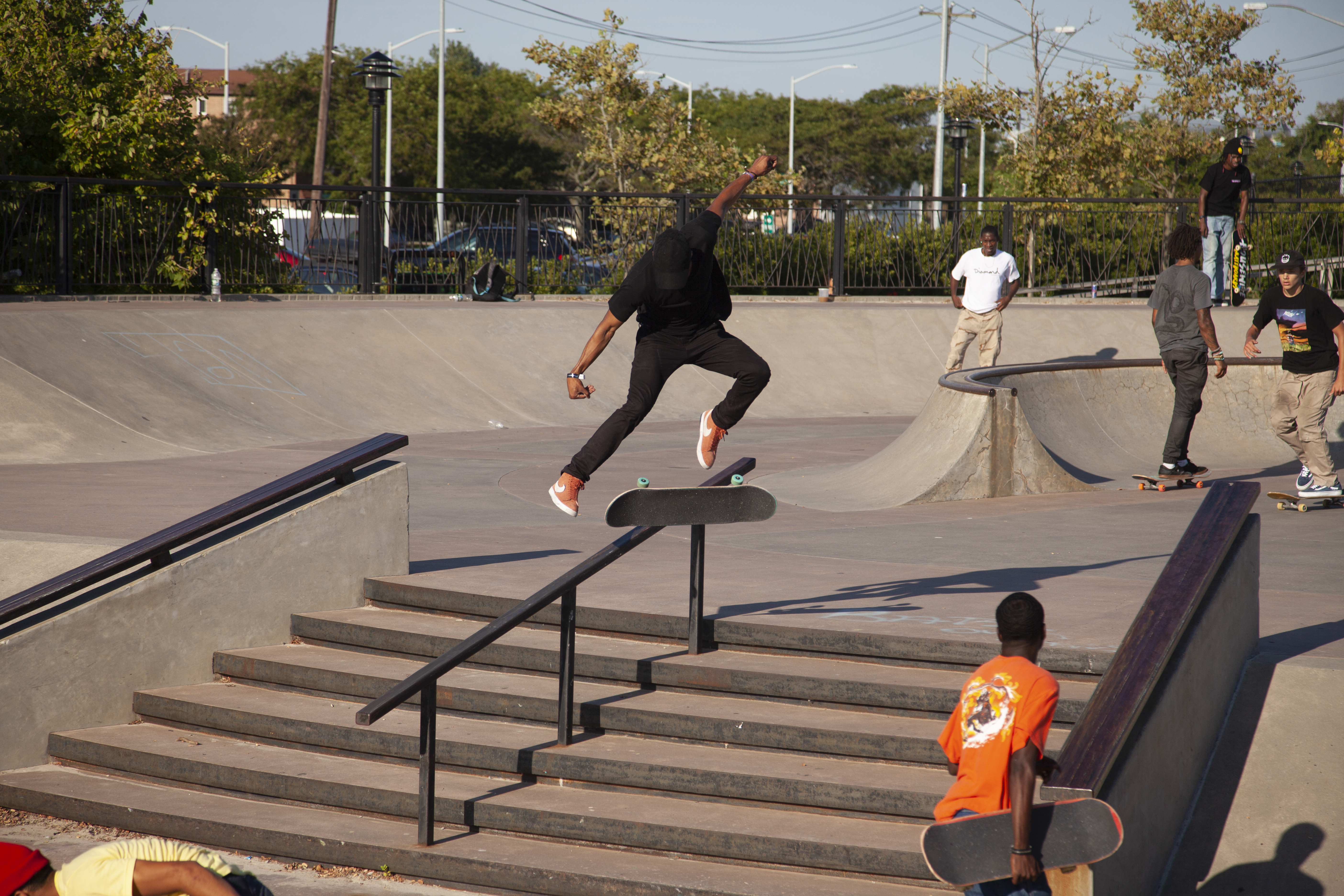
A skatepark, or skate park, is a purpose-built recreational environment made for skateboarding, BMX, scootering, wheelchairs, and aggressive inline skating. A skatepark may contain half-pipes, handrails, funboxes, vert ramps, stairsets, quarter pipes, ledges, spine transfers, pyramids, banked ramps, full pipes, pools, bowls, snake runs, and any number of other objects. History The first skatepark in the world, Surf City, opened for business at 5140 E. Speedway in Tucson, Arizona on September 3, 1965. Patti McGee, Women's National Champion, attended the grand opening. The park had concrete ramps and was operated by Arizona Surf City Enterprises, Inc. A skatepark for skateboarders and skaters made of plywood ramps on a half-acre lot in Kelso, Washington, USA opened in April 1966. It was lighted for night use. California's first skatepark, the Carlsbad Skatepark opened on March 3, 1976. The World Skateboard Championships were held here on April 10, 1977. It operated un ... [...More Info...] [...Related Items...] OR: [Wikipedia] [Google] [Baidu] |
Millennium Park (Calgary)
Shaw Millennium Park is a skatepark in Calgary, Alberta, Canada, on the western end of downtown Calgary, on the site of the former Mewata Stadium adjacent to Mewata Armouries Mewata Armoury (also referred to as Mewata Armouries) is a Canadian Forces reserve armoury in Calgary, Alberta, Canada. ''Mewata'' ( is derived from the Cree word (), meaning "Oh, be joyful". The building was built between 1915 and 1918 for a .... The skatepark was built in 2000, and was the largest park of its kind in Canada. The park is sponsored by Shaw Communications. The skatepark is maintained by the City of Calgary Recreation Department. It consists of a street course with ledges, flatbars, stairs and transitions, an intermediate course with rails down stairs and banks, and an advanced course with cloverleaf bowl, street course and a large fullpipe. The facility is also used to host events such as the Calgary International Reggae Festival. References External links * Shaw Millenni ... [...More Info...] [...Related Items...] OR: [Wikipedia] [Google] [Baidu] |
Edworthy Park
Edworthy Park is a city park located in the Northwest section of Calgary along the south shore of the Bow River. The Canadian Pacific Railway crosses the length of the park. It was named after Thomas Edworthy, who immigrated to the Calgary area in 1883 from Devon, England. The park has a surface of , and contains over of hiking and biking trails, part of the Bow River pathway. Nature The trees that can be found in Edworthy Park include riparian woodland with aspen, willow and balsam poplar. There is also some grassland and mixed shrubland, and an escarpment where white spruce dominates. With the spruce is an isolated population of Douglas-fir The Douglas fir (''Pseudotsuga menziesii'') is an evergreen conifer species in the pine family, Pinaceae. It is native to western North America and is also known as Douglas-fir, Douglas spruce, Oregon pine, and Columbian pine. There are three va ..., some more than 400 years old. History Edworthy Park is built on the former site of a ... [...More Info...] [...Related Items...] OR: [Wikipedia] [Google] [Baidu] |

.jpg)


