|
Bosansko Primorje
''Bosansko Primorje'' (, or Bosnian Littoral) is a historical coastal region on the eastern Adriatic shores, which between the beginning of the 14th and the end of the 17th century stretched from the Neretva river delta to Kuril area of Petrovo Selo, near today's Dubrovnik, above Mokošica in Rijeka Dubrovačka. This region is referred in historiography as the ''Bosansko Primorje'', Bosnian Littoral or Bosnian Coast. ''Bosansko Primorje as'' historical region, which comprised entire Primorje Župa, was changing over time in scope and territorial area. It was mentioned in historical documents from the period of the beginning of the 14th century until the end of the 19th century. Since then, the related term ''Bosanskohercegovačko primorje'' has been in use. Geographical description and history This area included all coastal areas between Herceg-Novi and the Neretva river delta. This region in context of socio-political and territorial existence of the country, in all its iter ... [...More Info...] [...Related Items...] OR: [Wikipedia] [Google] [Baidu] |
Adriatic Sea
The Adriatic Sea () is a body of water separating the Italian Peninsula from the Balkan Peninsula. The Adriatic is the northernmost arm of the Mediterranean Sea, extending from the Strait of Otranto (where it connects to the Ionian Sea) to the northwest and the Po Valley. The countries with coasts on the Adriatic are Albania, Bosnia and Herzegovina, Croatia, Italy, Montenegro, and Slovenia. The Adriatic contains more than 1,300 islands, mostly located along the Croatian part of its eastern coast. It is divided into three basins, the northern being the shallowest and the southern being the deepest, with a maximum depth of . The Otranto Sill, an underwater ridge, is located at the border between the Adriatic and Ionian Seas. The prevailing currents flow counterclockwise from the Strait of Otranto, along the eastern coast and back to the strait along the western (Italian) coast. Tidal movements in the Adriatic are slight, although larger amplitudes are known to occur occasi ... [...More Info...] [...Related Items...] OR: [Wikipedia] [Google] [Baidu] |
Neum
Neum ( cyrl, Неум, ) is a town and municipality in Bosnia and Herzegovina, located in Herzegovina-Neretva Canton of the Federation of Bosnia and Herzegovina. It is the only town to be situated along the Bosnia and Herzegovina's coastline, making it the country's only access to the Adriatic Sea. As of 2013, Neum municipality has a population of 4,653 inhabitants, while the town of Neum has a population of 3,013 inhabitants. Geography Neum is the only town to be situated along the Bosnia and Herzegovina's around or of coastline, making it the country's only access to the Adriatic Sea.Bosnia-and-Herzegovina Neum britannica.com ''britannica.com'', 2015-09-09 Neum is from |
Simeon I Of Bulgaria
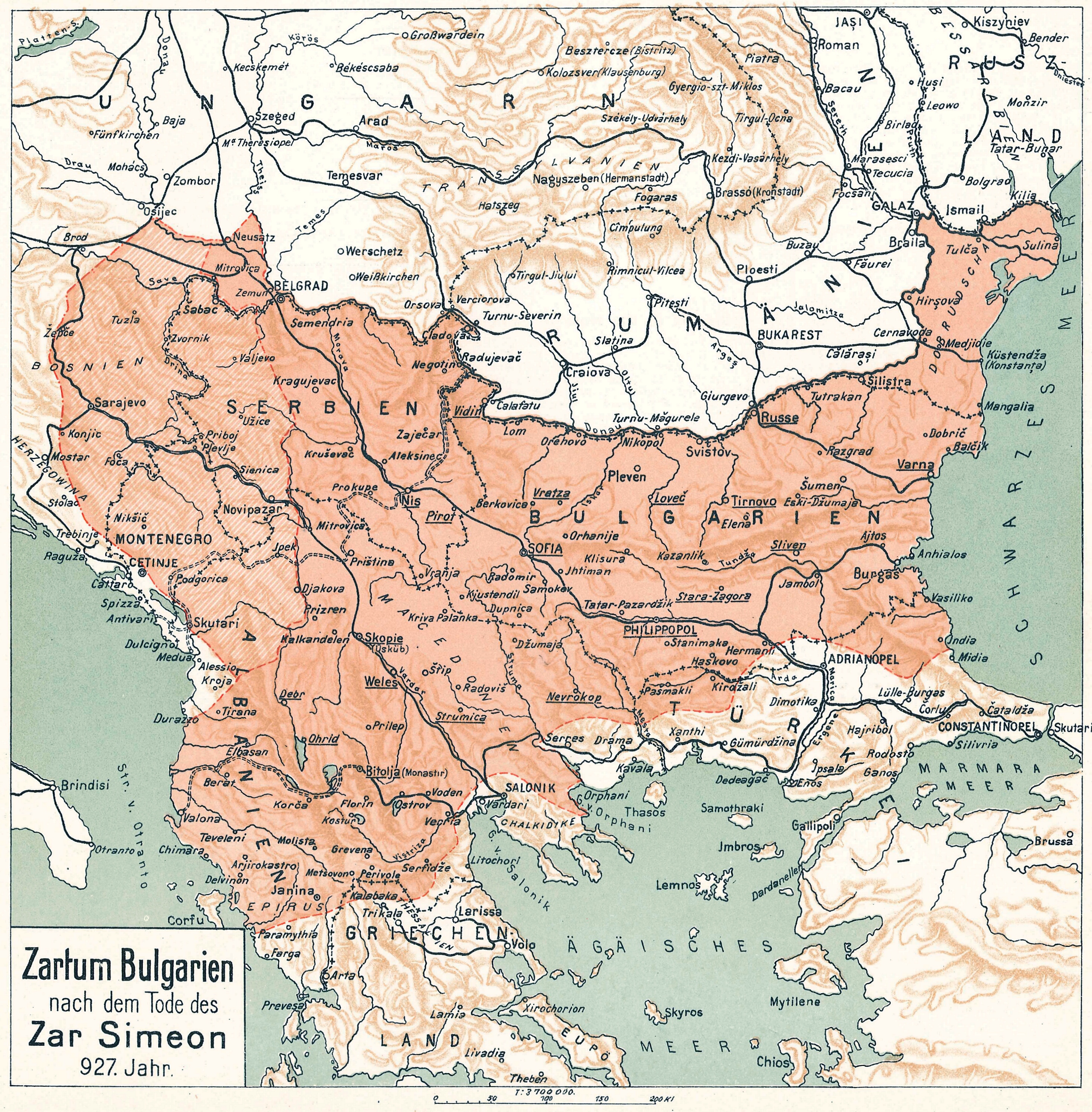
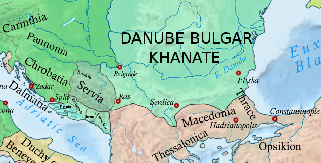
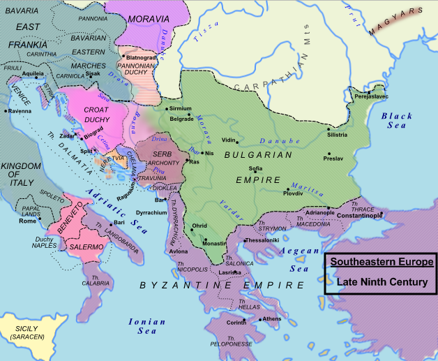
Tsar Simeon (also Symeon) I the Great ( cu, цѣсар҄ь Сѷмеѡ́нъ А҃ Вели́къ, cěsarĭ Sỳmeonŭ prĭvŭ Velikŭ bg, цар Симеон I Велики, Simeon I Veliki el, Συμεών Αʹ ὁ Μέγας, Sumeṓn prôtos ho Mégas) ruled over Bulgaria from 893 to 927,Lalkov, ''Rulers of Bulgaria'', pp. 23–25. during the First Bulgarian Empire. Simeon's successful campaigns against the Byzantines, Magyars and Serbs led Bulgaria to its greatest territorial expansion ever, making it the most powerful state in contemporary Eastern and Southeast Europe. His reign was also a period of unmatched cultural prosperity and enlightenment later deemed the Golden Age of Bulgarian culture. During Simeon's rule, Bulgaria spread over a territory between the Aegean, the Adriatic and the Black Sea.Bakalov, ''Istorija na Bǎlgarija'', "Simeon I Veliki". The newly independent Bulgarian Orthodox Church became the first new patriarchate besides the Pentarchy, and Bulgarian ... [...More Info...] [...Related Items...] OR: [Wikipedia] [Google] [Baidu] |
First Bulgarian Empire
The First Bulgarian Empire ( cu, блъгарьско цѣсарьствиѥ, blagarysko tsesarystviye; bg, Първо българско царство) was a medieval Bulgar- Slavic and later Bulgarian state that existed in Southeastern Europe between the 7th and 11th centuries AD. It was founded in 680–681 after part of the Bulgars, led by Asparuh, moved south to the northeastern Balkans. There they secured Byzantine recognition of their right to settle south of the Danube by defeatingpossibly with the help of local South Slavic tribesthe Byzantine army led by Constantine IV. During the 9th and 10th century, Bulgaria at the height of its power spread from the Danube Bend to the Black Sea and from the Dnieper River to the Adriatic Sea and became an important power in the region competing with the Byzantine Empire. It became the foremost cultural and spiritual centre of south Slavic Europe throughout most of the Middle Ages. As the state solidified its position in the Balka ... [...More Info...] [...Related Items...] OR: [Wikipedia] [Google] [Baidu] |
Mihajlo Višević
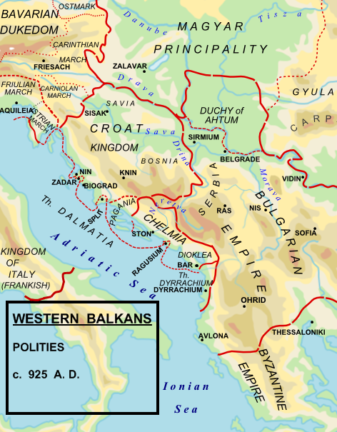
Michael of Zahumlje (reign usually dated c. 910–935), also known as Michael Višević (Serbo-Croatian: ''Mihailo Višević'', Serbian Cyrillic: Михаило Вишевић) or rarely as Michael Vuševukčić,Mihanovich, ''The Croatian nation in its struggle for freedom and independence: a symposium'', p. 112 was a semi-independent, or independent Slavic ruler of Zahumlje, in present-day central Herzegovina and southern Croatia, who flourished in the early part of the 10th century. Prince Michael of Zahumlje had a common boundary with the Serbia and probably with the Kingdom of Croatia, but was an ally of Bulgaria. He was nevertheless able to maintain independent rule throughout at least a good part of his reign. Michael came into territorial conflict with Petar of Serbia, who expand his power to the province of Narenta or Pagania, west from the Neretva River. To eliminate the threat, Michael warned his ally, the Bulgarian Tsar Simeon I, about the alliance between Peter and Sy ... [...More Info...] [...Related Items...] OR: [Wikipedia] [Google] [Baidu] |
Principality
A principality (or sometimes princedom) can either be a monarchical feudatory or a sovereign state, ruled or reigned over by a regnant-monarch with the title of prince and/or princess, or by a monarch with another title considered to fall under the generic meaning of the term ''prince''. Terminology Most of these states have historically been a polity, but in some occasions were rather territories in respect of which a princely title is held. The prince's estate and wealth may be located mainly or wholly outside the geographical confines of the principality. Generally recognised surviving sovereign principalities are Liechtenstein, Monaco, and the co-principality of Andorra. Extant royal primogenitures styled as principalities include Asturias (Spain). The Principality of Wales existed in the northern and western areas of Wales between the 13th and 16th centuries; the Laws in Wales Act of 1536 which legally incorporated Wales within England removed the distinction between th ... [...More Info...] [...Related Items...] OR: [Wikipedia] [Google] [Baidu] |
Mljet
Mljet (; la, Melita, it, Meleda) is the southernmost and easternmost of the larger Adriatic islands of the Dalmatia region of Croatia. The National Park includes the western part of the island, Veliko jezero, Malo jezero, Soline Bay and a sea belt 500 m wide from the most prominent cape of Mljet covering an area of 54 km2. The central parts of the park are Veliko jezero with the Isle of St. Mary, Malo jezero and the villages of Goveđari, Polače and Pomena.Naklad Naprijet, ''The Croatian Adriatic Tourist Guide'', pg. 338, Zagreb (1999), Population According to the 2011 census, Mljet has population of 1,088. Ethnic Croats make up 97.33% of the population. History Mljet was discovered by ancient Greco-Roman geographers, who wrote the first records and descriptions. The island was first described by Scylax of Caryanda in the 6th century BC; others prefer the text, Periplus of Pseudo-Scylax. In both texts, it is named Melite and supported by Apollonius of Rhodes.Bryant, Jacob ... [...More Info...] [...Related Items...] OR: [Wikipedia] [Google] [Baidu] |
Pelješac
Pelješac (; Chakavian: ; it, Sabbioncello) is a peninsula in southern Dalmatia in Croatia. The peninsula is part of the Dubrovnik-Neretva County and is the second largest peninsula in Croatia. From the isthmus that begins at Ston, to the top of Cape Lovišta, it is long. Etymology The name ''Pelješac'' is most likely derived from the name of a hill above town of Orebić, which is Pelisac. This is a relatively new name for the peninsula. Throughout history other names have been used, such as ''Stonski Rat'', ''Puncta Stagni'', ''Ponta di Stagno''. and ''Sabbioncello''. Geography The Bay of Mali Ston separates the peninsula from the Klek peninsula of Bosnia and Herzegovina and from the Croatian "mainland". The Strait of Pelješac is located at its far western end, and it divides the peninsula from the island of Korčula. In the western part of the peninsula is the highest summit of Pelješac, the Zmijino brdo mountain (lit. Snake's Hill) with the peak Sveti Ilija at . Muni ... [...More Info...] [...Related Items...] OR: [Wikipedia] [Google] [Baidu] |
Ston
Ston () is a settlement and a municipality in the Dubrovnik-Neretva County of Croatia, located at the south of isthmus of the Pelješac peninsula. History Because of its geopolitical and strategic position, Ston has had a rich history since antiquity. Located at the gates of the peninsula, surrounded by three seas, protected by four hills, rich in fresh water and saltwater, fertile plains, it has been an important political, cultural and ecclesiastical centre. It is possible that there was a bishop in Ston as early as at the end of the 7th century or the beginning of the 8th century. Initially it was an Illyrian settlement until the Romans established their own colony there, in 167 BC. In 533, at Salona, a diocese was established in Sarsenterum for the Zahumlje or Hum area, which belonged to the church in Ston (Pardui). Later Sarsenterum was destroyed (most likely at the time of Avar's campaign). Since Ston was not reached by Avar's, it was spared and became the seat of the loc ... [...More Info...] [...Related Items...] OR: [Wikipedia] [Google] [Baidu] |
Zachlumia
Zachlumia or Zachumlia ( sh-Latn-Cyrl, separator=" / ", Zahumlje, Захумље, ), also Hum, was a medieval principality located in the modern-day regions of Herzegovina and southern Dalmatia (today parts of Bosnia and Herzegovina and Croatia, respectively). In some periods it was a fully independent or semi-independent South Slavic principality. It maintained relations with various foreign and neighbouring powers (Byzantine Empire, First Bulgarian Empire, Kingdom of Croatia, Principality of Serbia) and later was subjected (temporarily or for a longer period) to Kingdom of Hungary, Kingdom of Serbia, Kingdom of Bosnia, Duchy of Saint Sava and at the end to the Ottoman Empire. Etymology Zachlumia is a derivative of ''Hum'', from Proto-Slavic '' *xŭlmŭ'', borrowed from a Germanic language (cf. Proto-Germanic '' *hulma-''), meaning ''"Hill"''. South Slavic ''Zahumlje'' is named after the mountain of Hum (za + Hum "behind the Hum"), above Bona, at the mouth of the Buna. The p ... [...More Info...] [...Related Items...] OR: [Wikipedia] [Google] [Baidu] |
Travunia
Travunia ( sh-Latn-Cyrl, separator=" / ", Travunija, Травунија; el, Τερβουνία, Tervounía; grc, Τερβουνία, Terbounía; la, Tribunia) was a South Slavic medieval principality that was part of Medieval Serbia (850–1371), and later the Medieval Bosnia (1373–1482). The principality became hereditary in a number of noble houses, often kin to the ruling dynasty. The region came under Ottoman rule in 1482. Its seat was in the city of Trebinje. In the 9th and 10th centuries, the ''Župa'' of Travunia was held by the Belojević noble family, who were entitled the rule during the reign of Prince Vlastimir (r. 830–850), of the Vlastimirović dynasty. After the death of Časlav, the last dynastic member, the principality disintegrated, and the provinces were annexed by the Bulgars and Byzantines. In 1034, Stefan Vojislav (the founder of the Vojislavljević dynasty) incited a rebellion and renounced Byzantine rule, becoming the ''Prince of Serbs'', rul ... [...More Info...] [...Related Items...] OR: [Wikipedia] [Google] [Baidu] |
Narentines
The Narentines were a South Slavic tribe that occupied an area of southern Dalmatia centered at the river Neretva (), active in the 9th and 10th centuries, noted as pirates on the Adriatic. Named ''Narentani'' in Venetian sources, Greek sources call them ''Paganoi'', "pagans", as they were for long pagan, in a time when neighbouring tribes were Christianized. The tribe were fierce enemies of the Republic of Venice, having attacked Venetian merchants and clergy passing on the Adriatic, and even raided close to Venice itself, as well as defeated the doge several times. Venetian–Narentine peace treaties did not last long, as the Narentines quickly returned to piracy. They were finally defeated in a Venetian crackdown at the turn of the 10th century and disappeared from sources by the 11th century. Terminology The word ''Narentine'' is a demonym derived from the local Neretva River ( lat, Narenta). The terms "Narentines", "Pagania" or "Pagans" are found in two contemporary source ... [...More Info...] [...Related Items...] OR: [Wikipedia] [Google] [Baidu] |

