|
Borda Rock
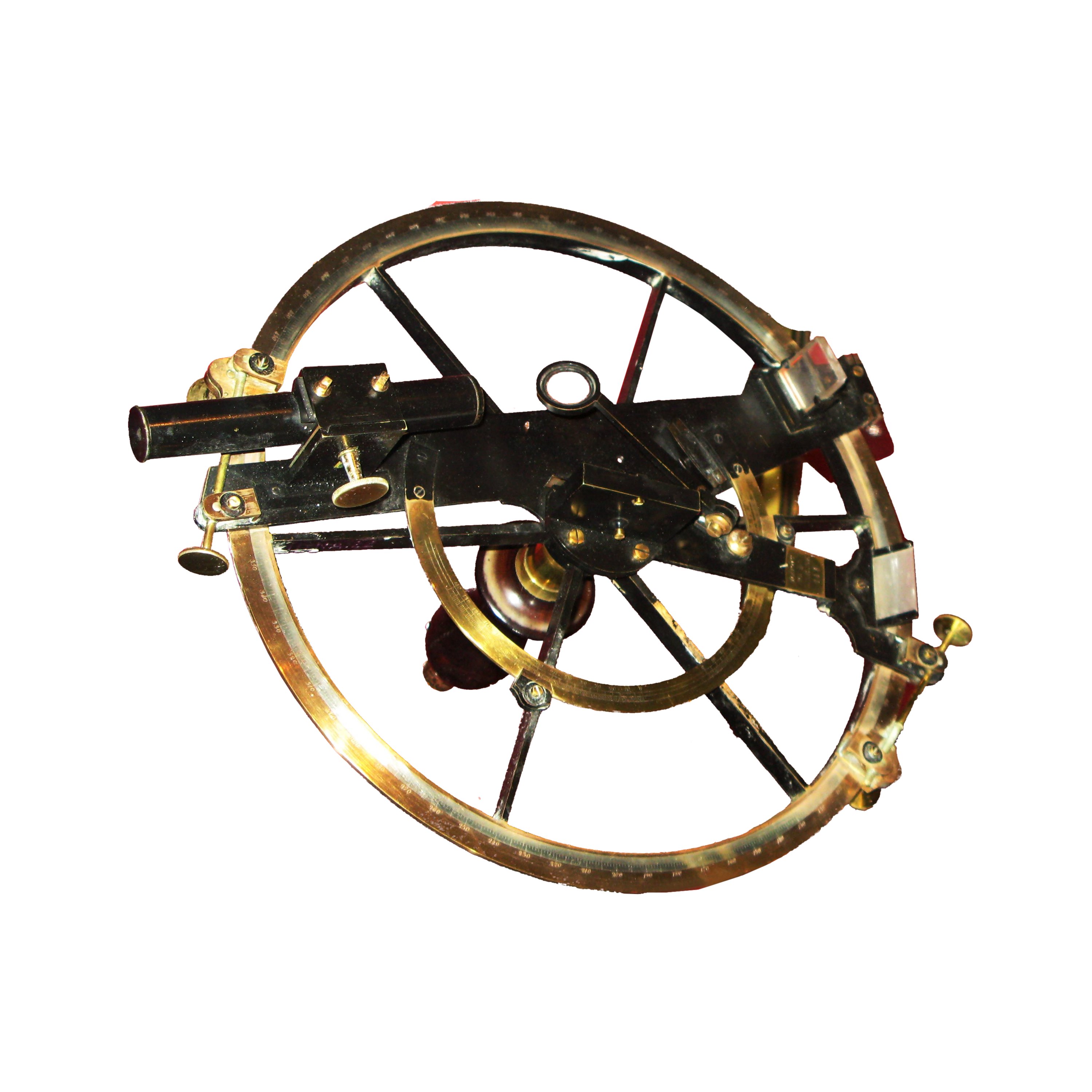
Borda Rock ( bg, скала Борда, skala Borda, ) is the rock off the NW coast of Smith Island in the South Shetland Islands, Antarctica 270 m long in southwest-northeast direction and 90 m wide (extending 543 by 175 m together with the adjacent minor rocks). Its surface area is 1.46 ha. The vicinity was visited by early 19th century sealers.L. IvanovGeneral Geography and History of Livingston Island.In: ''Bulgarian Antarctic Research: A Synthesis''. Eds. C. Pimpirev and N. Chipev. Sofia: St. Kliment Ohridski University Press, 2015. pp. 17–28 The feature is named after Jean-Charles de Borda (1733-1799), a French mathematician, physicist and Navy officer who refined the reflecting circle; in association with other names in the area deriving from the early development or use of geodetic instruments and methods. Location Borda Rock is located at , [...More Info...] [...Related Items...] OR: [Wikipedia] [Google] [Baidu] |
Antarctica
Antarctica () is Earth's southernmost and least-populated continent. Situated almost entirely south of the Antarctic Circle and surrounded by the Southern Ocean, it contains the geographic South Pole. Antarctica is the fifth-largest continent, being about 40% larger than Europe, and has an area of . Most of Antarctica is covered by the Antarctic ice sheet, with an average thickness of . Antarctica is, on average, the coldest, driest, and windiest of the continents, and it has the highest average elevation. It is mainly a polar desert, with annual precipitation of over along the coast and far less inland. About 70% of the world's freshwater reserves are frozen in Antarctica, which, if melted, would raise global sea levels by almost . Antarctica holds the record for the lowest measured temperature on Earth, . The coastal regions can reach temperatures over in summer. Native species of animals include mites, nematodes, penguins, seals and tardigrades. Where vegetation o ... [...More Info...] [...Related Items...] OR: [Wikipedia] [Google] [Baidu] |
South Shetland Islands
The South Shetland Islands are a group of Antarctic islands with a total area of . They lie about north of the Antarctic Peninsula, and between southwest of the nearest point of the South Orkney Islands. By the Antarctic Treaty of 1959, the islands' sovereignty is neither recognized nor disputed by the signatories and they are free for use by any signatory for non-military purposes. The islands have been claimed by the United Kingdom since 1908 and as part of the British Antarctic Territory since 1962. They are also claimed by the governments of Chile (since 1940, as part of the Antártica Chilena province) and Argentina (since 1943, as part of Argentine Antarctica, Tierra del Fuego Province). Several countries maintain research stations on the islands. Most of them are situated on King George Island, benefitting from the airfield of the Chilean base Eduardo Frei. There are sixteen research stations in different parts of the islands, with Chilean stations being ... [...More Info...] [...Related Items...] OR: [Wikipedia] [Google] [Baidu] |
Antarctic Treaty System
russian: link=no, Договор об Антарктике es, link=no, Tratado Antártico , name = Antarctic Treaty System , image = Flag of the Antarctic Treaty.svgborder , image_width = 180px , caption = Flag of the Antarctic Treaty System , type = Condominium , date_drafted = , date_signed = December 1, 1959"Antarctic Treaty" in ''The New Encyclopædia Britannica''. Chicago: Encyclopædia Britannica Inc., 15th edn., 1992, Vol. 1, p. 439. , location_signed = Washington, D.C., United States , date_sealed = , date_effective = June 23, 1961 , condition_effective = Ratification of all 12 signatories , date_expiration = , signatories = 12 , parties = 55 , depositor = Federal government of the United States , languages = English, French, Russian, and Spanish , wikisource = Antarctic Treaty The Antarctic Treaty an ... [...More Info...] [...Related Items...] OR: [Wikipedia] [Google] [Baidu] |
Smith Island (South Shetland Islands)
__NOTOC__ Smith Island is long and wide, lying west of Deception Island in the South Shetland Islands of the British Antarctic Territory. Surface area .L.L. Ivanov. Antarctica: Livingston Island and Greenwich, Robert, Snow and Smith Islands. Scale 1:120000 topographic map. Troyan: Manfred Wörner Foundation, 2010. (First edition 2009. ) The discovery of the South Shetland Islands was first reported in 1819 by Capt. William Smith, for whom the island is named. This island was known to both American and British sealers as early as 1820, and the name Smith has been well established in international usage for over 100 years, although in Russian literature it is often referred to as Borodino Island, sometimes marked as Borodino (Smith) Island. The island hosts no research stations or camps, and is seldom visited by scientists or mountaineers. Its interior is entirely occupied by Imeon Range rising to (Mount Foster).L. Ivanov and N. Ivanova. South Shetlands. In''The World of An ... [...More Info...] [...Related Items...] OR: [Wikipedia] [Google] [Baidu] |
Seal Hunting
Seal hunting, or sealing, is the personal or commercial hunting of seals. Seal hunting is currently practiced in ten countries: United States (above the Arctic Circle in Alaska), Canada, Namibia, Denmark (in self-governing Greenland only), Iceland, Norway, Russia, Finland and Sweden. Most of the world's seal hunting takes place in Canada and Greenland. The Canadian Department of Fisheries and Oceans (DFO) regulates the seal hunt in Canada. It sets quotas (total allowable catch – TAC), monitors the hunt, studies the seal population, works with the Canadian Sealers' Association to train sealers on new regulations, and promotes sealing through its website and spokespeople. The DFO set harvest quotas of over 90,000 seals in 2007; 275,000 in 2008; 280,000 in 2009; and 330,000 in 2010. The actual kills in recent years have been less than the quotas: 82,800 in 2007; 217,800 in 2008; 72,400 in 2009; and 67,000 in 2010. In 2007, Norway claimed that 29,000 harp seals were killed, Russ ... [...More Info...] [...Related Items...] OR: [Wikipedia] [Google] [Baidu] |
Jean-Charles De Borda
Jean-Charles, chevalier de Borda (4 May 1733 – 19 February 1799) was a French mathematician, physicist, and Navy officer. Biography Borda was born in the city of Dax to Jean‐Antoine de Borda and Jeanne‐Marie Thérèse de Lacroix. In 1756, Borda wrote ''Mémoire sur le mouvement des projectiles'', a product of his work as a military engineer. For that, he was elected to the French Academy of Sciences in 1764. Borda was a mariner and a scientist, spending time in the Caribbean testing out advances in chronometers. Between 1777 and 1778, he participated in the American Revolutionary War. In 1781, he was put in charge of several vessels in the French Navy. In 1782, he was captured by the English, and was returned to France shortly after. He returned as an engineer in the French Navy, making improvements to waterwheels and pumps. He was appointed as France's Inspector of Naval Shipbuilding in 1784, and with the assistance of the naval architect Jacques-Noël Sané in 17 ... [...More Info...] [...Related Items...] OR: [Wikipedia] [Google] [Baidu] |
Reflecting Circle
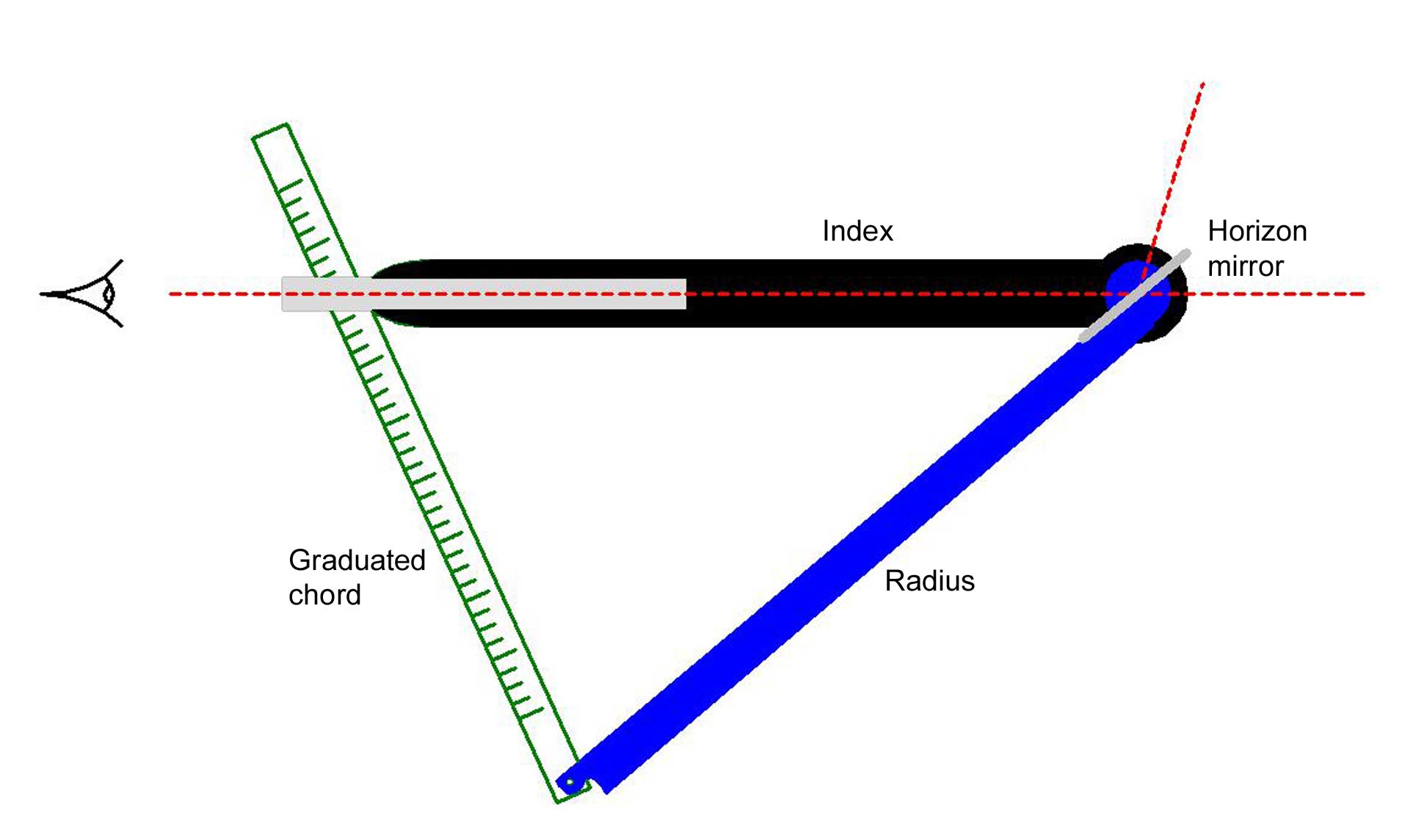
Reflecting instruments are those that use mirrors to enhance their ability to make measurements. In particular, the use of mirrors permits one to observe two objects simultaneously while measuring the angular distance between the objects. While reflecting instruments are used in many professions, they are primarily associated with celestial navigation as the need to solve navigation problems, in particular the problem of the longitude, was the primary motivation in their development. Objectives of the instruments The purpose of reflecting instruments is to allow an observer to measure the altitude of a celestial object or measure the angular distance between two objects. The driving force behind the developments discussed here was the solution to the problem of finding one's longitude at sea. The solution to this problem was seen to require an accurate means of measuring angles and the accuracy was seen to rely on the observer's ability to measure this angle by simultaneously ... [...More Info...] [...Related Items...] OR: [Wikipedia] [Google] [Baidu] |
Geodesy
Geodesy ( ) is the Earth science of accurately measuring and understanding Earth's figure (geometric shape and size), orientation in space, and gravity. The field also incorporates studies of how these properties change over time and equivalent measurements for other planets (known as '' planetary geodesy''). Geodynamical phenomena, including crustal motion, tides and polar motion, can be studied by designing global and national control networks, applying space geodesy and terrestrial geodetic techniques and relying on datums and coordinate systems. The job title is geodesist or geodetic surveyor. History Definition The word geodesy comes from the Ancient Greek word ''geodaisia'' (literally, "division of Earth"). It is primarily concerned with positioning within the temporally varying gravitational field. Geodesy in the German-speaking world is divided into "higher geodesy" ( or ), which is concerned with measuring Earth on the global scale, and "practical geodes ... [...More Info...] [...Related Items...] OR: [Wikipedia] [Google] [Baidu] |
Gregory Point
Gregory Point is a rocky point on the northwest coast of Smith Island in the South Shetland Islands, Antarctica projecting 700 m into Drake Passage. Situated 12.85 km west-southwest of Cape Smith, 3.9 km northwest of Mount Pisgah and 2 km north-northeast of Markeli Point Markeli Point ( bg, нос Маркели, ‘Nos Markeli’ \'nos mar-'ke-li\) is a point on the northwest coast of Smith Island in the South Shetland Islands, Antarctica, projecting 1.2 km west-southwestwards into Drake Passage. Situated .... The point was roughly charted by Captain Henry Foster in 1829 and named Cape Gregory. MapsChart of South Shetland including Coronation Island, &c.from the exploration of the sloop Dove in the years 1821 and 1822 by George Powell Commander of the same. Scale ca. 1:200000. London: Laurie, 1822. * L.L. Ivanov. Antarctica: Livingston Island and Greenwich, Robert, Snow and Smith Islands. Scale 1:120000 topographic map. Troyan: Manfred Wörner Fou ... [...More Info...] [...Related Items...] OR: [Wikipedia] [Google] [Baidu] |


