|
Borchen
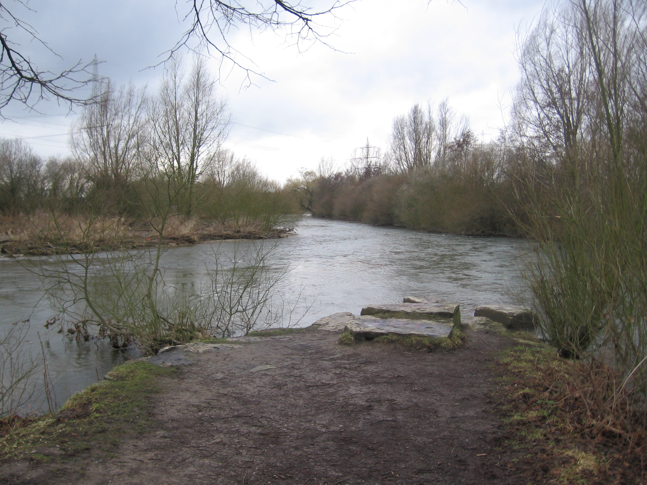
Borchen is a municipality in the district of Paderborn, in North Rhine-Westphalia, Germany. Geography Location Borchen is situated in the Paderborn tableland, approximately 5 km south of Paderborn. The municipality also contains a small part of the eastern Hellweg area. At the north-western border of Borchen the Altenau flows into the Alme River. Neighbouring municipalities Starting in the north, rotating clockwise, Paderborn, Lichtenau, Bad Wünnenberg and Salzkotten are neighbouring municipalities of Borchen. Division of the municipality According to § 4 of Borchen's ordinanceHauptsatzung der Gemeinde Borchen the municipality is divided into the following urban areas: *Alfen *Dörenhagen (including Eggeringhausen and Busch) * |
Paderborn (district)
Paderborn () is a Kreis (district) in the east of North Rhine-Westphalia, Germany. Neighboring districts are Gütersloh, Lippe, Höxter, Hochsauerland, and Soest. History Paderborn was part of the Bishopric of Paderborn until it was included into Prussia in 1802. After the Napoleonic wars when Prussia created the province Westphalia it also created five districts roughly covering the area of the previous state - Brakel, Büren, Höxter, Paderborn and Warburg. In 1975 Paderborn and Büren districts were merged to the current Paderborn district. At the same time the towns and municipalities in the district were merged to form today's ten towns and municipalities. It is a rural district with urban municipalities. Geography The Paderborn district is located at the western slope of the Teutoburg Forest, west of the Eggegebirge. The highest elevation is on the side of the Totenkopf (498 m) at the district border near Bleiwäsche (Bad Wünnenberg), the lowest near Delbrück at 77 m. The ... [...More Info...] [...Related Items...] OR: [Wikipedia] [Google] [Baidu] |
Altenau (Alme)
Altenau is a river of North Rhine-Westphalia, Germany. It is a right tributary of the Alme, which it joins in Borchen. See also * List of rivers of North Rhine-Westphalia References Rivers of North Rhine-Westphalia Rivers of Germany {{NorthRhineWestphalia-river-stub ... [...More Info...] [...Related Items...] OR: [Wikipedia] [Google] [Baidu] |
Etteln
Etteln is a village in the municipality of Borchen, district of Paderborn in the German State of North Rhine-Westphalia. Etteln is situated near Atteln at the river Altenau Altenau () is a town and a former municipality in the district of Goslar, in Lower Saxony, Germany. Since 1 January 2015 it is part of the town Clausthal-Zellerfeld. It is situated in the middle of the Harz mountains, between Clausthal-Zellerf .... Image:Kirche Etteln.jpg, Church St. Simon und Judas Thaddäus. Image:Altar Kirche Etteln.jpg, Church Image:Kapelle Etteln.jpg, Chapel File:Altenau Etteln.jpg , The river Altenau Enten Image:Altenau Etteln2.jpg, References Villages in North Rhine-Westphalia {{Paderborn-geo-stub ... [...More Info...] [...Related Items...] OR: [Wikipedia] [Google] [Baidu] |
Alme River
The Alme is a long river in North Rhine-Westphalia, Germany. It is a left tributary of the Lippe, into which it flows near Paderborn. The Alme defines the Alme Valley and flows through the towns Büren, Borchen and Paderborn. Tributaries * Nette * Gosse (river) * Afte * Altenau Altenau () is a town and a former municipality in the district of Goslar, in Lower Saxony, Germany. Since 1 January 2015 it is part of the town Clausthal-Zellerfeld. It is situated in the middle of the Harz mountains, between Clausthal-Zellerf ... History Flood of 1965 In July 1965 a devastating flood occurred, which became part of regional history as a once-in-a-hundred-years flooding and is remembered by locals as the "Heinrichsflut" (Henry's Day Flood). After heavy rainfalls from July 15 through to 17 (more than 135 L/m2), basements were flooded. In the village of Wewelsburg a bridge collapsed, an Army sapper unit had to be brought in for disaster relief. Streets turned into river ... [...More Info...] [...Related Items...] OR: [Wikipedia] [Google] [Baidu] |
Schwarzenberg, Saxony
Schwarzenberg is a town in the district of Erzgebirgskreis in Saxony’s Ore Mountains, near the German–Czech border. The town lies roughly 15 km southeast of Aue, and 35 km southwest of Chemnitz. Founded in the 12th century to protect a trade road, the small mountain town became the centre of a territory known as '' Herrschaft Schwarzenberg'' and later ''Amt Schwarzenberg''. During the division of Germany, Schwarzenberg was part of East Germany and became the greatest producer of washing machines in Eastern Europe. Schwarzenberg became more widely known in 1987, when Stefan Heym coined the term Free Republic of Schwarzenberg for a small gap between the Soviet and American occupation zones in May/June 1945. Geography Schwarzenberg is in the southwestern Ore Mountains. It lies at elevations stretching from above sea level. The Old Town with church and castle is located on a rock (the Schlossberg, ) around which a meander of the River Schwarzwasser has formed; the ... [...More Info...] [...Related Items...] OR: [Wikipedia] [Google] [Baidu] |
Paderborn
Paderborn (; Westphalian: ''Patterbuorn'', also ''Paterboärn'') is a city in eastern North Rhine-Westphalia, Germany, capital of the Paderborn district. The name of the city derives from the river Pader and ''Born'', an old German term for the source of a river. The river Pader originates in more than 200 springs near Paderborn Cathedral, where St. Liborius is buried. Paderborn ranks 55th on the List of cities in Germany by population. History Paderborn was founded as a bishopric by Charlemagne in 795, although its official history began in 777 when Charlemagne built a castle near the Pader springs.Ed. Heribert Zelder, Tourist Information Services, ''Welcome to Paderborn'', Stadt Paderborn: Paderborn, Germany, 2009. In 799 Pope Leo III fled his enemies in Rome and reached Paderborn, where he met Charlemagne, and stayed there for three months. It was during this time that it was decided that Charlemagne would be crowned emperor. Charlemagne reinstated Leo in Rome in 800 ... [...More Info...] [...Related Items...] OR: [Wikipedia] [Google] [Baidu] |
Hellweg
In the Middle Ages, Hellweg was the official and common name given to main travelling routes in Germany. Their breadth was decreed as an unimpeded passageway a lance's width, about three metres, which the landholders through which the Hellweg passed were required to maintain. In German scholarship and literature, however, ''Helweg'', i.e. when employed without an adjective, usually refers to the well-researched ''Westphalian Hellweg'', the main road from the region of the lower Rhine east to the mountains of the Teutoburg Forest, linking the imperial cities of Duisburg, at the confluence of the Rhine and Ruhr rivers, and Paderborn, with the slopes of the Sauerland to its south. At Paderborn, it very probably continued into at least two other main imperial roads leading further east and north to the Harz mountains and the middle Elbe river, and the lower Weser and lower Elbe rivers, respectively.The Westphalian Hellweg, as an essential corridor that operated in overland transit of ... [...More Info...] [...Related Items...] OR: [Wikipedia] [Google] [Baidu] |
Flag Of Germany
The national flag of Germany is a tricolour (flag), tricolour consisting of three equal horizontal bands displaying the national colours of Germany: Sable (heraldry), black, Gules, red, and Or (heraldry), gold (german: :de:Schwarz-Rot-Gold, Schwarz-Rot-Gold). The flag was first sighted in 1848 in the German Confederation. It was officially adopted as the national flag of the Weimar Republic from 1919 to 1933, and has been in use since its reintroduction in West Germany in 1949. Since the mid-19th century, Germany has two competing traditions of national colours, black-red-gold and black-white-red. Black-red-gold were the colours of the German revolutions of 1848–1849, 1848 Revolutions, the Weimar Republic of 1919–1933 and the Federal Republic (since 1949). They were also Flag of East Germany, adopted by the German Democratic Republic (1949–1990). The colours black-white-red appeared for the first time in 1867, in the constitution of the North German Confederation. This n ... [...More Info...] [...Related Items...] OR: [Wikipedia] [Google] [Baidu] |
Büren (district)
Büren may refer to the following places: Germany * Büren, Westphalia, a town near Paderborn, North Rhine-Westphalia *Büren, a village in the municipality of Lotte, North Rhine-Westphalia *Büren, a village in the municipality of Neustadt am Rübenberge, Lower Saxony Switzerland * Büren, Aargau, part of Gansingen in the canton of Aargau *Büren nid dem Bach, in the canton of Nidwalden *Büren ob dem Bach, in the Canton of Nidwalden] *Büren, Solothurn, in the canton of Solothurn *Büren District, a former district in the canton of Bern *Büren an der Aare in the canton of Bern *Büren zum Hof, in the canton of Bern *Büron, in the canton of Lucerne Mongolia *Büren, Töv, a sum in Töv Province See also *Buren (other) *Bühren, a municipality in Lower Saxony, Germany *Beuren (other) Beuren may refer to: *Beuren, Esslingen, a municipality in the district of Esslingen, Baden-Württemberg, Germany *Beuren, Cochem-Zell, a municipality in the district Cochem- ... [...More Info...] [...Related Items...] OR: [Wikipedia] [Google] [Baidu] |
Districts Of Germany
In all German states, except for the three city states, the primary administrative subdivision higher than a '' Gemeinde'' (municipality) is the (official term in all but two states) or (official term in the states of North Rhine-Westphalia and Schleswig-Holstein). Most major cities in Germany are not part of any ''Kreis'', but instead combine the functions of a municipality and a ''Kreis''; such a city is referred to as a (literally "district-free city"; official term in all but one state) or (literally "urban district"; official term in Baden-Württemberg). ''(Land-)Kreise'' stand at an intermediate level of administration between each German state (, plural ) and the municipal governments (, plural ) within it. These correspond to level-3 administrative units in the Nomenclature of Territorial Units for Statistics (NUTS 3). Previously, the similar title ( Imperial Circle) referred to groups of states in the Holy Roman Empire. The related term was used for similar a ... [...More Info...] [...Related Items...] OR: [Wikipedia] [Google] [Baidu] |
Province Of Westphalia
The Province of Westphalia () was a province of the Kingdom of Prussia and the Free State of Prussia from 1815 to 1946. In turn, Prussia was the largest component state of the German Empire from 1871 to 1918, of the Weimar Republic and from 1918 to 1933, and of Nazi Germany from 1933 until 1945. The province was formed and awarded to Prussia at the Congress of Vienna in 1815, in the aftermath of the Napoleonic Wars. It combined some territories that had previously belonged to Prussia with a range of other territories that had previously been independent principalities. The population included a large population of Catholics, a significant development for Prussia, which had hitherto been almost entirely Protestant. The politics of the province in the early nineteenth century saw local expectations of Prussian reforms, increased self-government, and a constitution largely stymied. The Revolutions of 1848 led to an effervescence of political activity in the province, but the failur ... [...More Info...] [...Related Items...] OR: [Wikipedia] [Google] [Baidu] |
Minden
Minden () is a middle-sized town in the very north-east of North Rhine-Westphalia, Germany, the greatest town between Bielefeld and Hanover. It is the capital of the district (''Kreis'') of Minden-Lübbecke, which is part of the region of Detmold. The town extends along both sides of the River Weser, and is crossed by the Mittelland Canal, which is passing the river on the Minden Aqueduct. In the 1,200 years longing time of written history, Minden had functions as diocesan town from 800 AD to the Peace of Westphalia in 1648, as capital of the Prince-Bishopric of Minden as imperial territory since the 12th century, afterwards as capital of the Prussian territory of Minden-Ravensberg until the end of the Holy Roman Empire in 1806, and as capital of the East-Westphalian region from the Congress of Vienna until 1947. Furthermore Minden has been of great military importance with fortifications from the 15th to the late 19th century, and is yet place of a garrison. Minden is locati ... [...More Info...] [...Related Items...] OR: [Wikipedia] [Google] [Baidu] |


