|
Bonhamtown, New Jersey
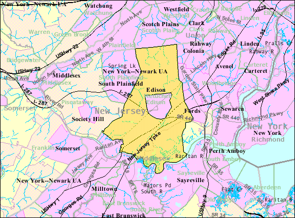
Bonhamtown is a section of Edison Township in Middlesex County, New Jersey, United States. The area was named after Nicholas Bonham, a freeholder from the 17th century. Along with New Dover, New Durham, and Stelton it is one of the older historical communities established when the municipality was known as Raritan Township. Bonhamtown is surrounded by several major roads, which include: Interstate 287, the New Jersey Turnpike, U.S. Route 1, Route 27, and Route 440. The Bonhamtown Branch of Conrail Shared Assets Operations (CRCX) runs through the area from the Northeast Corridor to Raritan Center, site of the former Raritan Arsenal. See also *List of neighborhoods in Edison, New Jersey Edison, New Jersey is a township in Middlesex County, New Jersey in central New Jersey. The township was originally founded as the settlement of Piscatawaytown, a small neighborhood that still exists within it, and incorporated as Raritan Townsh ... References External links Bonhamtown ... [...More Info...] [...Related Items...] OR: [Wikipedia] [Google] [Baidu] |
Local Government In New Jersey
Local government in New Jersey is composed of counties and municipalities. Local jurisdictions in New Jersey differ from those in some other U.S. state, states because every square foot of the state is part of exactly one List of municipalities in New Jersey, municipality; each of the 564 municipalities is in exactly one List of counties in New Jersey, county; and each of the 21 counties has more than one municipality. New Jersey has no independent city, independent cities, or consolidated city-county, consolidated city-counties. The forms of municipality in New Jersey are more complex than in most other states, though, potentially leading to misunderstandings regarding the governmental nature of an area and what local laws apply. All municipalities can be classified as one of five types of local government—Borough (New Jersey), Borough, City (New Jersey), City, Township (New Jersey), Township, Town (New Jersey), Town, and Village (New Jersey), Village—and one of twelve forms ... [...More Info...] [...Related Items...] OR: [Wikipedia] [Google] [Baidu] |
Stelton, New Jersey
Stelton is an unincorporated community located within Edison Township in Middlesex County, New Jersey, United States. Established in 1689, the Stelton Baptist Church is the state's second oldest baptist congregation. The present-day NJ Transit Edison station was originally constructed at Central Avenue and Plainfield Avenue and named “Stelton” after the Stelle family, early settlers in Piscatawaytown who arrived in 1668 and who were still numerous in the area in the 1880s. The Pennsylvania Railroad renamed the station to Edison on October 29, 1956, as part of the changing of names in Edison to reflect the newly honored Thomas Alva Edison.Staff"Edison Township Adopts Fire Code" ''Edison Township and Fords Beacon'', October 11, 1956. Accessed December 11, 2017. "The commissioners were notified that on October 29 at 1:30 o'clock there will be an official ceremony at the Stelton station of the Pennsylvania Railroad , when the station name will be formally changed to Edison." ... [...More Info...] [...Related Items...] OR: [Wikipedia] [Google] [Baidu] |
Neighborhoods In Edison, New Jersey
A neighbourhood (British English, Irish English, Australian English and Canadian English) or neighborhood (American English; see spelling differences) is a geographically localised community within a larger city, town, suburb or rural area, sometimes consisting of a single street and the buildings lining it. Neighbourhoods are often social communities with considerable face-to-face interaction among members. Researchers have not agreed on an exact definition, but the following may serve as a starting point: "Neighbourhood is generally defined spatially as a specific geographic area and functionally as a set of social networks. Neighbourhoods, then, are the spatial units in which face-to-face social interactions occur—the personal settings and situations where residents seek to realise common values, socialise youth, and maintain effective social control." Preindustrial cities In the words of the urban scholar Lewis Mumford, "Neighbourhoods, in some annoying, inchoate fashi ... [...More Info...] [...Related Items...] OR: [Wikipedia] [Google] [Baidu] |
List Of Neighborhoods In Edison, New Jersey
Edison, New Jersey is a township in Middlesex County, New Jersey in central New Jersey. The township was originally founded as the settlement of Piscatawaytown, a small neighborhood that still exists within it, and incorporated as Raritan Township on March 17, 1870.Snyder, John P''The Story of New Jersey's Civil Boundaries: 1606–1968'' Bureau of Geology and Topography, Trenton, New Jersey, 1969. p. 170 re Edison Township, p. 173 re Raritan Township. As of the 2020 United States Census, Edison had a total population of 107,588, making it the sixth-most populous municipality in New Jersey. The township had a total area of 30.638 square miles (79.351 km2).US Gazetteer files: 2010, 2000, and 1990 |
Raritan Center
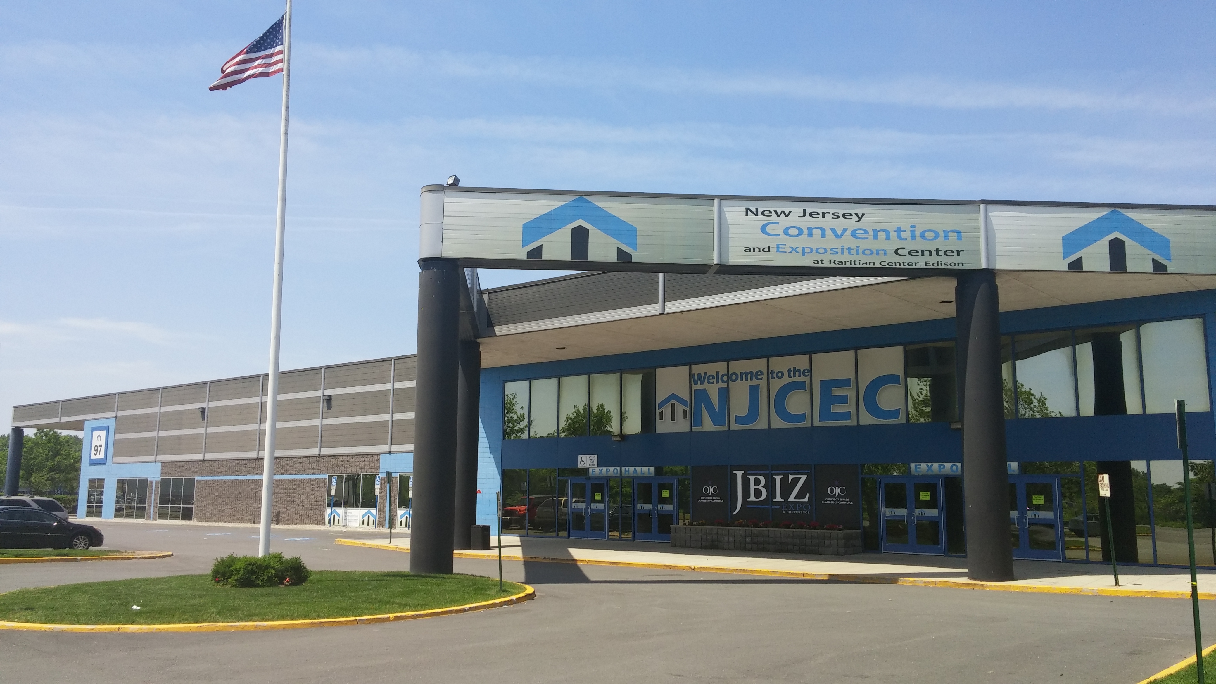
Raritan Center is a business park located in Edison, New Jersey. Sited on part of the former Raritan Arsenal, the Raritan Center Business Park is a logistics center with office buildings and millions of square feet of light manufacturing or distribution. It provides services for transload, cross-dock, warehousing and “3PL” service providers operations. It is home to regional distribution facilities for organizations including Federal Express, CertainTeed, Arizona Beverage Company, United Parcel Service, among others. The newsroom of News 12 New Jersey and the New Jersey Convention & Expo Center are located at the center. In 2012, Avidan Management built which what was then the nation's largest solar rooftop installation at at the center.Santarris, Ben"Avidan Management Commissions Nation's Largest Rooftop Solar System in New Jersey", SolarWorld SolarWorld is a German company dedicated to the manufacture and marketing photovoltaic products worldwide by integrating all ... [...More Info...] [...Related Items...] OR: [Wikipedia] [Google] [Baidu] |
Conrail Shared Assets Operations
Conrail Shared Assets Operations (CSAO) is the commonly used name for modern-day Conrail (reporting mark CRCX), an American railroad company. It operates three networks, the North Jersey, South Jersey/Philadelphia, and Detroit Shared Assets Areas, where it serves as a contract local carrier and switching company for its owners, CSX Transportation and the Norfolk Southern Railway. When most of the former Conrail's track was split between these two railroads, the three shared assets areas (a total of about 1,200 miles of track) were kept separate to avoid giving one railroad an advantage in those areas. The company operates using its own employees and infrastructure but owns no equipment outside MOW equipment. North Jersey Shared Assets Area The North Jersey Shared Assets Area stretches from the North Bergen Yard in North Bergen, New Jersey south into Jersey City and Newark, and beyond to Manville ( Port Reading Junction) and Trenton, much of which is operated over Amtrak's ... [...More Info...] [...Related Items...] OR: [Wikipedia] [Google] [Baidu] |
New Jersey Route 440
Route 440 is a state highway in New Jersey, United States. It comprises two segments, a freeway in Middlesex County linking Interstate 287 (I-287) and the New Jersey Turnpike (I-95), in Edison to the Outerbridge Crossing in Perth Amboy and a four-lane divided highway in Hudson County running from the Bayonne Bridge in Bayonne to U.S. Route 1/9 Truck (US 1-9 Truck) in Jersey City. These two segments are connected by New York State Route 440 (NY 440), which runs across Staten Island. The freeway portion in Middlesex County is six lanes wide and interchanges with the Garden State Parkway and US 9 in Woodbridge. What is now Route 440 was designated as two different routes in 1927: the Middlesex County portion between Route 4 (now Route 35) and the proposed Outerbridge Crossing was designated Route S4 (a spur of Route 4) while the Hudson County portion was designated as a part of Route 1. In 1953, Route 440 replaced Route S4 as well as Route 1 south of Communipaw ... [...More Info...] [...Related Items...] OR: [Wikipedia] [Google] [Baidu] |
New Jersey Route 27
Route 27 is a state highway in New Jersey, United States. It runs from U.S. Route 206 (US 206) in Princeton, Mercer County northeast to an interchange with Route 21 (McCarter Highway) and Broad Street in Newark, Essex County. The route passes through many communities along the way, including New Brunswick, Highland Park, Edison, Metuchen, Rahway, and Elizabeth. Route 27 is a two- to four-lane undivided highway for most of its length, passing through a variety of urban and suburban environments. It intersects many roads along the way, including Route 18 in New Brunswick, Interstate 287 (I-287) in Edison, the Garden State Parkway in Woodbridge Township, Route 35 in Rahway, Route 28 in Elizabeth, and U.S. Route 22 in Newark. Route 27 crosses the Raritan River on the Albany Street Bridge, which connects Highland Park on the east with New Brunswick on the west. Route 27 was part of the alignment through New Jersey of the Lincoln Highway, the United States' first transc ... [...More Info...] [...Related Items...] OR: [Wikipedia] [Google] [Baidu] |
New Jersey Turnpike
The New Jersey Turnpike (NJTP) is a system of controlled-access highways in the U.S. state of New Jersey. The turnpike is maintained by the New Jersey Turnpike Authority (NJTA).The Garden State Parkway, although maintained by NJTA, is not considered part of the turnpike. The mainline's southern terminus is at a complex interchange with Interstate 295 (Delaware–Pennsylvania), Interstate 295 (I-295), U.S. Route 40 in New Jersey, U.S. Route 40 (US 40), U.S. Route 130, US 130, and New Jersey Route 49, Route 49 near the border of Pennsville Township, New Jersey, Pennsville and Carneys Point Township, New Jersey, Carneys Point townships in Salem County, New Jersey, Salem County, east of the Delaware Memorial Bridge. Its original northern terminus was at an interchange with Interstate 80 in New Jersey , I-80 and U.S. Route 46, US 46 in Ridgefield Park, New Jersey, Ridgefield Park, Bergen County, New Jersey, Bergen County; the turnpike was later extended to t ... [...More Info...] [...Related Items...] OR: [Wikipedia] [Google] [Baidu] |
Interstate 287 In New Jersey
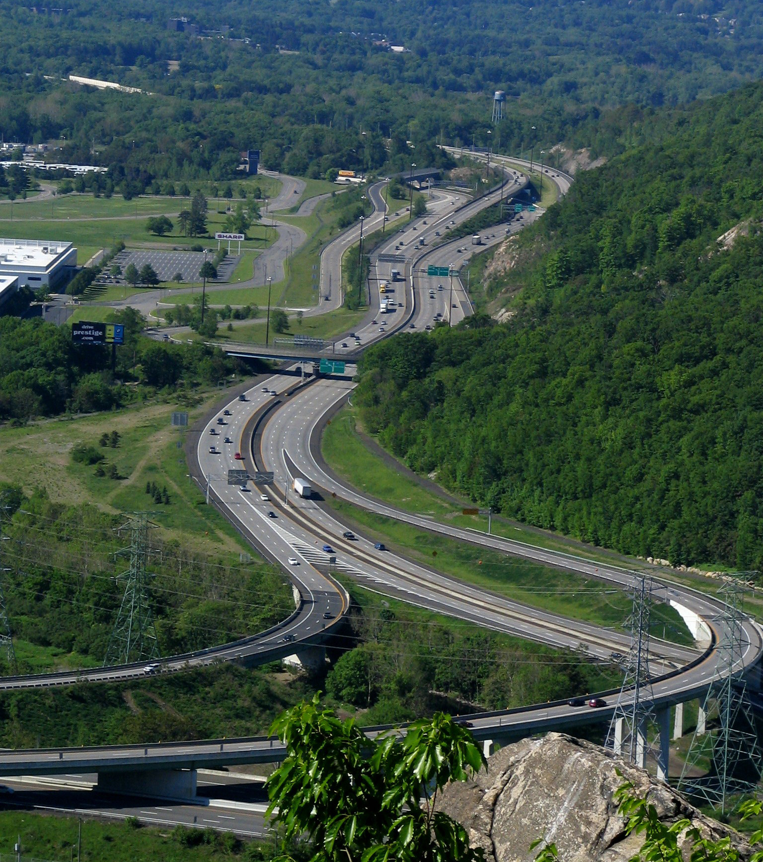
Interstate 287 (I-287) is an auxiliary Interstate Highway in the US states of New Jersey and New York. It is a partial beltway around New York City, serving the northern half of New Jersey and the counties of Rockland and Westchester in New York. I-287, which is signed north–south in New Jersey and east–west in New York, follows a roughly horseshoe-shaped route from the New Jersey Turnpike (I-95) in Edison, New Jersey, clockwise to the New England Thruway (I-95) in Rye, New York, for . Through New Jersey, I-287 runs west from its southern terminus in Edison through suburban areas. In Bridgewater Township, the freeway takes a more northeasterly course, paralleled by US Route 202 (US 202). The northernmost part of I-287 in New Jersey passes through mountainous surroundings. After crossing into New York at Suffern, I-287 turns east on the New York State Thruway (I-87) and runs through Rockland County. After crossing the Hudson River on the Tappan Zee Bridge, I-2 ... [...More Info...] [...Related Items...] OR: [Wikipedia] [Google] [Baidu] |
New Durham, Middlesex County, New Jersey
New Durham was an unincorporated community and now a neighborhood located within Edison in Middlesex County, New Jersey, United States, south of Dismal Swamp. Along with Piscatawaytown, Bonhamtown, New Dover and Stelton, New Durham is one of the older historical crossroad communities established in Edison (either as once part of Piscataway or Woodbridge before the establishment of Raritan Township, as Edison was earlier known). It was described in 1834 as having a tavern, a store, and a half-dozen dwellings. See also *Edison, New Jersey natural gas explosion *List of neighborhoods in Edison, New Jersey Edison, New Jersey is a township in Middlesex County, New Jersey in central New Jersey. The township was originally founded as the settlement of Piscatawaytown, a small neighborhood that still exists within it, and incorporated as Raritan Townshi ... References Neighborhoods in Edison, New Jersey Unincorporated communities in Middlesex County, New Jersey Unincor ... [...More Info...] [...Related Items...] OR: [Wikipedia] [Google] [Baidu] |
List Of Sovereign States
The following is a list providing an overview of sovereign states around the world with information on their status and recognition of their sovereignty. The 206 listed states can be divided into three categories based on membership within the United Nations System: 193 UN member states, 2 UN General Assembly non-member observer states, and 11 other states. The ''sovereignty dispute'' column indicates states having undisputed sovereignty (188 states, of which there are 187 UN member states and 1 UN General Assembly non-member observer state), states having disputed sovereignty (16 states, of which there are 6 UN member states, 1 UN General Assembly non-member observer state, and 9 de facto states), and states having a special political status (2 states, both in free association with New Zealand). Compiling a list such as this can be a complicated and controversial process, as there is no definition that is binding on all the members of the community of nations concerni ... [...More Info...] [...Related Items...] OR: [Wikipedia] [Google] [Baidu] |


