|
Bon Air, Virginia
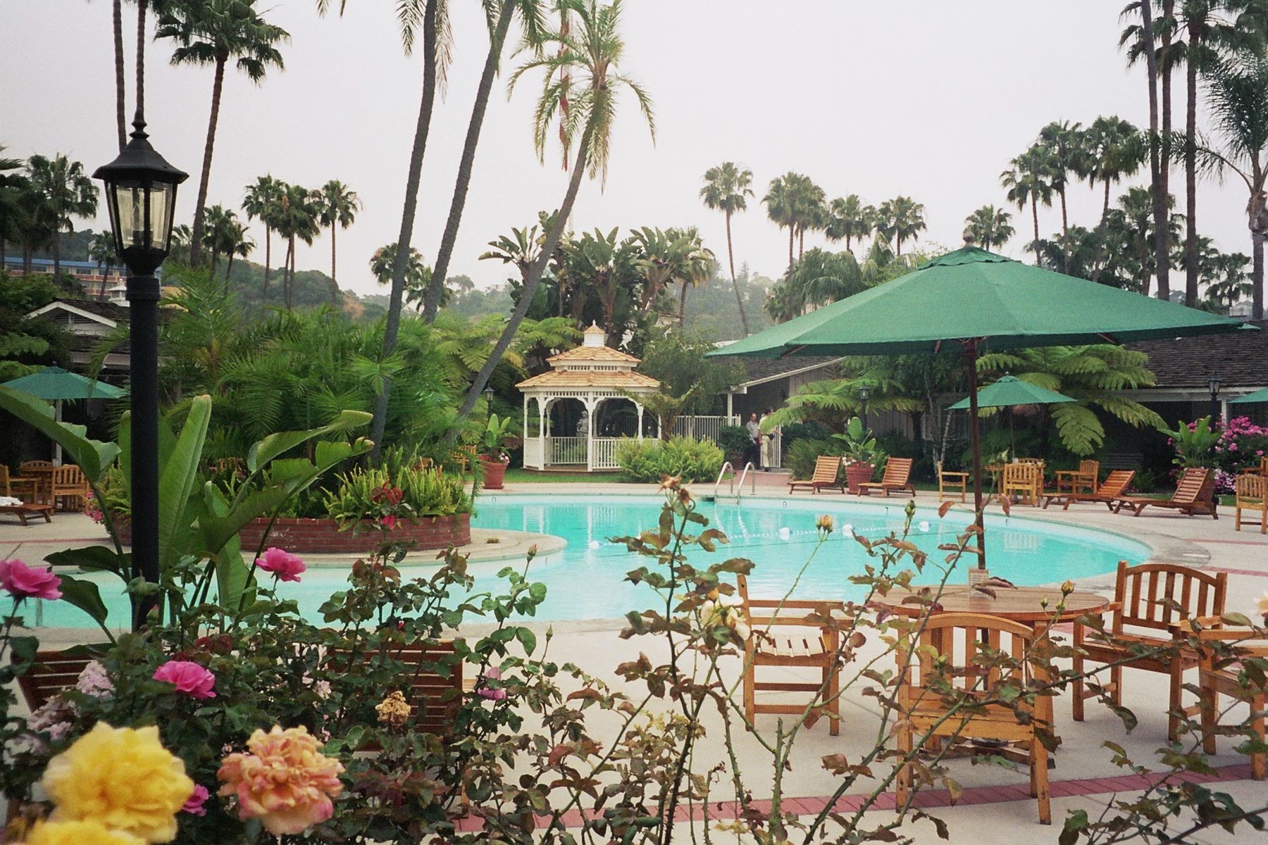
Bon Air is a census-designated place (CDP) in Chesterfield County, Virginia, Chesterfield County, Virginia, United States. The population was 16,366 at the 2010 United States Census, 2010 census. The community is considered a suburb of the independent city of Richmond, Virginia, Richmond in the Richmond-Petersburg region and is a part of the Southside (Richmond, Virginia), Southside neighborhoods. Originally developed as a resort, a central portion of Bon Air has been designated as a National Register of Historic Places, National Historic District with many structures of Victorian architecture, Victorian design from the late 19th and early 20th centuries. Its name means "good air," reflecting its role as a resort getaway that wealthy Richmonders enjoyed for its fresh air as opposed to the dirty air of Richmond's industrial downtown of the late 19th century. Definition and Boundaries Bon Air is located entirely within Chesterfield County, Virginia and mostly within the 23235 zip ... [...More Info...] [...Related Items...] OR: [Wikipedia] [Google] [Baidu] |
Census-designated Place
A census-designated place (CDP) is a concentration of population defined by the United States Census Bureau for statistical purposes only. CDPs have been used in each decennial census since 1980 as the counterparts of incorporated places, such as self-governing cities, towns, and villages, for the purposes of gathering and correlating statistical data. CDPs are populated areas that generally include one officially designated but currently unincorporated community, for which the CDP is named, plus surrounding inhabited countryside of varying dimensions and, occasionally, other, smaller unincorporated communities as well. CDPs include small rural communities, edge cities, colonias located along the Mexico–United States border, and unincorporated resort and retirement communities and their environs. The boundaries of any CDP may change from decade to decade, and the Census Bureau may de-establish a CDP after a period of study, then re-establish it some decades later. Most unin ... [...More Info...] [...Related Items...] OR: [Wikipedia] [Google] [Baidu] |
Richmond, Virginia
(Thus do we reach the stars) , image_map = , mapsize = 250 px , map_caption = Location within Virginia , pushpin_map = Virginia#USA , pushpin_label = Richmond , pushpin_map_caption = Location within Virginia##Location within the contiguous United States , pushpin_relief = yes , coordinates = , subdivision_type = Country , subdivision_name = , subdivision_type1 = U.S. state, State , subdivision_name1 = , established_date = 1742 , , named_for = Richmond, London, Richmond, United Kingdom , government_type = , leader_title = List of mayors of Richmond, Virginia, Mayor , leader_name = Levar Stoney (Democratic Party (United States), D) , total_type = City , area_magnitude = 1 E8 , area_total_sq_mi = 62.57 , area_land_sq_mi = 59.92 , area_ ... [...More Info...] [...Related Items...] OR: [Wikipedia] [Google] [Baidu] |
Richmond And Danville Railroad
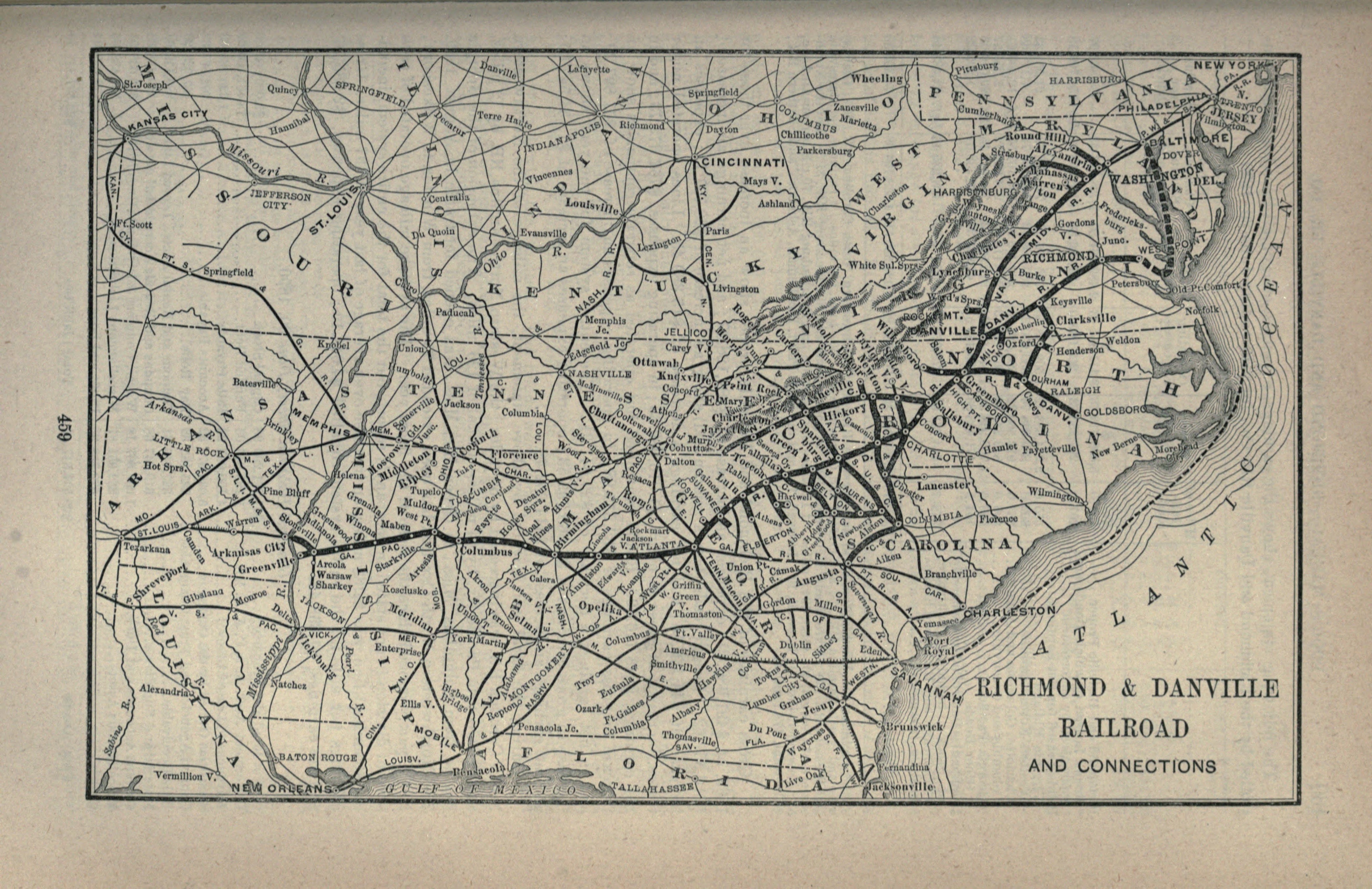
The Richmond and Danville Railroad (R&D) Company was a railroad that operated independently from 1847 until 1894, first in the U.S. state of Virginia, and later on of track in nine states. Chartered on March 9, 1847, the railroad completed its line between Richmond and Danville in 1856.Interstate Commerce Commission. ''Southern Ry. Co.'', Volume 37, Interstate Commerce Commission Valuation Reports, November 6, 1931, p. 555. Washington: United States Government Printing Office, 1932. . During the American Civil War, the railroad was a vital link between the Confederate capital of Richmond and the rest of the Confederacy. After the Civil War, the railroad grew to become the Richmond and Danville Railroad Company System. Placed in receivership in 1892, the Richmond and Danville Railroad Company was sold in 1894 and conveyed into the new Southern Railway Company (later the Norfolk Southern Railway) in 1896 and 1897. History Beginnings (1847-61) The new Richmond and Danville Ra ... [...More Info...] [...Related Items...] OR: [Wikipedia] [Google] [Baidu] |
Chatham, Virginia
Chatham is a town in Pittsylvania County, Virginia, Pittsylvania County, Virginia, United States. It is the county seat of Pittsylvania County, Virginia, Pittsylvania County. Chatham's population was 1,269 at the 2010 census. It is included in the Danville, Virginia Danville, Virginia metropolitan area, Metropolitan Statistical Area. The town was originally called Competition, but the name was changed to Chatham by the Virginia General Assembly on May 1, 1852. Chatham is home to Chatham High School (Virginia), Chatham High School, Hargrave Military Academy, and Chatham Hall, an all-female boarding high school. History It is the home to the oldest continually used building in Pittsylvania County, once an 18th-century tavern, since turned into a house and now occupied by Chatham Hall faculty. Chatham is the county seat for Pittsylvania County and has held that status since 1777. There is a large U.S. Department of Agriculture office to support farmers in the area and a small branch ... [...More Info...] [...Related Items...] OR: [Wikipedia] [Google] [Baidu] |
Algernon S
Algernon may refer to: * Algernon (name), a given name (includes a list of people and characters with the name) * Algernon Township, Custer County, Nebraska See also * Treaty of Algeron, an agreement signed by the United Federation of Planets and the Romulan Star Empire in ''Star Trek'' * "Flowers for Algernon", a science fiction short story and subsequent novel written by Daniel Keyes * United States v. Algernon Blair, Inc, a 1973 American lawsuit regarding its breach of contract with a subcontractor * '' Růže pro Algernon'', Aleš Brichta Aleš Brichta (born 9 August 1959 in Prague, Czechoslovakia) is a Czech heavy metal music, heavy metal singer, songwriter, and artist. He is a founding member of the band Arakain, which he left in 2002. He now plays with Aleš Brichta Project. ... album {{disambig ... [...More Info...] [...Related Items...] OR: [Wikipedia] [Google] [Baidu] |
Resort
A resort (North American English) is a self-contained commercial establishment that tries to provide most of a vacationer's wants, such as food, drink, swimming, lodging, sports, entertainment, and shopping, on the premises. The term ''resort'' may be used for a hotel property that provides an array of amenities, typically including entertainment and recreational activities. A hotel is frequently a central feature of a resort, such as the Grand Hotel at Mackinac Island, Michigan. Some resorts are also condominium complexes that are timeshares or owned fractionally or wholly owned condominium. A resort is not always a commercial establishment operated by a single company, but in the late 20th century, that sort of facility became more common. In British English, "resort" means a town which people visit for holidays and days out which usually contains hotels at which such holidaymakers stay. Examples would include Blackpool and Brighton. Destination resort A destinatio ... [...More Info...] [...Related Items...] OR: [Wikipedia] [Google] [Baidu] |
Warwick, Virginia
Warwick is an extinct independent city which was located in the State of Virginia in the United States from 1952 until 1958. Formed by a political conversion of the former Warwick County, Virginia (1634–1952), it is now part of the independent city of Newport News, Virginia. History Warwick River Shire, named for the Warwick River, was established in the British Colony of Virginia by order of King Charles I in 1634. Soon thereafter, it was renamed Warwick County, and eventually became one of the smaller and lesser populated counties in Virginia as the colony grew and after Virginia became a state. Warwick County remained a primarily farming area until the arrival of the Peninsula Extension of the Chesapeake and Ohio Railway in late 1881. At rural Newport News Point, on the harbor of Hampton Roads, a small community of farms was transformed into a major port for shipping coal. Virginia has had an independent city political subdivision since 1871. Newport News became an ... [...More Info...] [...Related Items...] OR: [Wikipedia] [Google] [Baidu] |
Warwick Road
Warwick Road is an arterial east-west road located in the northern suburbs of Perth, Western Australia. It was built in 1969 to service the Shire of Wanneroo parts of the Hamersley Development Scheme, which was later split into the suburbs of Duncraig, Warwick and Greenwood. Its original alignment, which was gazetted in 1949 as Road No. 10578 by the Wanneroo Road Board, was a straight east-west road extending to Alexander Drive, but in the mid-1970s, the alignment was altered southwards in the vicinity of the freeway alignment (the Mitchell Freeway was not, however, built until 1986), and in the late 1970s, the section east of Wanneroo Road was split off to form Marangaroo Drive. Apart from the Glengarry and Greenwood neighbourhood shopping centres, Warwick Road also passes Warwick Open Space east of Erindale Road and the Percy Doyle Reserve, which includes sports and recreation facilities and the Duncraig Library, near Marmion Avenue. Major intersections * Marmion A ... [...More Info...] [...Related Items...] OR: [Wikipedia] [Google] [Baidu] |
Midlothian Turnpike
U.S. Route 60 (US 60) in the Commonwealth of Virginia runs west to east through the central part of the state, generally close to and paralleling the Interstate 64 corridor, except for the crossing of the Blue Ridge Mountains, and in the South Hampton Roads area. Between Lexington in the Shenandoah Valley and Richmond, I-64 uses a lower elevation crossing of the Blue Ridge Mountains located about further north, where it runs parallel to U.S. Route 250 through Rockfish Gap. In contrast, through this section, the older US 60 is mostly a rural two-lane road. With the crossing of the Blue Ridge Mountains at Humphreys Gap at a higher altitude in more rugged terrain, US 60 in this area offers much more challenging and weather-sensitive driving conditions, as well as a history of many crashes in the years before I-64 was completed. (The original US 60 alignment through Glasgow, now US 501, is lower than either but much curvier than I-64.) East of north–south U.S. Route 29 ... [...More Info...] [...Related Items...] OR: [Wikipedia] [Google] [Baidu] |
Huguenot Road
State Route 147 (SR 147) is a primary state highway in the U.S. state of Virginia. The state highway runs from U.S. Route 60 (US 60) in Midlothian east to US 60 in Richmond. In various places, it is known as Huguenot Road, River Road, Cary Street Road and Main Street. SR 147 connects Midlothian with the West End of Richmond via the Huguenot Memorial Bridge across the James River. Within Richmond, the state highway follows Cary Street, a major thoroughfare that connects the city's two major universities, the University of Richmond and Virginia Commonwealth University, with Downtown Richmond. Route description SR 147 begins at an intersection with US 60 (Midlothian Turnpike) in Midlothian. The south leg of the intersection is SR 653 (Courthouse Road), which heads south toward Chesterfield Court House. SR 147 heads north as Huguenot Road, a four-lane divided highway that heads north through the expansive commercial area that surrounds the SR 147–US 60 intersection. Th ... [...More Info...] [...Related Items...] OR: [Wikipedia] [Google] [Baidu] |
Robious Road
The following is a list of former primary state highways completely or mostly within the Richmond District (VDOT District 4) of the U.S. state of Virginia. SR 33 Alternate State Route 33 Alternate was a loop off US 33 near Glen Allen, following Old Courtney Road, Courtney Road, and Mountain Road (including Old Mountain Road, cut by I-295). It was added to the state highway system in 1928 and 1930 as part of SR 420, which became SR 4 in the 1933 renumberingVirginia Department of HighwaysNumbers and Descriptions of Routes in State Highway Primary System July 1, 1933 and US 33 in 1937. A new shorter alignment of SR 4 was added in 1935, creating State Route 4 Alternate on the old road; this was renumbered SR 33 Alt. when SR 4 became US 33. SR 33 Alt. was transferred to Henrico County in 1942 by a state law that also added SR 161 north of SR 356. SR 44 State Route 44 followed what is now State Route 711 (Huguenot Trail and Robious Road) from US 522 at Jefferson east to SR 147 ... [...More Info...] [...Related Items...] OR: [Wikipedia] [Google] [Baidu] |


