|
Blue Mountain Ridge (Pennsylvania)
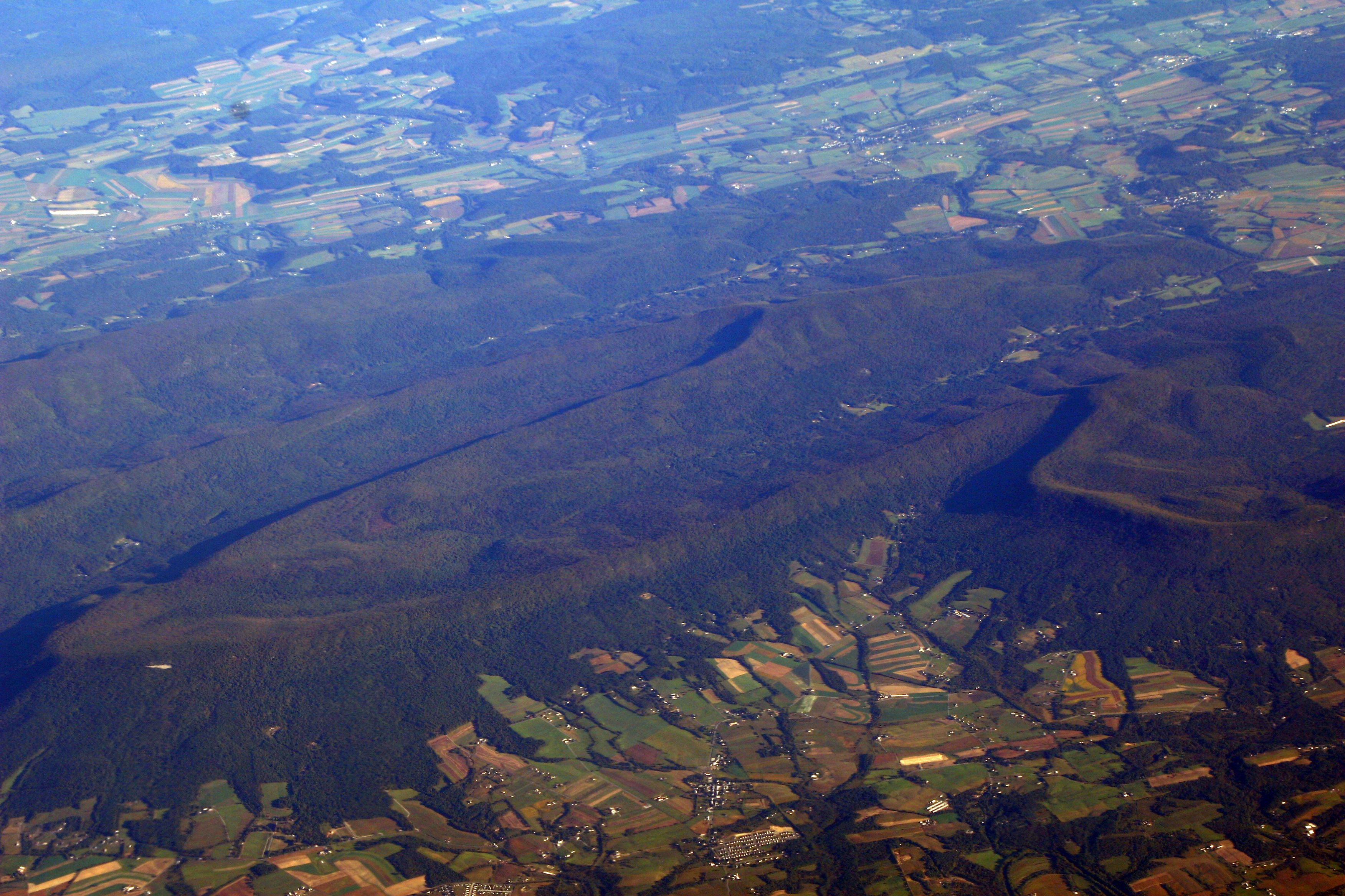
Blue Mountain, Blue Mountain Ridge, or the Blue Mountains of Pennsylvania, is a ridge of the Appalachian Mountains in eastern Pennsylvania. Forming the southern and eastern edge of the Ridge-and-Valley Appalachians physiographic province in Pennsylvania, Blue Mountain extends from the Delaware Water Gap on the New Jersey border in the east to Big Gap in Franklin County, Pennsylvania, Franklin County in south-central Pennsylvania at its southwestern end. Views of Blue Mountain dominate the southern tier of most eastern and central Pennsylvanian counties, providing an ever-visible backdrop cutting across the northern or western horizon. Most transport corridors and road beds piercing the barrier necessarily pass through either large water gaps (west to east: the Susquehanna River, Susquehanna, Schuylkill River, Schuylkill, Lehigh River, Lehigh and Delaware River valleys) or wind gaps, low gaps in the ridge caused by ancient watercourses. The barrier ridge forms a distinct boundary ... [...More Info...] [...Related Items...] OR: [Wikipedia] [Google] [Baidu] |
Blue Ridge Mountain, Pennsylvania
Blue Ridge Mountain is an isolated single peak in Wyoming County, Pennsylvania overlooking a loop of the Main Branch Susquehanna River in the sparsely settled Endless Mountains in Northeastern Pennsylvania a couple of miles west of Meshoppen at latitude, longitude coordinates: 41.6078537, -76.0929827 overlooking the northern end of the Wyoming Valley region. U.S. Route 6, a main east-west secondary highway and the railroad tracks built by the Lehigh Valley Railroad once followed by the famous ''Black Diamond Express'' named luxury trains on their daily runs from New York City to Buffalo, New York passes by its foot between the summit and the left bank In geography, a bank is the land alongside a body of water. Different structures are referred to as ''banks'' in different fields of geography, as follows. In limnology (the study of inland waters), a stream bank or river bank is the terrai ... (north) of the Susquehanna River. References Mountains of Pennsylvania End ... [...More Info...] [...Related Items...] OR: [Wikipedia] [Google] [Baidu] |
Susquehanna River
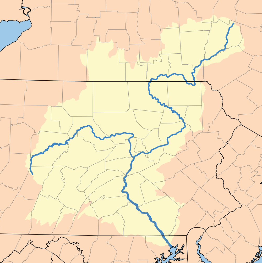
The Susquehanna River (; Lenape: Siskëwahane) is a major river located in the Mid-Atlantic region of the United States, overlapping between the lower Northeast and the Upland South. At long, it is the longest river on the East Coast of the United States. By watershed area, it is the 16th-largest river in the United States,Susquehanna River Trail Pennsylvania Fish and Boat Commission, accessed March 25, 2010.Susquehanna River , Green Works Radio, accessed March 25, 2010. and also the longest river in ... [...More Info...] [...Related Items...] OR: [Wikipedia] [Google] [Baidu] |
Harrisburg, Pennsylvania
Harrisburg is the capital city of the Commonwealth of Pennsylvania, United States, and the county seat of Dauphin County. With a population of 50,135 as of the 2021 census, Harrisburg is the 9th largest city and 15th largest municipality in Pennsylvania. Harrisburg is situated on the east bank of the Susquehanna River. It is the larger principal city of the Harrisburg–Carlisle metropolitan statistical area, also known as the Susquehanna Valley, which had a population of 591,712 as of 2020, making it the fourth most populous metropolitan area in Pennsylvania after the Philadelphia, Pittsburgh, and Lehigh Valley metropolitan areas. Harrisburg played a role in American history during the Westward Migration, the American Civil War, and the Industrial Revolution. During part of the 19th century, the building of the Pennsylvania Canal and later the Pennsylvania Railroad allowed Harrisburg to develop into one of the most industrialized cities in the Northeastern United States. ... [...More Info...] [...Related Items...] OR: [Wikipedia] [Google] [Baidu] |
Harrisburg–Carlisle Metropolitan Statistical Area
The Harrisburg–Carlisle metropolitan statistical area, officially the Harrisburg–Carlisle, PA Metropolitan Statistical Area, and also referred to as the Susquehanna Valley, is defined by the Office of Management and Budget as an area consisting of three counties in South Central Pennsylvania, anchored by the cities of Harrisburg and Carlisle. As of the 2020 census, the metropolitan statistical area (MSA) had a population of 591,712, making it the fourth-most-populous metropolitan area in Pennsylvania, after the Delaware Valley, Greater Pittsburgh, and the Lehigh Valley. Since 2012, it has been defined as part of the Harrisburg–York–Lebanon combined statistical area, which also includes York, Lebanon and Adams counties. Components The Harrisburg–Carlisle Metropolitan Area consists of three counties, located entirely within the Commonwealth of Pennsylvania. The following three counties are designated as being part of the greater Harrisburg–Carlisle area: * Cum ... [...More Info...] [...Related Items...] OR: [Wikipedia] [Google] [Baidu] |
Pocono Mountains
The Pocono Mountains, commonly referred to as the Poconos , are a geographical, geological, and cultural region in Northeastern Pennsylvania. They overlook the Delaware River and Delaware Water Gap to the east, Lake Wallenpaupack to the north, Wyoming Valley and the Coal Region to the west, and the Lehigh Valley to the south. The name Pocono is derived from the Munsee word Pokawachne, which means "Creek Between Two Hills". Much of the Poconos region lies within the Greater New York–Newark, NY–NJ–CT–PA Combined Statistical Area. The wooded hills and valleys have long been a popular recreation area, accessible within a two-hour drive to millions of metropolitan area residents, with many Pocono communities having resort hotels with fishing, hunting, skiing, and other sports facilities. The Poconos are an upland of the larger Allegheny Plateau, forming a escarpment. Population The Pocono Mountains are a popular recreational destination for local and regional visitors. W ... [...More Info...] [...Related Items...] OR: [Wikipedia] [Google] [Baidu] |
Wyoming Valley
The Wyoming Valley is a historic industrialized region of Northeastern Pennsylvania. The region is historically notable for its influence in helping fuel the American Industrial Revolution with its many anthracite coal-mines. As a metropolitan area, it is known as the Scranton/Wilkes-Barre metropolitan area, after its principal cities, Scranton and Wilkes-Barre. With a population of 567,559 as of the 2020 United States census, it is the fifth-largest metropolitan area in Pennsylvania, after the Delaware Valley, Greater Pittsburgh, the Lehigh Valley, and the Harrisburg–Carlisle metropolitan statistical areas. Within the geology of Pennsylvania the Wyoming Valley makes up its own unique physiographic province, the Anthracite Valley. Greater Pittston occupies the center of the valley. Scranton is the most populated city in the metropolitan area with a population of 77,114. The city of Scranton grew in population after the 2015 mid-term census while Wilkes-Barre declined in po ... [...More Info...] [...Related Items...] OR: [Wikipedia] [Google] [Baidu] |
Coal Region
The Coal Region is a region of Northeastern Pennsylvania. It is known for being home to the largest known deposits of anthracite, anthracite coal in the world with an estimated reserve of seven billion short tons. The region is typically defined as comprising five Pennsylvania counties, Carbon County, Pennsylvania, Carbon County, Lackawanna County, Pennsylvania, Lackawanna County, Luzerne County, Pennsylvania, Luzerne County, Northumberland County, Pennsylvania, Northumberland County, and Schuylkill County, Pennsylvania, Schuylkill County. It is home to 910,716 people as of the 2010 census. The Coal Region is bordered by Berks County, Pennsylvania, Berks, Lehigh County, Pennsylvania, Lehigh, and Northampton County, Pennsylvania, Northampton Counties (including the Lehigh Valley) to its south; Columbia County, Pennsylvania, Columbia and Dauphin County, Pennsylvania, Dauphin Counties to its west; Wyoming County, Pennsylvania, Wyoming County to its north; and Warren County, New Je ... [...More Info...] [...Related Items...] OR: [Wikipedia] [Google] [Baidu] |
Main Branch Susquehanna
The Susquehanna River (; Lenape: Siskëwahane) is a major river located in the Mid-Atlantic region of the United States, overlapping between the lower Northeast and the Upland South. At long, it is the longest river on the East Coast of the United States. By watershed area, it is the 16th-largest river in the United States,Susquehanna River Trail , accessed March 25, 2010.Susquehanna River , Green Works Radio, accessed March 25, 2010. ... [...More Info...] [...Related Items...] OR: [Wikipedia] [Google] [Baidu] |
Susquehanna Valley
The Susquehanna Valley is a region of low-lying land that borders the Susquehanna River in the United States, U.S. states of New York (state), New York, Pennsylvania, and Maryland. The valley consists of areas that lie along the main branch of the river, which flows from Upstate New York through Pennsylvania and Maryland into the Chesapeake Bay, as well as areas that lie along the shorter West Branch Susquehanna River, West Branch in Pennsylvania. Communities in the valley Main Branch Cities * Oneonta, New York * Binghamton, New York * Wilkes-Barre, Pennsylvania * Scranton, Pennsylvania * Sunbury, Pennsylvania * Harrisburg, Pennsylvania * York, Pennsylvania * Havre de Grace, Maryland Counties * Otsego County, New York * Delaware County, New York * Chenango County, New York * Broome County, New York * Susquehanna County, Pennsylvania * Tioga County, New York * Bradford County, Pennsylvania * Wyoming County, Pennsylvania * Lackawanna County, Pennsylvania * Luzerne Cou ... [...More Info...] [...Related Items...] OR: [Wikipedia] [Google] [Baidu] |
Cumberland Valley
The Cumberland Valley is a northern constituent valley of the Great Appalachian Valley, within the Atlantic Seaboard watershed in Pennsylvania and Maryland. The Appalachian Trail crosses through the valley. Geography The valley is bound to the west and north by the Ridge-and-Valley Appalachians (Bear Pond Mountains/Blue Mountain (Pennsylvania), Blue Mountain), to the east and south by South Mountain (Maryland and Pennsylvania), South Mountain, to the northeast by the Susquehanna River at Harrisburg, Pennsylvania, Harrisburg, and to the south by the Potomac River. The portion of the valley residing in Maryland is sometimes referred to as the Hagerstown Valley. The Cumberland Valley Railroad, the Cumberland Valley AVA wine region, and the Cumberland Valley School District are named for the region. Settlements Cities in the Cumberland Valley include Harrisburg, Pennsylvania, [...More Info...] [...Related Items...] OR: [Wikipedia] [Google] [Baidu] |
Barrier Ridge
The terms barrier ridge, a term of art in the earth sciences, especially geology and sometimes barrier range (more common as a geography term) describing the existence of gross landforms describing long ridgelines which are particularly difficult to pass, ''especially in the context of being on foot'' or dependent upon other forms of animal powered transportation systems, in mountainous and sometimes hilly terrains. ''Barrier ridges'' such as the steep rising slopes or escarpments of the Allegheny Front, separating the ridge-and-valley Appalachians from the drainage divides of the uplands of the Appalachian Plateau. The ridge and valley region is filled with a succession of nearly impassible ridges from Southern Georgia, along the Appalachian chain all the way to Maine. Notes References External links *{{Commons category-inline Geography terminology Landscape Landforms ... [...More Info...] [...Related Items...] OR: [Wikipedia] [Google] [Baidu] |
Wind Gap
A wind gap (or air gap) is a gap through which a waterway once flowed that is now dry as a result of stream capture. A water gap is a similar feature, but one in which a waterway still flows. Water gaps and wind gaps often provide routes which, due to their gently inclined profile, are suitable for trails, roads, and railroads through mountainous terrain. Examples of wind gaps in the Blue Ridge Mountains of Virginia include Swift Run Gap, Rockfish Gap, and Buford's Gap. The last was the original crossing of the Blue Ridge Mountains near Bedford for the Virginia and Tennessee Railroad, later the Norfolk and Western Railway, a precursor of today's Norfolk Southern Railway system. Another wind gap with substantial importance in U.S. history is the Cumberland Gap near the junction of Kentucky, Virginia, and Tennessee. Gallery Rockfish Gap November 2009.jpg, Wind gap Rockfish Gap, Blue Ridge Mountains, Virginia Desfiladero C Encantada.jpg, Wind gap opened by an ancient stream on ... [...More Info...] [...Related Items...] OR: [Wikipedia] [Google] [Baidu] |
_(12735489134).jpg)


