|
Black Lake (Nova Scotia)
There are various Black Lakes in Nova Scotia, Canada. They vary widely in size, depth and usability. Many counties, such as Cumberland, Halifax, Inverness, and Pictou Counties have more than one Black Lake so named, while other counties mentioned in this article have only one named Black Lake. Colchester County There a Black Lake in Colchester County, Nova Scotia south of the collector road Nova Scotia Route 256, 256 and north of the Highway Nova Scotia Highway 104, 104 near Clear Lake. It is located at: Cumberland County There are two Black Lakes in Cumberland County, Nova Scotia. One is located at . The lake is northeast of Parrsboro. Fish include brown trout, white perch and smallmouth bass. The lake is surrounded by nutrient poor coniferous forest dominated by black spruce canopy, with high shrub and sphagnum moss cover. As of 2005 there was a woodlot near the lake with about 200 specimens of the economically valuable Northern White Cedar. The other Black Lake in Cumberl ... [...More Info...] [...Related Items...] OR: [Wikipedia] [Google] [Baidu] |
Nova Scotia
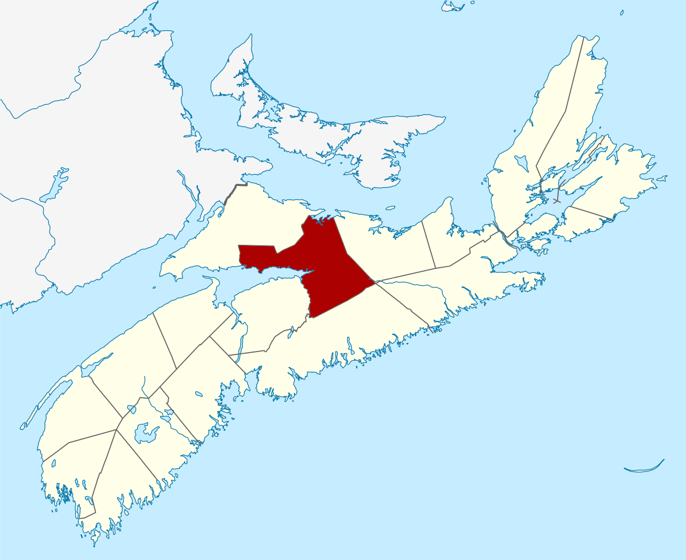
Nova Scotia ( ; ; ) is one of the thirteen provinces and territories of Canada. It is one of the three Maritime provinces and one of the four Atlantic provinces. Nova Scotia is Latin for "New Scotland". Most of the population are native English-speakers, and the province's population is 969,383 according to the 2021 Census. It is the most populous of Canada's Atlantic provinces. It is the country's second-most densely populated province and second-smallest province by area, both after Prince Edward Island. Its area of includes Cape Breton Island and 3,800 other coastal islands. The Nova Scotia peninsula is connected to the rest of North America by the Isthmus of Chignecto, on which the province's land border with New Brunswick is located. The province borders the Bay of Fundy and Gulf of Maine to the west and the Atlantic Ocean to the south and east, and is separated from Prince Edward Island and the island of Newfoundland by the Northumberland and Cabot straits, ... [...More Info...] [...Related Items...] OR: [Wikipedia] [Google] [Baidu] |
Atlas Of Canada
The Atlas of Canada (french: L'Atlas du Canada) is an online atlas published by Natural Resources Canada that has information on every city, town, village, and hamlet in Canada. It was originally a print atlas, with its first edition being published in 1906 by geographer James White and a team of 20 cartographers. Much of the geospatial data used in the atlas is available for download and commercial re-use from the Atlas of Canada site or from GeoGratis. Information used to develop the atlas is used in conjunction with information from Mexico and the United States The United States of America (U.S.A. or USA), commonly known as the United States (U.S. or US) or America, is a country Continental United States, primarily located in North America. It consists of 50 U.S. state, states, a Washington, D.C., ... to produce collaborative continental-scale tools such as the North American Environmental Atlas. External links {{Portal, Geography, Canada The Atlas of Canada * The 191 ... [...More Info...] [...Related Items...] OR: [Wikipedia] [Google] [Baidu] |
Bras D'Or Lake
Bras d'Or Lake ( Mi'kmawi'simk: Pitupaq) is an irregular estuary in the centre of Cape Breton Island in Nova Scotia, Canada. It has a connection to the open sea, and is tidal. It also has inflows of fresh water from rivers, making the brackish water a very productive natural habitat. It was designated the Bras d'Or Lake Biosphere Reserve by UNESCO in 2011. Toponym Pronounced ( or ), maps before 1872 name it ''Le Lac de Labrador'' (or more simply ''Labrador''). ''Labrador'' was the name given by the Portuguese to much of eastern Canada. It meant ''farmer'', and is cognate with ''laborer''. An error of folk etymology, the name is spelt to resemble the French language ''Arm of'' ''Gold'', a homonym. It is also called locally ''The Bras d'Or Lakes''. In Mi'kmawi'simk, the lake's name, ''Pitupaq'', refers to the brackish waters, meaning "the long salt water." Geography The lake has a surface area of 1099 square kilometers. Three arms stretch out to the north east. At t ... [...More Info...] [...Related Items...] OR: [Wikipedia] [Google] [Baidu] |
Inverness County, Nova Scotia
Inverness County is an historical county and census division of Nova Scotia, Canada. Local government is provided by the Municipality of the County of Inverness, the town of Port Hawkesbury and the Whycocomagh 2 Waycobah First Nation reserve. History Established as the County of Juste au Corps in 1835, Inverness County was given its present name in 1837. It was named after Sir Cameron Inverness of Scotland, the land from which many of the early settlers came. Agriculture and fishing dominated the economy with exports of butter and cattle to Newfoundland and Halifax for most of the nineteenth century. The construction of the Inverness and Richmond Railway in 1901, and the subsequent opening of coal mines at Port Hood, Mabou, and Inverness, created the "only home market" local farmers had ever had. The boundaries of Inverness County had been previously defined when Cape Breton Island was divided by statute into three districts in 1823. In 1996, the county was amalgamated into a ... [...More Info...] [...Related Items...] OR: [Wikipedia] [Google] [Baidu] |
Cape Breton Island
Cape Breton Island (french: link=no, île du Cap-Breton, formerly '; gd, Ceap Breatainn or '; mic, Unamaꞌki) is an island on the Atlantic coast of North America and part of the province of Nova Scotia, Canada. The island accounts for 18.7% of Nova Scotia's total area. Although the island is physically separated from the Nova Scotia peninsula by the Strait of Canso, the long Canso Causeway connects it to mainland Nova Scotia. The island is east-northeast of the mainland with its northern and western coasts fronting on the Gulf of Saint Lawrence with its western coast forming the eastern limits of the Northumberland Strait. The eastern and southern coasts front the Atlantic Ocean with its eastern coast also forming the western limits of the Cabot Strait. Its landmass slopes upward from south to north, culminating in the highlands of its northern cape. One of the world's larger saltwater lakes, ("Arm of Gold" in French), dominates the island's centre. The total populatio ... [...More Info...] [...Related Items...] OR: [Wikipedia] [Google] [Baidu] |
Lake
A lake is an area filled with water, localized in a basin, surrounded by land, and distinct from any river or other outlet that serves to feed or drain the lake. Lakes lie on land and are not part of the ocean, although, like the much larger oceans, they do form part of the Earth's water cycle. Lakes are distinct from lagoons, which are generally coastal parts of the ocean. Lakes are typically larger and deeper than ponds, which also lie on land, though there are no official or scientific definitions. Lakes can be contrasted with rivers or streams, which usually flow in a channel on land. Most lakes are fed and drained by rivers and streams. Natural lakes are generally found in mountainous areas, rift zones, and areas with ongoing glaciation. Other lakes are found in endorheic basins or along the courses of mature rivers, where a river channel has widened into a basin. Some parts of the world have many lakes formed by the chaotic drainage patterns left over from the la ... [...More Info...] [...Related Items...] OR: [Wikipedia] [Google] [Baidu] |
Bedford Basin
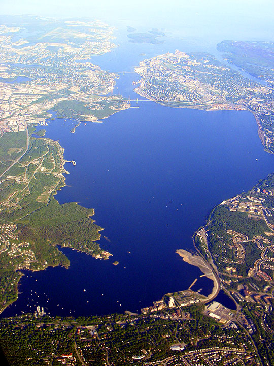
Bedford Basin is a large enclosed bay, forming the northwestern end of Halifax Harbour on Canada's Atlantic coast. It is named in honour of John Russell, 4th Duke of Bedford. Geography Geographically, the basin is situated entirely within the Halifax Regional Municipality and is oriented northwest-southeast, measuring approximately 8 kilometres long and 5 kilometres wide, surrounded by low hills measuring up to 160 metres (525 feet) in elevation, although most elevations range up to 30–60 m (100–200 ft). The basin is quite deep with some areas measuring several dozen metres in depth; the good holding ground (mud) on the basin floor make it an ideal protected anchorage. The basin's geologic history can be traced to the Wisconsin Glaciation when it, along with "The Narrows", formed part of the pre-historic Sackville River valley. The basin contains the following sub-basins: * Bedford Bay, in the extreme northwest. * Birch Cove, on the western shore. * Fairview Co ... [...More Info...] [...Related Items...] OR: [Wikipedia] [Google] [Baidu] |
Dartmouth, Nova Scotia
Dartmouth ( ) is an urban community and former city located in the Halifax, Nova Scotia, Halifax Regional Municipality of Nova Scotia, Canada. Dartmouth is located on the eastern shore of Halifax Harbour. Dartmouth has been nicknamed the City of Lakes, after the large number of lakes located within its boundaries. On April 1, 1996, the provincial government amalgamated all the municipalities within the boundaries of Halifax County, Nova Scotia, Halifax County into a single-tier regional government named the Halifax Regional Municipality (HRM). Dartmouth and its neighbouring city of Halifax, the town of Bedford, Nova Scotia, Bedford and the Municipality of the County of Halifax were dissolved. The city of Dartmouth forms part of the urban core of the larger regional municipality and is officially designated as part of the "capital district" by the Halifax Regional Municipality. At the time that the City of Dartmouth was dissolved, the provincial government altered its status to a ... [...More Info...] [...Related Items...] OR: [Wikipedia] [Google] [Baidu] |
Halifax Regional Municipality
Halifax is the capital and largest municipality of the Provinces and territories of Canada, Canadian province of Nova Scotia, and the largest municipality in Atlantic Canada. As of the 2021 Census, the municipal population was 439,819, with 348,634 people in its urban area. The regional municipality consists of four former municipalities that were Amalgamation (politics), amalgamated in 1996: History of Halifax (former city), Halifax, Dartmouth, Nova Scotia, Dartmouth, Bedford, Nova Scotia, Bedford, and Halifax County, Nova Scotia, Halifax County. Halifax is a major economic centre in Atlantic Canada, with a large concentration of government services and private sector companies. Major employers and economic generators include the Canadian Armed Forces, Department of National Defence, Dalhousie University, Nova Scotia Health Authority, Saint Mary's University (Halifax), Saint Mary's University, the Halifax Shipyard, various levels of government, and the Port of Halifax. Agricult ... [...More Info...] [...Related Items...] OR: [Wikipedia] [Google] [Baidu] |


.jpg)
