|
Bitter Spring Valley
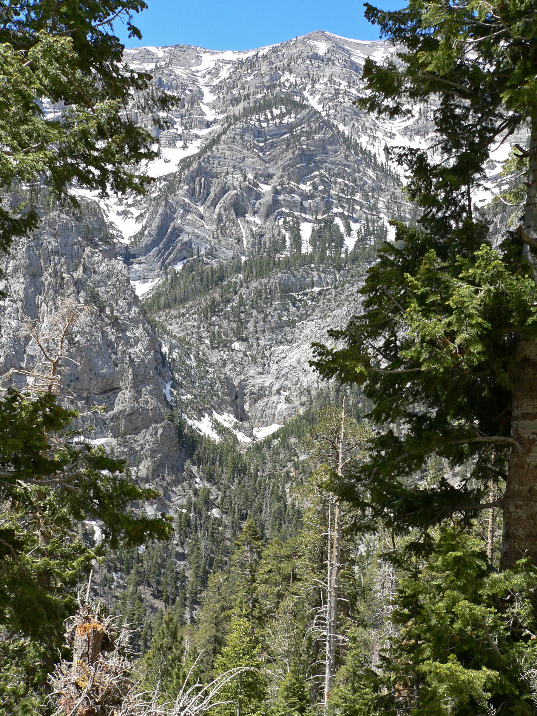
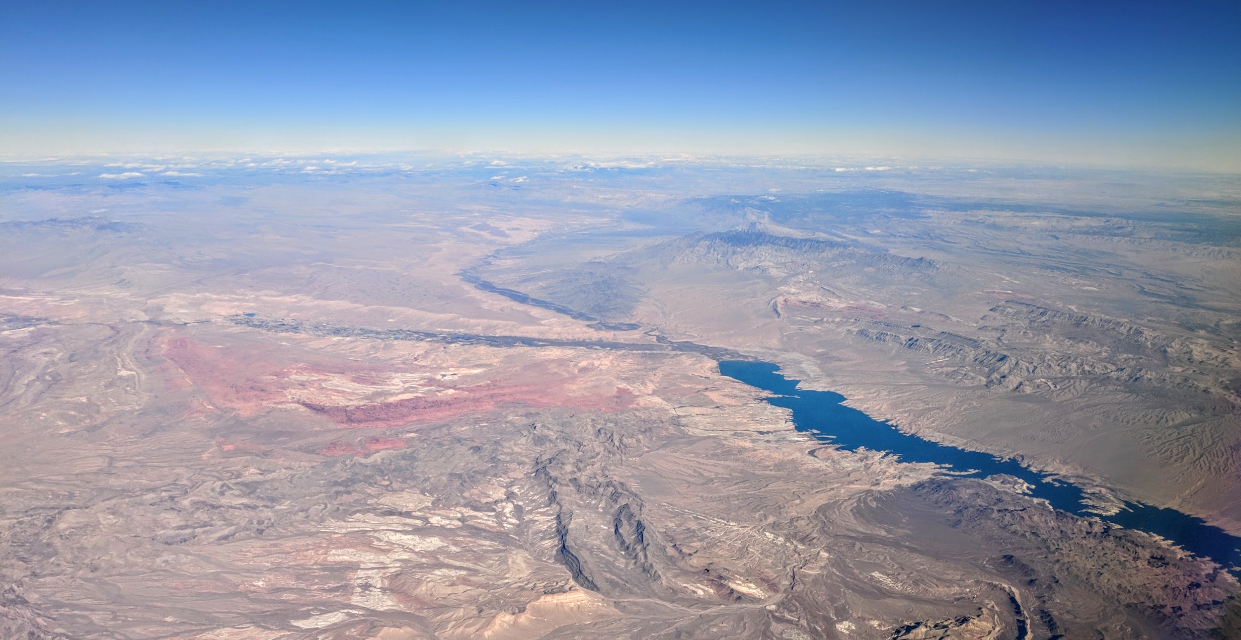
The Bitter Spring Valley is a 13-mile (21 km) longNevada DeLorme Atlas & Gazetteer, pp. 70-71. valley located northeast of Las Vegas, Nevada on the west edge of Lake Mead, on the north-trending Overton Arm, (of the Virgin River, and Meadow Valley Wash). The valley is a small valley basin located between two bordering mountain ranges. The Bitter Spring Wash exits east-northeastwards into the Overton Arm of Lake Mead, at Echo Bay, Nevada. The Valley of Fire State Park lies adjacent north, on the north side of the Muddy Mountains. An unimproved route, named Bitter Spring Trail traverses the Muddy Mountains and the valley from paved routes from Echo Bay to Valley of Fire Highway, and Interstate 15. Description Bitter Spring Valley is about in width. The arc shaped long Bitter Ridge separates the longer South Section from a North Section surrounded by the Muddy Mountains west, northwest, and north. The North Section drains southeastwards into two washes that meet the South Sec ... [...More Info...] [...Related Items...] OR: [Wikipedia] [Google] [Baidu] |
Clark County, Nevada
Clark County is located in the U.S. state of Nevada. As of the 2020 census, the population was 2,265,461. Most of the county population resides in the Las Vegas Census County Divisions, which hold 1,771,945 people as of the 2010 Census, across . It is by far the most populous county in Nevada, and the 11th most populous county in the United States. It covers 7% of the state's land area but holds 74% of the state's population, making Nevada one of the most centralized states in the United States. History Las Vegas, the state's most populous city, has been the county seat since its establishment. The county was formed by the Nevada Legislature by splitting off a portion of Lincoln County, Nevada, Lincoln County on February 5, 1909, and was organized on July 1, 1909. The Las Vegas Valley (landform), Las Vegas Valley, a basin, includes Las Vegas and other major cities and communities such as North Las Vegas, Henderson, Nevada, Henderson, and the unincorporated community of Parad ... [...More Info...] [...Related Items...] OR: [Wikipedia] [Google] [Baidu] |
Echo Bay, Nevada
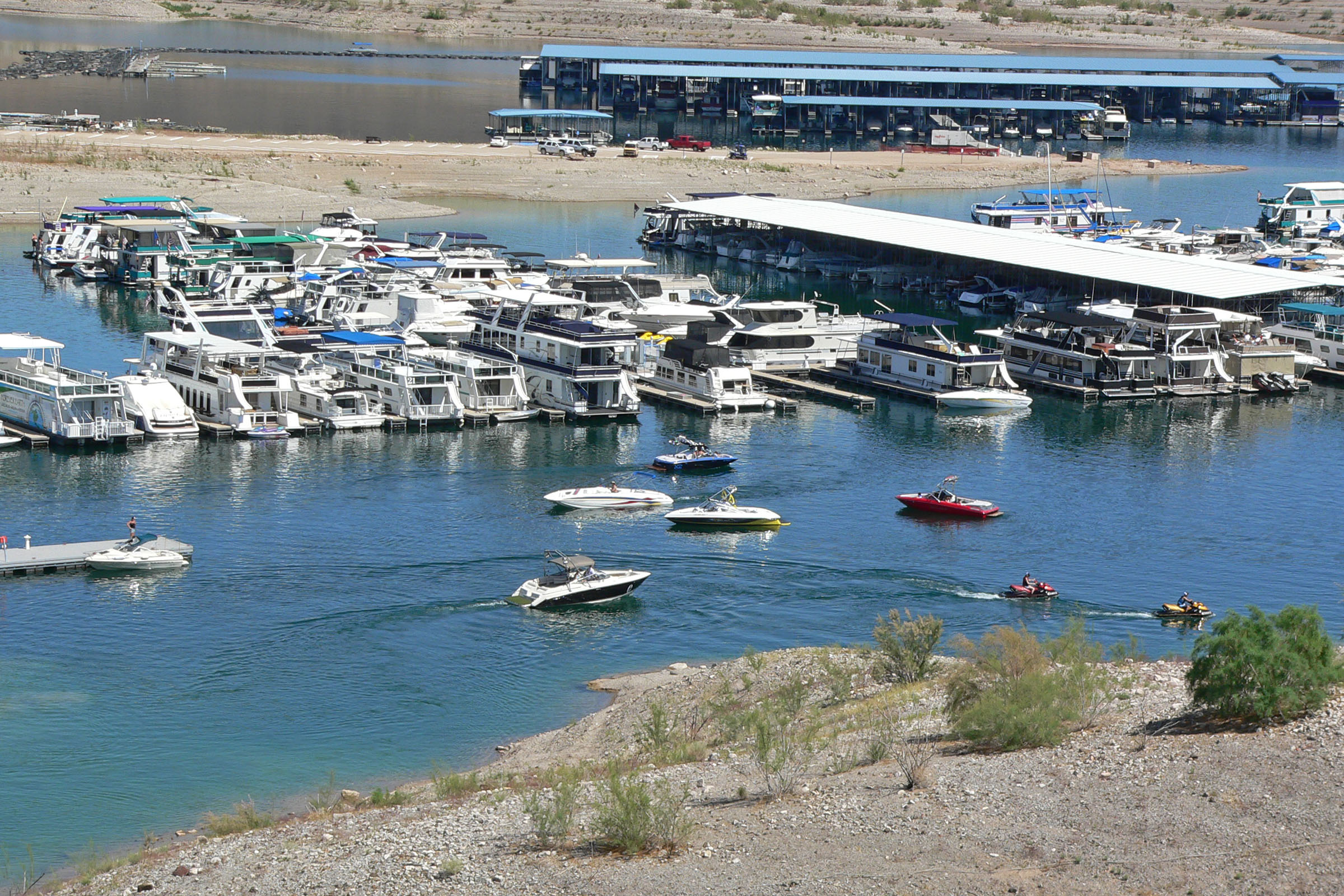
Echo Bay is an unincorporated community in the U.S. state of Nevada. It is located on the western shore of the Overton Arm (northern portion of Lake Mead), within the Lake Mead National Recreation Area. The community contains a campground run by the National Park Service and a boat ramp. There used to be a marina there as well, but it closed in February 2013. Approximately 200,000 people visit Echo Bay annually. There was a small trailer park for housing. Pierre Omidyar, founder of eBay, used to frequent the Echo Bay marina before it closed in 2013, and the area is credited for being the inspiration for the name of the online auction marketplace. He was said to have a fondness for the area and when asked about the reason behind the name choice, he said that Echo Bay "just sounded cool." The web address Echo Bay Mines, echobay.com was already taken by a Canadian mining company at the time, so he went with his second choice of eBay.com. References [...More Info...] [...Related Items...] OR: [Wikipedia] [Google] [Baidu] |
Overton Beach, Nevada
Overton may refer to: Places Canada * Overton, Nova Scotia United Kingdom * Overton, Aberdeen, a location * Overton, Frodsham, a location in Cheshire * Overton, Malpas, Cheshire * Overton, Gloucestershire, a hamlet in the parish of Arlingham * Overton, Greenock, Inverclyde * Overton, Hampshire * Overton, Lancashire * Overton, North Yorkshire * Overton, Shropshire * Overton, Staffordshire, a location * Overton, Swansea * Overton, West Yorkshire * Overton, a settlement in Cunninghamhead, Perceton and Annick Lodge, Ayrshire * Overton, an area of Halfway, South Lanarkshire * Overton Down, an experimental archaeology site * Overton or Overton-on-Dee, Wrexham * Cold Overton, Leicestershire * Market Overton, Rutland * West Overton, Wiltshire United States * Overton, Missouri * Overton, Nebraska * Overton, Nevada * Overton, Ohio * Overton, Texas * Overton, Virginia * Overton County, Tennessee * Overton Township, Bradford County, Pennsylvania * West Overton, Pennsylvania Oth ... [...More Info...] [...Related Items...] OR: [Wikipedia] [Google] [Baidu] |
Henderson, Nevada
Henderson is a city in Clark County, Nevada, United States, about southeast of downtown Las Vegas. It is the second largest city in Nevada, after Las Vegas, with an estimated population of 320,189 in 2019. The city is part of the Las Vegas Valley. Henderson occupies the southeastern end of the valley, at an elevation of . Henderson is known for its supply of magnesium during World War II. With the decline of magnesium production, the Nevada legislature approved a bill that gave Nevada's Colorado River Commission the authority to purchase the industrial plants, and Henderson was incorporated in 1953. Henderson is the location of Lake Las Vegas. History The township of Henderson first emerged in the 1940s during World War II with the building of the Basic Magnesium Plant. Henderson quickly became the main supplier of magnesium in the United States, which was called the "miracle metal" of World War II. The plant supplied the US War Department with magnesium for incendiary munitio ... [...More Info...] [...Related Items...] OR: [Wikipedia] [Google] [Baidu] |
Nevada State Route 564
State Route 564 (SR 564) is an east–west highway in Clark County, Nevada, in the southeast portion of the Las Vegas Valley. The route travels through the city of Henderson, traveling from the junction of Interstate 215 (I-215) and I-11 south and I-515 north, also part of U.S. Route 93 (US 93) and US 95, to Lake Las Vegas, ending near Lake Mead. The route was designated in 2002, replacing a portion of SR 146. Route description State Route 564 begins as a continuation of the Las Vegas Beltway, starting where I-215 ends at its junction with I-11 and I-515, which are concurrent with US 93 and US 95. From there, the route travels east along Lake Mead Parkway, a major arterial roadway, towards downtown Henderson and intersects the Boulder Highway ( SR 582). SR 564 continues northeast through Henderson's residential neighborhoods and turns east just west of Lake Mead National Recreation Area. SR 564 enters the park, at a point southeast of Lake Las Vegas, and terminates at ... [...More Info...] [...Related Items...] OR: [Wikipedia] [Google] [Baidu] |
Muddy Peak
Muddy Peak is the second tallest summit A summit is a point on a surface that is higher in elevation than all points immediately adjacent to it. The topography, topographic terms acme, apex, peak (mountain peak), and zenith are synonymous. The term (mountain top) is generally used ... in the Muddy Mountains in Clark County, Nevada. It rises to an elevation of . External links Muddy Peak, Nevada; Prominence: ; Elevation: from peakbagger.com accessed December 24, 2016] References {{reflist Mountains of Clark County, Nevada Mountains of Nevada Muddy Mountains ... [...More Info...] [...Related Items...] OR: [Wikipedia] [Google] [Baidu] |
Interstate 15 In Nevada
Interstate 15 (I-15) is an Interstate Highway in the U.S. state of Nevada that begins in Primm, continues through Las Vegas and it crosses the border with Arizona in Mesquite. Within the state, the freeway runs entirely in Clark County. The highway was built along the corridor of the older U.S. Route 91 (US 91) and Arrowhead Trail, eventually replacing both of these roads. The entire route of I-15 is designated the Las Vegas Freeway. Route description Motorists in California begin a long descent through Ivanpah Valley and Ivanpah Dry Lake. I-15 crosses the Nevada state line at the first exit, Primm. Once I-15 leaves Primm, the route travels north through the desert with few services. The highway then enters the Las Vegas urban area upon passing the State Route 146 (SR 146, Saint Rose Parkway) interchange. From Silverado Ranch Boulevard to US 95, the freeway has HOV lanes that are currently enforced by both Metro and NHP, 24 hours a day an ... [...More Info...] [...Related Items...] OR: [Wikipedia] [Google] [Baidu] |
Valley Of Fire State Park
Valley of Fire State Park is a public recreation and nature preservation area covering nearly located south of Overton, Nevada. The state park derives its name from red sandstone formations, the Aztec Sandstone, which formed from shifting sand dunes 150 million years ago. These features, which are the centerpiece of the park's attractions, often appear to be on fire when reflecting the sun's rays. It is Nevada's oldest state park, as commemorated with Nevada Historical Marker #150. It was designated as a National Natural Landmark in 1968. Valley of Fire is located in the Mojave Desert northeast of Las Vegas, at an elevation between . It abuts the Lake Mead National Recreation Area on the east at the Virgin River confluence. It lies in a basin. Geology Complex uplifting and faulting of the region, followed by extensive erosion, have created the present landscape. The rough floor and jagged walls of the park contain brilliant formations of eroded sandstone and sand dunes mor ... [...More Info...] [...Related Items...] OR: [Wikipedia] [Google] [Baidu] |
Meadow Valley Wash
The Meadow Valley Wash is a southern Nevada stream draining the Meadow Watershed that is bordered on three sides by the Great Basin Divide. The wash's Lincoln County head point is in the Wilson Creek Range, and the wash includes two upper confluences (e.g., the Patterson Wash). Panaca is along the upper wash, and downstream of Caliente is the wash's confluence with its east fork. Just before the junction with the Muddy River, the wash flows from Lincoln County into northeastern Clark County. It flows into the Muddy in the Moapa Valley just west of Glendale adjacent to Interstate 15 approximately northwest of Las Vegas. In addition to the Wilson Creek Range, the watershed's drainage divide is in the Delamar Mountains (to the west) and the Meadow Valley Range (east). The northern tip of the watershed is a triple watershed point with two Great Basin subregions: the Central Nevada Desert Basins and the Escalante-Sevier subregion. History William Andrews Clark's 1903– ... [...More Info...] [...Related Items...] OR: [Wikipedia] [Google] [Baidu] |
Callville Bay
Callville Bay is a waterway on the northwestern side of Lake Mead in the U.S. state of Nevada. It has a marina and camping resort. Situated east of Las Vegas and upstream from Las Vegas Bay, it lies within the Lake Mead National Recreation Area, which was established in 1935. Its name derives from the settlement of Callville which was established in 1865 by Anson Call under a directive led by Brigham Young. Though the settlement was abandoned in 1869, and submerged under Lake Mead when the Colorado River was dammed, Callville Bay retained the name. History The bay derives its name from the permanent settlement of Callville, known alternately as Call's Landing, Call's Fort, and Old Callville. The settlement, containing residences, a warehouse, and irrigation systems, was established in December 2, 1864 by Anson Call, James Whitmore, A. M. Cannon, Jacob Hamblin and son, under a directive to Call by Brigham Young. The steamboat port of Callville was used for shipping freight to Salt ... [...More Info...] [...Related Items...] OR: [Wikipedia] [Google] [Baidu] |
Virgin River
The Virgin River is a tributary of the Colorado River in the U.S. states of Utah, Nevada, and Arizona. The river is about long.Calculated with Google Maps and Google Earth It was designated Utah's first wild and scenic river in 2009, during the centennial celebration of Zion National Park. History The first known Euro-American party to encounter the Virgin was led by Jedediah Smith in 1826. Smith named it "Adams River", after then-president John Quincy Adams.Smith, Jedediah S., arrison G. Rogers and George R. Brooks (ed.). ''The Southwest Expedition of Jedediah S. Smith: His Personal Account of the Journey to California, 1826–1827'', p. 55. Lincoln and London, University of Nebraska Press, 9771989. Later explorer and mapmaker John C. Fremont reported that it was called "Rio Virgen" but did not state the origin of the name. Hiram Chittenden speculated that Smith had later renamed the river after Thomas Virgin, who was badly wounded in an 1827 attack by Mohave people during ... [...More Info...] [...Related Items...] OR: [Wikipedia] [Google] [Baidu] |


.jpg)


