|
Birrong
Birrong, a suburb of local government area City of Canterbury-Bankstown, is located 22 kilometres south-west of the Sydney central business district, in the state of New South Wales, Australia, and is a part of the South-western Sydney region. Birrong shares its postcode of 2143 with neighboring suburbs Regents Park and Potts Hill. Landmarks Birrong features a large number of community facilities such as six soccer/rugby league fields, tennis courts, a large natural park reserve, a bowls club, and a swimming pool. Birrong also has two high schools, Birrong Boys High School and Birrong Girls High School, and a primary school. A small group of shops is located on Auburn Road, featuring a barber, bakery, newsagent, IGA (including bottle shop and butcher), hair salon and florist. History The Aboriginal word Birrong, meaning ''star'', was adopted as the suburb's name around 1927. One of the first settlers of Birrong was Joseph Hyde Potts who was granted land in the area in 183 ... [...More Info...] [...Related Items...] OR: [Wikipedia] [Google] [Baidu] |
Birrong Railway Station
Birrong railway station is located on the Bankstown line, serving the Sydney suburb of Birrong. It is served by Sydney Trains T3 Bankstown line services. History Birrong station opened on 16 July 1928, when the Bankstown line was extended from Bankstown to Regents Park. To the north of the station lies Sefton Park Junction with services heading north to Lidcombe and west to Liverpool on the Main South line. The Bankstown line also passes over the Southern Sydney Freight Line. Birrong is now a key interchange station on the Bankstown Line for passengers travelling along the Liverpool via Regents Park route due to the removal of services from this route on 20 October 2013. In 2020, following the NSW Legislative Council Inquiry into Sydenham to Bankstown line conversion's review of Transport for NSW plans to close stations in the west of Bankstown, the NSW Government announced a Bankstown to Lidcombe shuttle service would operate in the short-term through Birrong once Sydney Met ... [...More Info...] [...Related Items...] OR: [Wikipedia] [Google] [Baidu] |
Bankstown Line
The Bankstown Line (numbered T3, coloured orange) is a commuter rail line operated by Sydney Trains in Sydney, New South Wales, Australia. It serves Canterbury-Bankstown and parts of the Inner West and Western Sydney. The Bankstown railway line is the physical railway line which carries the section of the Bankstown Line between Sydenham and Birrong. History Railway line history The Bankstown railway line opened between Sydenham on the Illawarra railway line and Belmore in 1895. This was the second solely suburban line to open in Sydney, following the North Shore railway line in 1890–all other rail lines were mainlines carrying traffic into and out of Sydney. In 1909, the line was extended to Bankstown, with intermediate stations at Lakemba and Punchbowl. In 1916, the Metropolitan Goods Line was constructed, running parallel to the Bankstown Line between Marrickville and Campsie. A second extension, from Bankstown to Birrong, opened in 1928. This provided ... [...More Info...] [...Related Items...] OR: [Wikipedia] [Google] [Baidu] |
Birrong Girls High School
Birrong Girls High School is a government-funded single-sex comprehensive secondary day school for girls, located on Cooper Road, Birrong, a western suburb of Sydney, in New South Wales, Australia. Established in 1957, the school enrolled approximately 790 students in 2018, from Year 7 to Year 12, of whom one percent identified as Indigenous Australians and 94 percent were from a language background other than English. The school is operated by the NSW Department of Education in accordance with a curriculum developed by the New South Wales Education Standards Authority; the principal is Zena Dabaja. Overview The school was established on 29 January 1957 as Birrong Home Science School. It was officially reopened as a multi-lateral high school, with the new name Birrong Girls High School, on 25 September 1959. Amongst its students there is a diverse range of cultural backgrounds representing 46 language groups, the majority of whom are from Arabic, Vietnamese, Chinese and ... [...More Info...] [...Related Items...] OR: [Wikipedia] [Google] [Baidu] |
Regents Park, New South Wales
''Alternate uses: Regents Park (other)'' Regents Park is a suburb in western Sydney, in the state of New South Wales, Australia. Regents Park is located 22 kilometres west of the Sydney central business district, in the local government area of Cumberland Council and City of Canterbury-Bankstown. Regents Park shares the postcode of 2143 with neighbouring suburbs Birrong and Potts Hill. History The suburb took its name from a local property built by Mr Peck and Mr Johnson in 1879, which they had named after Regent's Park, in the north-west of London, United Kingdom. European Settlement The area was originally part of a land grant to Joseph Hyde Potts and the first subdivision was made in 1880. When the school opened in 1899 it was known as Potts Hill School, but became Sefton Park School in 1907 when this area became known as Sefton Park. In 1929 it was changed to Regent Park School. The railway station opened in 1914 as Regents Park but the site was changed i ... [...More Info...] [...Related Items...] OR: [Wikipedia] [Google] [Baidu] |
Potts Hill, New South Wales
Potts Hill, a suburb of local government area City of Canterbury-Bankstown, is 21 kilometres south-west of the Sydney central business district, in the state of New South Wales, Australia. It is a part of the South-western Sydney region. Potts Hill shares its postcode of 2143 with neighboring suburbs Regents Park and Birrong. Much of the area of Potts Hill is occupied by the Potts Hill Reservoir owned and operated by Sydney Water. History Potts Hill is named for Joseph Hyde Potts, an accountant in the Bank of New South Wales, who received a grant of in 1833. He originally called his property Hyde Park and had increased his holdings to by 1835. Two reservoirs were built here between 1888 and 1923 as part of the Sydney water supply system. Heritage listings Potts Hill has a number of heritage-listed sites, including: * Pressure Tunnel and Shafts * Cooper Road: Potts Hill Reservoirs 1 and 2 Potts Hill migrant camp In 1946 the Metropolitan Water, Sewerage and Dra ... [...More Info...] [...Related Items...] OR: [Wikipedia] [Google] [Baidu] |
Suburbs Of Sydney
This is a complete listing of the suburbs and localities in the greater Sydney area in alphabetical order. Sydney has about 30 local government areas, each consisting of several suburbs. Suburbs in Australia are purely geographical, not political, divisions. See table below, : Suburbs of Sydney and : Local government areas in Sydney. Suburbs are listed here if they are inside the Sydney metro area, and are listed in the New South Wales Geographical Names Register as being suburbs. For this list, the boundaries of the Sydney metro area are defined as the Hawkesbury/Nepean River in the north/north west, and then the outer boundaries of the City of Penrith, Camden Council, the City of Campbelltown and Sutherland Shire. Some but not all Sydney localities are also listed, and localities are shown in italics to differentiate them from suburbs. Further localities may be added if they are on the Geographical Names Register, are inside the Sydney metro area, and are also listed i ... [...More Info...] [...Related Items...] OR: [Wikipedia] [Google] [Baidu] |
Electoral District Of Bankstown
Bankstown is an electoral district of the Legislative Assembly in the Australian state of New South Wales in Sydney's West. It has historically been one of the safest seats in New South Wales. It is currently represented by independent Independent or Independents may refer to: Arts, entertainment, and media Artist groups * Independents (artist group), a group of modernist painters based in the New Hope, Pennsylvania, area of the United States during the early 1930s * Independe ... Tania Mihailuk. Bankstown includes the suburbs of Bankstown, Bass Hill, New South Wales, Bass Hill, Birrong, New South Wales, Birrong, Chester Hill, New South Wales, Chester Hill, Condell Park, New South Wales, Condell Park, Georges Hall, New South Wales, Georges Hall, Lansdowne, New South Wales, Lansdowne, Potts Hill, New South Wales, Potts Hill, Punchbowl, New South Wales, Punchbowl, Regents Park, New South Wales, Regents Park, Revesby, New South Wales, Revesby, Sefton, New South Wales, Seft ... [...More Info...] [...Related Items...] OR: [Wikipedia] [Google] [Baidu] |
Sefton, New South Wales
Sefton – a suburb of the City of Canterbury-Bankstown local government area—is located 23 kilometres west of the Sydney central business district, in New South Wales, Australia. Part of the Western Sydney region, it shares the 2162 postcode with the neighbouring Chester Hill suburb. History The name Sefton was taken from Sefton in Merseyside, England. James Wood gave the name 'Sefton Park' to the of land granted to him in 1839. Prior to subdivision, Sefton was an area of market gardens, orchards and poultry farms. It was the birthplace of property group Stockland in 1952, when founder Ervin Graf undertook a development project of 19 houses in the suburb. Transport and commercial area Sefton railway station is on the Bankstown Line of the Sydney Trains network. There is a small shopping centre clustered around it which is made up of Sefton Growers Market, Sefton Newsagency and a Thai/Australian bistro. Schools Sefton Infants School is a small public school ... [...More Info...] [...Related Items...] OR: [Wikipedia] [Google] [Baidu] |
Yagoona, New South Wales
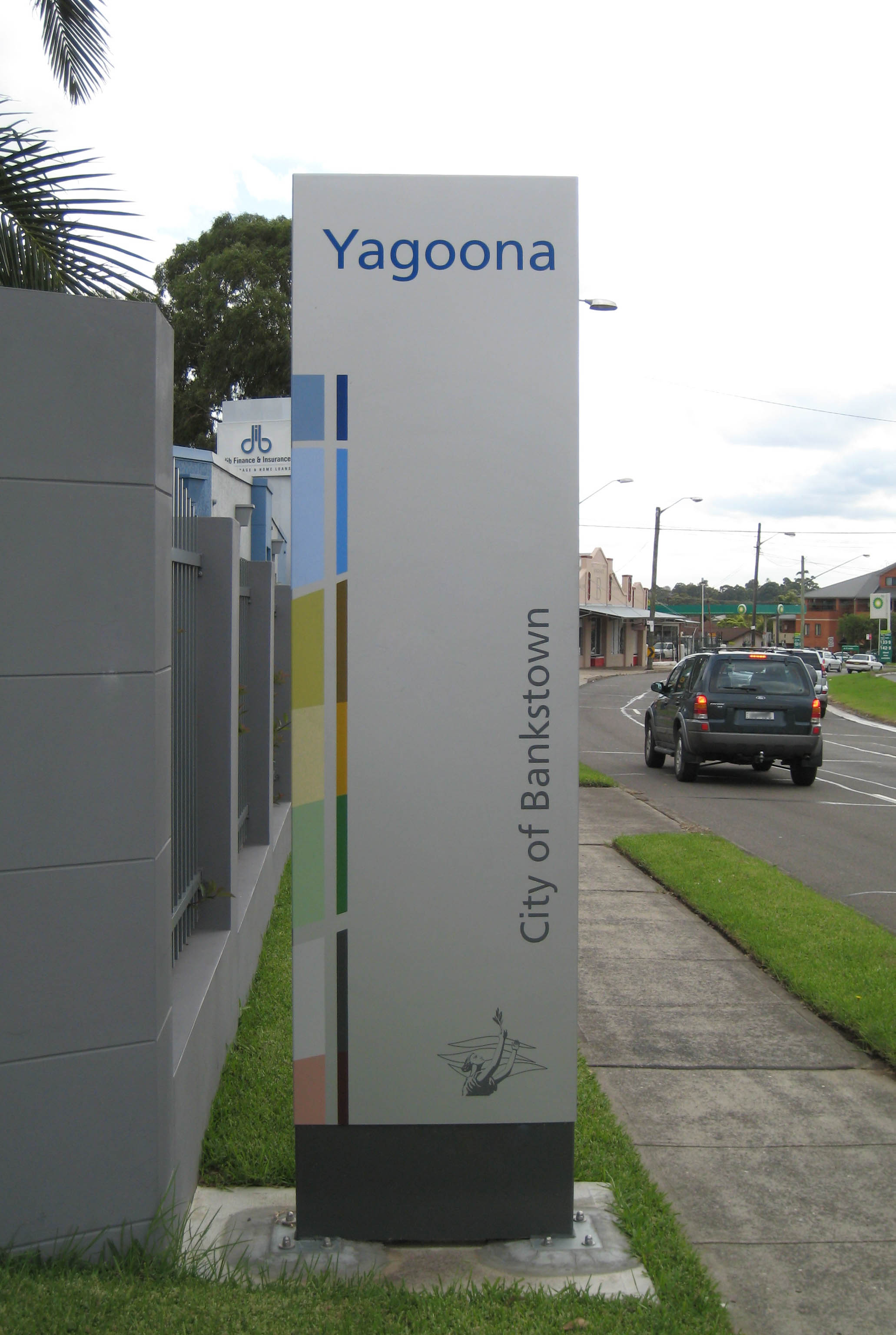
Yagoona, a suburb of the local government area City of Canterbury-Bankstown, is located 20 kilometres south-west of the Sydney central business district, in the state of New South Wales, Australia. It is a part of the South-western Sydney region. Yagoona is an Aboriginal word meaning 'now' or 'today'. It was the site of the first McDonald's restaurant to open in Australia in December 1971. History Before European settlement, the area was originally occupied by the Bediagal people. The area now known as Yagoona—Bass Hill, and north Bankstown—was once known as Irish Town, due to the high concentration of Irish rebels transported here from Ireland in the late 1700s. Land grants were issued to Irish families and finally the suburb of Yagoona was created in 1927. St Matthew's Anglican Church was built on Liverpool Road (now Hume Highway) in 1861 to cater for the Protestants of the district as well as to function as a school. Commercial area The main commercial area is loca ... [...More Info...] [...Related Items...] OR: [Wikipedia] [Google] [Baidu] |
City Of Canterbury-Bankstown
The City of Canterbury Bankstown (also known as Canterbury-Bankstown Council) is a local government area located in the South Western region of Sydney, New South Wales, Australia. The council was formed on 12 May 2016 from a merger of the City of Canterbury and the City of Bankstown, after a review of local government in New South Wales by the state government. In July 2022, the council began preparations to submit a business case to de-amalgamate the City of Canterbury Bankstown. The City of Canterbury Bankstown comprises an area of and as per the , had a population of making it the most populous local government area in New South Wales. The current Mayor of Canterbury-Bankstown is Khal Asfour, the final Mayor of Bankstown and a member of the Labor Party, who was first elected on 26 September 2017 as the inaugural Mayor. History Early history The traditional Aboriginal inhabitants of the land now known as the Canterbury-Bankstown were the Dharug (Darag, Daruk, D ... [...More Info...] [...Related Items...] OR: [Wikipedia] [Google] [Baidu] |
Division Of Blaxland
The Division of Blaxland is an Australian electoral division in the state of New South Wales. Blaxland runs from the North Shore and Western railway line in the north to Marion Street and the Bankstown railway line in the south, between Woodville Road in the west and Stacey Street in the east, covering 61 square kilometers of Labor heartland in the Cumberland and Canterbury-Bankstown local government areas in Sydney's west, with strong Middle Eastern and East Asian communities. History The division was created in 1949 and is named after Gregory Blaxland, a farmer and an early Australian explorer of the Blue Mountains in New South Wales. The division has been a comfortably safe seat for Labor since its creation; western Sydney has been a Labor ''heartland'' for over a century. Initially created as a notional Lang Labor seat, the official ALP narrowly won it over former NSW Premier Jack Lang. This is the only election at which (official) Labor has won less than 56 percent of ... [...More Info...] [...Related Items...] OR: [Wikipedia] [Google] [Baidu] |
New South Wales
) , nickname = , image_map = New South Wales in Australia.svg , map_caption = Location of New South Wales in AustraliaCoordinates: , subdivision_type = Country , subdivision_name = Australia , established_title = Before federation , established_date = Colony of New South Wales , established_title2 = Establishment , established_date2 = 26 January 1788 , established_title3 = Responsible government , established_date3 = 6 June 1856 , established_title4 = Federation , established_date4 = 1 January 1901 , named_for = Wales , demonym = , capital = Sydney , largest_city = capital , coordinates = , admin_center = 128 local government areas , admin_center_type = Administration , leader_title1 = Monarch , leader_name1 = Charles III , leader_title2 = Governor , leader_name2 = Margaret Beazley , leader_title3 = Premier , leader_name3 = Dominic Perrottet ( Liberal) , national_representation = Parliament of Australia , national_representation_type1 = Sen ... [...More Info...] [...Related Items...] OR: [Wikipedia] [Google] [Baidu] |


