|
Bijaći
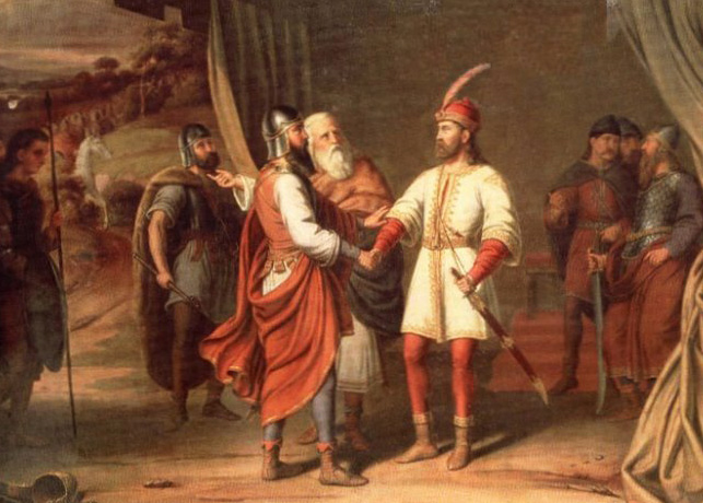
Bijaći ( it, Santa Marta) is a village in Croatia, northeast of Trogir, at the contact point between the Trogir part and the Lower Kaštela part of the Velo field. It was first mentioned in two old Croatian documents from AD 852 (Byaci) and AD 892 (Biaci). At the locality of Stombrate are the remains of an early Croatian church of St. Martha, mentioned in 1197. It is a three-nave structure with an angular apse and a bell tower on the front, built on the remains of an early Christian three-nave basilica. The remains of other structures, as well as the late antique and early Croatian cemetery have been discovered close to the ruins. Numerous fragments of pleter from the 9th and the 10th centuries have been found as well. Interesting are the parts of the altar partition, pediments and beams, and particularly the reconstructed quadrilateral ciborium (today kept at the Museum of Croatian Archaeological Monuments in Split) with part of an inscription. Six stone lintels have also be ... [...More Info...] [...Related Items...] OR: [Wikipedia] [Google] [Baidu] |
Croatia
, image_flag = Flag of Croatia.svg , image_coat = Coat of arms of Croatia.svg , anthem = "Lijepa naša domovino"("Our Beautiful Homeland") , image_map = , map_caption = , capital = Zagreb , coordinates = , largest_city = capital , official_languages = Croatian , languages_type = Writing system , languages = Latin , ethnic_groups = , ethnic_groups_year = 2021 , religion = , religion_year = 2021 , demonym = , government_type = Unitary parliamentary republic , leader_title1 = President , leader_name1 = Zoran Milanović , leader_title2 = Prime Minister , leader_name2 = Andrej Plenković , leader_title3 = Speaker of Parliament , leader_name3 = Gordan Jandroković , legislature = Sabor , sovereignty_type ... [...More Info...] [...Related Items...] OR: [Wikipedia] [Google] [Baidu] |
Trogir
Trogir (; historically known as Traù (from Dalmatian, Venetian and Italian: ); la, Tragurium; Ancient Greek: Τραγύριον, ''Tragyrion'' or Τραγούριον, ''Tragourion'') is a historic town and harbour on the Adriatic coast in Split-Dalmatia County, Croatia, with a population of 10,923 (2011) and a total municipal population of 13,192 (2011). The historic city of Trogir is situated on a small island between the Croatian mainland and the island of Čiovo. It lies west of the city of Split. Since 1997, the historic centre of Trogir has been included in the UNESCO list of World Heritage Sites for its Venetian architecture. History In the 3rd century BC, ''Tragurion'' was founded as a colony by Ancient Greek colonists on the Illyrian coast from the island of Vis, and it developed into a major port until the Roman period. The name comes from the Greek "tragos" (male goat) and "oros" (hill or mountain). Similarly, the name of the neighbouring island of Bua c ... [...More Info...] [...Related Items...] OR: [Wikipedia] [Google] [Baidu] |
Kaštela
Kaštela (;) is a town in Split-Dalmatia County. The town is an agglomeration of seven individual settlements which are administered as a single municipality with populations individually ranging from 3,000 to 7,000 residents. The town is located northwest of the city of Split, west of Solin and east of Trogir, on the central Dalmatian coast. With a total population of 37,794 census, it is the 14th largest town in the country. Geography Settlements The Town of Kaštela consists of following settlements (populations parenthesised): *Kaštel Gomilica (4,699) *Kaštel Kambelovac (5,051) *Kaštel Lukšić (5,221) *Kaštel Novi (6,507) *Kaštel Stari (6,950) *Kaštel Sućurac (6,544) *Kaštel Štafilić (2,822) Overview The Kaštela Riviera is a fertile area, about in length, featuring the first Roman floating docks and 50 places on the long, verdant area, northwest of Split. It is divided into Gornja (''upper'') and Donja Kaštela (''lower''), and it consists of seven old a ... [...More Info...] [...Related Items...] OR: [Wikipedia] [Google] [Baidu] |
Croatian Wattle
The Croatian interlace or Croatian wattle, known as the or in Croatian, is a type of interlace, most characteristic for its three-ribbon pattern. It is one of the most often used patterns of pre-romanesque Croatian art. It is found on and within churches as well as monasteries built in early medieval Kingdom of Croatia between the 9th and beginning of the 12th century. The ornamental strings were sometimes grouped together with animal and herbal figures. Most representative examples of inscriptions embellished with the interlace include the Baška tablet, baptismal font of Duke Višeslav of Croatia and the Branimir Inscription. Other notable examples are located near Knin, in Ždrapanj and Žavić by the Bribir settlement, Rižinice near Solin and in Split and Zadar. Croatia has a civil and military decoration called the Order of the Croatian Interlace. Pleter Cross During the 8th century, the Pope assigned Croatia with its own idiosyncratic cross based on Croatian interlac ... [...More Info...] [...Related Items...] OR: [Wikipedia] [Google] [Baidu] |
Museum Of Croatian Archaeological Monuments
The Museum of Croatian Archaeological Monuments ( hr , Muzej hrvatskih arheoloških spomenika) located at Meštrovićevo šetalište 18, Split, Croatia, is the only museum in the country dedicated to researching and presenting cultural artifacts of the Croats in the Middle Ages, between the 7th and 15th centuries, particularly the time of the early medieval Croatian state from 9th to 12th century. The museum was founded in Knin in 1893, and was moved first to Sinj, then Klis Klis ( hr, Klis, it, Clissa, tr, Kilis) is a Croatian municipality located around a mountain fortress bearing the same name. It is located in the region of Dalmatia, located just northeast of Solin, Croatia, Solin and Split, Croatia, Split near ... and finally to Split where today the collection is displayed in a purpose-built museum complex, opened in 1976. The holdings consist mainly of jewellery, weapons and items of daily use, and include many stone artifacts that once belonged to the old Croatian chur ... [...More Info...] [...Related Items...] OR: [Wikipedia] [Google] [Baidu] |
Split, Croatia
)'' , settlement_type = List of cities and towns in Croatia, City , anthem = ''Marjane, Marjane'' , image_skyline = , imagesize = 267px , image_caption = Top: Nighttime view of Split from Mosor; 2nd row: Cathedral of Saint Domnius; City center of Split; 3rd row: View of the city from Marjan, Split, Marjan Hill; Night in Poljička Street; Bottom: ''Riva'' waterfront , image_flag = Flag of the City of Split.svg , flag_size = 150px , flag_link = Flag of Split , image_seal = , seal_size = , image_shield = Coat of arms of Split.svg , shield_size = 90px , shield_link = Coat of arms of Split , image_map = , mapsize = , map_caption = Map of the Split city area. , image_map1 = , mapsize1 = , map_caption1 = ... [...More Info...] [...Related Items...] OR: [Wikipedia] [Google] [Baidu] |
Kings Of Croatia
This is a complete list of rulers of Croatia under domestic ethnic and elected dynasties during the Croatian Kingdom (925–1918). This article follows the monarch's title number according to Hungarian succession for convenience. For example, the Hungarian monarch Béla IV is according to Croatian succession correctly titled Béla III. This is because Hungarians had a king named Béla prior to the incorporation of Croatia under the Hungarian Crown but the Croats did not. Early history The details of the arrival of the Croats in the Balkans are sparsely documented by reliable historical sources. Around 626 CE, Croats migrated from White Croatia (around present-day Galicia) at the invitation of the Byzantine Emperor Heraclius. According to a legend recorded in the 10th-century ''De Administrando Imperio'', the Croats came to their present region under the leadership of five brothers (called Kloukas, Lobelos, Kosentzis, Mouchlo, and Chrobatos) and of two sisters (called Touga and ... [...More Info...] [...Related Items...] OR: [Wikipedia] [Google] [Baidu] |
Ottoman Empire
The Ottoman Empire, * ; is an archaic version. The definite article forms and were synonymous * and el, Оθωμανική Αυτοκρατορία, Othōmanikē Avtokratoria, label=none * info page on book at Martin Luther University) // CITED: p. 36 (PDF p. 38/338) also known as the Turkish Empire, was an empire that controlled much of Southeast Europe, Western Asia, and Northern Africa between the 14th and early 20th centuries. It was founded at the end of the 13th century in northwestern Anatolia in the town of Söğüt (modern-day Bilecik Province) by the Turkoman tribal leader Osman I. After 1354, the Ottomans crossed into Europe and, with the conquest of the Balkans, the Ottoman beylik was transformed into a transcontinental empire. The Ottomans ended the Byzantine Empire with the conquest of Constantinople in 1453 by Mehmed the Conqueror. Under the reign of Suleiman the Magnificent, the Ottoman Empire marked the peak of its power and prosperity, as well a ... [...More Info...] [...Related Items...] OR: [Wikipedia] [Google] [Baidu] |
Geography Of Split-Dalmatia County
Geography (from Ancient Greek, Greek: , ''geographia''. Combination of Greek words ‘Geo’ (The Earth) and ‘Graphien’ (to describe), literally "earth description") is a field of science devoted to the study of the lands, features, inhabitants, and phenomena of Earth. The first recorded use of the word γεωγραφία was as a title of a book by Greek scholar Eratosthenes (276–194 BC). Geography is an all-encompassing discipline that seeks an understanding of Earth and world, its human and natural complexities—not merely where objects are, but also how they have changed and come to be. While geography is specific to Earth, many concepts can be applied more broadly to other celestial bodies in the field of planetary science. One such concept, the Tobler's first law of geography, first law of geography, proposed by Waldo Tobler, is "everything is related to everything else, but near things are more related than distant things." Geography has been called "the worl ... [...More Info...] [...Related Items...] OR: [Wikipedia] [Google] [Baidu] |
Former Capitals Of Croatia
A former is an object, such as a template, gauge or cutting die, which is used to form something such as a boat's hull. Typically, a former gives shape to a structure that may have complex curvature. A former may become an integral part of the finished structure, as in an aircraft fuselage, or it may be removable, being using in the construction process and then discarded or re-used. Aircraft formers Formers are used in the construction of aircraft fuselage, of which a typical fuselage has a series from the nose to the empennage, typically perpendicular to the longitudinal axis of the aircraft. The primary purpose of formers is to establish the shape of the fuselage and reduce the column length of stringers to prevent instability. Formers are typically attached to longerons, which support the skin of the aircraft. The "former-and-longeron" technique (also called stations and stringers) was adopted from boat construction, and was typical of light aircraft built until the ad ... [...More Info...] [...Related Items...] OR: [Wikipedia] [Google] [Baidu] |


.jpg)

