|
Biggings
Biggings is a village on the island of Papa Stour, in Shetland Shetland, also called the Shetland Islands and formerly Zetland, is a subarctic archipelago in Scotland lying between Orkney, the Faroe Islands and Norway. It is the northernmost region of the United Kingdom. The islands lie about to the no ..., Scotland. Papa Stour's church is situated at the south of Biggings. A homestead of Duke Haakon of Norway is thought to have been at Biggings, and archaeological digs have discovered the remains of a substantial Norse house, dating to around the 12th or 13th century. A partial reconstruction of a Norse building has also been undertaken. References External links Canmore - Papa Stour, Biggings Norse House site record Villages in Shetland {{Shetland-geo-stub ... [...More Info...] [...Related Items...] OR: [Wikipedia] [Google] [Baidu] |
Papa Stour
Papa Stour ( sco, Papa Stour) is one of the Shetland Islands in Scotland, with a population of under fifteen people, some of whom immigrated after an appeal for residents in the 1970s. Located to the west of mainland Shetland and with an area of 828 hectares (3.2 square miles), Papa Stour is the eighth largest island in Shetland. Erosion of the soft volcanic rocks by the sea has created an extraordinary variety of caves, stacks, arches, blowholes, and cliffs. The island and its surrounding seas harbour diverse populations of wildlife. The west side of the island is a Site of Special Scientific Interest and the seas around the island are a Special Area of Conservation. The island has several Neolithic burial chamber sites, as well as the remains of Duke Hakon's 13th-century house dating from the Norse occupation of the island. The population reached 380 or more in the nineteenth century, when a fishing station was opened at Crabbaberry in West Voe. Subsequently, ther ... [...More Info...] [...Related Items...] OR: [Wikipedia] [Google] [Baidu] |
Walls, Shetland
Walls, known locally as Waas (Old Norse: ''Vagar'' = "Sheltered Bays" (voes) - the Ordnance Survey added the "ll" as they thought it was a corruption of "walls". Cf Vágar and Vágur in the Faroe Islands), is a settlement on the south side of West Mainland, Shetland Islands in Scotland. The settlement is at the head of Vaila Sound and sheltered even from southerly storms by the islands of Linga and Vaila. Walls is within the parish of Walls and Sandness. History One of its old names is "Vagaland", hence the name of the local poet. A pier was built at Walls in the 18th century, and from 1838, it was a center for fish curing. Walls itself is a quieter place than once it was. The large houses of Bayhall, now converted into flats, and Voe House are signs of past wealth, as are the three churches visible around the head of the sound. Two are still in use, while the third bears a sign showing its later conversion to a bakery. Waas was the childhood home of two fine poets, Vagaland and ... [...More Info...] [...Related Items...] OR: [Wikipedia] [Google] [Baidu] |
Sandness
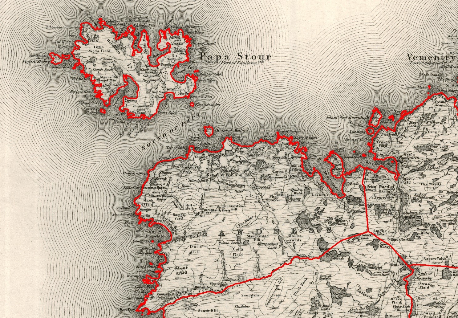
Sandness (the "d" is not pronounced locally) is a headland and district in the west of Shetland Mainland, Scotland. Sandness was a civil parish, which also included the island of Papa Stour some 1600 metres northwest across ''Papa Sound''. In 1891, it was combined with Walls to the south, to form Walls and Sandness Parish, which had an administrative function until the abolition of Civil parishes in Scotland by the Local Government (Scotland) Act 1929, and had been a statistical regional unit since. Currently, the community council area of Sandness and Walls covers about the same area. The 1878 map of Sandness Parish shows that the parish to the east was Aithsting, before it was included into Sandsting Sandsting is a parish in the West Mainland of Shetland, Scotland, forming a southern arm of the Walls Peninsula. After the parish of Aithsting was annexed into Sandsting in the sixteenth century, it became known as Sandsting and Aithsting pari ... to the south. The headl ... [...More Info...] [...Related Items...] OR: [Wikipedia] [Google] [Baidu] |
Shetland Islands
Shetland, also called the Shetland Islands and formerly Zetland, is a subarctic archipelago in Scotland lying between Orkney, the Faroe Islands and Norway. It is the northernmost region of the United Kingdom. The islands lie about to the northeast of Orkney, from mainland Scotland and west of Norway. They form part of the border between the Atlantic Ocean to the west and the North Sea to the east. Their total area is ,Shetland Islands Council (2012) p. 4 and the population totalled 22,920 in 2019. The islands comprise the Shetland constituency of the Scottish Parliament. The local authority, the Shetland Islands Council, is one of the 32 council areas of Scotland. The islands' administrative centre and only burgh is Lerwick, which has been the capital of Shetland since 1708, before which time the capital was Scalloway. The archipelago has an oceanic climate, complex geology, rugged coastline, and many low, rolling hills. The largest island, known as " the Mainland", ha ... [...More Info...] [...Related Items...] OR: [Wikipedia] [Google] [Baidu] |


