|
Big Run (North Fork South Branch Potomac River Tributary)
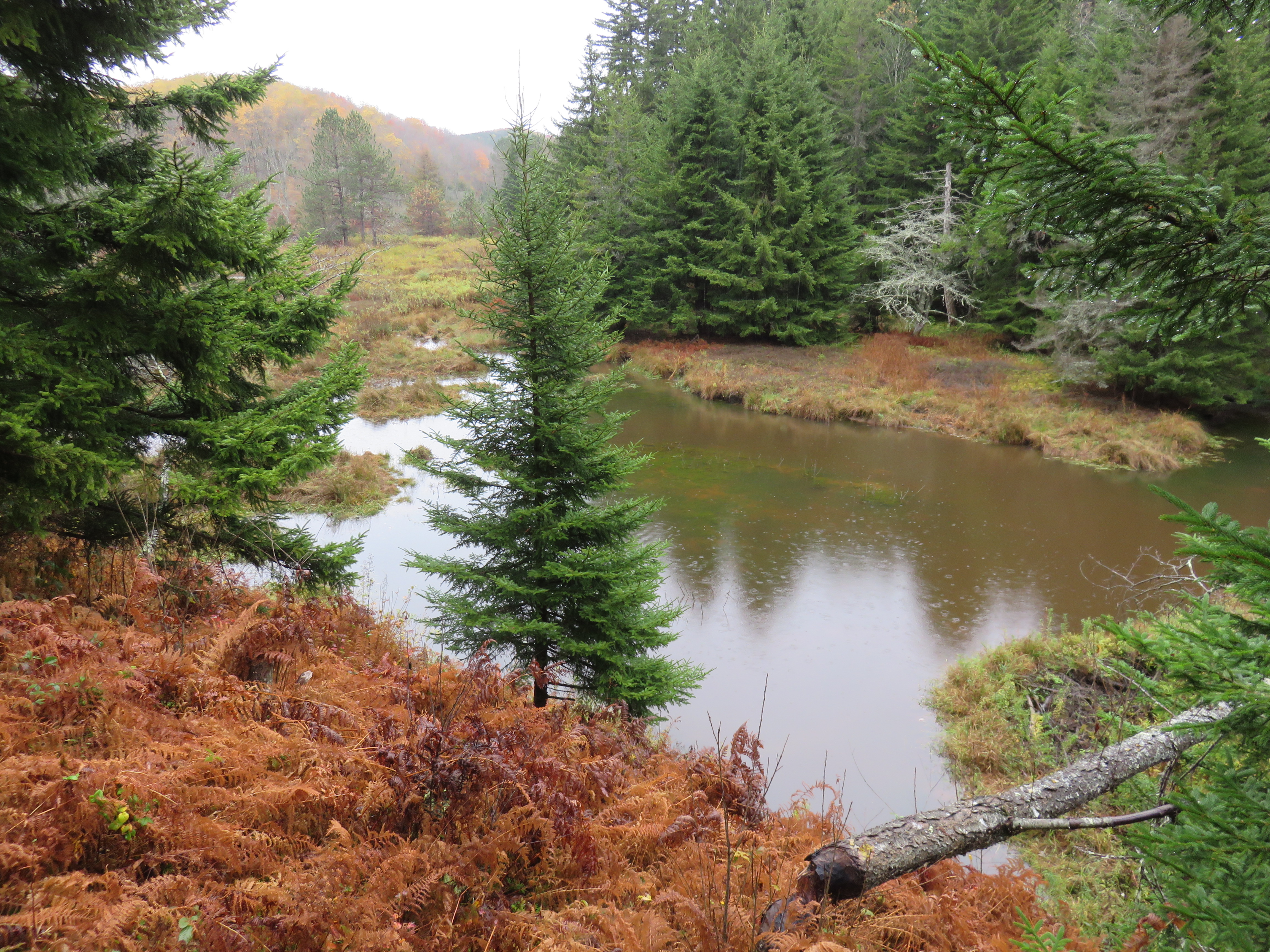
Big Run is a river of 13 miles in length, located one-and-a-half miles west of Spruce Knob in Monongahela National Forest, in Pendleton County, West Virginia. It is a tributary of the North Fork South Branch Potomac River. Description The river begins as a series of gullies through an open marshland just south of the northernmost bend in Forest Road 112. Between river mile (RM) 12.8 and 12.4, a series of beaver dams causes the valley to transition from wetland into a string of lakes. From the last beaver dam at RM 12.4, a recognizable river emerges. The open field ends and the river enters a forested ravine. Big Run joins with tributaries Elk Run at RM 5, Teeter Camp Run at RM 3.6 and Sawmill Branch Run at RM 3.2. The river empties into the North Fork South Branch Potomac River just outside of Cherry Grove, along Snowy Mountain Road just across the bridge over the Potomac. This is one of a number of Potomac tributaries known as Big Run, including Big Run at Romney and ... [...More Info...] [...Related Items...] OR: [Wikipedia] [Google] [Baidu] |
United States
The United States of America (U.S.A. or USA), commonly known as the United States (U.S. or US) or America, is a country primarily located in North America. It consists of 50 states, a federal district, five major unincorporated territories, nine Minor Outlying Islands, and 326 Indian reservations. The United States is also in free association with three Pacific Island sovereign states: the Federated States of Micronesia, the Marshall Islands, and the Republic of Palau. It is the world's third-largest country by both land and total area. It shares land borders with Canada to its north and with Mexico to its south and has maritime borders with the Bahamas, Cuba, Russia, and other nations. With a population of over 333 million, it is the most populous country in the Americas and the third most populous in the world. The national capital of the United States is Washington, D.C. and its most populous city and principal financial center is New York City. Paleo-Americ ... [...More Info...] [...Related Items...] OR: [Wikipedia] [Google] [Baidu] |
Big Run (South Branch Potomac River)
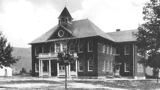
Big Run is a U.S. Geological Survey. National Hydrography Dataset high-resolution flowline dataThe National Map, accessed August 15, 2011 tributary stream of the South Branch Potomac River, belonging to the Potomac River and Chesapeake Bay watersheds. Big Run flows through the city of Romney and the campus of the West Virginia Schools for the Deaf and Blind in Hampshire County, West Virginia. The stream is known by local residents as Town Run and Town Creek. Headwaters and course Big Run rises on the western flanks of South Branch Mountain to the east of Romney. From its source, the stream parallels the Northwestern Turnpike (U.S. Route 50) as it travels down the mountain. From the base of South Branch Mountain, Big Run flows under Grassy Lick Road (County Route 10) and beneath the old Miller's Market store followed by US 50. Once it flows north of US 50, Big Run meanders around the Koolwink Motel and continues to parallel the highway. On its northwestern track, the stream tri ... [...More Info...] [...Related Items...] OR: [Wikipedia] [Google] [Baidu] |
Rivers Of West Virginia
This is a list of rivers in the U.S. state of West Virginia. List of West Virginia rivers includes streams formally designated as rivers. There are also smaller streams (i.e., branches, creeks, drains, forks, licks, runs, etc.) in the state. Exclusive of major tributaries, there are about 46 named rivers in West Virginia. Though relatively few in number, rivers have traditionally provided easy avenues of transportation through the rough terrain of the Mountain State, first by Native Americans and later by European settlers. Even today, the larger rivers transport large volumes of commercial goods, while the smaller ones provide recreational opportunities such as canoeing, fishing, swimming, and white-water rafting. By tributary **Ohio River ***Monongahela River ****Tygart Valley River ***** Leading Creek *****Middle Fork River *****Buckhannon River ****** Left Fork Buckhannon River ******Right Fork Buckhannon River ****** French Creek ***** Sandy Creek ***** Three Fork Creek ... [...More Info...] [...Related Items...] OR: [Wikipedia] [Google] [Baidu] |
Rivers Of Pendleton County, West Virginia
A river is a natural flowing watercourse, usually freshwater, flowing towards an ocean, sea, lake or another river. In some cases, a river flows into the ground and becomes dry at the end of its course without reaching another body of water. Small rivers can be referred to using names such as creek, brook, rivulet, and rill. There are no official definitions for the generic term river as applied to geographic features, although in some countries or communities a stream is defined by its size. Many names for small rivers are specific to geographic location; examples are "run" in some parts of the United States, "burn" in Scotland and northeast England, and "beck" in northern England. Sometimes a river is defined as being larger than a creek, but not always: the language is vague. Rivers are part of the water cycle. Water generally collects in a river from precipitation through a drainage basin from surface runoff and other sources such as groundwater recharge, springs, a ... [...More Info...] [...Related Items...] OR: [Wikipedia] [Google] [Baidu] |
Harper, Pendleton County, West Virginia
Harper is an unincorporated community on the South Branch Potomac River in Pendleton County, West Virginia, United States. Harper is located along U.S. Route 220. References Unincorporated communities in Pendleton County, West Virginia Unincorporated communities in West Virginia {{PendletonCountyWV-geo-stub ... [...More Info...] [...Related Items...] OR: [Wikipedia] [Google] [Baidu] |
Big Run, Harper, West Virginia
Big or BIG may refer to: * Big, of great size or degree Film and television * ''Big'' (film), a 1988 fantasy-comedy film starring Tom Hanks * ''Big!'', a Discovery Channel television show * ''Richard Hammond's Big'', a television show presented by Richard Hammond * ''Big'' (TV series), a 2012 South Korean TV series * ''Banana Island Ghost'', a 2017 fantasy action comedy film Music * '' Big: the musical'', a 1996 musical based on the film * Big Records, a record label * ''Big'' (album), a 2007 album by Macy Gray * "Big" (Dead Letter Circus song) * "Big" (Sneaky Sound System song) * "Big" (Rita Ora and Imanbek song) * "Big", a 1990 song by New Fast Automatic Daffodils * "Big", a 2021 song by Jade Eagleson from ''Honkytonk Revival'' *The Notorious B.I.G., an American rapper Places * Allen Army Airfield (IATA code), Alaska, US * BIG, a VOR navigational beacon at London Biggin Hill Airport * Big River (other), various rivers (and other things) * Big Island (disambig ... [...More Info...] [...Related Items...] OR: [Wikipedia] [Google] [Baidu] |
Romney, West Virginia
Romney is a town in and the county seat of Hampshire County, West Virginia, United States. The population was 1,722 at the 2020 census. History Established by consecutive acts of the Virginia House of Burgesses and approved by the governor on December 23, 1762, Romney and Mecklenburg (later renamed Shepherdstown), in Jefferson County, are the oldest towns in West Virginia. The bill containing the ''Act for establishing the town of Romney, in the county of Hampshire, and for other purposes therein-mentioned,'' is listed 20th on a list of approved "publick and private bills" and is immediately followed by ''An Act for establishing the town of Mecklenburg, in the county of Frederick.'' Originally settled in 1725 by hunters and traders, Romney was known as Pearsall's Flats and was the site of the French and Indian War stockade Fort Pearsall. Named for the Cinque Ports town of Romney, Kent, England, by Thomas Fairfax, 6th Lord Fairfax of Cameron, the town still bears place nam ... [...More Info...] [...Related Items...] OR: [Wikipedia] [Google] [Baidu] |
River Mile
A river mile is a measure of distance in miles along a river from its mouth. River mile numbers begin at zero and increase further upstream. The corresponding metric unit using kilometers is the river kilometer. They are analogous to vehicle roadway mile markers, except that river miles are rarely marked on the physical river; instead they are marked on navigation charts, and topographic maps. Riverfront properties are sometimes partially legally described by their river mile. The river mile is not the same as the length of the river, rather it is a means of locating any feature along the river relative to its distance from the mouth, when measured along the course (or navigable channel) of the river. River mile zero may not be exactly at the mouth. For example, the Willamette River (which discharges into the Columbia River) has its river mile zero at the edge of the navigable channel in the Columbia, some beyond the mouth. Also, the river mile zero for the Lower Mississippi Ri ... [...More Info...] [...Related Items...] OR: [Wikipedia] [Google] [Baidu] |
West Virginia
West Virginia is a state in the Appalachian, Mid-Atlantic and Southeastern regions of the United States.The Census Bureau and the Association of American Geographers classify West Virginia as part of the Southern United States while the Bureau of Labor Statistics classifies the state as a part of the Mid-Atlantic regionMid-Atlantic Home : Mid-Atlantic Information Office: U.S. Bureau of Labor Statistics" www.bls.gov. Archived. It is bordered by Pennsylvania to the north and east, Maryland to the east and northeast, Virginia to the southeast, Kentucky to the southwest, and Ohio to the northwest. West Virginia is the 10th-smallest state by area and ranks as the 12th-least populous state, with a population of 1,793,716 residents. The capital and largest city is Charleston. West Virginia was admitted to the Union on June 20, 1863, and was a key border state during the American Civil War. It was the only state to form by separating from a Confederate state, the second to sepa ... [...More Info...] [...Related Items...] OR: [Wikipedia] [Google] [Baidu] |
Monongahela National Forest
The Monongahela National Forest is a national forest located in the Allegheny Mountains of eastern West Virginia, USA. It protects over of federally managed land within a proclamation boundary that includes much of the Potomac Highlands Region and portions of 10 counties. The Monongahela National Forest includes some major landform features such as the Allegheny Front and the western portion of the Ridge-and-valley Appalachians. Within the forest boundaries lie some of the highest mountain peaks in the state, including the highest, Spruce Knob (4,863 ft). Spruce Knob is also the highest point in the Allegheny Mountains. Approximately 75 tree species are found in the forest. Almost all of the trees are a second growth forest, grown back after the land was heavily cutover around the start of the 20th century. Species for which the forest is important include red spruce (''Picea rubens''), balsam fir (''Abies balsamea''), and mountain ash (''Sorbus americana''). The Monong ... [...More Info...] [...Related Items...] OR: [Wikipedia] [Google] [Baidu] |


