|
Bicolored Antpitta
The bicolored antpitta (''Grallaria rufocinerea'') is a species of bird in the family Grallariidae. It is found in Colombia and Ecuador. Taxonomy and systematics Starting in 1979 the bicolored antpitta was treated as having two subspecies, the nominate ''G. r. rufocinerea'' ( Sclater, PL & Salvin, 1879) and ''G. r. romeroana'' (Hernández-Camacho & Rodríguez-M, 1979). A study published in 2022 determined that the two were indistinguishable.Cuervo, A. M. (2022). Unnoticed anomaly in the holotype of ''Grallaria rufocinerea'' (Myrmotheridae) deprives ''romeroana'' Hernández-Camacho & Rodríguez, 1979 of diagnosability. Zootaxa 5213(4):445–450 In 2023 the Clements taxonomy disallowed ''romeroana'' and returned the bicolored antpitta to monotypic status; the International Ornithological Committee followed suit in 2024.Clements, J. F., P.C. Rasmussen, T. S. Schulenberg, M. J. Iliff, T. A. Fredericks, J. A. Gerbracht, D. Lepage, A. Spencer, S. M. Billerman, B. L. Sullivan, ... [...More Info...] [...Related Items...] OR: [Wikipedia] [Google] [Baidu] |
Bicolored Antbird
The bicolored antbird (''Gymnopithys bicolor'') is a species of bird in the family Thamnophilidae. It is found in Honduras south to Panama, western Colombia and Ecuador. Its natural habitat is subtropical or tropical moist lowland forest. It is dark brown with a white belly and grey and black facial markings. Taxonomy The bicolored antbird was species description, described by the American amateur ornithologist George Newbold Lawrence in 1863 and given the binomial name ''Pithys bicolor''. There are five recognised subspecies: * ''G. b. olivascens'' (Robert Ridgway, Ridgway, 1891) – Honduras to west Panama * ''G. b. bicolor'' (Lawrence, 1863) – east Panama and northwest Colombia * ''G. b. daguae'' Carl Eduard Hellmayr, Hellmayr, 1906 – west Colombia * ''G. b. aequatorialis'' (Hellmayr, 1902) – southwest Colombia and west Ecuador * ''G. b. ruficeps'' Osbert Salvin, Salvin & Frederick DuCane Godman, Godman, 1892 – central Colombia The bicolored antbird was formerly cons ... [...More Info...] [...Related Items...] OR: [Wikipedia] [Google] [Baidu] |
The Auk
''Ornithology'', formerly ''The Auk'' and ''The Auk: Ornithological Advances'', is a peer-reviewed scientific journal and the official publication of the American Ornithological Society (AOS). It was established in 1884 and is published quarterly. The journal covers the anatomy, behavior, and distribution of birds. It was named for the great auk, the symbol of the AOS. In 2018, the American Ornithology Society announced a partnership with Oxford University Press to publish ''The Auk: Ornithological Advances'' and '' The Condor: Ornithological Applications'' ''.'' In January 2021, the journal was renamed ''Ornithology'', with the stated goal of improving descriptiveness, thematic focus, and ease of citation of the journal title. The society's sister publication '' The Condor'' was renamed ''Ornithological Applications'' at the same time. Editors The following have been editors-in-chief of the journal: See also * List of ornithology journals References External links ... [...More Info...] [...Related Items...] OR: [Wikipedia] [Google] [Baidu] |
Tapir
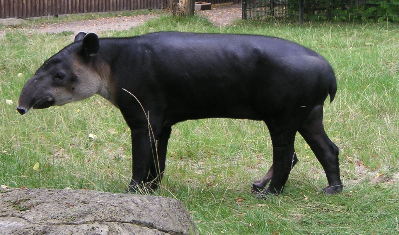
Tapirs ( ) are large, herbivorous mammals belonging to the family Tapiridae. They are similar in shape to a pig, with a short, prehensile nose trunk. Tapirs inhabit jungle and forest regions of South and Central America, with one species inhabiting Southeast Asia. They are one of three extant branches of Perissodactyla (odd-toed ungulates), alongside equines and rhinoceros. Only a single genus, ''Tapirus'' is currently extant. Tapirs migrated into South America during the Pleistocene epoch from North America after the formation of the Isthmus of Panama as part of the Great American Interchange. Tapirs were once widespread in North America until the arrival of humans at the end of the Late Pleistocene, around 12,000 years ago. Species There are four widely recognized extant species of tapir, all in the genus ''Tapirus'' of the family Tapiridae. They are the South American tapir, the Malayan tapir, Baird's tapir, and the mountain tapir. In 2013, a group of researchers said they ... [...More Info...] [...Related Items...] OR: [Wikipedia] [Google] [Baidu] |
Army Ants
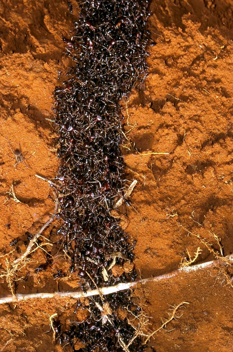
The name army ant (or legionary ant or ''marabunta'') is applied to over 200 ant species in different lineages. Because of their aggressive predatory foraging groups, known as "raids", a huge number of ants forage simultaneously over a limited area. Another shared feature is that, unlike most ant species, army ants do not construct permanent nests; an army ant colony moves almost incessantly over the time it exists. All species are members of the true ant family, Formicidae, but several groups have independently evolved the same basic behavioural and ecological syndrome. This syndrome is often referred to as "legionary behaviour", and may be an example of convergent evolution. Most New World army ants belong to the genera ''Cheliomyrmex'', '' Neivamyrmex'', '' Nomamyrmex'', '' Labidus'', and '' Eciton''. The largest genus is ''Neivamyrmex'', which contains more than 120 species; the most predominant species is ''Eciton burchellii''; its common name "army ant" is considered ... [...More Info...] [...Related Items...] OR: [Wikipedia] [Google] [Baidu] |
Arthropod
Arthropods (, (gen. ποδός)) are invertebrate animals with an exoskeleton, a Segmentation (biology), segmented body, and paired jointed appendages. Arthropods form the phylum Arthropoda. They are distinguished by their jointed limbs and Arthropod cuticle, cuticle made of chitin, often Mineralization (biology), mineralised with calcium carbonate. The arthropod body plan consists of segments, each with a pair of appendages. Arthropods are bilaterally symmetrical and their body possesses an exoskeleton, external skeleton. In order to keep growing, they must go through stages of moulting, a process by which they shed their exoskeleton to reveal a new one. Some species have wings. They are an extremely diverse group, with up to 10 million species. The haemocoel, an arthropod's internal cavity, through which its haemolymph – analogue of blood – circulates, accommodates its interior Organ (anatomy), organs; it has an open circulatory system. Like their exteriors, the internal or ... [...More Info...] [...Related Items...] OR: [Wikipedia] [Google] [Baidu] |
Secondary Forest
A secondary forest (or second-growth forest) is a forest or woodland area which has re-grown after a timber harvest or clearing for agriculture, until a long enough period has passed so that the effects of the disturbance are no longer evident. It is distinguished from an old-growth forest (primary or primeval forest), which has not recently undergone such disruption, and complex early seral forest, as well as third-growth forests that result from harvest in second growth forests. Secondary forest regrowing after timber harvest differs from forest regrowing after natural disturbances such as fire, insect infestation, or windthrow because the dead trees remain to provide nutrients, structure, and water retention after natural disturbances. However, often after natural disturbance the timber is harvested and removed from the system, in which case the system more closely resembles secondary forest rather than seral forest. Description Depending on the forest, the development of ... [...More Info...] [...Related Items...] OR: [Wikipedia] [Google] [Baidu] |
Treeline
The tree line is the edge of the habitat at which trees are capable of growing. It is found at high elevations and high latitudes. Beyond the tree line, trees cannot tolerate the environmental conditions (usually cold temperatures, extreme snowpack, or associated lack of available moisture). The tree line is sometimes distinguished from a lower timberline, which is the line below which trees form a forest with a closed Canopy (biology), canopy. At the tree line, tree growth is often sparse, stunted, and deformed by wind and cold. This is sometimes known as ''krummholz'' (German for "crooked wood"). The tree line often appears well-defined, but it can be a more gradual transition. Trees grow shorter and often at lower densities as they approach the tree line, above which they are unable to grow at all. Given a certain latitude, the tree line is approximately 300 to 1000 meters below the permanent snow line and roughly parallel to it. Causes Due to their vertical structure, tree ... [...More Info...] [...Related Items...] OR: [Wikipedia] [Google] [Baidu] |
Cloudforest
A cloud forest, also called a water forest, primas forest, or tropical montane cloud forest (TMCF), is a generally tropical or subtropical, evergreen, montane, moist forest characterized by a persistent, frequent or seasonal low-level cloud cover, usually at the canopy level, formally described in the ''International Cloud Atlas'' (2017) as silvagenitus. Cloud forests often exhibit an abundance of mosses covering the ground and vegetation, in which case they are also referred to as mossy forests. Mossy forests usually develop on the saddles of mountains, where moisture introduced by settling clouds is more effectively retained. Cloud forests are among the most biodiversity rich ecosystems in the world with a large amount of species directly or indirectly depending on them. Other moss forests include black spruce/feathermoss climax forest, with a moderately dense canopy and a forest floor of feathermosses including ''Hylocomium splendens'', ''Pleurozium schreberi'' and ''Ptil ... [...More Info...] [...Related Items...] OR: [Wikipedia] [Google] [Baidu] |
Huila Department
Huila () is one of the departments of Colombia. It is located in the southwest of the country, and its capital is Neiva. Demography and Ethnography Huila is a department that has a population of 1,122,622 inhabitants, of which 679,667 (60.54%) people live in municipal capitals and 442,955 (39.46%) in the rest of the Huilense territory. This corresponds to 2.5% of the total Colombian population. The majority of the population is settled in the Magdalena valley, with epicenters in Neiva and Garzón due to the possibilities offered by the commercial-type agricultural economy, oil exploitation, the best provision of services and the road axes connected to the central axis that borders the Magdalena. The rest of the populations are located on the coffee belt, standing out Pitalito and La Plata, the North Subregion presents a decrease in its rural population, mainly attributable to the alterations of agricultural and oil activities on the landscape. The average population density ... [...More Info...] [...Related Items...] OR: [Wikipedia] [Google] [Baidu] |
Antioquia Department
) , anthem = Himno de Antioquia , image_map = Antioquia in Colombia (mainland).svg , map_alt = , map_caption = Antioquia shown in red , image_map1 = Antioquia Topographic 2.png , map_caption1 = Topography of the department , coordinates = , subdivision_type = Country , subdivision_name = , subdivision_type1 = Region , subdivision_name1 = Andean Region , established_title = Established , established_date = 1826 , founder = , named_for = , seat_type = Capital , seat = Medellín , parts_type = Largest city , parts_style = para , p1 = , government_footnotes ... [...More Info...] [...Related Items...] OR: [Wikipedia] [Google] [Baidu] |
Cordillera Central (Colombia)
The Cordillera Central ( en, Central Ranges) is the highest of the three branches of the Colombian Andes. The range extends from south to north dividing from the Colombian Massif in Cauca Department to the Serranía de San Lucas in Bolivar Departments. The highest peak is Nevado del Huila at . Geography The range is bounded by the Cauca and Magdalena river valleys to the west and east, respectively. Highest Peaks * Nevado del Huila - - Cauca, Huila & Tolima * Nevado del Ruiz - - Caldas & Tolima * Nevado del Tolima - - Tolima * Nevado de Santa Isabel - - Risaralda, Tolima & Caldas * Nevado del Quindio - - Quindio, Tolima & Risaralda * Cerro Pan de Azucar - - Cauca & Huila * Puracé - - Cauca & Huila Protected Areas * PNN Los Nevados * PNN Nevado del Huila * PNN Puracé * PNN Las Hermosas * PNN Selva de Florencia * SFF Otún Quimbaya * SFF Serranía de las Minas - proposed See also * Geography of Colombia * Andean Region, Colombia * Cordillera Occidental (Colo ... [...More Info...] [...Related Items...] OR: [Wikipedia] [Google] [Baidu] |


