|
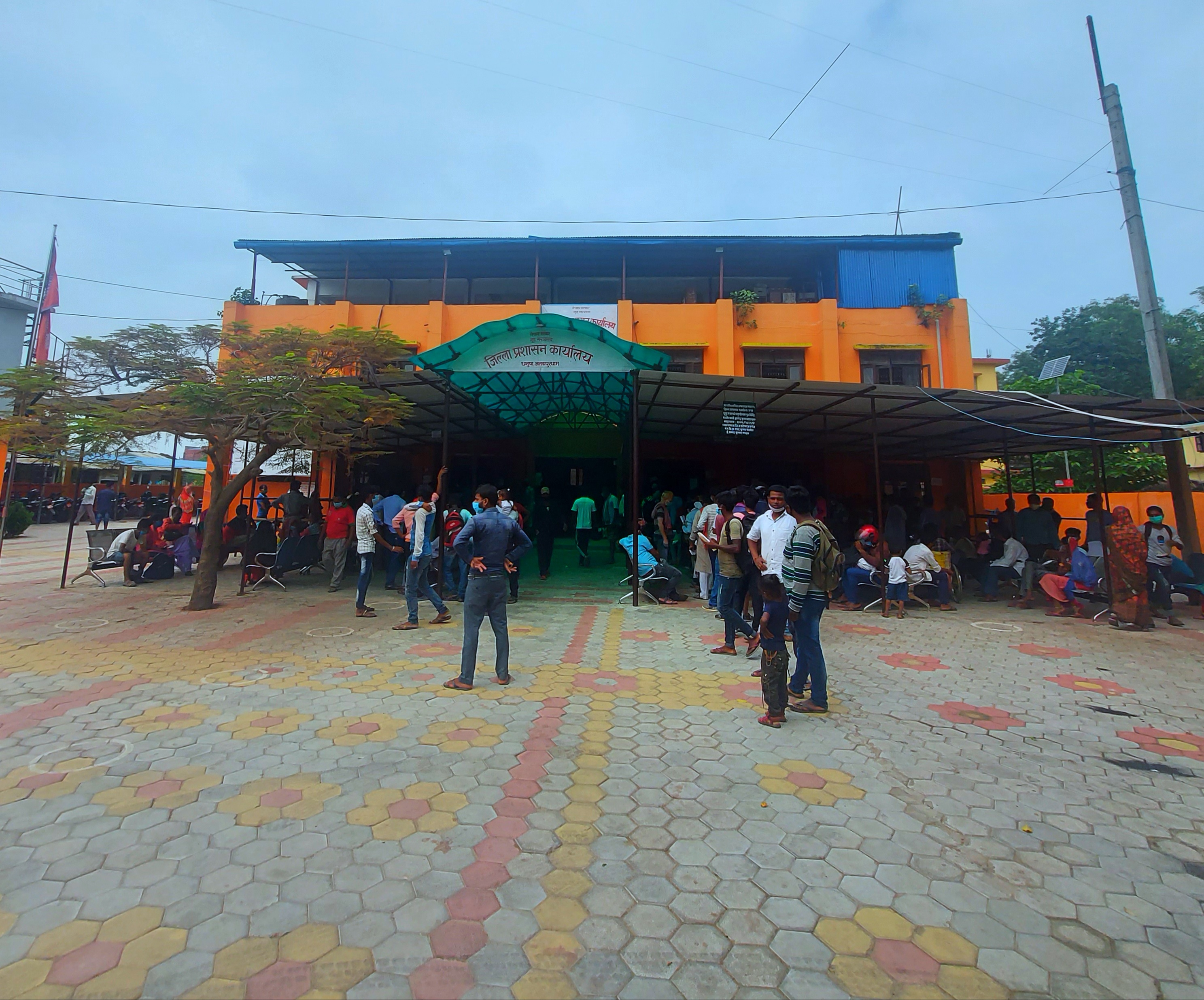
Bhathihan Bazar
Bhathihan Bazar ( ne, भठिहन ) is one of the main bazar of Sabaila municipality in Dhanusa District of Province No. 2 Madhesh Province ( Nepali/ mai, मधेश प्रदेश) is a province of Nepal that was formed after the adoption of the Constitution of Nepal. It is Nepal's most populous province, and smallest province by area. It borders Province N ... of Nepal. Bhathihan Bazar was central village of Satoshar V.D.C., where the V.D.C. office was established. During the new law process of Nepal, this village lies under the Sabaila Municipality, Dhanusa. Schools *Shree Jan-chetna primary School *Happy Land English Boarding School *Star English Boarding School *Shree Ram janaki higher secondary school and college *Royal Dhanusha boarding school References External links "Nepal Census 2001" * http://sabailamun.gov.np/ UN map of the municipalities of Dhanusa District Populated places in Dhanusha District {{Dhanusa-geo-stub ... [...More Info...] [...Related Items...] OR: [Wikipedia] [Google] [Baidu] |
Zones Of Nepal
Until the establishment of seven new provinces in 2015, Nepal was divided into 14 administrative zones ( Nepali: अञ्चल; ''anchal'') and 77 districts ( Nepali: जिल्ला; ''jillā''). The 14 administrative zones were grouped into five development regions ( Nepali: विकास क्षेत्र; ''vikās kṣetra''). Each district was headed by a Chief District Officer (CDO), who was responsible for maintaining law and order and coordinating the work of field agencies of the various government ministries. From east to west: * Eastern Development Region: **Mechi Zone, named after the Mechi River **Kosi Zone, named after the Kosi River ** Sagarmatha Zone, named after Sagarmatha (Mount Everest) * Central Development Region: **Janakpur Zone, named after its capital city **Bagmati Zone, named after the Bagmati River **Narayani Zone, named after the Narayani (lower Gandaki) River * Western Development Region: **Gandaki Zone, named after the Gandaki River ... [...More Info...] [...Related Items...] OR: [Wikipedia] [Google] [Baidu] |
Janakpur Zone
Janakpur ( ne, जनकपुर अञ्चल ) was one of the fourteen zones of Nepal, reaching from the Indian border in the south to the Tibetan border in the north and Sagarmatha Zone in the east and Bagmati and Naryani Zones in the west. The headquarters of Janakpur Zone and its main city was Janakpur. Close to the Indian border, it is a historic city of Hinduism. The city is believed to have been the capital city of King Janaka, the father-in-law of Lord Rama, the son of the then king of Ayodhya, Dasharatha. The city was then called 'Mithila Nagari'. The name of Janakpur zone is related to the historic King Janaka and his capital Janakpur. Other cities within Janakpur Zone are Kamalamai (in Inner Terai) and Bhimeshwor and Bardibas, Dhalkebar, Jaleshwor, Malangwa, Hariwan, Lalbandi, Gaushala Bazar and Matihani (Outer Terai). Administrative subdivisions Janakpur was divided into six districts; since 2015 the three northern districts have been redesignated as pa ... [...More Info...] [...Related Items...] OR: [Wikipedia] [Google] [Baidu] |
Madhesh Province
Madhesh Province ( Nepali/ mai, मधेश प्रदेश) is a province of Nepal that was formed after the adoption of the Constitution of Nepal. It is Nepal's most populous province, and smallest province by area. It borders Province No. 1 to the east, Bagmati Province to the north, and India’s Bihar state to the south. It has an area of -about 6.5% of the country's total area. It has a population of 6,126,288 as per the 2021 Nepal census, making it the most populated province of Nepal. The Koshi River and Koshi Tappu Wildlife Reserve acts as provincial demarcation border between Madhesh Province and Province No.1 in the east. And the demarcation line between Chitwan National Park and Parsa National Park (previously Wildlife Reserve) acts as provincial demarcation border between Madhesh Province and Bagmati Province in the west. The province includes eight districts from Saptari District in the east to Parsa District in the west. The majority of the province's po ... [...More Info...] [...Related Items...] OR: [Wikipedia] [Google] [Baidu] |
Dhanusha District
Dhanusha District, (; ), a part of Madhesh Province, is one of the seventy-seven districts of Nepal. It is situated in the Outer Terai. The district, with Janakpurdham as its district headquarter, covers an area of and has a population (2021) of 8,38,084. During the elections in April 2008, the district was divided into seven constituencies. It is also the home district of the first president of Nepal, Dr. Ram Baran Yadav, who contested and won the elections from constituency 5. As a political center of the region, it has prominent leaders like Bimalendra Nidhi (Former Deputy Prime Minister of Nepal), Anand Prasad Dhungana, Mahendra Yadav and Ram Krishna Yadav from the Nepali Congress, Anand Yadav (Gangaram Yadav ) from the CPN-UML, Matrika Yadav from the CPN-Maoist and Ram Chandra Jha from CPN (Unified Socialist) who have been ministers at various point of time and are still active. The most common language spoken in Dhanusha is Maithili. Dhanusha district has an air ... [...More Info...] [...Related Items...] OR: [Wikipedia] [Google] [Baidu] |
Nepal Nekpa Maowadi
Nepal (; ne, :ne:नेपाल, नेपाल ), formerly the Federal Democratic Republic of Nepal ( ne, सङ्घीय लोकतान्त्रिक गणतन्त्र नेपाल ), is a landlocked country in South Asia. It is mainly situated in the Himalayas, but also includes parts of the Indo-Gangetic Plain, bordering the Tibet Autonomous Region of China China–Nepal border, to the north, and India India–Nepal border, in the south, east, and west, while it is narrowly separated from Bangladesh by the Siliguri Corridor, and from Bhutan by the States and union territories of India, Indian state of Sikkim. Nepal has a Geography of Nepal, diverse geography, including Terai, fertile plains, subalpine forested hills, and eight of the world's ten List of highest mountains#List, tallest mountains, including Mount Everest, the highest point on Earth. Nepal is a multi-ethnic, multi-lingual, multi-religious and multi-cultural state, with Nepali langua ... [...More Info...] [...Related Items...] OR: [Wikipedia] [Google] [Baidu] |

