|
Bexley, New Zealand
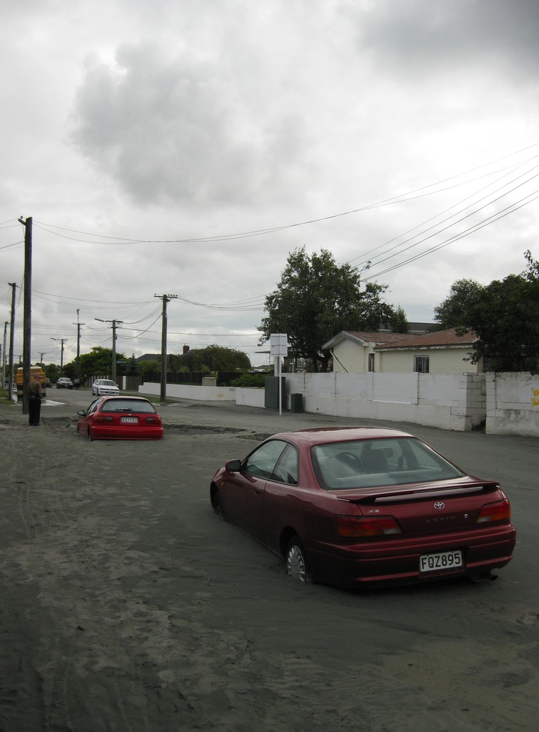
The suburb of Bexley is situated in East Christchurch on the west bank of the Avon River (Canterbury), Avon River approximately one kilometre from the Avon Heathcote Estuary. It is enclosed within a bend in the Avon River and borders the suburb of Aranui. Geography Bexley is one of the eastern suburbs. Its eastern boundary is the Avon River. Boundary roads are Pages Road in the north, Shuttle Drive in the west, and Cuthberts Road, Breezes Road and Bridge Street in the south. Bexley was substantially damaged in the February 2011 earthquake, with approximately 90% of homes in the area needing to be demolished, mostly due to the effects of liquefaction, and placed in a residential red zone. Much of the suburb is now recreational open space. Aranui is located to the north of Pages Road. Description Bexley is best known for its wetlands which in recent years have been developed for housing and also a wildlife preserve. There are a number of walkways along the Avon River and through ... [...More Info...] [...Related Items...] OR: [Wikipedia] [Google] [Baidu] |
Christchurch
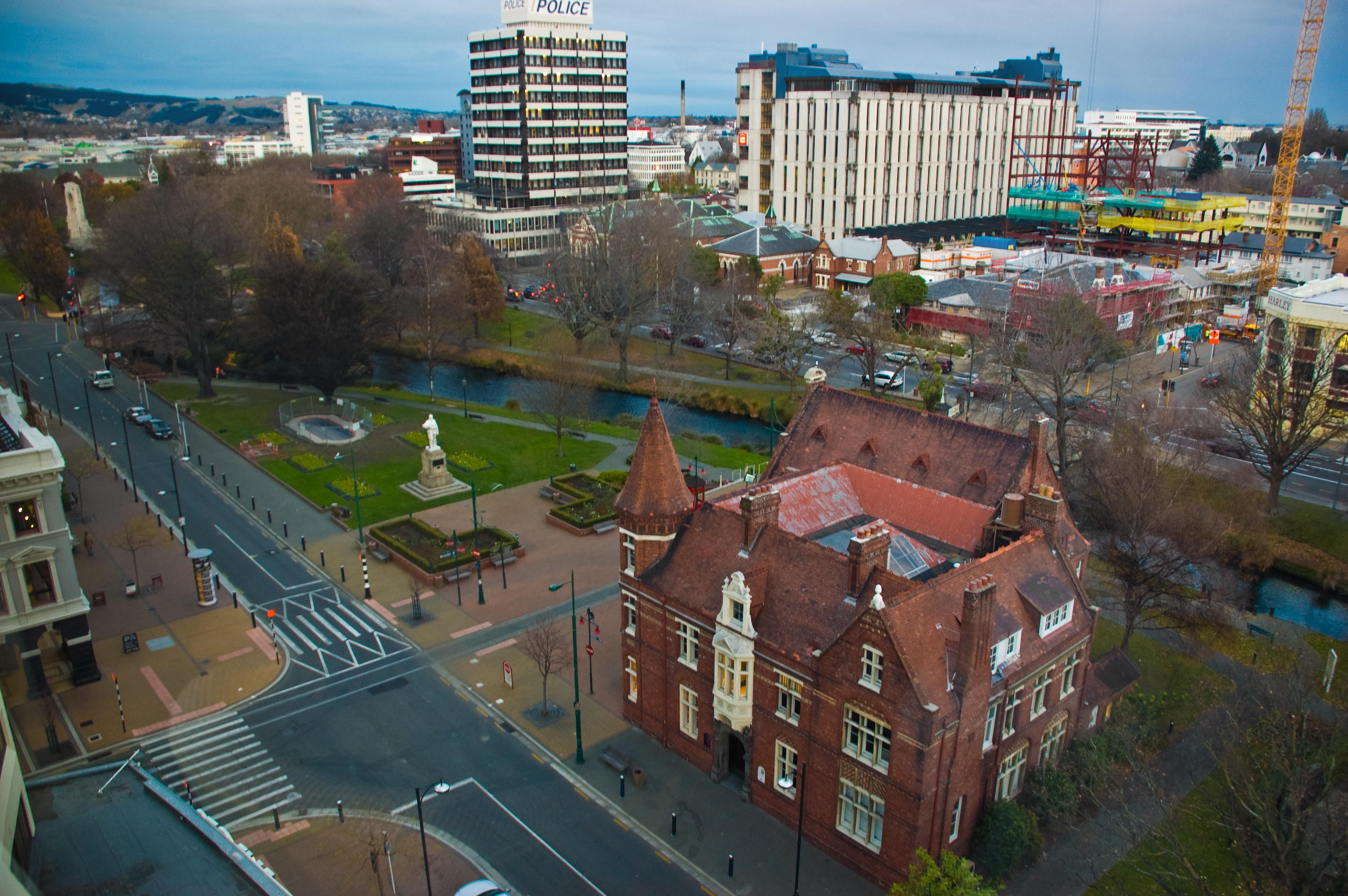
Christchurch ( ; mi, Ōtautahi) is the largest city in the South Island of New Zealand and the seat of the Canterbury Region. Christchurch lies on the South Island's east coast, just north of Banks Peninsula on Pegasus Bay. The Avon River / Ōtākaro flows through the centre of the city, with an urban park along its banks. The city's territorial authority population is people, and includes a number of smaller urban areas as well as rural areas. The population of the urban area is people. Christchurch is the second-largest city by urban area population in New Zealand, after Auckland. It is the major urban area of an emerging sub-region known informally as Greater Christchurch. Notable smaller urban areas within this sub-region include Rangiora and Kaiapoi in Waimakariri District, north of the Waimakariri River, and Rolleston and Lincoln in Selwyn District to the south. The first inhabitants migrated to the area sometime between 1000 and 1250 AD. They hunted moa, which led ... [...More Info...] [...Related Items...] OR: [Wikipedia] [Google] [Baidu] |
2013 New Zealand Census
The 2013 New Zealand census was the thirty-third national census. "The National Census Day" used for the census was on Tuesday, 5 March 2013. The population of New Zealand was counted as 4,242,048, – an increase of 214,101 or 5.3% over the 2006 census. The 2013 census forms were the same as the forms developed for the 2011 census which was cancelled due to the February 2011 major earthquake in Christchurch. There were no new topics or questions. New Zealand's next census was conducted in March 2018. Collection methods The results from the post-enumeration survey showed that the 2013 census recorded 97.6 percent of the residents in New Zealand on census night. However, the overall response rate was 92.9 percent, with a non-response rate of 7.1 percent made up of the net undercount and people who were counted in the census but had not received a form. Results Population and dwellings Population counts for New Zealand regions. Note: All figures are for the census usually r ... [...More Info...] [...Related Items...] OR: [Wikipedia] [Google] [Baidu] |
2018 New Zealand Census
Eighteen or 18 may refer to: * 18 (number), the natural number following 17 and preceding 19 * one of the years 18 BC, AD 18, 1918, 2018 Film, television and entertainment * ''18'' (film), a 1993 Taiwanese experimental film based on the short story ''God's Dice'' * ''Eighteen'' (film), a 2005 Canadian dramatic feature film * 18 (British Board of Film Classification), a film rating in the United Kingdom, also used in Ireland by the Irish Film Classification Office * 18 (''Dragon Ball''), a character in the ''Dragon Ball'' franchise * "Eighteen", a 2006 episode of the animated television series ''12 oz. Mouse'' Music Albums * ''18'' (Moby album), 2002 * ''18'' (Nana Kitade album), 2005 * '' 18...'', 2009 debut album by G.E.M. Songs * "18" (5 Seconds of Summer song), from their 2014 eponymous debut album * "18" (One Direction song), from their 2014 studio album ''Four'' * "18", by Anarbor from their 2013 studio album '' Burnout'' * "I'm Eighteen", by Alice Cooper commo ... [...More Info...] [...Related Items...] OR: [Wikipedia] [Google] [Baidu] |
Canterbury Earthquake Recovery Authority
The Canterbury Earthquake Recovery Authority (CERA; Māori: ''Te Mana Haumanu ki Waitaha'') was the public service department of New Zealand charged with coordinating the rebuild of Christchurch and the surrounding areas following the 22 February 2011 earthquake. After it was disestablished on 18 April 2016, CERA's functions were taken over by a variety of other agencies. Description CERA was formed in response to the February 2011 Christchurch earthquake, and its establishment was announced late March 2011. It had wide-ranging powers and could suspend laws and regulations for the purpose of earthquake recovery. The department operated for five years, with annual reviews. CERA was disestablished on 18 April 2016. Roger Sutton commenced as CERA's CEO on 13 June 2011. He had previously been CEO of Orion New Zealand, the electricity distribution company for the Christchurch area. Sutton resigned as CEO on 17 November 2014 effective on 31 January 2015 when CERA was downgraded from ... [...More Info...] [...Related Items...] OR: [Wikipedia] [Google] [Baidu] |
2011 Christchurch Earthquake
A major earthquake occurred in Christchurch on Tuesday 22 February 2011 at 12:51 p.m. local time (23:51 UTC, 21 February). The () earthquake struck the entire of the Canterbury region in the South Island, centred south-east of the central business district. It caused widespread damage across Christchurch, killing 185 people, in New Zealand's fifth-deadliest disaster. Christchurch's central city and eastern suburbs were badly affected, with damage to buildings and infrastructure already weakened by the magnitude 7.1 Canterbury earthquake of 4 September 2010 and its aftershocks. Significant liquefaction affected the eastern suburbs, producing around 400,000 tonnes of silt. The earthquake was felt across the South Island and parts of the lower and central North Island. While the initial quake only lasted for approximately 10 seconds, the damage was severe because of the location and shallowness of the earthquake's focus in relation to Christchurch as well as ... [...More Info...] [...Related Items...] OR: [Wikipedia] [Google] [Baidu] |
The New Zealand Herald
''The New Zealand Herald'' is a daily newspaper published in Auckland, New Zealand, owned by New Zealand Media and Entertainment, and considered a newspaper of record for New Zealand. It has the largest newspaper circulation of all newspapers in New Zealand, peaking at over 200,000 copies in 2006, although circulation of the daily ''Herald'' had declined to 100,073 copies on average by September 2019. Its main circulation area is the Auckland region. It is also delivered to much of the upper North Island including Northland, Waikato and King Country. History ''The New Zealand Herald'' was founded by William Chisholm Wilson, and first published on 13 November 1863. Wilson had been a partner with John Williamson in the ''New Zealander'', but left to start a rival daily newspaper as he saw a business opportunity with Auckland's rapidly growing population. He had also split with Williamson because Wilson supported the war against the Māori (which the ''Herald'' termed "the ... [...More Info...] [...Related Items...] OR: [Wikipedia] [Google] [Baidu] |
Soil Liquefaction
Soil liquefaction occurs when a cohesionless saturated or partially saturated soil substantially loses strength and stiffness in response to an applied stress such as shaking during an earthquake or other sudden change in stress condition, in which material that is ordinarily a solid behaves like a liquid. In soil mechanics, the term "liquefied" was first used by Allen Hazen in reference to the 1918 failure of the Calaveras Dam in California. He described the mechanism of flow liquefaction of the embankment dam as: The phenomenon is most often observed in saturated, loose (low density or uncompacted), sandy soils. This is because a loose sand has a tendency to compress when a load is applied. Dense sands, by contrast, tend to expand in volume or 'dilate'. If the soil is saturated by water, a condition that often exists when the soil is below the water table or sea level, then water fills the gaps between soil grains ('pore spaces'). In response to soil compressing, the po ... [...More Info...] [...Related Items...] OR: [Wikipedia] [Google] [Baidu] |
2010 Canterbury Earthquake
The 2010 Canterbury earthquake (also known as the Darfield earthquake) struck the South Island of New Zealand with a moment magnitude of 7.1 at on , and had a maximum perceived intensity of X (''Extreme'') on the Mercalli intensity scale. Some damaging aftershocks followed the main event, the strongest of which was a magnitude 6.3 shock known as the Christchurch earthquake that occurred nearly six months later on 22 February 2011. Because this aftershock was centred very close to Christchurch, it was much more destructive and resulted in the deaths of 185 people. The earthquake on 4 September caused widespread damage and several power outages, particularly in the city of Christchurch, New Zealand's second largest city at that time. Two residents were seriously injured, one by a collapsing chimney and a second by flying glass. One person died of a heart attack suffered during the quake. Another person died after a fall during the quake. Mass fatalities were avoided partly due t ... [...More Info...] [...Related Items...] OR: [Wikipedia] [Google] [Baidu] |
Lyttelton, New Zealand
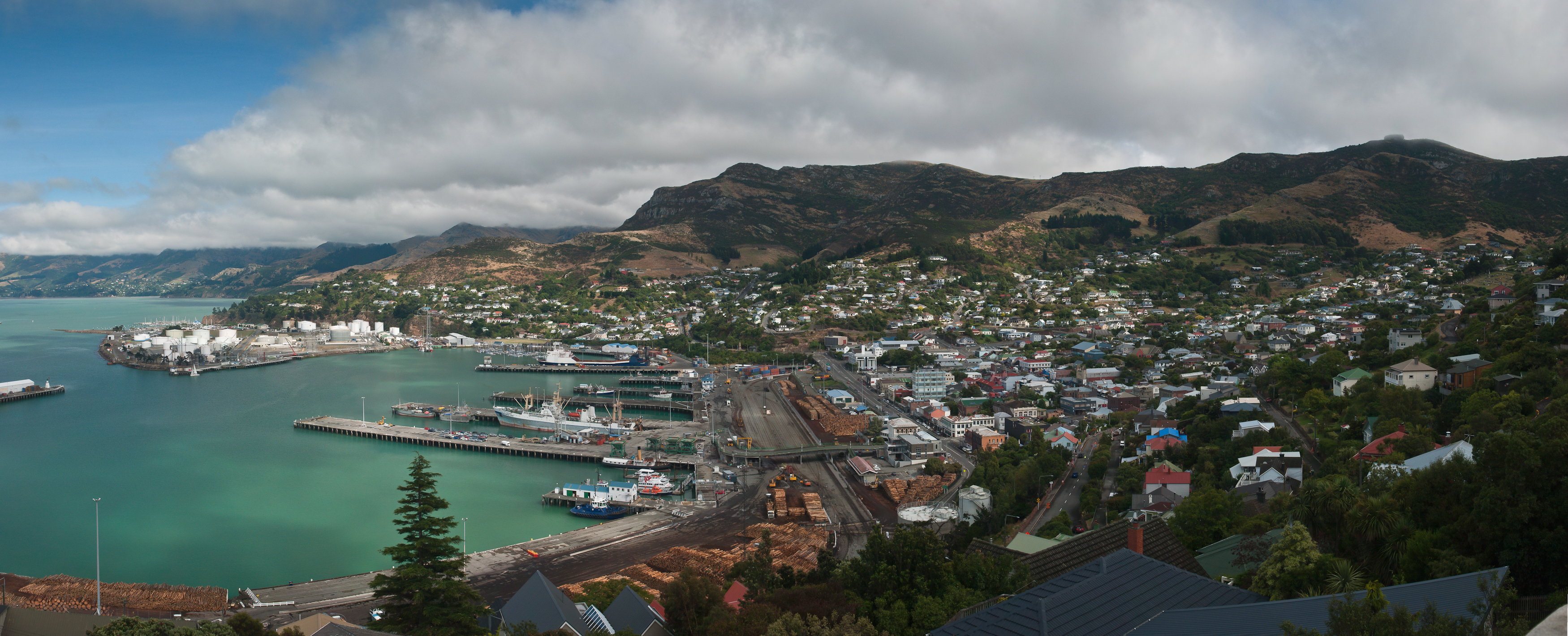
Lyttelton (Māori: ''Ōhinehou'') is a port town on the north shore of Lyttelton Harbour / Whakaraupō, at the northwestern end of Banks Peninsula and close to Christchurch, on the eastern coast of the South Island of New Zealand. As a landing point for Christchurch-bound seafarers, Lyttelton has historically been regarded as the "Gateway to Canterbury" for colonial settlers. Until the 2020 coronavirus pandemic, the port has been a regular destination for cruise ships. It is the South Island's principal goods-transport terminal, handling 34% of exports and 61% of imports by value. In 2009 Lyttelton was awarded Category I Historic Area status by the Historic Places Trust (NZHPT) defined as "an area of special or outstanding historical or cultural heritage significance or value", not long before much of the historic fabric was destroyed in the 2011 Christchurch earthquake. Location Lyttelton is the largest settlement on Lyttelton Harbour / Whakaraupō, an inlet on the northwe ... [...More Info...] [...Related Items...] OR: [Wikipedia] [Google] [Baidu] |
Christchurch City Council
The Christchurch City Council is the local government authority for Christchurch in New Zealand. It is a territorial authority elected to represent the people of Christchurch. Since October 2022, the Mayor of Christchurch is Phil Mauger, who succeeded after the retirement of Lianne Dalziel. The council currently consists of 16 councillors elected from sixteen wards, and is presided over by the mayor, who is elected at large. The number of elected members and ward boundaries changed prior during the 2016 election. History As a result of the 1989 local government reforms, on 1 November 1989 Christchurch City Council took over the functions of the former Christchurch City Council, Heathcote County Council, Riccarton Borough Council, Waimairi District Council, part of Paparua County Council, and the Christchurch Drainage Board. On 6 March 2006, Banks Peninsula District Council merged with Christchurch City Council. Councillor Yani Johanson campaigned since 2010 to live-strea ... [...More Info...] [...Related Items...] OR: [Wikipedia] [Google] [Baidu] |
New Zealand State Highway 74
State Highway 74 is a state highway in New Zealand servicing the eastern suburbs of Christchurch. Mostly two-lane, it is composed of limited-access expressways, with part of the highway as the Christchurch-Lyttelton Motorway, and connects the city to its port town of Lyttelton. Route The highway begins immediately north of Belfast, with ramps connecting to the Western Bypass of the Christchurch Northern Motorway on State Highway 1. It then proceeds in a southerly direction on the Christchurch Northern Corridor (which opened in 2020) around the suburbs of Belfast, Northwood and Redwood. At Mairehau, the highway turns east onto Queen Elizabeth II (QEII) Drive and begins its concurrency with the Christchurch Ring Road. As a dual carriageway, QEII Drive skirts through the northern suburbs of Christchurch, with major intersections at Innes Road and Marshland Road. After the Burwood Road traffic lights, the road changes name to Travis Road, drops to single carriage and runs in an ... [...More Info...] [...Related Items...] OR: [Wikipedia] [Google] [Baidu] |


