|
Belknap Range
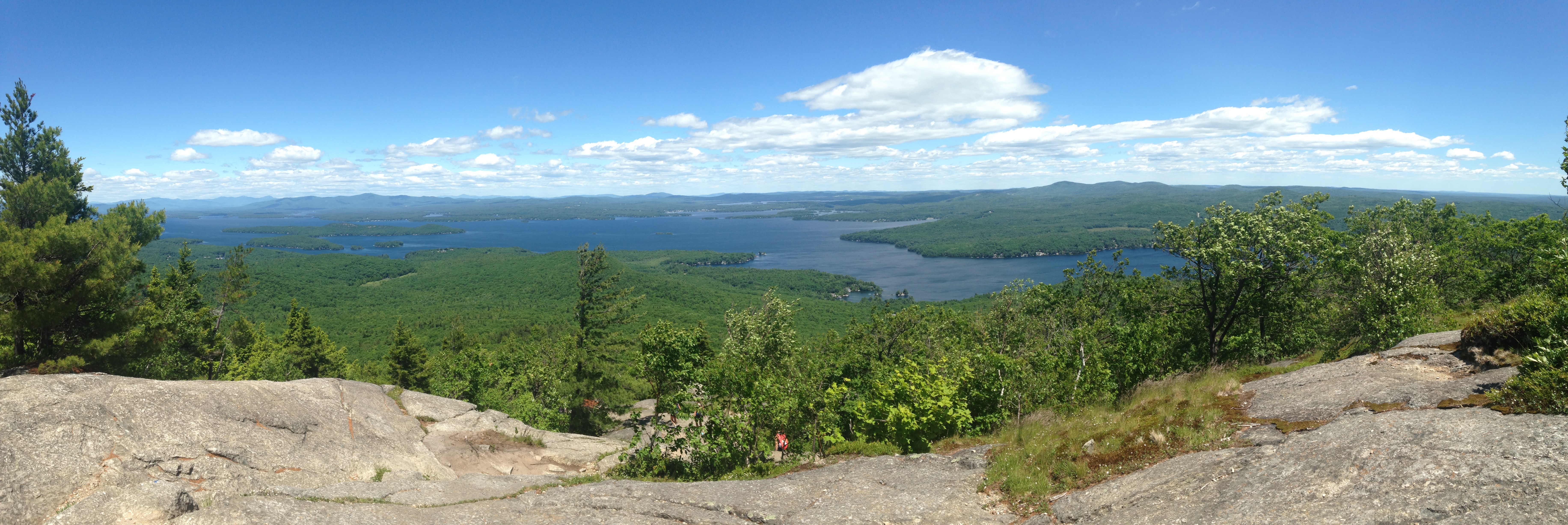
The Belknap Mountains are a small mountain range in the Lakes Region of New Hampshire in the United States. The range lies in the towns of Gilford, Gilmanton, and Alton in Belknap County. The highest peak, Belknap Mountain, with an elevation of above sea level, is the highest point in Belknap County. Belknap Mountain State Forest covers the central part of the range, including the summit and slopes of Belknap Mountain. The range extends for approximately in an arc that begins at New Hampshire Route 11A in Gilford and runs south, then curves east through the northern end of Gilmanton, before ending in the town of Alton, where it overlooks Alton Bay of Lake Winnipesaukee. The named summits in the range, from northwest to southeast, are Mount Rowe (), Gunstock Mountain (), Belknap Mountain, Straightback Mountain (), and Mount Major (). A cluster of several unofficially named summits with elevations ranging from are on the main crest of the range between Belknap Mountain an ... [...More Info...] [...Related Items...] OR: [Wikipedia] [Google] [Baidu] |
Gunstock Mountain
Gunstock Mountain is the second highest peak in the Belknap Mountains of central New Hampshire with an elevation greater than 2240 feet (683 m). It is located north of Belknap Mountain, the highest point in the range. It is home to the Gunstock Mountain Resort ski area. The ski resort has been written up in national ski magazines for its views of Lake Winnipesaukee. Gunstock Mountain stands within the watershed of the Merrimack River, which drains into the Gulf of Maine in Massachusetts. The east side of the mountain, on which the ski resorted is located, drains into Poorfarm Brook, then into Lake Winnipesaukee, the Winnipesaukee River, and the Merrimack. The west side of the mountain drains into the Gunstock River The Gunstock River is a river in the Lakes Region of central New Hampshire in the United States. It is a tributary of Lake Winnipesaukee, part of the Merrimack River watershed. The Gunstock River is entirely within the town of Gilford. It rise ..., then into L ... [...More Info...] [...Related Items...] OR: [Wikipedia] [Google] [Baidu] |
Alton Bay
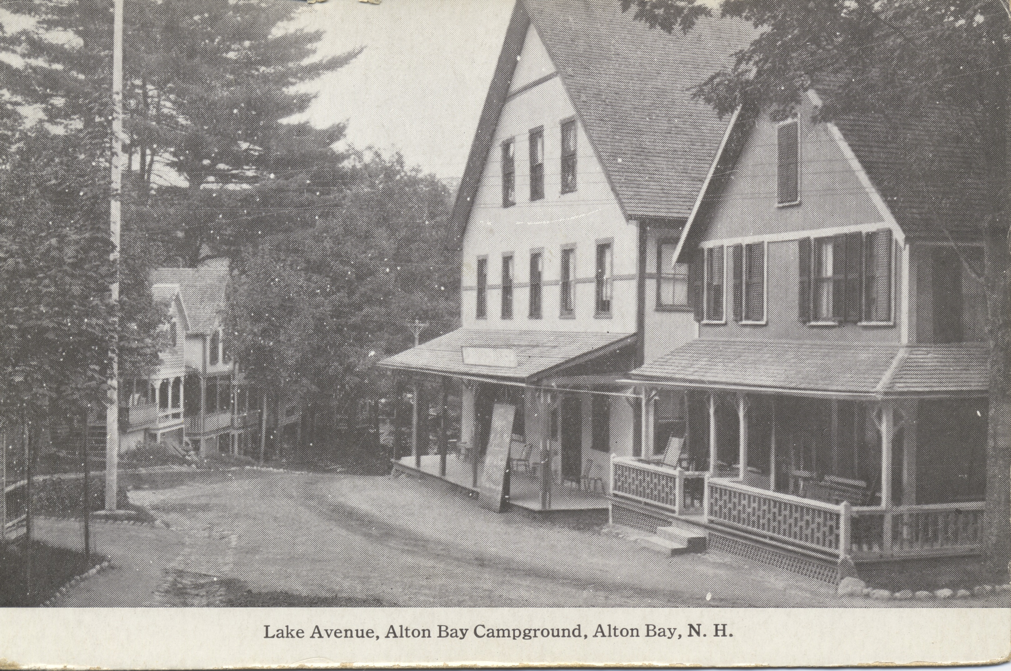
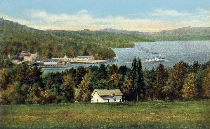
Alton Bay is an unincorporated community in the town of Alton, New Hampshire, United States, and is located on Alton Bay, a cove of Lake Winnipesaukee which forms the southernmost point on the lake. The village is part of the Lakes Region, a popular resort area of New Hampshire. Alton Bay is located at the intersection of New Hampshire Route 11 and Route 28A, north of the center of Alton. Route 11 is an east-west highway that crosses the entire state of New Hampshire, connecting Laconia to the west and Rochester to the east. Route 28A is a local highway that joins Route 28 north of Alton Bay. In 1851 the village became the terminus of the Cochecho Railroad from Dover, New Hampshire Dover is a city in Strafford County, New Hampshire, United States. The population was 32,741 at the 2020 census, making it the largest city in the New Hampshire Seacoast region and the fifth largest municipality in the state. It is the county se .... The rail line became the Lake Shore Railro ... [...More Info...] [...Related Items...] OR: [Wikipedia] [Google] [Baidu] |
Gunstock Mountain Resort
Gunstock Mountain Resort, originally known as Belknap Mountain Recreation Area, is an outdoor recreation complex located on Gunstock Mountain in Gilford, New Hampshire. Constructed by the Works Progress Administration, it was completed in 1937 and is owned by Belknap County. Activities include alpine and cross-country skiing, snow tubing, ski jumping, snowshoeing, hiking, and swimming. History Originally known as Belknap Mountain Recreation Area, Gunstock Mountain Resort was built by the Works Progress Administration, a New Deal agency that provided employment and created public works projects throughout the United States during the Great Depression. Hussey Manufacturing Company of North Berwick, Maine, led hundreds of previously unemployed laborers in the development of the recreation area, which transformed the economy of the region. The resort had the first chairlift in the eastern United States. After the completion of the 60-meter ski jump, the first meet was held in F ... [...More Info...] [...Related Items...] OR: [Wikipedia] [Google] [Baidu] |
Suncook River
The Suncook River is a river located in central New Hampshire in the United States. It is a tributary of the Merrimack River, which flows to the Gulf of Maine. Course The Suncook River begins at the outlet of Crystal Lake in the town of Gilmanton, New Hampshire. The village of Gilmanton Ironworks is located at the lake's outlet. The Suncook flows south two miles to the Suncook Lakes (Upper and Lower) in Barnstead. Below the lakes, the river passes through the village of Center Barnstead and enters the town of Pittsfield, whose village is centered on a 19th century dam on the river. The river continues south through the towns of Chichester and Epsom, and then forms the town boundary between Pembroke and Allenstown. Shortly before reaching the Merrimack River, the Suncook drops in , a natural waterpower site that led to the growth of the village of Suncook. 2006 flood On May 16, 2006, the Suncook River, responding to the highest rainfall amounts in at least 70 years (more ... [...More Info...] [...Related Items...] OR: [Wikipedia] [Google] [Baidu] |
Tioga River (New Hampshire)
The Tioga River is a river located in the Lakes Region of central New Hampshire in the United States. It is a tributary of the Winnipesaukee River, part of the Merrimack River watershed. The Tioga River rises on the western slopes of the Belknap Mountains in Gilmanton, New Hampshire. Flowing west, the river quickly enters the town of Belmont, where it spends most of its existence. The river passes through Badger Pond shortly before reaching the village proper of Belmont, which was sited along the Tioga River in the 19th century for its waterpower. The river continues west, reaching a broad wetland along the Belmont-Northfield town line, and ends at the Winnipesaukee River near the outlet of Silver Lake. New Hampshire Route 140 follows the general course of the river from Belmont village to the Winnipesaukee. See also *List of rivers of New Hampshire This is a list of rivers and significant streams in the U.S. state of New Hampshire. All watercourses named "River" (freshwa ... [...More Info...] [...Related Items...] OR: [Wikipedia] [Google] [Baidu] |
Gunstock River
The Gunstock River is a river in the Lakes Region of central New Hampshire in the United States. It is a tributary of Lake Winnipesaukee, part of the Merrimack River watershed. The Gunstock River is entirely within the town of Gilford. It rises in the southern part of town, west of Piper Mountain, and flows north, collecting streamflow from the west side of the Belknap Range. The river flows through a wide valley in the center of Gilford, passing the town's middle and high schools, then drops through a steep ravine before reaching flat ground near Lake Winnipesaukee. The river enters the lake at Sanders Bay, near the junction of Routes 11 and 11B. See also *List of rivers of New Hampshire This is a list of rivers and significant streams in the U.S. state of New Hampshire. All watercourses named "River" (freshwater or tidal) are listed here, as well as other streams which are either subject to thNew Hampshire Comprehensive Shorelan ... References Tributaries of t ... [...More Info...] [...Related Items...] OR: [Wikipedia] [Google] [Baidu] |
Winnipesaukee River
The Winnipesaukee River is a river that connects Lake Winnipesaukee with the Pemigewasset and Merrimack rivers in Franklin, New Hampshire. The river is in the Lakes Region of central New Hampshire. The river's drainage area is approximately . The river has two distinct sections. The upstream section consists of a series of river courses connecting a chain of lakes, beginning with Lake Winnipesaukee. From the dam at the outlet of Lake Winnipesaukee in the Lakeport section of Laconia, the river almost immediately enters Opechee Bay. down the lake, the river exits over a dam and drops through the center of Laconia, its banks lined by industrial buildings from the 19th century that were constructed to take advantage of the river's power. The section through Laconia ends at Lake Winnisquam, the fourth-largest lake in New Hampshire. A stretch across Winnisquam leads to the dam at the lake's outlet and a short descent to Silver Lake. The river's lower section begins at the nat ... [...More Info...] [...Related Items...] OR: [Wikipedia] [Google] [Baidu] |
Merrimack River
The Merrimack River (or Merrimac River, an occasional earlier spelling) is a river in the northeastern United States. It rises at the confluence of the Pemigewasset and Winnipesaukee rivers in Franklin, New Hampshire, flows southward into Massachusetts, and then flows northeast until it empties into the Gulf of Maine at Newburyport. From Pawtucket Falls in Lowell, Massachusetts, onward, the Massachusetts–New Hampshire border is roughly calculated as the line three miles north of the river. The Merrimack is an important regional focus in both New Hampshire and Massachusetts. The central-southern part of New Hampshire and most of northeast Massachusetts is known as the Merrimack Valley. Several U.S. naval ships have been named and USS ''Merrimac'' in honor of this river. The river is perhaps best known for the early American literary classic ''A Week on the Concord and Merrimack Rivers'' by Henry David Thoreau. Etymology and spelling The etymology of the name of the ... [...More Info...] [...Related Items...] OR: [Wikipedia] [Google] [Baidu] |
Mount Major
Mount Major is a mountain located in Alton, New Hampshire, south of Lake Winnipesaukee and northeast of Straightback Mountain in the Belknap Range. The scenic, rocky summit is a popular hiking destination, accessible by multiple trails including the Mount Major Trail, the Brook Trail, and the Boulder Loop. The north, east and south faces of Mount Major drain into Lake Winnipesaukee, thence via the Winnipesaukee River into the Merrimack River and finally into the Gulf of Maine in Massachusetts. The west ridge of Mount Major rises only feet above the col with the higher Straightback Mountain. The Society for the Protection of New Hampshire Forests owns three parcels of land on the west, north, and east sides of the mountain. See also * List of mountains in New Hampshire List of Mountains in New Hampshire is a general list of mountains in New Hampshire, with elevation. This list includes many mountains in the White Mountains range that covers about a quarter of the state, ... [...More Info...] [...Related Items...] OR: [Wikipedia] [Google] [Baidu] |
Mount Rowe
Mount Rowe, elevation , is a mountain located north of Gunstock Mountain in the Belknap Range, Belknap County, New Hampshire, United States. It has been home to multiple alpine ski operations, including the original Gunstock Mountain Resort single chairlift (now removed), the Belknap Ski Jumps, and the defunct Alpine Ridge/Mt. Rowe ski area. External links Mt. Rowe - FranklinSites.com Hiking Guide New England Lost Ski Areas Project "Mt. Rowe" Belknap Range Trails site Rowe Rowe Rowe may refer to: Places * Rowe, Massachusetts, U.S. *Rowe, New Mexico, U.S. *Rowes Bay, Queensland, a suburb of Townsville Australia *Rowe, now Rówek, Poland Other *Rowe (surname) *Rowe (musician), solo project of Becky Louise Filip, former me ... Defunct ski areas and resorts in New Hampshire {{NewHampshire-sports-venue-stub ... [...More Info...] [...Related Items...] OR: [Wikipedia] [Google] [Baidu] |
Lake Winnipesaukee
Lake Winnipesaukee () is the largest lake in the U.S. state of New Hampshire, located in the Lakes Region at the foothills of the White Mountains. It is approximately long (northwest-southeast) and from wide (northeast-southwest), covering — when Paugus Bay is included—with a maximum depth of . The center area of the lake is called The Broads. The lake contains at least 264 islands, half of which are less than in size, and is indented by several peninsulas, yielding a total shoreline of approximately . The driving distance around the lake is . It is above sea level. Winnipesaukee is the third-largest lake in New England after Lake Champlain and Moosehead Lake. Outflow is regulated by the Lakeport Dam in Lakeport, New Hampshire, on the Winnipesaukee River. History The Abenaki name ''Winnipesaukee'' (often spelled Winnipiseogee in earlier centuries) means either "smile of the Great Spirit" or "beautiful water in a high place". At the outlet of the lake, th ... [...More Info...] [...Related Items...] OR: [Wikipedia] [Google] [Baidu] |
New Hampshire Route 11A
New Hampshire Route 11 is a east–west state highway in New Hampshire, running completely across the central part of the state. Its western terminus is at the Vermont state line in Charlestown, where it continues west as Vermont Route 11. The eastern terminus is at the Maine state line in Rochester, where it crosses the border with U.S. Route 202 and continues as Maine State Route 11. Its number is derived from its original 1925 designation as New England Interstate Route 11. The highway follows a generally southwest to northeast alignment from the Vermont state line until reaching Lake Winnipesaukee, then turns southeast for the remainder of its routing to the Maine state line. There are 4 auxiliary routes, labeled 11A through 11D, all located along the shores of Lake Winnipesaukee. Route description Charlestown to Newport NH 11 begins on the western bank of the Connecticut River, where VT 11 crosses from Springfield, Vermont, into Charlestown, New Hampshire, just feet from ... [...More Info...] [...Related Items...] OR: [Wikipedia] [Google] [Baidu] |


