|
Belgian Railway Line 125
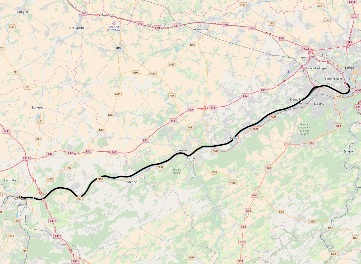
The Belgian railway line 125 is a railway line in Belgium connecting Liège and Namur. Completed in 1851, the line runs 59.5 km. It runs along the northern (left) bank of the river Meuse. Stations The main interchange stations on line 125 are: * Liège-Guillemins: to Brussels, Hasselt, Maastricht, Aachen, Marche-en-Famenne and Gouvy * Namur: to Brussels, Luxembourg City, Dinant and Charleroi Accidents and incidents *On 3 July 2008, a passenger train was in a rear-end collision with a freight train at Huy, near Saint-Georges-sur-Meuse. Forty-two people were injured. *On 5 June 2016, a passenger train was in a rear-end collision with a freight train at Hermalle-sous-Huy. Three people were killed and 36 were wounded, nine seriously. : References 125 125 may refer to: *125 (number), a natural number *AD 125, a year in the 2nd century AD *125 BC, a year in the 2nd century BC *125 (dinghy) *125 (New Jersey bus) See also * 12/5 (other) 12/5 may refer to: *Decem ... [...More Info...] [...Related Items...] OR: [Wikipedia] [Google] [Baidu] |
Liège-Guillemins Railway Station
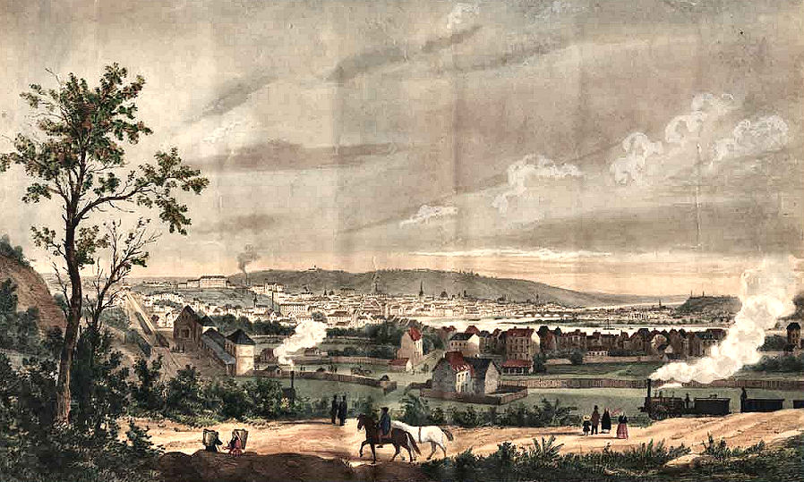
Liège-Guillemins railway station (french: Gare de Liège-Guillemins, nl, Station Luik-Guillemins, IATA code: XHN), officially Liège-Guillemins, is the main station in Liège, Belgium. It is one of the most important hubs in the country and is one of the four Belgian stations on the high-speed rail network. The station is used by 15,000 people every day, which makes it the eleventh-busiest station in Belgium and the third in Wallonia. It is operated by the National Railway Company of Belgium (SNCB/NMBS). History First station (1842–1863) The choice to make Liège the crossing point of a railway goes back to the first sketches of the railway from Antwerp to the Rhine, drawn up just after the Belgian Revolution. A royal decree issued on 21 March 1832 mentions it and a law dated 1 May 1834 provides for the creation of four lines, including the "eastern line", from Mechelen to Liège and the Prussian border.Ulysse Lamalle, ''Histoire des chemins de fer Belges'' (in French), Bru ... [...More Info...] [...Related Items...] OR: [Wikipedia] [Google] [Baidu] |
Hasselt
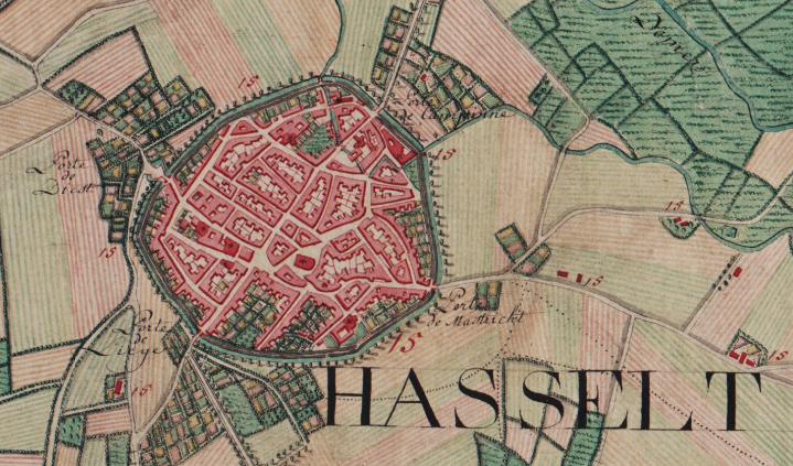
Hasselt (, , ; la, Hasseletum, Hasselatum) is a Belgian city and municipality, and capital and largest city of the province of Limburg in the Flemish Region of Belgium. It is known for its former branding as "the city of taste", as well as its local distelleries of Hasselt jenever (gin), the Hasselt Jenever Festivities, Limburgish pie and the Hasselt speculaas. The municipality includes the original city of Hasselt, plus the boroughs of Sint-Lambrechts-Herk, Wimmertingen, Kermt, Spalbeek, Kuringen, Stokrooie, Stevoort and Runkst, as well as the hamlets and parishes of Kiewit, Godsheide and Rapertingen. On 01 July 2022 Hasselt had a total population of 80,260 (39,288 men and 40,972 women). Both the Demer river and the Albert Canal run through the municipality. Hasselt is located in between the Campine region, north of the Demer river, and the Hesbaye region, to the south. On a larger scale, it is also situated in the Meuse-Rhine Euroregion. History Hasselt was founde ... [...More Info...] [...Related Items...] OR: [Wikipedia] [Google] [Baidu] |
Standard Gauge Railways In Belgium
Standard may refer to: Symbols * Colours, standards and guidons, kinds of military signs * Standard (emblem), a type of a large symbol or emblem used for identification Norms, conventions or requirements * Standard (metrology), an object that bears a defined relationship to a unit of measure used for calibration of measuring devices * Standard (timber unit), an obsolete measure of timber used in trade * Breed standard (also called bench standard), in animal fancy and animal husbandry * BioCompute Standard, a standard for next generation sequencing * ''De facto'' standard, product or system with market dominance * Gold standard, a monetary system based on gold; also used metaphorically for the best of several options, against which the others are measured * Internet Standard, a specification ratified as an open standard by the Internet Engineering Task Force * Learning standards, standards applied to education content * Standard displacement, a naval term describing the wei ... [...More Info...] [...Related Items...] OR: [Wikipedia] [Google] [Baidu] |
Saint-Georges-sur-Meuse
Saint-Georges-sur-Meuse (, literally ''Saint-Georges on Meuse''; wa, Sint-Djôr-so-Mouze) is a municipality of Wallonia located in the province of Liège, Belgium. On January 1, 2006, Saint-Georges-sur-Meuse had a total population of 6,613. The total area is 20.90 km² which gives a population density of 316 inhabitants per km². The municipality also includes the following population centres: Dommartin, la Mallieue, Saint-Georges-sur-Meuse, Stockay, Sur-les-Bois, Tincelle, Warfée, Warfusée, and Yernawe. See also * List of protected heritage sites in Saint-Georges-sur-Meuse This table shows an overview of the protected heritage sites in the Walloon town Saint-Georges-sur-Meuse. This list is part of Belgium's national heritage. See also * List of protected heritage sites in Liège (province) *Saint- ... References External links * Municipalities of Liège Province {{Liege-geo-stub ... [...More Info...] [...Related Items...] OR: [Wikipedia] [Google] [Baidu] |
Charleroi
Charleroi ( , , ; wa, Tchålerwè ) is a city and a municipality of Wallonia, located in the province of Hainaut, Belgium. By 1 January 2008, the total population of Charleroi was 201,593.Statistics Belgium; ''Population de droit par commune au 1 janvier 2008'' (excel-file) Population of all municipalities in Belgium, as of 1 January 2008. Retrieved on 19 October 2008. The , including the outer commuter zone, covers an area of with a total population of 522,522 by 1 January 2008, ranking it as the 5th most populous in |
Dinant
Dinant () is a city and municipality of Wallonia located in the province of Namur, Belgium. On the shores of river Meuse, in the Ardennes, it lies south-east of Brussels, south-east of Charleroi and south of the city of Namur. Dinant is situated north of the border with France. The municipality consists of the following districts: Anseremme, Bouvignes-sur-Meuse, Dinant, Dréhance, Falmagne, Falmignoul, Foy-Notre-Dame, Furfooz, Lisogne, Sorinnes and Thynes. Geography Dinant is positioned in the Upper Meuse valley, at a point where the river cuts deeply into the western Condroz plateau. Sited in a steep sided valley, between the rock face and the river. The original settlement had little space in which to grow away from the river, and it therefore expanded into a long, thin town, on a north-south axis, along the river shore. During the 19th century, the former ''Île des Batteurs'' (Drummers' Island) to the south was attached directly to the town when a branch of the Meuse ... [...More Info...] [...Related Items...] OR: [Wikipedia] [Google] [Baidu] |
Luxembourg City
Luxembourg ( lb, Lëtzebuerg; french: Luxembourg; german: Luxemburg), also known as Luxembourg City ( lb, Stad Lëtzebuerg, link=no or ; french: Ville de Luxembourg, link=no; german: Stadt Luxemburg, link=no or ), is the capital city of the Grand Duchy of Luxembourg and the country's most populous commune. Standing at the confluence of the Alzette and Pétrusse rivers in southern Luxembourg, the city lies at the heart of Western Europe, situated by road from Brussels, from Paris, and from Cologne. The city contains Luxembourg Castle, established by the Franks in the Early Middle Ages, around which a settlement developed. , Luxembourg City has a population of 128,514 inhabitants, which is more than three times the population of the country's second most populous commune ( Esch-sur-Alzette). The city's population consists of 160 nationalities. Foreigners represent 70% of the city's population, whilst Luxembourgers represent 30% of the population; the number of foreign-born r ... [...More Info...] [...Related Items...] OR: [Wikipedia] [Google] [Baidu] |
Gouvy
Gouvy (; wa, Gouvi) is a municipality of Wallonia located in the province of Luxembourg, Belgium. On 1 January 2007 the municipality, which covers 165.11 km2, had 4,780 inhabitants, giving a population density of 29 inhabitants per km2. The municipality consists of the following districts: Beho, Bovigny, Cherain, Limerlé, and Montleban. Villages in the municipality include Baclain, Bistain, Brisy, Cherapont, Cierreux, Courtil, Deiffelt, Halconreux, Halonru, Honvelez, Langlire, Lomré, Ourthe, Rettigny, Rogery, Steinbach, Sterpigny, Vaux and Wathermal. The administrative headquarters are situated in Bovigny. The Ourthe Orientale river originates in the municipality of Gouvy, near the hamlet of Ourthe. Transportation Gouvy railway station is served by intercity trains between Liège and Luxembourg. [...More Info...] [...Related Items...] OR: [Wikipedia] [Google] [Baidu] |
Marche-en-Famenne
Marche-en-Famenne (, literally ''Marche in Famenne''; wa, Måtche-el-Fåmene, ) is a city and municipality of Wallonia located in the Belgian province of Luxembourg. The municipality consists of the following districts: Aye, Hargimont, Humain, Marche-en-Famenne, On, Roy, and Waha. Other population centres include Grimbiémont, Hollogne, Lignières, Marloie, and Verdenne. History Middle Ages In the early Middle Ages, Marche was just a little hamlet on the Marchette brook, one of the dependencies of the nearby Abbey of Stavelot. In the 12th century, this territory was made part of the County of La Roche. It was ideally located, on the main road between Namur and Luxembourg City, and quickly evolved into a town, which obtained its charter in the 13th century. At the end of the century, in true medieval fashion, it acquired a complete system of defensive walls, with two gates, a series of watchtowers, and a keep. The market place and religious organizations, such as ... [...More Info...] [...Related Items...] OR: [Wikipedia] [Google] [Baidu] |
Aachen
Aachen ( ; ; Aachen dialect: ''Oche'' ; French and traditional English: Aix-la-Chapelle; or ''Aquisgranum''; nl, Aken ; Polish: Akwizgran) is, with around 249,000 inhabitants, the 13th-largest city in North Rhine-Westphalia, and the 28th-largest city of Germany. It is the westernmost city in Germany, and borders Belgium and the Netherlands to the west, the triborder area. It is located between Maastricht (NL) and Liège (BE) in the west, and Bonn and Cologne in the east. The Wurm River flows through the city, and together with Mönchengladbach, Aachen is the only larger German city in the drainage basin of the Meuse. Aachen is the seat of the City Region Aachen (german: link=yes, Städteregion Aachen). Aachen developed from a Roman settlement and (bath complex), subsequently becoming the preferred medieval Imperial residence of Emperor Charlemagne of the Frankish Empire, and, from 936 to 1531, the place where 31 Holy Roman Emperors were crowned Kings of the Ge ... [...More Info...] [...Related Items...] OR: [Wikipedia] [Google] [Baidu] |
Maastricht
Maastricht ( , , ; li, Mestreech ; french: Maestricht ; es, Mastrique ) is a city and a municipality in the southeastern Netherlands. It is the capital and largest city of the province of Limburg. Maastricht is located on both sides of the Meuse ( nl, Maas), at the point where the Jeker joins it. Mount Saint Peter (''Sint-Pietersberg'') is largely situated within the city's municipal borders. Maastricht is about 175 km south east of the capital Amsterdam and 65 km from Eindhoven; it is adjacent to the border with Belgium and is part of the Meuse-Rhine Euroregion, an international metropolis with a population of about 3.9 million, which includes the nearby German and Belgian cities of Aachen, Liège and Hasselt. Maastricht developed from a Roman settlement (''Trajectum ad Mosam'') to a medieval religious centre. In the 16th century it became a garrison town and in the 19th century an early industrial centre. Today, the city is a thriving cultural and regional hub. It be ... [...More Info...] [...Related Items...] OR: [Wikipedia] [Google] [Baidu] |
Brussels
Brussels (french: Bruxelles or ; nl, Brussel ), officially the Brussels-Capital Region (All text and all but one graphic show the English name as Brussels-Capital Region.) (french: link=no, Région de Bruxelles-Capitale; nl, link=no, Brussels Hoofdstedelijk Gewest), is a region of Belgium comprising 19 municipalities, including the City of Brussels, which is the capital of Belgium. The Brussels-Capital Region is located in the central portion of the country and is a part of both the French Community of Belgium and the Flemish Community, but is separate from the Flemish Region (within which it forms an enclave) and the Walloon Region. Brussels is the most densely populated region in Belgium, and although it has the highest GDP per capita, it has the lowest available income per household. The Brussels Region covers , a relatively small area compared to the two other regions, and has a population of over 1.2 million. The five times larger metropolitan area of Bruss ... [...More Info...] [...Related Items...] OR: [Wikipedia] [Google] [Baidu] |


