|
Bazoft District
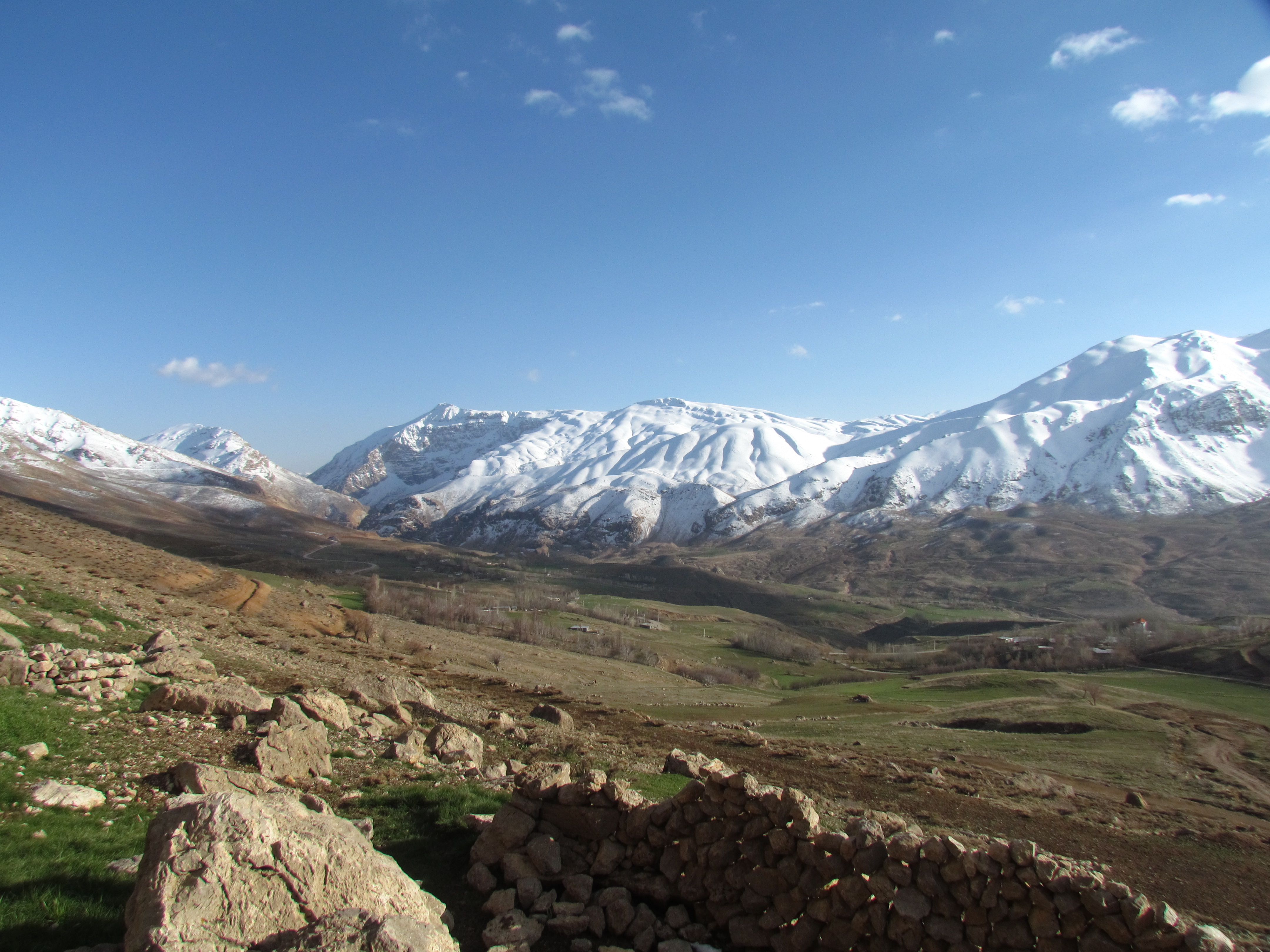
Bazoft District ( fa, بخش بازفت) is in Kuhrang County, Chaharmahal and Bakhtiari province, Iran. At the 2006 census, its population was 14,270 in 2,459 households. The following census in 2011 counted 12,185 people in 2,459 households. At the latest census in 2016, the district had 14,742 inhabitants living in 3,478 households. The population is mainly composed of Bakhtiari Lors from the Haft Lang tribes. Geography In the heart of the Zagros mountains, in the foothills of the Zardkuh mountain range, the Bazoft district is located about 180km west of Shahrekord and 200km east of Masjed Soleyman on the Shahrekord-Masjed Soleyman road. The Bazoft river, located near the Zardkuh mountains, is one of the main affluents of the Karun river. Gallery Bazoft_Fog.jpg, Bazoft valley under a heavy fog View_of_Zardkuh.jpg, Zard Kuh Zard-Kuh (meaning "Yellow Mountain", also spelled Zardkuh, Zarduh Kuh or Zard Kuh-e Bakhtiari; Persian: زردکوه بختیاری) is ... [...More Info...] [...Related Items...] OR: [Wikipedia] [Google] [Baidu] |
Bakhsh
A ( fa, بخش, also romanized as ) is a third-level administrative division of Iran. While sometimes translated as "county," it is more accurately translated as "district," similar to a township in the United States or a district of England. In Iran, the provinces (first-level divisions) (استان, ''ostān'') consist of several counties (second-level divisions) (شهرستان, ''shahrestān''), and the counties consist of one or more districts (third-level divisions) (بخش, ''bakhsh''). A district consists of a combination of cities (شهر ''shahr'') and rural districts (دهستان, ''dehestān'') (fourth-level divisions). The official governor of a district is called a ''bakhshdar'', the head of the ''bakhshdari'' office. Rural districts are a collection of villages and their surrounding lands. One of the cities of the county is named its capital. To better understand such subdivisions, the following table may be helpful. Below is the 2006 structure of Khash ... [...More Info...] [...Related Items...] OR: [Wikipedia] [Google] [Baidu] |
Bazoft Rural District
, native_name_lang = , settlement_type = Former Rural District , image_skyline = , image_alt = , image_caption = , image_flag = , flag_alt = , image_seal = , seal_alt = , image_shield = , shield_alt = , nickname = , motto = , image_map = , map_alt = , map_caption = , pushpin_map = Iran , pushpin_label_position = , pushpin_map_alt = , pushpin_map_caption = , coordinates = , coor_pinpoint = , coordinates_footnotes = , subdivision_type = Country , subdivision_name = , subdivision_type1 = Province , subdivision_name1 = Chaharmahal and Bakhtiari , subdivision_type2 = County , subdivision_name2 = Kuhrang , subdivision_type3 = District , subdivision_name3 = Bazoft ... [...More Info...] [...Related Items...] OR: [Wikipedia] [Google] [Baidu] |
Districts Of Chaharmahal And Bakhtiari Province
A district is a type of administrative division that, in some countries, is managed by the local government. Across the world, areas known as "districts" vary greatly in size, spanning regions or counties, several municipalities, subdivisions of municipalities, school district, or political district. By country/region Afghanistan In Afghanistan, a district (Persian ps, ولسوالۍ ) is a subdivision of a province. There are almost 400 districts in the country. Australia Electoral districts are used in state elections. Districts were also used in several states as cadastral units for land titles. Some were used as squatting districts. New South Wales had several different types of districts used in the 21st century. Austria In Austria, the word is used with different meanings in three different contexts: * Some of the tasks of the administrative branch of the national and regional governments are fulfilled by the 95 district administrative offices (). The area a dist ... [...More Info...] [...Related Items...] OR: [Wikipedia] [Google] [Baidu] |
Zard Kuh
Zard-Kuh (meaning "Yellow Mountain", also spelled Zardkuh, Zarduh Kuh or Zard Kuh-e Bakhtiari; Persian: زردکوه بختیاری) is a sub-range in the central Zagros Range, Iran. With an elevation of 4221 metres, the Zard-Kuh is located in the Zagros Mountains in the Chaharmahal and Bakhtiari Province of Iran. The Karun and also Zayanderud rivers start in the Zagros mountains near the Zard-Kuh. There are small glaciers on the mountain owing to the relatively high precipitation, which are the only glaciers in the subtropics outside the Himalayas, Andes and Trans-Mexican Volcanic Belt. Geologically, the Zard-Kuh is situated in the Sanandaj-Sirjan geologic and structural zone of Iran and is mainly made of Cretaceous limestone.Geological Map of Iran, National Geoscience Database of Iran, www.ngdir.ir The famous early documentary ''Grass'' captures on film the Bakhtiari tribe's crossing of Zard-Kuh barefoot in the snow with 50,000 people and 125,000 animals. See also * L ... [...More Info...] [...Related Items...] OR: [Wikipedia] [Google] [Baidu] |
Doab Samsami District
, native_name_lang = , settlement_type = District , image_skyline = , image_alt = , image_caption = , image_flag = , flag_alt = , image_seal = , seal_alt = , seat_type = , seat = , image_shield = , shield_alt = , nickname = , motto = , image_map = , map_alt = , map_caption = , pushpin_map = Iran , pushpin_label_position = , pushpin_map_alt = , pushpin_map_caption = , coordinates = , coor_pinpoint = , coordinates_footnotes = , subdivision_type = Country , subdivision_name = , subdivision_type1 = Province , subdivision_name1 = Chaharmahal and Bakhtiari , subdivision_type2 = County , subdivision_name2 = Kuhrang , subdivision_type3 ... [...More Info...] [...Related Items...] OR: [Wikipedia] [Google] [Baidu] |
Bazoft, Kuhrang
, settlement_type = City , image_skyline = Bazoft city.jpg , imagesize = , image_caption = , pushpin_map = Iran , mapsize = , subdivision_type = Country , subdivision_name = Iran , subdivision_type1 = Province , subdivision_name1 = Chaharmahal and Bakhtiari , subdivision_type2 = County , subdivision_name2 = Kuhrang , subdivision_type3 = District , subdivision_name3 = Bazoft , subdivision_type4 = , subdivision_name4 = , leader_title = , leader_name = , established_title = , established_date = , area_total_km2 = , area_footnotes = , population_as_of = 2016 , population_footnotes = , population_total = 1519 , population_density_km2 = auto , timezone = IRST , utc_offset = +3:30 , coordinates = , coordinates_footnotes = , elevation_m = , area_ ... [...More Info...] [...Related Items...] OR: [Wikipedia] [Google] [Baidu] |
Doab Rural District (Kuhrang County)
, native_name_lang = , settlement_type = Rural District , image_skyline = , image_alt = , image_caption = , image_flag = , flag_alt = , image_seal = , seal_alt = , image_shield = , shield_alt = , nickname = , motto = , image_map = , map_alt = , map_caption = , pushpin_map = Iran , pushpin_label_position = , pushpin_map_alt = , pushpin_map_caption = , coordinates = , coor_pinpoint = , coordinates_footnotes = , subdivision_type = Country , subdivision_name = , subdivision_type1 = Province , subdivision_name1 = Chaharmahal and Bakhtiari , subdivision_type2 = County , subdivision_name2 = Kuhrang , subdivision_type3 = District , subdivision_name3 = Doab Samsami ... [...More Info...] [...Related Items...] OR: [Wikipedia] [Google] [Baidu] |
Bazoft-e Pain Rural District
, native_name_lang = , settlement_type = Rural District , image_skyline = , image_alt = , image_caption = , image_flag = , flag_alt = , image_seal = , seal_alt = , image_shield = , shield_alt = , nickname = , motto = , image_map = , map_alt = , map_caption = , pushpin_map = Iran , pushpin_label_position = , pushpin_map_alt = , pushpin_map_caption = , coordinates = , coor_pinpoint = , coordinates_footnotes = , subdivision_type = Country , subdivision_name = , subdivision_type1 = Province , subdivision_name1 = Chaharmahal and Bakhtiari , subdivision_type2 = County , subdivision_name2 = Kuhrang , subdivision_type3 = District , subdivision_name3 = Bazoft , esta ... [...More Info...] [...Related Items...] OR: [Wikipedia] [Google] [Baidu] |
Bazoft-e Bala Rural District
, native_name_lang = , settlement_type = Rural District , image_skyline = , image_alt = , image_caption = , image_flag = , flag_alt = , image_seal = , seal_alt = , image_shield = , shield_alt = , nickname = , motto = , image_map = , map_alt = , map_caption = , pushpin_map = Iran , pushpin_label_position = , pushpin_map_alt = , pushpin_map_caption = , coordinates = , coor_pinpoint = , coordinates_footnotes = , subdivision_type = Country , subdivision_name = , subdivision_type1 = Province , subdivision_name1 = Chaharmahal and Bakhtiari , subdivision_type2 = County , subdivision_name2 = Kuhrang , subdivision_type3 = District , subdivision_name3 = Bazoft , esta ... [...More Info...] [...Related Items...] OR: [Wikipedia] [Google] [Baidu] |
Haft Lang
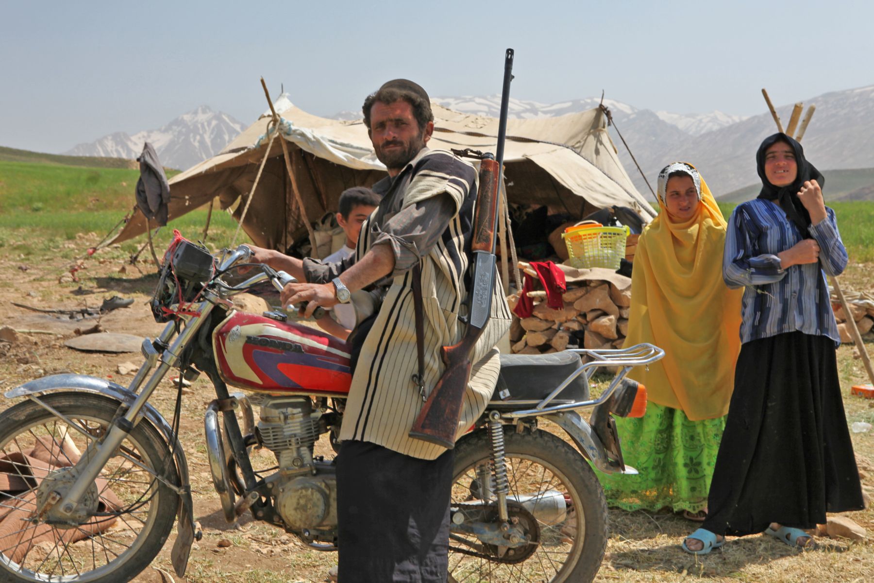
The Bakhtiari (also spelled Bakhtiyari; fa, بختیاری) are a Lur tribe from Iran. They speak the Bakhtiari dialect of the Luri language. Bakhtiaris primarily inhabit Chaharmahal and Bakhtiari and eastern Khuzestan, Lorestan, Bushehr, and Isfahan provinces. Bakhtiari tribes have an especially large population concentration in the cities of Masjed Soleyman, Izeh, Shahr-e Kord, and Andika, and the surrounding villages. A small percentage of Bakhtiari are still nomadic pastoralists, migrating between summer quarters (''sardsīr'' or ''yaylāq'') and winter quarters (''garmsīr'' or ''qishlāq''). Numerical estimates of their total population vary widely. Origins Although there have been several suggested theories for the origin of the Bakhtiyaris, historians and researchers generally agree that they are Lurs. According to folklore, the Lurs are descended from a group of youngsters who survived and fled from the demon Zahhak, a demonic figure who is mentioned in Zoroastrian ... [...More Info...] [...Related Items...] OR: [Wikipedia] [Google] [Baidu] |
Provinces Of Iran
Iran is subdivided into thirty-one provinces ( fa, استان ''ostân''), each governed from a local centre, usually the largest local city, which is called the capital (Persian: , '' markaz'') of that province. The provincial authority is headed by a governor-general (Persian: ''ostândâr''), who is appointed by the Minister of the Interior subject to approval of the cabinet. Modern history Iran has held its modern territory since the Treaty of Paris in 1857. From 1906 until 1950, Iran was divided into twelve provinces: Ardalan, Azerbaijan, Baluchestan, Fars, Gilan, Araq-e Ajam, Khorasan, Khuzestan, Kerman, Larestan, Lorestan, and Mazandaran. In 1950, Iran was reorganized to form ten numbered provinces with subordinate governorates: Gilan; Mazandaran; East Azerbaijan; West Azerbaijan; Kermanshah; Khuzestan; Fars; Kerman; Khorasan; Isfahan. Iran has had a historical claim to Bahrain as its 14th province: Bahrain Province, until 1971 under British colonial o ... [...More Info...] [...Related Items...] OR: [Wikipedia] [Google] [Baidu] |
Bakhtiari People
The Bakhtiari (also spelled Bakhtiyari; fa, بختیاری) are a Lur tribe from Iran. They speak the Bakhtiari dialect of the Luri language. Bakhtiaris primarily inhabit Chaharmahal and Bakhtiari and eastern Khuzestan, Lorestan, Bushehr, and Isfahan provinces. Bakhtiari tribes have an especially large population concentration in the cities of Masjed Soleyman, Izeh, Shahr-e Kord, and Andika, and the surrounding villages. A small percentage of Bakhtiari are still nomadic pastoralists, migrating between summer quarters (''sardsīr'' or ''yaylāq'') and winter quarters (''garmsīr'' or ''qishlāq''). Numerical estimates of their total population vary widely. Origins Although there have been several suggested theories for the origin of the Bakhtiyaris, historians and researchers generally agree that they are Lurs. According to folklore, the Lurs are descended from a group of youngsters who survived and fled from the demon Zahhak, a demonic figure who is mentioned in Zoroastr ... [...More Info...] [...Related Items...] OR: [Wikipedia] [Google] [Baidu] |


