|
Battle Of Arachova
The Battle of Arachova ( el, Μάχη της Αράχωβας), took place between 18 and 24 November 1826 ( N.S.). It was fought between an Ottoman Empire force under the command of Mustafa Bey and Greek rebels under Georgios Karaiskakis. After receiving intelligence of the Ottoman army's maneuvers, Karaiskakis prepared a surprise attack in vicinity of the village of Arachova, in central Greece. On 18 November, Mustafa Bey's 2,000 Ottoman troops were blockaded in Arachova. An 800-man force that attempted to relieve the defenders three days later failed. On 22 November Mustafa Bey was mortally wounded and Ottoman morale plunged, as cold weather and heavy rainfall plagued the hunger-stricken defenders. At midday on 24 November the Ottomans made a disastrous attempt at breaking out. Most were killed in the fighting or perished from the cold. The Greek victory at Arachova gained the rebels valuable time before the Great Powers came to their assistance a year later. Background In ... [...More Info...] [...Related Items...] OR: [Wikipedia] [Google] [Baidu] |
Greek War Of Independence
The Greek War of Independence, also known as the Greek Revolution or the Greek Revolution of 1821, was a successful war of independence by Greek revolutionaries against the Ottoman Empire between 1821 and 1829. The Greeks were later assisted by the British Empire, Bourbon Restoration in France, Kingdom of France, and the Russian Empire, while the Ottomans were aided by their North African vassals, particularly the eyalet of Egypt Eyalet, Egypt. The war led to the formation of modern Greece. The revolution is Celebration of the Greek Revolution, celebrated by Greeks around the world as Greek Independence Day, independence day on 25 March. Greece, with the exception of the Ionian Islands, came under Ottoman rule in the 15th century, in the decades before and after the fall of Constantinople. During the following centuries, there were sporadic but unsuccessful Ottoman Greece#Uprisings before 1821, Greek uprisings against Ottoman rule. In 1814, a secret organization called Filiki Et ... [...More Info...] [...Related Items...] OR: [Wikipedia] [Google] [Baidu] |
Morea
The Morea ( el, Μορέας or ) was the name of the Peloponnese peninsula in southern Greece during the Middle Ages and the early modern period. The name was used for the Byzantine province known as the Despotate of the Morea, by the Ottoman Empire for the Morea Eyalet, and later by the Republic of Venice for the short-lived Kingdom of the Morea. Etymology There is some uncertainty over the origin of the medieval name "Morea", which is first recorded only in the 10th century in the Byzantine chronicles. Traditionally, scholars thought the name to have originated from the word ''morea'' (μορέα), meaning morus or mulberry, a tree which, though known in the region from the ancient times, gained value after the 6th century, when mulberry-eating silkworms were smuggled from China to Byzantium. The British Byzantinist Steven Runciman suggested that the name comes "from the likeness of its shape to that of a mulberry leaf". History After the conquest of Constantinople by t ... [...More Info...] [...Related Items...] OR: [Wikipedia] [Google] [Baidu] |
Distomo
:"Distomo" ''may also refer to a work by Federico García Lorca'' Distomo ( el, Δίστομο) is a town in western Boeotia, Greece. Since the 2011 local government reform it is part of the municipality Distomo-Arachova-Antikyra, of which it is the seat and a municipal unit. The municipal unit has an area of 131.270 km2, the community 80.498 km2. Population 3,881 (2011). Distomo is situated in the western foothills of Mount Helicon, at about 450 m elevation. It is 5 km north of the Gulf of Corinth coast, 9 km southeast of Arachova, 12 km east of Desfina, 16 km southeast of Delphi, 18 km west of Livadeia and 105 km northwest of Athens. The Greek National Road 48 (Naupactus - Arachova - Livadeia) passes north of the town. Distomo is known as the site of the Distomo massacre that was perpetrated by the German army against the local inhabitants during the Second World War. One of the most important monuments of Byzantine architecture and a UNES ... [...More Info...] [...Related Items...] OR: [Wikipedia] [Google] [Baidu] |
Hosios Loukas
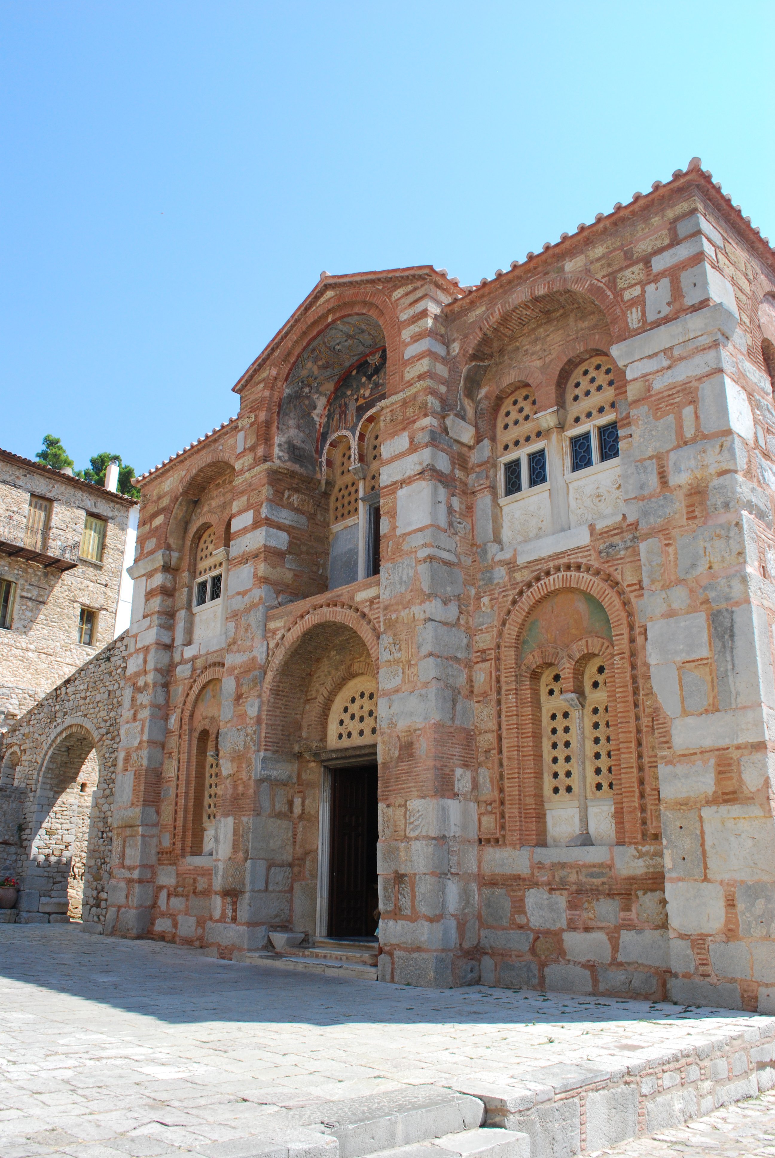
Hosios Loukas ( el, Ὅσιος Λουκᾶς) is a historic walled monastery situated near the town of Distomo, in Boeotia, Greece. Founded in the mid-10th century, the monastery is one of the most important monuments of Middle Byzantine architecture and art, and has been listed on UNESCO's World Heritage Sites since 1990, along with the monasteries of Nea Moni and Daphnion. History The monastery of Hosios Loukas is situated at a scenic site on the slopes of Mount Helicon. It was founded in the early 10th century AD by the hermit, Venerable (Greek: ''Hosios'') Luke of Steiris (Greek: ''Lukas''), whose relics are kept in the monastery to this day. St Luke (not to be confused with the Evangelist author of the Gospel of Saint Luke), was a hermit who died on 7 February 953. He is famous for having predicted the conquest of Crete by Emperor Romanos. It was unclear if he was referring to Romanos I, the emperor at the time. However the island was actually reconquered by Nicephorus ... [...More Info...] [...Related Items...] OR: [Wikipedia] [Google] [Baidu] |
Atalanti
Atalanti ( el, Αταλάντη '' Atalantē'') is the second largest town in Phthiotis, Greece. It is located southeast of Lamia, north of Livadeia and northwest of Chalcis. In 2011, it was incorporated into the municipality of Lokroi, of which it is the government seat and a municipal unit. Geography The town can be accessed via the Greek National Road 1 (Athens – Lamia – Thessaloniki). It is situated in central Greece, surrounded by Mt. Knimida to the north, Mt. Chlomo to the south, Mt. Parnassus to the west, and the northern Eubean Gulf to the east. The area is characterized by high concentrations of magnesium and iron in the soil. The municipal unit has an area of 304.141 km2. Economy Atalanti is known as a market town and was the capital of the former Locris Province. The town's geography has garnered it a reputation in Greece as a notable wine-producing hub. Subdivisions The municipal unit, Atalanti, is subdivided into the following communities ( ... [...More Info...] [...Related Items...] OR: [Wikipedia] [Google] [Baidu] |
Amfissa
Amfissa ( el, Άμφισσα , also mentioned in classical sources as Amphissa) is a town in Phocis, Greece, part of the municipality of Delphi, of which it is the seat and a municipal unit. The municipal unit has an area of 315.174 km2. It lies on the northern edge of the olive forest of the Crissaean plain, between two mountains, Giona to the west and Parnassus to the east, northwest of Athens and of Delphi, as well as northeast of Naupactus and south of Lamia. Amfissa dates back to antiquity, with its history spanning around 3,000 years, and has been traditionally the largest and capital city of Phocis. It was the most important city of the ancient Greek tribe of the Ozolian Locrians and one of the most powerful cities in Central Greece. In the Middle Ages, Amfissa came to be known as Salona, it declined after several foreign conquests and destructions, but emerged as an important city in the region and played a major role during the Greek War of Independence. Origin ... [...More Info...] [...Related Items...] OR: [Wikipedia] [Google] [Baidu] |
Livadeia
Livadeia ( el, Λιβαδειά ''Livadiá'', ; grc, Λεβάδεια, Lebadeia or , ''Lebadia'') is a town in central Greece. It is the capital of the Boeotia regional district. Livadeia lies north-west of Athens, west of Chalkida, south-east of Lamia, east-south-east of Amfissa, and east-north-east of Nafpaktos. The town lies some west of Greek National Road 3, to which it is linked by National Road 48. The area around Livadeia is mountainous, with farming activities mainly confined to the valleys. The area has traditionally been associated with the production and processing of cotton and tobacco, as well as the cultivation of cereal crops and the raising of livestock. The city also known for having participated in the War of Troy in allegiance with Mycenae. Livadeia is home to Levadiakos FC, members of the Greek Superleague. Geography The municipality of Livadeia covers an area of , the municipal unit of Livadeia and the community . Municipality The municipality ... [...More Info...] [...Related Items...] OR: [Wikipedia] [Google] [Baidu] |
Tower Houses In The Balkans
A distinctive type of Ottoman tower houses ( sq, kullë; bg, кули, ; sr, kуле, ro, culă, all meaning "tower", from Arabic (, “fort, fortress”) via Persian , meaning "mountain" or "top", and Turkish ) developed and were built in the BalkansGreville Pounds 1994p. 335 "In southeastern Europe, where the extended family was exemplified as nowhere else in the western world, the home itself was often protected, giving rise to the kula or tower- house." (Albania, Bosnia and Herzegovina, Montenegro, Bulgaria, Greece, Kosovo, Macedonia and Serbia), as well as in Oltenia, in Romania, after the Ottoman conquest in the Middle Ages by both Christian and Muslim communities. The practice began during the decline of Ottoman power in the 17th centuryGrube-Mitchell 1978, p. 204: "a distinctive form of defensive tower-dwelling, the kula, developed among both the Christian and the Muslim communities during the insecure period of the decline of the Ottoman authority in the 17th century ... [...More Info...] [...Related Items...] OR: [Wikipedia] [Google] [Baidu] |
Domvrena
The Gulf of Corinth or the Corinthian Gulf ( el, Κορινθιακός Kόλπος, ''Korinthiakόs Kόlpos'', ) is a deep inlet of the Ionian Sea, separating the Peloponnese from western mainland Greece. It is bounded in the east by the Isthmus of Corinth which includes the shipping-designed Corinth Canal and in the west by the Strait of Rion which widens into the shorter Gulf of Patras (part of the Ionian Sea) and of which the narrowest point is crossed since 2004 by the Rio–Antirrio bridge. The gulf is bordered by the large administrative divisions (regional units): Aetolia-Acarnania and Phocis in the north, Boeotia in the northeast, Attica in the east, Corinthia in the southeast and south and Achaea in the southwest. The gulf is in tectonic movement comparable to movement in parts of Iceland and Turkey, growing by per year. In the Middle Ages, the gulf was known as the Gulf of Lepanto (the Italian form of Naupactus). Shipping routes between the Greek commercial port ... [...More Info...] [...Related Items...] OR: [Wikipedia] [Google] [Baidu] |
Russo-Turkish War (1806–1812)
The Russo-Turkish War (1806–1812) between the Russian Empire and the Ottoman Empire was one of the Russo-Ottoman Wars. Russia prevailed, but both sides wanted peace as they feared Napoleon's moves to the east. Background The war broke out against the background of the Napoleonic Wars. In 1806, Sultan Selim III, encouraged by the Russian defeat at Austerlitz and advised by the French Empire, deposed the pro-Russian Constantine Ypsilantis as Hospodar of the Principality of Wallachia and Alexander Mourousis as Hospodar of Moldavia, both Ottoman vassal states. Simultaneously, the French Empire occupied Dalmatia and threatened to penetrate the Danubian principalities at any time. In order to safeguard the Russian border against a possible French attack, a 40,000-strong Russian contingent advanced into Moldavia and Wallachia. The Sultan reacted by blocking the Dardanelles to Russian ships and declared war on Russia. Early hostilities Initially, Emperor Alexander I was relu ... [...More Info...] [...Related Items...] OR: [Wikipedia] [Google] [Baidu] |
Wallachia
Wallachia or Walachia (; ro, Țara Românească, lit=The Romanian Land' or 'The Romanian Country, ; archaic: ', Romanian Cyrillic alphabet: ) is a historical and geographical region of Romania. It is situated north of the Lower Danube and south of the Southern Carpathians. Wallachia is traditionally divided into two sections, Muntenia (Greater Wallachia) and Oltenia (Lesser Wallachia). Dobruja could sometimes be considered a third section due to its proximity and Dobruja#Wallachian rule, brief rule over it. Wallachia as a whole is sometimes referred to as Muntenia through identification with the larger of the two traditional sections. Wallachia was founded as a principality in the early 14th century by Basarab I of Wallachia, Basarab I after a rebellion against Charles I of Hungary, although the first mention of the territory of Wallachia west of the river Olt River, Olt dates to a charter given to the voivode Seneslau in 1246 by Béla IV of Hungary. In 1417, Wallachia was fo ... [...More Info...] [...Related Items...] OR: [Wikipedia] [Google] [Baidu] |
Kodjabashis
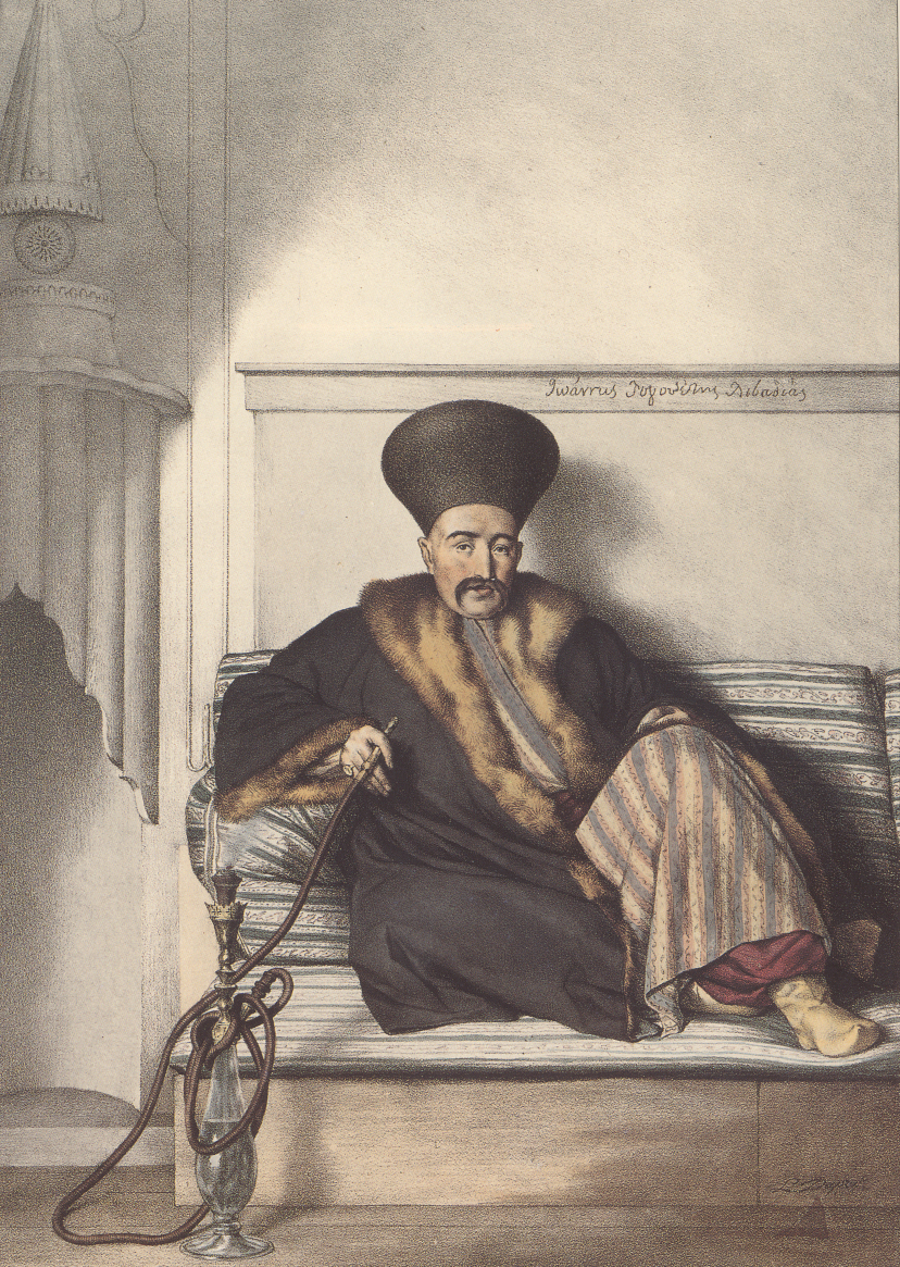
The kodjabashis ( el, κοτζαμπάσηδες, kotzabasides; singular κοτζάμπασης, ''kotzabasis''; sh, kodžobaša, kodžabaša; from tr, kocabaṣı, hocabaṣı) were local Christian notables in parts of the Ottoman Balkans, most often referring to Ottoman Greece and especially the Peloponnese. They were also known in Greek as ''proestoi'' or ''prokritoi'' (προεστοί/πρόκριτοι, "primates") or ''demogerontes'' (δημογέροντες, "elders of the people"). In some places they were elected (such in the islands for example), but, especially in the Peloponnese, they soon became a hereditary oligarchy, who exercised considerable influence and held posts in the Ottoman administration. The title was also present in Ottoman Serbia and Bosnia, where it was known as ''starešina'' ("elder, chief") instead of the official Turkish name. The terms '' chorbaji'' (from Turkish ''çorbacı'') and '' knez'' (a Slavic title) were also used for this type of pri ... [...More Info...] [...Related Items...] OR: [Wikipedia] [Google] [Baidu] |


