|
Battle Of Gythium
The siege of Gythium was fought in 195 BC between Sparta and the coalition of Rome, Rhodes, the Achaean League, and Pergamum. As the port of Gythium was an important Spartan base, the allies decided to capture it before they advanced inland to Sparta. The Romans and the Achaeans were joined outside the city by the Pergamese and Rhodian fleets. The Spartans held out, but one of the joint commanders, Dexagoridas, decided to surrender the city to the Roman legate. When Gorgopas, the other commander, found out, he killed Dexagoridas and took sole command of the city. After Dexagoridas' murder, the Spartans held out more vigorously. However, Titus Quinctius Flamininus of the allied forces arrived with 4,000 more men and the Spartans decided to surrender the city on the condition that the garrison could leave unharmed. The result of this siege forced Nabis, the tyrant of Sparta, to abandon the surrounding land and withdraw to the city of Sparta. Later that year, Sparta capitulated to t ... [...More Info...] [...Related Items...] OR: [Wikipedia] [Google] [Baidu] |
War Against Nabis
The Laconian War of 195 BC was fought between the Greek city-state of Sparta and a coalition composed of Rome, the Achaean League, Pergamum, Rhodes, and Macedon. During the Second Macedonian War (200–196 BC), Macedon had given Sparta control over Argos, an important city on the Aegean coast of Peloponnese. Sparta's continued occupation of Argos at the end of war was used as a pretext for Rome and its allies to declare war. The anti-Spartan coalition laid siege to Argos, captured the Spartan naval base at Gythium, and soon invested and besieged Sparta itself. Eventually, negotiations led to peace on Rome's terms, under which Argos and the coastal towns of Laconia were separated from Sparta and the Spartans were compelled to pay a war indemnity to Rome over the next eight years. Argos joined the Achaean League, and the Laconian towns were placed under Achaean protection. As a result of the war, Sparta lost its position as a major power in Greece. Subsequent Spartan attempts to ... [...More Info...] [...Related Items...] OR: [Wikipedia] [Google] [Baidu] |
Siegecraft In Ancient Greece
Siegecraft originated in Ancient Greece. This type of siege originated from the moment in which the stage of the mere siege was surpassed by an exceptional development of military techniques, which were hardly taken any further during the Middle Ages, until the invention of firearms. The importance of siege techniques was due to the increase in the strategic role of the city to the detriment of the territory in the overall defense of the polis. Origins Apart from the Mycenae tablet, in which slingers, archers and stone throwers are seen fighting a battle under the walls of a city, Homer's description of the chariot assault launched by the Trojans against the fortified camp of the Achaeans, and the anecdote of the Trojan Horse, there is nothing, except the fortifications discovered by archaeologists, that informs us about the evolution of Greek poliorcetics before the end of the Archaic Period. Since the Neolithic, defensive concerns have presided over the organization of the ... [...More Info...] [...Related Items...] OR: [Wikipedia] [Google] [Baidu] |
Parley
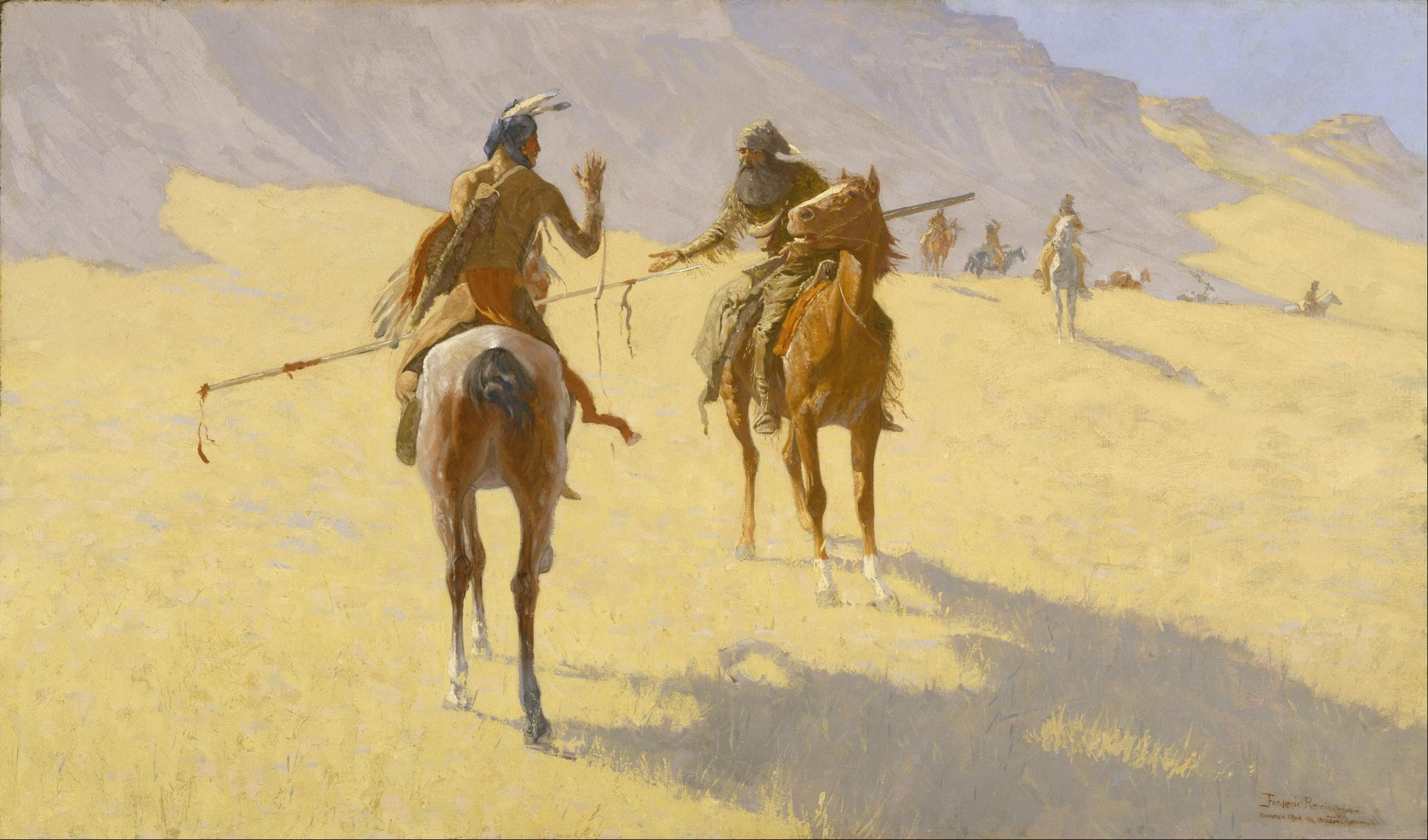
A parley (from french: link=no, parler – "to speak") refers to a discussion or conference, especially one designed to end an argument or hostilities between two groups of people. The term can be used in both past and present tense; in present tense the term is referred to as parleying. In some cases, opposing parties would signal their intent to invoke parley by using a white flag, however the use of a white flag to invoke or request parley is not considered mandatory. The term ''parley'' has been used to refer to numerous high-profile meetings of the 20th century, including the London and Paris Conferences held in 1954 to determine the status of West Germany. In popular culture Below are some examples where a parley is a significant element of the plot. * The Last of the Mohicans features a scene depicting a parley at the end the siege of Fort William Henry. * In the ''Pirates of the Caribbean'' series, parley is a plot device introduced in the first film, '' Pirates of ... [...More Info...] [...Related Items...] OR: [Wikipedia] [Google] [Baidu] |
Macedonia And The Aegean World C
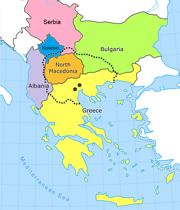
Macedonia most commonly refers to: * North Macedonia, a country in southeastern Europe, known until 2019 as the Republic of Macedonia * Macedonia (ancient kingdom), a kingdom in Greek antiquity * Macedonia (Greece), a traditional geographic region spanning three administrative divisions of northern Greece * Macedonia (region), a geographic and historical region that today includes parts of six Balkan countries (see map) Macedonia, Makedonia, Makedonija, or Makedoniya may also refer to: Other historical entities * Achaemenid Macedonia, a satrapy of Achaemenid Empire * Macedonia (Roman province), a province of the early Roman Empire * Diocese of Macedonia, a late Roman administrative unit * Macedonia (theme), a province of the Byzantine Empire * Independent Macedonia (1944), a proposed puppet state of the Axis powers (1944) * Socialist Republic of Macedonia, a part of the former Yugoslavia (1945–1991) and a predecessor of North Macedonia Other geographical uses Within the re ... [...More Info...] [...Related Items...] OR: [Wikipedia] [Google] [Baidu] |
Laconia
Laconia or Lakonia ( el, Λακωνία, , ) is a historical and administrative region of Greece located on the southeastern part of the Peloponnese peninsula. Its administrative capital is Sparta. The word ''laconic''—to speak in a blunt, concise way—is derived from the name of this region, a reference to the ancient Spartans who were renowned for their verbal austerity and blunt, often pithy remarks. Geography Laconia is bordered by Messenia to the west and Arcadia to the north and is surrounded by the Myrtoan Sea to the east and by the Laconian Gulf and the Mediterranean Sea to the south. It encompasses Cape Malea and Cape Tainaron and a large part of the Mani Peninsula. The Mani Peninsula is in the west region of Laconia. The islands of Kythira and Antikythera lie to the south, but they administratively belong to the Attica regional unit of islands. The island, Elafonisos, situated between the Laconian mainland and Kythira, is part of Laconia. The Eurotas is the lon ... [...More Info...] [...Related Items...] OR: [Wikipedia] [Google] [Baidu] |
Sellasia
Sellasia ( el, Σελλασία, before 1929: Βρουλιά - ''Vroulia'') is a village in Laconia, Greece. It was the seat of the former municipality Oinountas. Since 2011, it is part of the municipality of Sparta. Sellasia is situated on the edge of the Eurotas valley, 10 km north of Sparta. The Greek National Road 39 (Sparta - Tripoli) passes east of the village. Sellasia is known for the cultivation of olives. History Sellasia was named after the ancient town ''Vroulia'', which controlled the entrance to Sparta from the north. It was the site of the 222 BC Battle of Sellasia between the Spartans under Cleomenes III and the Macedonian/ Achaean coalition under Antigonus III Doson. Afterwards, Sellasia was destroyed and the population was sold as slaves. People Sellasia is the birthplace of Pavlos and Thanasis Giannakopoulos, owners of pharmaceutical company Vianex and former owners of Panathinaikos A.O. sports club. It is the ancestral place of origin for both the families ... [...More Info...] [...Related Items...] OR: [Wikipedia] [Google] [Baidu] |
Thessaly
Thessaly ( el, Θεσσαλία, translit=Thessalía, ; ancient Thessalian: , ) is a traditional geographic and modern administrative region of Greece, comprising most of the ancient region of the same name. Before the Greek Dark Ages, Thessaly was known as Aeolia (, ), and appears thus in Homer's ''Odyssey''. Thessaly became part of the modern Greek state in 1881, after four and a half centuries of Ottoman rule. Since 1987 it has formed one of the country's 13 regions and is further (since the Kallikratis reform of 2011) sub-divided into five regional units and 25 municipalities. The capital of the region is Larissa. Thessaly lies in northern Greece and borders the regions of Macedonia on the north, Epirus on the west, Central Greece on the south, and the Aegean Sea on the east. The Thessaly region also includes the Sporades islands. Name and etymology Thessaly is named after the ''Thessaloi'', an ancient Greek tribe. The meaning of the name of this tribe is unknow ... [...More Info...] [...Related Items...] OR: [Wikipedia] [Google] [Baidu] |
Caryae
Caryae or Karyai ( grc, Κάρυαι) was a town of ancient Laconia upon the frontiers of Arcadia. It was originally an Arcadian town belonging to Tegea, but was conquered by the Spartans and annexed to their territory. Caryae revolted from Sparta after the Battle of Leuctra (371 BCE), and offered to guide a Theban army into Laconia; but shortly afterwards it was severely punished for its treachery, for Archidamus III took the town and put to death all the inhabitants who were made prisoners. Caryae was celebrated for its temple of Artemis Caryatis, and for the annual festival of this goddess, at which the Lacedaemonian virgins used to perform a peculiar kind of dance. This festival was of great antiquity, for in the Second Messenian War, Aristomenes is said to have carried off the Lacedaemonian virgins, who were dancing at Caryae in honour of Artemis. It was, perhaps, from this ancient dance of the Lacedaemonian maidens, that the Greek artists gave the name of Caryatid to ... [...More Info...] [...Related Items...] OR: [Wikipedia] [Google] [Baidu] |
Tegea
Tegea (; el, Τεγέα) was a settlement in ancient Arcadia, and it is also a former municipality in Arcadia, Peloponnese, Greece. Since the 2011 local government reform it is part of the Tripoli municipality, of which it is a municipal unit with an area of 118.350 km2. It is near the modern villages of Alea and Episkopi. The legendary founder of Tegea was Tegeates, a son of Lycaon. History Tegea ( grc, Τεγέα; grc-x-ionic, Τεγέη) was one of the most ancient and powerful towns of ancient Arcadia, situated in the southeast of the country. Its territory, called Tegeatis (Τεγεᾶτις), was bounded by Cynuria and Argolis on the east, from which it was separated by Mount Parthenium, by Laconia on the south, by the Arcadian district of Maenalia on the west, and by the territory of Mantineia on the north. The Tegeatae are said to have derived their name from Tegeates, a son of Lycaon, and to have dwelt originally in eight, afterwards nine, demoi or townships ... [...More Info...] [...Related Items...] OR: [Wikipedia] [Google] [Baidu] |
Boeotia
Boeotia ( ), sometimes Latinized as Boiotia or Beotia ( el, Βοιωτία; modern: ; ancient: ), formerly known as Cadmeis, is one of the regional units of Greece. It is part of the region of Central Greece. Its capital is Livadeia, and its largest city is Thebes. Boeotia was also a region of ancient Greece, from before the 6th century BC. Geography Boeotia lies to the north of the eastern part of the Gulf of Corinth. It also has a short coastline on the Gulf of Euboea. It bordered on Megaris (now West Attica) in the south, Attica in the southeast, Euboea in the northeast, Opuntian Locris (now part of Phthiotis) in the north and Phocis in the west. The main mountain ranges of Boeotia are Mount Parnassus in the west, Mount Helicon in the southwest, Cithaeron in the south and Parnitha in the east. Its longest river, the Cephissus, flows in the central part, where most of the low-lying areas of Boeotia are found. Lake Copais was a large lake in the center of Boeotia. It was ... [...More Info...] [...Related Items...] OR: [Wikipedia] [Google] [Baidu] |
Plataea
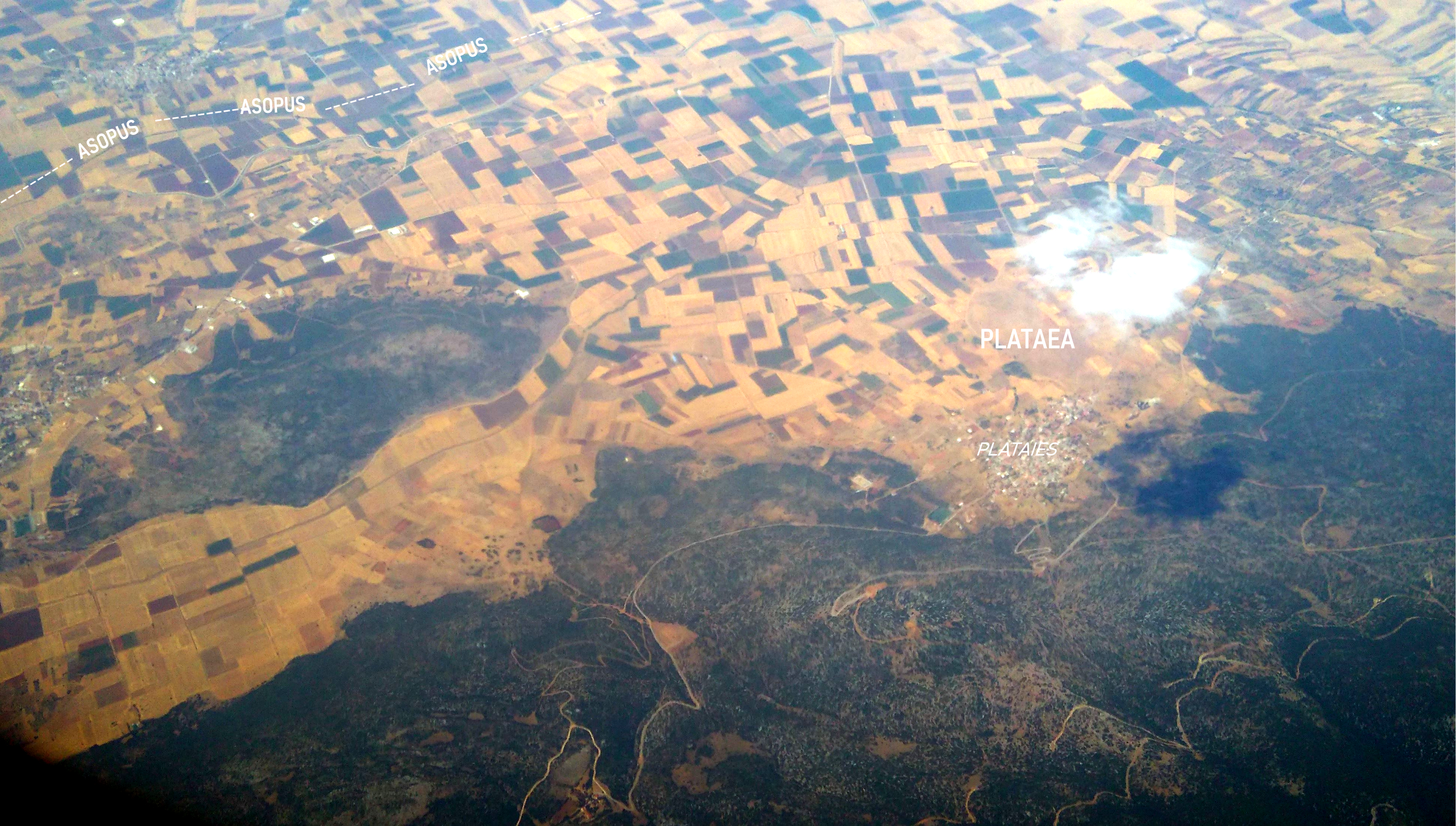
Plataea or Plataia (; grc, Πλάταια), also Plataeae or Plataiai (; grc, Πλαταιαί), was an ancient city, located in Greece in southeastern Boeotia, south of Thebes.Mish, Frederick C., Editor in Chief. “Plataea.” '' Webster’s Ninth New Collegiate Dictionary''. 9th ed. Springfield, MA: Merriam-Webster Inc., 1985. , (indexed), and (deluxe). It was the location of the Battle of Plataea in 479 BC, in which an alliance of Greek city-states defeated the Persians. Plataea was destroyed in the Peloponnesian War by Thebes and Sparta in 427 BC, and rebuilt in 386. The modern Greek town of Plataies is built near its ruins. Alliance with Athens and presence at Marathon Herodotus wrote that, in order to avoid coming under Theban hegemony, Plataea offered to "put themselves into Spartan hands". However, the Spartans refused this offer and, wishing to cause mischief between the Boeotians and Athens, recommended that the Plataeans ally themselves with Athens inste ... [...More Info...] [...Related Items...] OR: [Wikipedia] [Google] [Baidu] |
Ancient Argos
Argos (; el, Άργος ; grc, label=Ancient and Katharevousa, Ἄργος ) is a city in Argolis, Peloponnese, Greece and is one of the oldest continuously inhabited cities in the world, and the oldest in Europe. It is the largest city in Argolis and a major center for the area. Since the 2011 local government reform it has been part of the municipality of Argos-Mykines, of which it is a municipal unit. The municipal unit has an area of 138.138 km2. It is from Nafplion, which was its historic harbour. A settlement of great antiquity, Argos has been continuously inhabited as at least a substantial village for the past 7,000 years. A resident of the city of Argos is known as an Argive ( , ; grc-gre, Ἀργεῖος). However, this term is also used to refer to those ancient Greeks generally who assaulted the city of Troy during the Trojan War; the term is more widely applied by the Homeric bards. Numerous ancient monuments can be found in the city today. Agriculture ... [...More Info...] [...Related Items...] OR: [Wikipedia] [Google] [Baidu] |


