|
Barn Bluff (Red Wing, Minnesota)
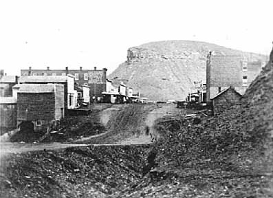
Barn Bluff ( dak, italics=no, Ȟemníčhaŋ, frequently anglicized to He Mni Can) is a bluff along the Mississippi River in Red Wing, Minnesota, United States. The bluff is considered sacred by the Dakota people because it is the site of many burial mounds. During the 19th century, the bluff functioned as a visual reference for explorers and travelers and later served as a limestone quarry. The bluff overlooks the downtown area and towers about above the Mississippi River with an extensive view of Lake Pepin to the south. It is one of hundreds of bluffs in the Driftless Area, which covers parts of Wisconsin, Iowa, and Illinois, in addition to the southeastern toe of Minnesota. Geology Most of the bluff is displaced approximately upwards relative to the adjoining bedrock along the Red Wing Fault, which transects the bluff near its south face. It is composed of early Paleozoic rocks, including Ordovician dolomite and sandstone atop Cambrian shale, siltstone and ... [...More Info...] [...Related Items...] OR: [Wikipedia] [Google] [Baidu] |
Red Wing, Minnesota
Red Wing is a city in Goodhue County, Minnesota, Goodhue County, Minnesota, United States, along the upper Mississippi River. The population was 16,547 at the 2020 United States Census, 2020 census. It is the county seat of Goodhue County. This city is named for early 19th-century Dakota Sioux chief Tatankamani, Red Wing. The federal government established a Mdewakanton Sioux Indian reservation—now Prairie Island Indian Community—in 1889 along the Mississippi River to free up land for new settlers. The city of Red Wing developed around it. The National Trust for Historic Preservation placed Red Wing on its 2008 distinctive destinations list because of its "impressive architecture and enviable natural environment." History In the early 1850s, settlers from Mississippi River steamboats came to Red Wing to farm in Goodhue County, Minnesota, Goodhue County. They encroached on traditional territory of the Mdewakanton Sioux. The settlers cleared the land for wheat, the ... [...More Info...] [...Related Items...] OR: [Wikipedia] [Google] [Baidu] |
Siltstone
Siltstone, also known as aleurolite, is a clastic sedimentary rock that is composed mostly of silt. It is a form of mudrock with a low clay mineral content, which can be distinguished from shale by its lack of fissility.Blatt ''et al.'' 1980, pp.381-382 Although its permeability and porosity is relatively low, siltstone is sometimes a tight gas reservoir rock, an unconventional reservoir for natural gas that requires hydraulic fracturing for economic gas production. Siltstone was prized in ancient Egypt for manufacturing statuary and cosmetic palettes. The siltstone quarried at Wadi Hammamat was a hard, fine-grained siltstone that resisted flaking and was almost ideal for such uses. Description There is not complete agreement on the definition of siltstone. One definition is that siltstone is mudrock ( clastic sedimentary rock containing at least 50% clay and silt) in which at least 2/3 of the clay and silt fraction is composed of silt-sized particles. Silt is defined a ... [...More Info...] [...Related Items...] OR: [Wikipedia] [Google] [Baidu] |
Seth Eastman
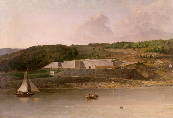
Seth Eastman (January 24, 1808– August 31, 1875) was an artist and West Point graduate who served in the US Army, first as a mapmaker and illustrator. He had two tours at Fort Snelling, Minnesota Territory; during the second, extended tour he was commanding officer of the fort. During these years, he painted many studies of Native American life. He was notable for the quality of his hundreds of illustrations for Henry Rowe Schoolcraft's six-volume study on the history of Indian tribes of the United States, commissioned by the US Congress. Eastman and his second wife Mary Henderson Eastman (1818 – 1887) were instrumental in recording Native American life. From their time at Fort Snelling, Mary Henderson Eastman wrote a book about Sioux#Linguistics, Dakota Sioux life and culture, which Seth Eastman illustrated. In 1838, he was elected into the National Academy of Design as an Honorary Academician. Seth Eastman retired as a Lieutenant Colonel and Brevet (military), Brevet Brig ... [...More Info...] [...Related Items...] OR: [Wikipedia] [Google] [Baidu] |
Treaty Of Traverse Des Sioux
The Treaty of Traverse des Sioux () was signed on July 23, 1851, at Traverse des Sioux in Minnesota Territory between the United States government and the Upper Dakota Sioux bands. In this land cession treaty, the Sisseton and Wahpeton Dakota bands sold 21 million acres of land in present-day Iowa, Minnesota and South Dakota to the U.S. for $1,665,000. The treaty was instigated by Alexander Ramsey, the first governor of Minnesota Territory, and Luke Lea, Commissioner of Indian Affairs in Washington, D.C. They were assisted by territorial Congressional delegate Henry Hastings Sibley and the traders who sought compensation for business losses which appeared on their books as "Indian debts." Governor Ramsey and Commissioner Lea justified the Treaty of Traverse des Sioux and the Treaty of Mendota to the United States Congress on the basis of an "overwhelming tide of migration...increasing and irresistible in its westward progress." In reality, they were responding to pressures from ... [...More Info...] [...Related Items...] OR: [Wikipedia] [Google] [Baidu] |
Barn Bluff, Upper Mississippi River, By Upton, B
A barn is an agricultural building usually on farms and used for various purposes. In North America, a barn refers to structures that house livestock, including cattle and horses, as well as equipment and fodder, and often grain.Allen G. Noble, ''Traditional Buildings: A Global Survey of Structural Forms and Cultural Functions'' (New York: Tauris, 2007), 30. As a result, the term barn is often qualified e.g. tobacco barn, dairy barn, cow house, sheep barn, potato barn. In the British Isles, the term barn is restricted mainly to storage structures for unthreshed cereals and fodder, the terms byre or shippon being applied to cow shelters, whereas horses are kept in buildings known as stables. In mainland Europe, however, barns were often part of integrated structures known as byre-dwellings (or housebarns in US literature). In addition, barns may be used for equipment storage, as a covered workplace, and for activities such as threshing. Etymology The word ''barn'' ... [...More Info...] [...Related Items...] OR: [Wikipedia] [Google] [Baidu] |
View Of Barn Bluff And Mississippi River, By Upton, B
A view is a sight or prospect or the ability to see or be seen from a particular place. View, views or Views may also refer to: Common meanings * View (Buddhism), a charged interpretation of experience which intensely shapes and affects thought, sensation, and action * Graphical projection in a technical drawing or schematic ** Multiview orthographic projection, standardizing 2D images to represent a 3D object * Opinion, a belief about subjective matters * Page view, a visit to a World Wide Web page * Panorama, a wide-angle view * Scenic viewpoint, an elevated location where people can view scenery * World view, the fundamental cognitive orientation of an individual or society encompassing the entirety of the individual or society's knowledge and point-of-view Places * View, Kentucky, an unincorporated community in Crittenden County * View, Texas, an unincorporated community in Taylor County Arts, entertainment, and media Music * ''View'' (album), the 2003 debut al ... [...More Info...] [...Related Items...] OR: [Wikipedia] [Google] [Baidu] |
Upper Mississippi River
The Upper Mississippi River is the portion of the Mississippi River upstream of St. Louis, Missouri, United States, at the confluence of its main tributary, the Missouri River. History In terms of geologic and hydrographic history, the Upper Mississippi east and south of Fort Snelling is a portion of the now-extinct Glacial River Warren which carved the valley of the Minnesota River, permitting the immense Glacial Lake Agassiz to join the world's oceans at the Gulf of Mexico. The collapse of ice dams holding back Glacial Lake Duluth and Glacial Lake Grantsburg carved out the Dalles of the St. Croix River at Interstate Park. The Upper Mississippi River valley likely originated as an ice-marginal stream during the Pre-Illinoian Stage. The Driftless Area is a portion of North America left unglaciated at that ice age's height, hence not smoothed out or covered over by previous geological processes. Inasmuch as the Wisconsin glaciation formed lobes that met (and blocked) wher ... [...More Info...] [...Related Items...] OR: [Wikipedia] [Google] [Baidu] |
Glacial River Warren
Glacial River Warren, also known as River Warren, was a prehistoric river that drained Lake Agassiz in central North America between about 13,500 and 10,650 BP calibrated (11,700 and 9,400 14C uncalibrated) years ago. A part of the uppermost portion of the former river channel was designated a National Natural Landmark in 1966. Geological history Lake Agassiz was formed from the meltwaters of the Laurentide Ice Sheet during the Wisconsin glaciation of the last ice age. Agassiz was an enormous body of water, up to deep, and at various times covering areas totaling over . Blocked by an ice sheet to the north, the lake water rose until about 13,500 BP calibrated (11,700 14C uncalibrated) years ago when it overtopped the ''Big Stone Moraine'', a ridge of glacial drift left by the receding glacier, at the location of Browns Valley, Minnesota. The lake's outflow was catastrophic, and carved a gorge through the moraine wide and deep, which is now known as the Traverse Gap. The ... [...More Info...] [...Related Items...] OR: [Wikipedia] [Google] [Baidu] |
US Highway 61
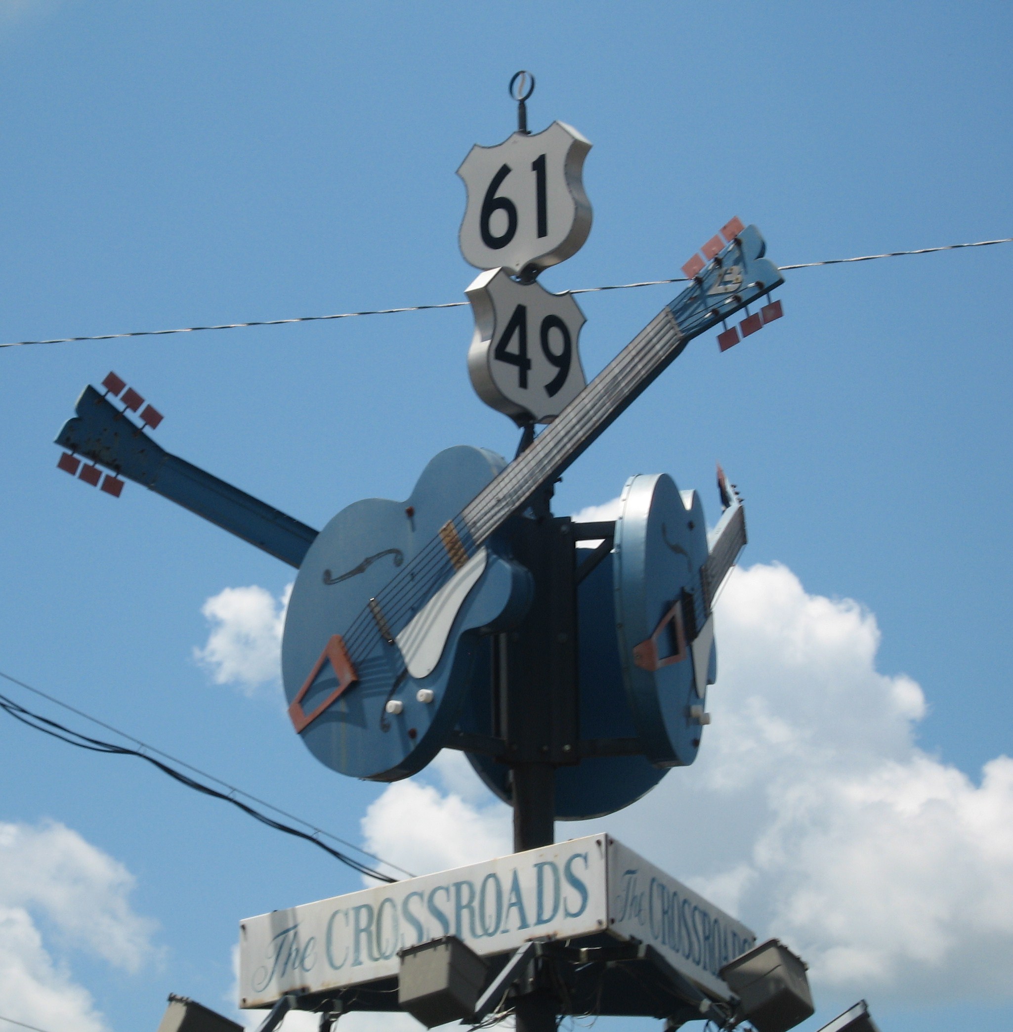
U.S. Route 61 or U.S. Highway 61 (U.S. 61) is a major United States highway that extends between New Orleans, Louisiana and the city of Wyoming, Minnesota. The highway generally follows the course of the Mississippi River and is designated the Great River Road for much of its route. As of 2004, the highway's northern terminus in Wyoming, Minnesota, is at an intersection with Interstate 35 (I-35). Until 1991, the highway extended north on what is now Minnesota State Highway 61 (MN 61) through Duluth to the Canada–U.S. border near Grand Portage. Its southern terminus in New Orleans is at an intersection with U.S. Route 90 (US 90). The route was an important south–north connection in the days before the interstate highway system. The highway is often called the Blues Highway because of its long history in blues music; Part of the route lies on the Mississippi Blues Trail and is denoted by markers in Vicksburg and Tunica. It is also the subject of numerous musical works, ... [...More Info...] [...Related Items...] OR: [Wikipedia] [Google] [Baidu] |
Loess
Loess (, ; from german: Löss ) is a clastic, predominantly silt-sized sediment that is formed by the accumulation of wind-blown dust. Ten percent of Earth's land area is covered by loess or similar deposits. Loess is a periglacial or aeolian (windborne) sediment, defined as an accumulation of 20% or less of clay and a balance of roughly equal parts sand and silt (with a typical grain size from 20 to 50 micrometers), often loosely cemented by calcium carbonate. It is usually homogeneous and highly porous and is traversed by vertical capillaries that permit the sediment to fracture and form vertical bluffs. Properties Loess is homogeneous, porous, friable, pale yellow or buff, slightly coherent, typically non- stratified and often calcareous. Loess grains are angular, with little polishing or rounding, and composed of crystals of quartz, feldspar, mica and other minerals. Loess can be described as a rich, dust-like soil. Loess deposits may become very thick, more than ... [...More Info...] [...Related Items...] OR: [Wikipedia] [Google] [Baidu] |


