|
Barker Peak
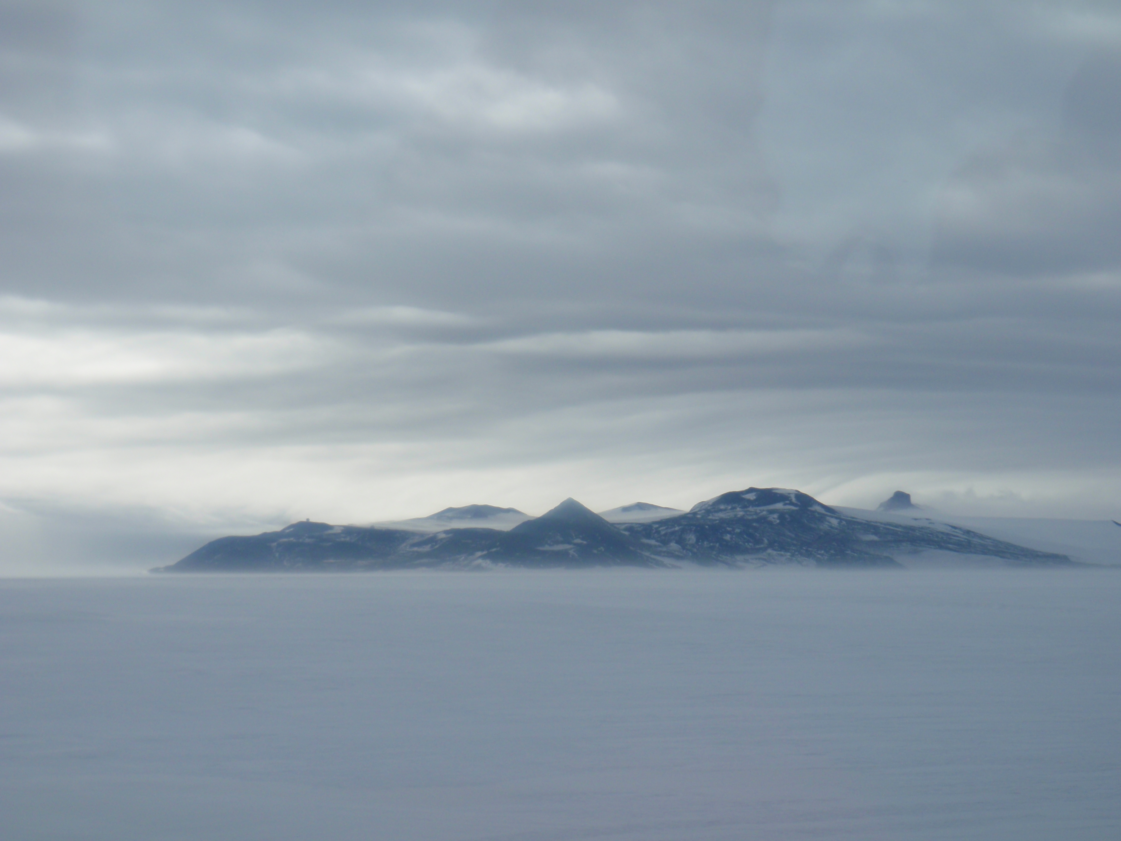
Barker Peak () is a peak west-northwest of Mount Terror on Ross Island. The feature rises to about and is the western of two peaks near the south end of the Giggenbach Ridge. It was named in 2000 by the New Zealand Geographic Board after Major James R. M. Barker, officer in command at Scott Base, 1970–71, and a New Zealand Antarctic Programme The New Zealand Antarctic Research Programme (NZARP) was a research program that operated a permanent research facility in Antarctica from 1959 to 1996. It was created by the Geophysics Division of New Zealand's Department of Scientific and Indust ... manager, 1970–86. References Mountains of Ross Island {{RossIsland-geo-stub ... [...More Info...] [...Related Items...] OR: [Wikipedia] [Google] [Baidu] |
Summit (topography)
A summit is a point on a surface that is higher in elevation than all points immediately adjacent to it. The topographic terms acme, apex, peak (mountain peak), and zenith are synonymous. The term (mountain top) is generally used only for a mountain peak that is located at some distance from the nearest point of higher elevation. For example, a big, massive rock next to the main summit of a mountain is not considered a summit. Summits near a higher peak, with some prominence or isolation, but not reaching a certain cutoff value for the quantities, are often considered ''subsummits'' (or ''subpeaks'') of the higher peak, and are considered part of the same mountain. A pyramidal peak is an exaggerated form produced by ice erosion of a mountain top. Summit may also refer to the highest point along a line, trail, or route. The highest summit in the world is Mount Everest with a height of above sea level. The first official ascent was made by Tenzing Norgay and Sir Edmund Hillary ... [...More Info...] [...Related Items...] OR: [Wikipedia] [Google] [Baidu] |
Mount Terror (Antarctica)
Mount Terror is a large shield volcano that forms the eastern part of Ross Island, Antarctica. It has numerous cinder cones and domes on the flanks of the shield and is mostly under snow and ice. It is the second largest of the four volcanoes that make up Ross Island and is somewhat overshadowed by its neighbour, Mount Erebus, to the west. Mount Terror was named in 1841 by Sir James Clark Ross for his second ship, HMS ''Terror''. The captain of ''Terror'' was Francis Crozier, a close friend of Ross for whom the nearby Cape Crozier is named. Geography The rocks at the summit have not been studied, but rocks from the lower areas range from 0.82 to 1.75 million years old, and Mount Terror shows no signs of more recent volcanic activity. The first ascent of Mt. Terror was made by a New Zealand party in 1959. Terror Point (), located just below Mt. Terror, is the eastern limit of Fog Bay, WNW of Cape MacKay on Ross Island. The name was first used by members of the British Nationa ... [...More Info...] [...Related Items...] OR: [Wikipedia] [Google] [Baidu] |
Ross Island
Ross Island is an island formed by four volcanoes in the Ross Sea near the continent of Antarctica, off the coast of Victoria Land in McMurdo Sound. Ross Island lies within the boundaries of Ross Dependency, an area of Antarctica claimed by New Zealand. History Discovery Sir James Ross discovered it in 1840, and it was later named in honour of him by Robert F. Scott. Ross Island was the base for many of the early expeditions to Antarctica. It is the southernmost island reachable by sea. Huts built by Scott's and Shackleton's expeditions are still standing on the island, preserved as historical sites. Today Ross Island is home to New Zealand's Scott Base, and the largest Antarctic settlement, the U.S. Antarctic Program's McMurdo Station. Greenpeace established World Park Base on the island and ran it for five years, from 1987 to 1992. Geography Because of the persistent presence of the ice sheet, the island is sometimes taken to be part of the Antarctic mainland. Its are ... [...More Info...] [...Related Items...] OR: [Wikipedia] [Google] [Baidu] |
Giggenbach Ridge
Mount Terror is a large shield volcano that forms the eastern part of Ross Island, Antarctica. It has numerous cinder cones and domes on the flanks of the shield and is mostly under snow and ice. It is the second largest of the four volcanoes that make up Ross Island and is somewhat overshadowed by its neighbour, Mount Erebus, to the west. Mount Terror was named in 1841 by Sir James Clark Ross for his second ship, HMS ''Terror''. The captain of ''Terror'' was Francis Crozier, a close friend of Ross for whom the nearby Cape Crozier is named. Geography The rocks at the summit have not been studied, but rocks from the lower areas range from 0.82 to 1.75 million years old, and Mount Terror shows no signs of more recent volcanic activity. The first ascent of Mt. Terror was made by a New Zealand party in 1959. Terror Point (), located just below Mt. Terror, is the eastern limit of Fog Bay, WNW of Cape MacKay on Ross Island. The name was first used by members of the British Nati ... [...More Info...] [...Related Items...] OR: [Wikipedia] [Google] [Baidu] |
New Zealand Geographic Board
The New Zealand Geographic Board Ngā Pou Taunaha o Aotearoa (NZGB) was established by the New Zealand Geographic Board Act 1946, which has since been replaced by the New Zealand Geographic Board (Ngā Pou Taunaha o Aotearoa) Act 2008. Although an independent institution, it is responsible to the Minister for Land Information. The board has authority over geographical and hydrographic names within New Zealand and its territorial waters. This includes the naming of small urban settlements, localities, mountains, lakes, rivers, waterfalls, harbours and natural features and may include researching local Māori names. It has named many geographical features in the Ross Sea region of Antarctica. It has no authority to alter street names (a local body responsibility) or the name of any country. The NZGB secretariat is part of Toitū Te Whenua Land Information New Zealand (LINZ) and provides the board with administrative and research assistance and advice. The New Zealand Geograph ... [...More Info...] [...Related Items...] OR: [Wikipedia] [Google] [Baidu] |
James R
James is a common English language surname and given name: *James (name), the typically masculine first name James * James (surname), various people with the last name James James or James City may also refer to: People * King James (other), various kings named James * Saint James (other) * James (musician) * James, brother of Jesus Places Canada * James Bay, a large body of water * James, Ontario United Kingdom * James College, a college of the University of York United States * James, Georgia, an unincorporated community * James, Iowa, an unincorporated community * James City, North Carolina * James City County, Virginia ** James City (Virginia Company) ** James City Shire * James City, Pennsylvania * St. James City, Florida Arts, entertainment, and media * ''James'' (2005 film), a Bollywood film * ''James'' (2008 film), an Irish short film * ''James'' (2022 film), an Indian Kannada-language film * James the Red Engine, a character in ''Thomas the Tank En ... [...More Info...] [...Related Items...] OR: [Wikipedia] [Google] [Baidu] |
Scott Base
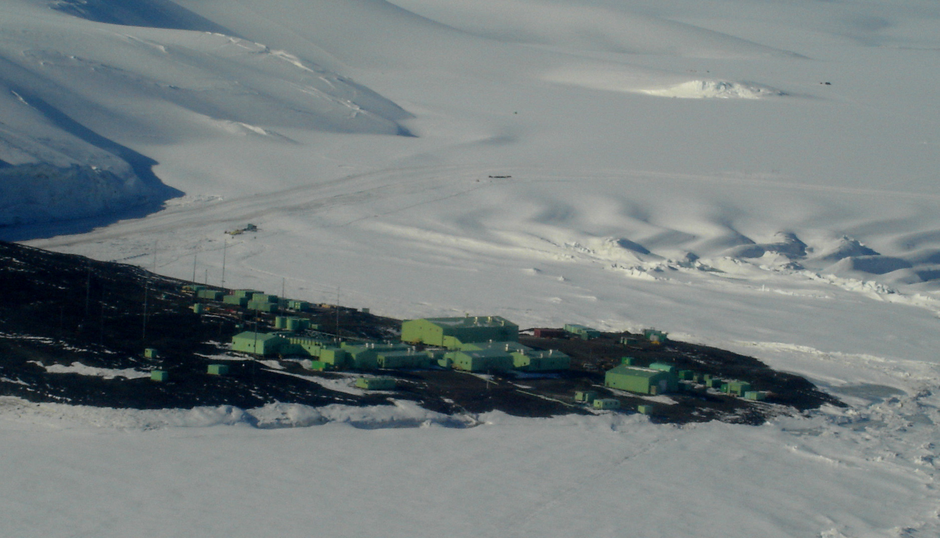
Scott Base is a New Zealand Antarctica, Antarctic research station at Pram Point on Ross Island near Mount Erebus in New Zealand's Ross Dependency territorial claim. It was named in honour of Captain Robert Falcon Scott, Royal Navy, RN, leader of two United Kingdom, British expeditions to the Ross Sea area of Antarctica. The base was set up as support to field research and the centre for research into earth sciences, and now conducts research in many fields, operated by Antarctica New Zealand. The base is from the larger U.S. McMurdo Station via Pegasus Road. History Scott Base was originally constructed in support of the UK inspired and privately managed Commonwealth Trans-Antarctic Expedition (TAE). The New Zealand government provided support for the TAE and also for the International Geophysical Year (IGY) project of 1957, five of whose members were attached to the Expedition. In February 1956, 10 months before the TAE and IGY parties were due to head to the Antarctic, ... [...More Info...] [...Related Items...] OR: [Wikipedia] [Google] [Baidu] |
New Zealand Antarctic Programme
The New Zealand Antarctic Research Programme (NZARP) was a research program that operated a permanent research facility in Antarctica from 1959 to 1996. It was created by the Geophysics Division of New Zealand's Department of Scientific and Industrial Research (DSIR), originally based in Wellington. The programme promoted research in geochemistry, zoology, geology, botany, meteorology, and limnology. History NZARP began as a proposal by the New Zealand government, in 1953, for a research base in Antarctica. Its mission was to provide support for a variety of scientific fieldwork in Antarctica. Members worked as researchers, assistants, tour guides, operators, and administrators to Scott Base. Ground was broken for Scott Base on 10 January 1957. Assembly of the base began 12 January, conducted by the eight men who first assembled the base in Wellington, and was completed by 20 January. In 1959, the NZARP was established to work with the Ross Dependency Research Committee in the Ro ... [...More Info...] [...Related Items...] OR: [Wikipedia] [Google] [Baidu] |


