|
Banteay Samré
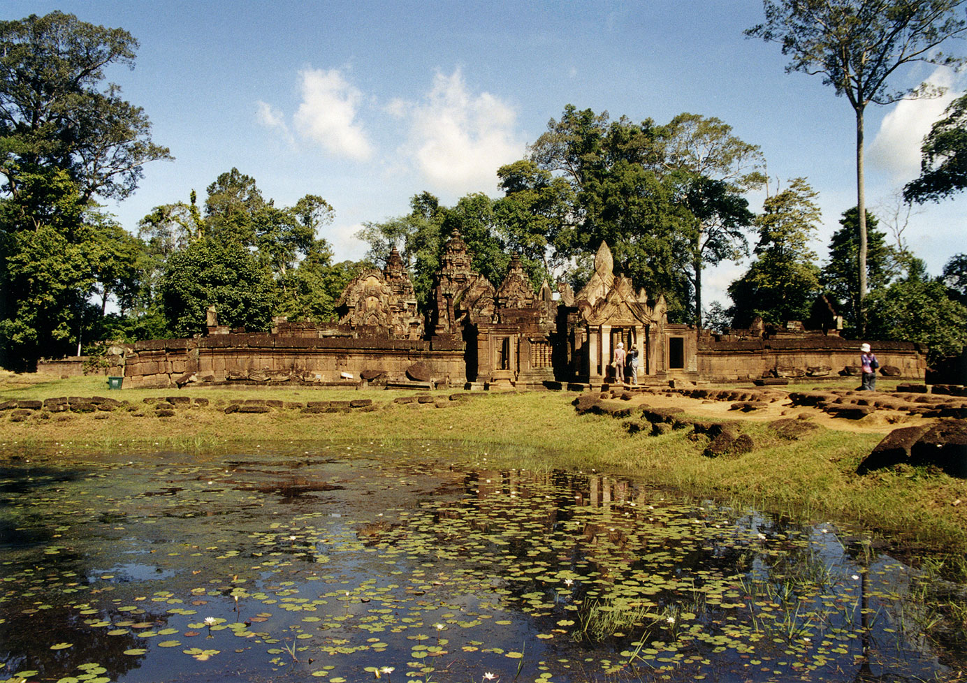
Banteay Samré ( km, បន្ទាយសំរែ ; "The Citadel of the Samré") is a temple at Angkor, Cambodia, located 400 metres to the east of the East Baray. Built during the reign of Suryavarman II and Yasovarman II in the early 12th century, it is a Hindu temple in the Angkor Wat style. Named after the Samré, an ancient people of Indochina, the temple uses the same materials as the Banteay Srei. Banteay Samré was excellently restored by Maurice Glaize from 1936 until 1944. The design of its single ogival tower is immediately recognizable as Angkor Wat style along with other temples in the region such as Thommanon and Chau Say Tevoda. Due to this temple's similarity to some monuments of north-east Thailand, it has the appearance of a compact Phimai. While there are no inscriptions describing its foundation, it seems likely to have been built by a high official of the court during the reign of King Suryavarman II. Plan It has a single tower over the shrine and t ... [...More Info...] [...Related Items...] OR: [Wikipedia] [Google] [Baidu] |
Cambodia
Cambodia (; also Kampuchea ; km, កម្ពុជា, UNGEGN: ), officially the Kingdom of Cambodia, is a country located in the southern portion of the Indochinese Peninsula in Southeast Asia, spanning an area of , bordered by Thailand to the northwest, Laos to the north, Vietnam to the east, and the Gulf of Thailand to the southwest. The capital and largest city is Phnom Penh. The sovereign state of Cambodia has a population of over 17 million. Buddhism is enshrined in the constitution as the official state religion, and is practised by more than 97% of the population. Cambodia's minority groups include Vietnamese, Chinese, Chams and 30 hill tribes. Cambodia has a tropical monsoon climate of two seasons, and the country is made up of a central floodplain around the Tonlé Sap lake and Mekong Delta, surrounded by mountainous regions. The capital and largest city is Phnom Penh, the political, economic and cultural centre of Cambodia. The kingdom is an elective co ... [...More Info...] [...Related Items...] OR: [Wikipedia] [Google] [Baidu] |
Banteay Srei
Banteay Srei or Banteay Srey ( km, បន្ទាយស្រី ) is a 10th-century Cambodian temple dedicated to the Hindu god Shiva. Located in the area of Angkor, it lies near the hill of Phnom Dei, north-east of the main group of temples that once belonged to the medieval capitals of Yasodharapura and Angkor Thom.Higham, ''The Civilization of Angkor'', p.79. Banteay Srei is built largely of red sandstone, a medium that lends itself to the elaborate decorative wall carvings which are still observable today. The buildings themselves are miniature in scale, unusually so when measured by the standards of Angkorian construction. These factors have made the temple extremely popular with tourists, and have led to its being widely praised as a "precious gem", or the "jewel of Khmer art." History Foundation and dedication Consecrated on 22 April 967 A.D., Bantãy Srĕi was the only major temple at Angkor not built by a monarch; its construction is credited to the courtiers ... [...More Info...] [...Related Items...] OR: [Wikipedia] [Google] [Baidu] |
Angkorian Sites In Siem Reap Province
Khmer architecture ( km, ស្ថាបត្យកម្មខ្មែរ), also known as Angkorian architecture ( km, ស្ថាបត្យកម្មសម័យអង្គរ), is the architecture produced by the Khmers during the Angkor period of the Khmer Empire from approximately the later half of the 8th century CE to the first half of the 15th century CE. The architecture of the Indian rock-cut temples, particularly in sculpture, had an influence on Southeast Asia and was widely adopted into the Indianised architecture of Cambodian (Khmer), Annamese and Javanese temples (of the Greater India). Evolved from Indian influences, Khmer architecture became clearly distinct from that of the Indian sub-continent as it developed its own special characteristics, some of which were created independently and others of which were incorporated from neighboring cultural traditions, resulting in a new artistic style in Asian architecture unique to the Angkorian tradition. T ... [...More Info...] [...Related Items...] OR: [Wikipedia] [Google] [Baidu] |
Gopura
A ''gopuram'' or ''gopura'' ( Tamil: கோபுரம், Malayalam: ഗോപുരം, Kannada: ಗೋಪುರ, Telugu: గోపురం) is a monumental entrance tower, usually ornate, at the entrance of a Hindu temple, in the South Indian architecture of the Southern Indian states of Tamil Nadu, Andhra Pradesh, Kerala, Karnataka, and Telangana, and Sri Lanka. In other areas of India they are much more modest, while in Southern Indian temples they are very often by far the highest part of the temple. Ancient and early medieval temples feature smaller ''gopuram'', while in later temples they are a prominent feature of Hindu Dravidian style; in many cases the temple compound was expanded and new larger gopuram built along the new boundary. They are topped by the ''kalasam'', a bulbous stone finial. They function as gateways through the walls that surround the temple complex. Another towering structure located towards the center of the temple is the Vimanam. Both of th ... [...More Info...] [...Related Items...] OR: [Wikipedia] [Google] [Baidu] |
Mandapa
A mandapa or mantapa () is a pillared hall or pavilion for public rituals in Indian architecture, especially featured in Hindu temple architecture. Mandapas are described as "open" or "closed" depending on whether they have walls. In temples, one or more mandapas very often lie between the sanctuary and the temple entrance, on the same axis. In a large temple other mandapas may be placed to the sides, or detached within the temple compound. Temple architecture In the Hindu temple the ''mandapa'' is a porch-like structure through the (''gopuram'') (ornate gateway) and leading to the temple. It is used for religious dancing and music and is part of the basic temple compound. The prayer hall was generally built in front of the temple's ''sanctum sanctorum'' (''garbhagriha''). A large temple would have many ''mandapa''. If a temple has more than one ''mandapa'', each one is allocated for a different function and given a name to reflect its use. For example, a ''mandapa'' ... [...More Info...] [...Related Items...] OR: [Wikipedia] [Google] [Baidu] |
Antarala
Antarala (Sanskrit: अन्तराल, lit. ''intermediate space'') is a small antechamber or foyer between the garbhagriha (shrine) and the mandapa A mandapa or mantapa () is a pillared hall or pavilion for public rituals in Indian architecture, especially featured in Hindu temple architecture. Mandapas are described as "open" or "closed" depending on whether they have walls. In temples, ..., more typical of north Indian temples. Antarala are commonly seen in Chalukyan Style temples in which the 'Vimana' and the 'Mandapa' are connected through the 'Antarala'. Notes Hindu temple architecture {{India-hindu-temple-stub ... [...More Info...] [...Related Items...] OR: [Wikipedia] [Google] [Baidu] |
Phimai Historical Park
The Phimai Historical Park ( km, ប្រាសាទពិមាយ, , th, ปราสาทหินพิมาย, ) is one of the largest Hindu Khmer temples in Thailand. It is located in the town of Phimai, Nakhon Ratchasima province. It is one of the most important tourist attractions in Nakhon Ratchasima province. Phimai had previously been an important town at the time of the Khmer Empire. The temple Prasat Hin Phimai, located in the center of the town, was one of the major Khmer temples in ancient Thailand, connected with Angkor by an ancient Khmer Highway, and oriented to face Angkor as its cardinal direction. The site is now protected as the Phimai Historical Park. History The temple marks one end of the Ancient Khmer Highway from Angkor. As the enclosed area of 1020x580m is comparable with that of Angkor Wat, it is suggested to have been an important city in the Khmer Empire. Most buildings are from the late 11th to the late 12th century, built in the Baph ... [...More Info...] [...Related Items...] OR: [Wikipedia] [Google] [Baidu] |
Chau Say Tevoda
Chau Say Tevoda ( km, ប្រាសាទចៅសាយទេវតា, literally: prolific grandchildren of a deity) is a temple at Angkor, Cambodia. It is just east of Angkor Thom, directly south of Thommanon across the Victory Way (it pre-dates the former and post-dates the latter). Built in the mid-12th century, it is a Hindu temple in the Angkor Wat period. It is dedicated to Shiva and Vishnu with unique types of female sculptures of devatas enshrined in it. The Buddha images have been interpreted to have been built during the reign of Dharanindravarman, father of Jayavarman VII, who ruled from Preah Khan of Kompong. The temple was in a dilapidated state with 4,000 of its elements lying scattered on the embankment and in the Siem Reap River. Many of these elements were used in the restoration work carried out by a Chinese team between 2000 and 2009 under a project sponsored by the People's Republic of China. The temple was reopened in late 2009. Location Chau Say Tevod ... [...More Info...] [...Related Items...] OR: [Wikipedia] [Google] [Baidu] |
Thommanon
Thommanon ( km, ប្រាសាទធម្មនន្ទ) is one of a pair of Hindu temples built during the reign of Suryavarman II (1113–1150) at Angkor, Cambodia.Higham, C., 2001, The Civilization of Angkor, London: Weidenfeld & Nicolson, The name of the temple is derived from the Pali words "Dhamma", which means 'Buddhist Teachings' and "Nanda", which means 'supreme wisdom'. This small and elegant temple is east of the Gate of Victory of Angkor Thom and north of Chau Say Tevoda. It is part of the UNESCO World Heritage Site, inscribed by UNESCO in 1992 titled Angkor. The temple is dedicated to Shiva and Vishnu. History Scholars studying the carvings of the devatas in Thommanon have concluded that it was built around the time when work on Angkor Wat was begun. However, there is some disagreement as to the precise date it was built. Some believe that the distinctive carvings of females, known as devatas, indicate that they were built during the reign of Jayavarman VI (1 ... [...More Info...] [...Related Items...] OR: [Wikipedia] [Google] [Baidu] |
Maurice Glaize
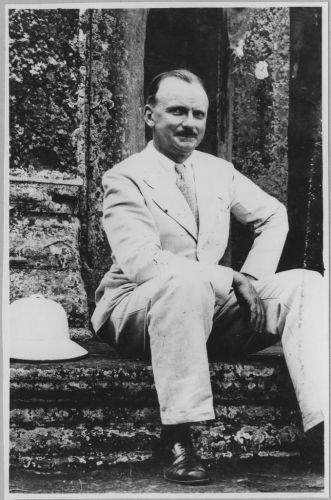
Maurice Glaize (26 December 1886 – 17 July 1964) was a French architect and archeologist, Conservator of Angkor from 1937 to 1945. Early years: education, wedding, war and professional experiences Born to a family of artists in Paris (his father was an architect and his grandfather was Auguste-Barthélemy Glaize), he attended at École nationale supérieure des Beaux-Arts, learning under the architect Henri Deglane. In 1913 he put in for the École française d'Extrême-Orient (EFEO), but ranked second behind Georges Demasur. On 3 January 1914 he married Louise Carlier, who gave him four sons and was a devoted mate. He served during World War I in a balloon unit, and then finally on 11 June 1919 he achieved the qualification of architect dplg. He lived in Paris several years, working mostly as freelance architect, but never losing his interest in Indochina. Thanks to his cousin, François Glaize, he was recruited by the ''Crédit foncier et de l'Union immobilière d'Indoc ... [...More Info...] [...Related Items...] OR: [Wikipedia] [Google] [Baidu] |
Pear (people)
Pearic peoples (; from ; also ''Por'') refers to indigenous groups, including the ''Pear'', ''Samre'', ''Chong'', ''Samray'', and ''Sa'och'', which speak one of the Pearic languages and live a sparse existence after years of conflict in Cambodia and Thailand. Pearic groups speak different, but closely related, languages and share many cultural traits that differ markedly from the dominant Khmer and Thai cultures. Ethnography Pearic peoples include: ''Samré'' in Pursat Province; ''Samray'' in Battambang; ''Chong'' and ''Chong-Samré'' in Trat Province of eastern Thailand; and ''Chong la'' and ''Chong heap'', in Chanthaburi Province, Thailand. In the Pear communities in Preah Vihear Province, the Pear population was estimated to be 299 households (1,674 persons) in 2002. According to the ''Pear Samray'' people of Kranhung, the Kulen hill region's ''Samray'' survived because of emigration in the days of the Angkor kingdom. After the 1967 revolt of Samlaut, Pear of the Stung Kr ... [...More Info...] [...Related Items...] OR: [Wikipedia] [Google] [Baidu] |


_2019_03.jpg)


_(6844744004).jpg)
