|
Baltalimanı
Baltalimanı is a neighbourhood in the municipality and district of Sarıyer, Istanbul Province, Turkey. Its population is 5,151 (2022). It lies at a bay of the European coast of Bosporus. The name means "axe port" in Turkish. The place is known for the Treaty of Balta Liman, signed between Great Britain and the Ottoman Empire The Ottoman Empire, * ; is an archaic version. The definite article forms and were synonymous * and el, Оθωμανική Αυτοκρατορία, Othōmanikē Avtokratoria, label=none * info page on book at Martin Luther University) ... in 1838. References Neighbourhoods of Sarıyer Bosphorus Gulfs of the Mediterranean {{Istanbul-geo-stub ... [...More Info...] [...Related Items...] OR: [Wikipedia] [Google] [Baidu] |
Treaty Of Balta Liman
The 1838 Treaty of Balta Liman, or the Anglo-Ottoman Treaty, is a formal trade agreement signed between the Sublime Porte of the Ottoman Empire and Great Britain. The trade policies imposed upon the Ottoman Empire, after the Treaty of Balta Liman, were some of the most liberal, open market, settlements that had ever been enacted during the time. The terms of the treaty stated that the Ottoman Empire will abolish all monopolies, allow British merchants and their collaborators to have full access to all Ottoman markets and will be taxed equally to local merchants. These agreements did not constitute an equal free trade arrangement, as the United Kingdom still employed protectionist policies on their agricultural markets. Leading up to the Treaty of Balta Liman, in the fall of 1831 the Governor of Egypt, Muhammad Ali of Egypt, retaliated against the Ottoman Empire. Mehmet Ali had not been given the territory that Ottoman Sultan, Mahmud II, had promised him, after he showed military ... [...More Info...] [...Related Items...] OR: [Wikipedia] [Google] [Baidu] |
Sarıyer
Sarıyer () is the northernmost district of Istanbul, Turkey, on the European side of the city. It consists of the neighbourhoods of Rumelifeneri, Tarabya, Yeniköy, İstinye, Emirgan and Rumelihisarı. Sarıyer also administers the Black Sea coast to the west of the mouth of the Bosphorus, including the neighbourhood of Kilyos. It borders Eyüp to the northwest, Beşiktaş to the south and Kağıthane to the west. Sarıyer has a population of approximately 260,000. The mayor is Şükrü Genç of the Republican People's Party (CHP). In 1930, some parts of the region of Beyoğlu and Çatalca were incorporated into Sarıyer, which also became the district centre. The district's boundaries shrunk after the neighbourhood of Kemerburgaz was given to the Eyüp district in 1936 and when the villages of Maslak and Ayazağa were given to Şişli district in 1954. The present boundaries of Sarıyer were created after incorporating the neighbourhoods of Maslak, Ayazağa and Huzur from the ... [...More Info...] [...Related Items...] OR: [Wikipedia] [Google] [Baidu] |
Istanbul Province
) , postal_code_type = Postal code , postal_code = 34000 to 34990 , area_code = +90 212 (European side) +90 216 (Asian side) , registration_plate = 34 , blank_name_sec2 = GeoTLD , blank_info_sec2 = .ist, .istanbul , website = , blank_name = GDP (Nominal) , blank_info = 2021 , blank1_name = - Total , blank1_info = US$ 248 billion , blank2_name = - Per capita , blank2_info = US$ 15,666 , blank3_name = HDI (2019) , blank3_info = 0.846 () · 1st , timezone = TRT , utc_offset = +3 , module = , name = , government_type = Mayor–council government , governing_body = Municipal Council of Istanbul , image_shield = , established_date = 11 May 330 AD , image_m ... [...More Info...] [...Related Items...] OR: [Wikipedia] [Google] [Baidu] |
Turkey
Turkey ( tr, Türkiye ), officially the Republic of Türkiye ( tr, Türkiye Cumhuriyeti, links=no ), is a list of transcontinental countries, transcontinental country located mainly on the Anatolia, Anatolian Peninsula in Western Asia, with a East Thrace, small portion on the Balkans, Balkan Peninsula in Southeast Europe. It shares borders with the Black Sea to the north; Georgia (country), Georgia to the northeast; Armenia, Azerbaijan, and Iran to the east; Iraq to the southeast; Syria and the Mediterranean Sea to the south; the Aegean Sea to the west; and Greece and Bulgaria to the northwest. Cyprus is located off the south coast. Turkish people, Turks form the vast majority of the nation's population and Kurds are the largest minority. Ankara is Turkey's capital, while Istanbul is its list of largest cities and towns in Turkey, largest city and financial centre. One of the world's earliest permanently Settler, settled regions, present-day Turkey was home to important Neol ... [...More Info...] [...Related Items...] OR: [Wikipedia] [Google] [Baidu] |
TÜİK
Turkish Statistical Institute (commonly known as TurkStat; tr, Türkiye İstatistik Kurumu or TÜİK) is the Turkish government agency commissioned with producing official statistics on Turkey, its population, resources, economy, society, and culture. It was founded in 1926 and has its headquarters in Ankara Ankara ( , ; ), historically known as Ancyra and Angora, is the capital of Turkey. Located in the central part of Anatolia, the city has a population of 5.1 million in its urban center and over 5.7 million in Ankara Province, maki .... Formerly named as the State Institute of Statistics (Devlet İstatistik Enstitüsü (DİE)), the Institute was renamed as the Turkish Statistical Institute on November 18, 2005. References External linksOfficial website of the institute National statistical services Statistical Organizations established in 1926 Organizations based in Ankara {{Sci-org-stub ... [...More Info...] [...Related Items...] OR: [Wikipedia] [Google] [Baidu] |
Bosporus
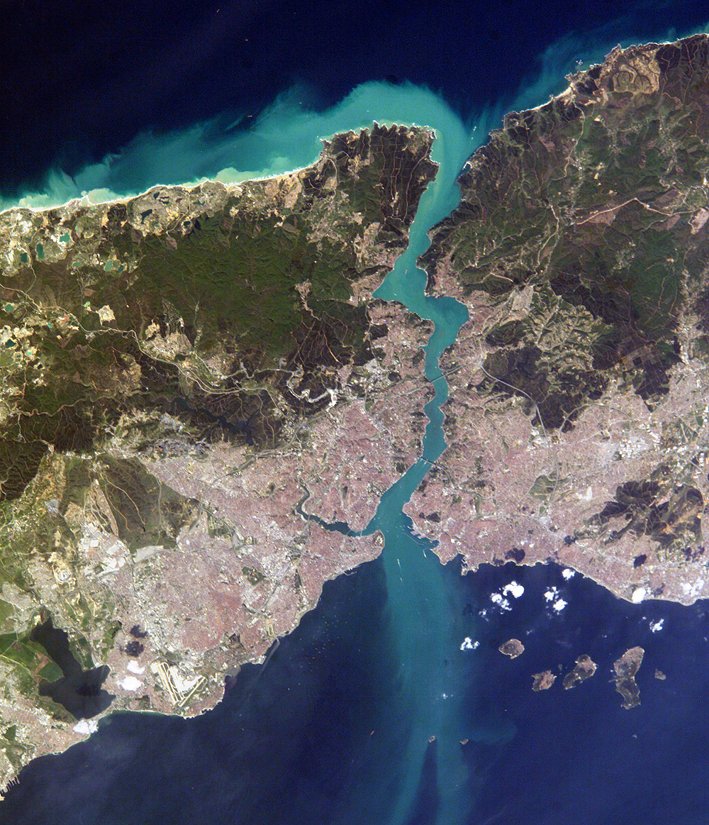
The Bosporus Strait (; grc, Βόσπορος ; tr, İstanbul Boğazı 'Istanbul strait', colloquially ''Boğaz'') or Bosphorus Strait is a natural strait and an internationally significant waterway located in Istanbul in northwestern Turkey. It forms part of the continental boundary between Asia and Europe, and divides Turkey by separating Anatolia from Thrace. It is the world's narrowest strait used for international navigation. Most of the shores of the Bosporus Strait, except for the area to the north, are heavily settled, with the city of Istanbul's metropolitan population of 17 million inhabitants extending inland from both banks. The Bosporus Strait and the Dardanelles Strait at the opposite end of the Sea of Marmara are together known as the Turkish Straits. Sections of the shore of the Bosporus in Istanbul have been reinforced with concrete or rubble and those sections of the Strait prone to deposition are periodically dredged. Name The name of th ... [...More Info...] [...Related Items...] OR: [Wikipedia] [Google] [Baidu] |
Turkish Language
Turkish ( , ), also referred to as Turkish of Turkey (''Türkiye Türkçesi''), is the most widely spoken of the Turkic languages, with around 80 to 90 million speakers. It is the national language of Turkey and Northern Cyprus. Significant smaller groups of Turkish speakers also exist in Iraq, Syria, Germany, Austria, Bulgaria, North Macedonia, Greece, the Caucasus, and other parts of Europe and Central Asia. Cyprus has requested the European Union to add Turkish as an official language, even though Turkey is not a member state. Turkish is the 13th most spoken language in the world. To the west, the influence of Ottoman Turkish—the variety of the Turkish language that was used as the administrative and literary language of the Ottoman Empire—spread as the Ottoman Empire expanded. In 1928, as one of Atatürk's Reforms in the early years of the Republic of Turkey, the Ottoman Turkish alphabet was replaced with a Latin alphabet. The distinctive characteristics of the Turk ... [...More Info...] [...Related Items...] OR: [Wikipedia] [Google] [Baidu] |
Great Britain
Great Britain is an island in the North Atlantic Ocean off the northwest coast of continental Europe. With an area of , it is the largest of the British Isles, the largest European island and the ninth-largest island in the world. It is dominated by a maritime climate with narrow temperature differences between seasons. The 60% smaller island of Ireland is to the west—these islands, along with over 1,000 smaller surrounding islands and named substantial rocks, form the British Isles archipelago. Connected to mainland Europe until 9,000 years ago by a landbridge now known as Doggerland, Great Britain has been inhabited by modern humans for around 30,000 years. In 2011, it had a population of about , making it the world's third-most-populous island after Java in Indonesia and Honshu in Japan. The term "Great Britain" is often used to refer to England, Scotland and Wales, including their component adjoining islands. Great Britain and Northern Ireland now constitute the ... [...More Info...] [...Related Items...] OR: [Wikipedia] [Google] [Baidu] |
Ottoman Empire
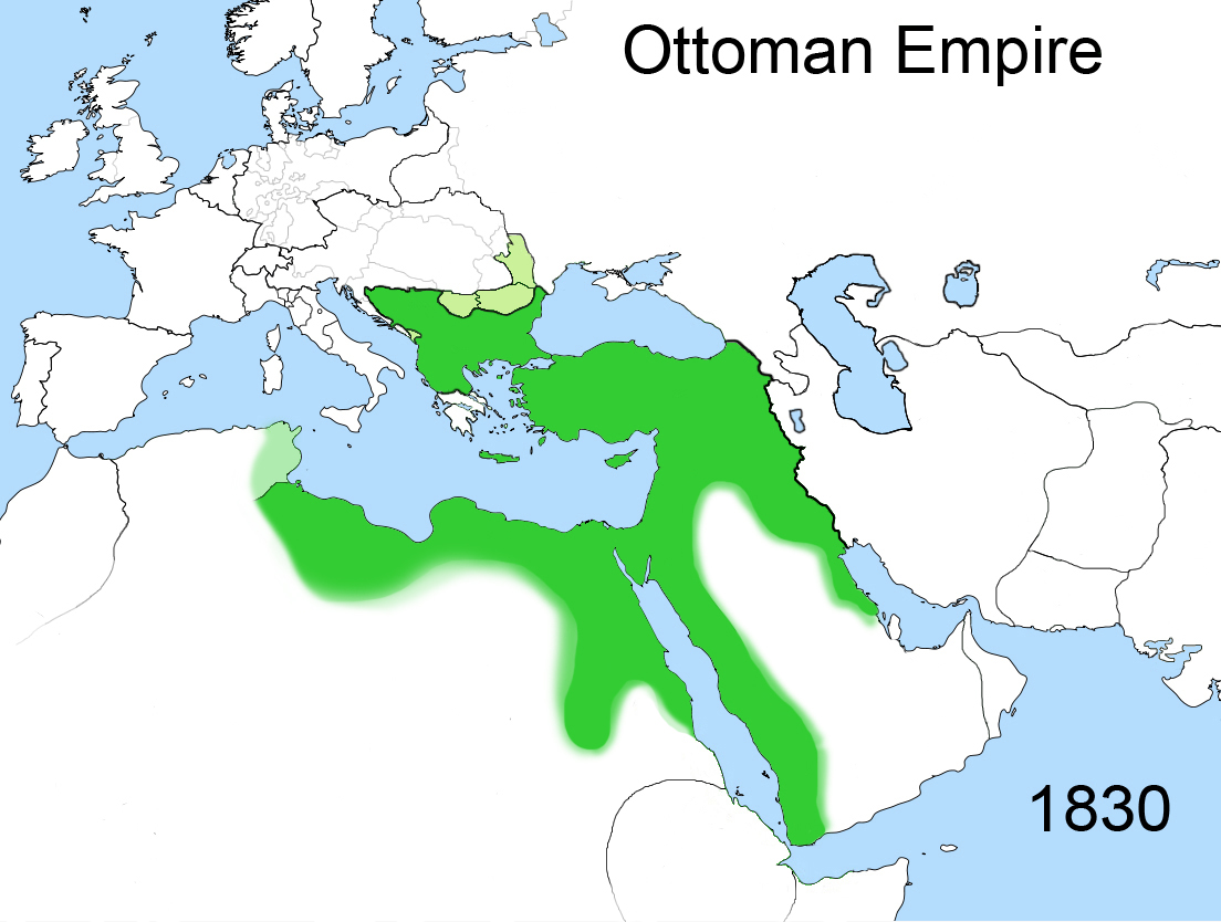
The Ottoman Empire, * ; is an archaic version. The definite article forms and were synonymous * and el, Оθωμανική Αυτοκρατορία, Othōmanikē Avtokratoria, label=none * info page on book at Martin Luther University) // CITED: p. 36 (PDF p. 38/338) also known as the Turkish Empire, was an empire that controlled much of Southeast Europe, Western Asia, and Northern Africa between the 14th and early 20th centuries. It was founded at the end of the 13th century in northwestern Anatolia in the town of Söğüt (modern-day Bilecik Province) by the Turkoman tribal leader Osman I. After 1354, the Ottomans crossed into Europe and, with the conquest of the Balkans, the Ottoman beylik was transformed into a transcontinental empire. The Ottomans ended the Byzantine Empire with the conquest of Constantinople in 1453 by Mehmed the Conqueror. Under the reign of Suleiman the Magnificent, the Ottoman Empire marked the peak of its power and prosperity, as well a ... [...More Info...] [...Related Items...] OR: [Wikipedia] [Google] [Baidu] |
Neighbourhoods Of Sarıyer
A neighbourhood (British English, Irish English, Australian English and Canadian English) or neighborhood (American English; see spelling differences) is a geographically localised community within a larger city, town, suburb or rural area, sometimes consisting of a single street and the buildings lining it. Neighbourhoods are often social communities with considerable face-to-face interaction among members. Researchers have not agreed on an exact definition, but the following may serve as a starting point: "Neighbourhood is generally defined spatially as a specific geographic area and functionally as a set of social networks. Neighbourhoods, then, are the spatial units in which face-to-face social interactions occur—the personal settings and situations where residents seek to realise common values, socialise youth, and maintain effective social control." Preindustrial cities In the words of the urban scholar Lewis Mumford, "Neighbourhoods, in some annoying, inchoate fashi ... [...More Info...] [...Related Items...] OR: [Wikipedia] [Google] [Baidu] |
Bosphorus
The Bosporus Strait (; grc, Βόσπορος ; tr, İstanbul Boğazı 'Istanbul strait', colloquially ''Boğaz'') or Bosphorus Strait is a natural strait and an internationally significant waterway located in Istanbul in northwestern Turkey. It forms part of the continental boundary between Asia and Europe, and divides Turkey by separating Anatolia from Thrace. It is the world's narrowest strait used for international navigation. Most of the shores of the Bosporus Strait, except for the area to the north, are heavily settled, with the city of Istanbul's metropolitan population of 17 million inhabitants extending inland from both banks. The Bosporus Strait and the Dardanelles Strait at the opposite end of the Sea of Marmara are together known as the Turkish Straits. Sections of the shore of the Bosporus in Istanbul have been reinforced with concrete or rubble and those sections of the Strait prone to deposition are periodically dredged. Name The name of the ... [...More Info...] [...Related Items...] OR: [Wikipedia] [Google] [Baidu] |


