|
Balderfonna
Balderfonna is a glacier in Spitsbergen, Svalbard. It is located on Ny-Friesland, between Hinlopen Strait and Lomfjorden. It is named after the Norse god Balder. Former names of the glacier include ''Lovén Plateau'' and ''Névé dôme Balder''. Further north on Lomfjordhalvøya Lomfjordhalvøya is a peninsula at the northeastern part of Ny-Friesland on Spitsbergen, Svalbard. It is 44 kilometers long, and 24 kilometers wide at its base. It is located between Lomfjorden and Hinlopen Strait. Its northern tip is Kapp Fans ... is Torsfonna. References Glaciers of Spitsbergen {{Spitsbergen-glacier-stub ... [...More Info...] [...Related Items...] OR: [Wikipedia] [Google] [Baidu] |
Torsfonna
Torsfonna is glacier at Spitsbergen, Svalbard. It is located on Lomfjordhalvøya at Ny-Friesland. It is named after the Norse god Thor. A former name of the glacier was ''Névé dôme Tor''. Further south, between Hinlopen Strait and Lomfjorden, is the glacier Balderfonna Balderfonna is a glacier in Spitsbergen, Svalbard. It is located on Ny-Friesland, between Hinlopen Strait and Lomfjorden. It is named after the Norse god Balder. Former names of the glacier include ''Lovén Plateau'' and ''Névé dôme Balder'' .... References Glaciers of Spitsbergen {{Spitsbergen-glacier-stub ... [...More Info...] [...Related Items...] OR: [Wikipedia] [Google] [Baidu] |
Lomfjordhalvøya
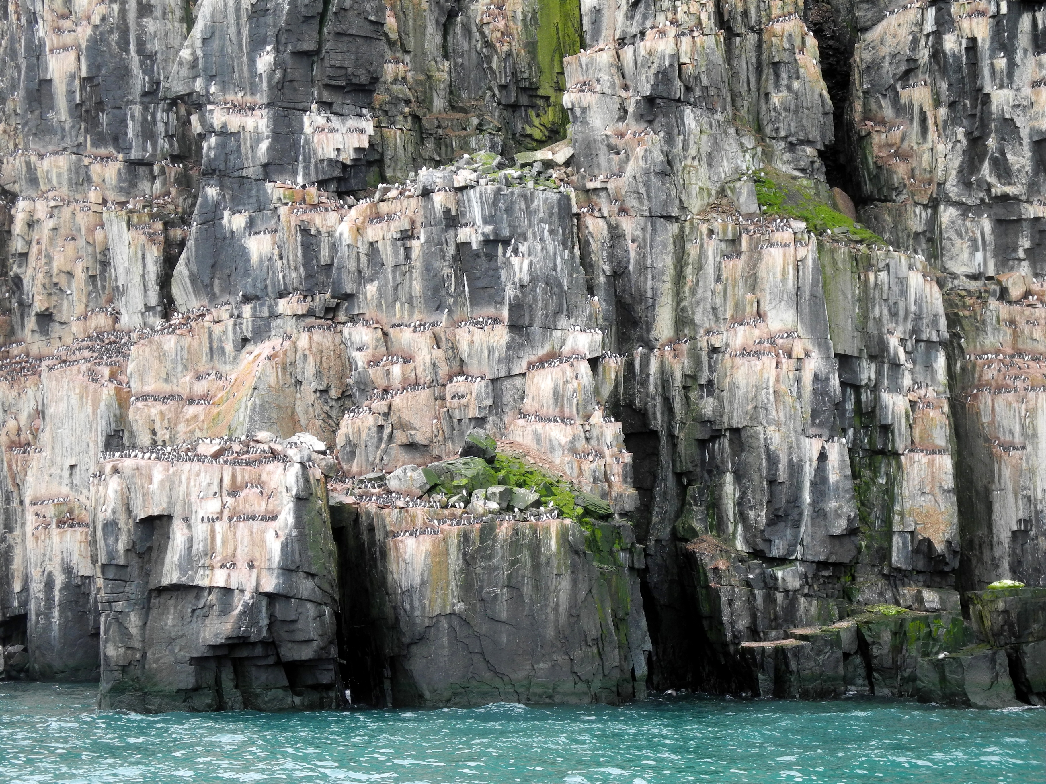
Lomfjordhalvøya is a peninsula at the northeastern part of Ny-Friesland on Spitsbergen, Svalbard. It is 44 kilometers long, and 24 kilometers wide at its base. It is located between Lomfjorden and Hinlopen Strait. Its northern tip is Kapp Fanshawe. Former names of the peninsula include ''Terre Margareta'' and ''Margaretas Land''. The peninsula is covered by two glaciers, Balderfonna and Torsfonna. It also includes the large nesting cliffs of Lovénberget. The peninsula falls within the Nordaust-Svalbard Nature Reserve Nordaust-Svalbard Nature Reserve ( no, Nordaust-Svalbard naturreservat) is located in the north-eastern part of the Svalbard archipelago in Norway. The nature reserve covers all of Nordaustlandet, Kong Karls Land, Kvitøya, Sjuøyane, Storøya, .... References Peninsulas of Spitsbergen {{Spitsbergen-geo-stub ... [...More Info...] [...Related Items...] OR: [Wikipedia] [Google] [Baidu] |
Glacier
A glacier (; ) is a persistent body of dense ice that is constantly moving under its own weight. A glacier forms where the accumulation of snow exceeds its Ablation#Glaciology, ablation over many years, often Century, centuries. It acquires distinguishing features, such as Crevasse, crevasses and Serac, seracs, as it slowly flows and deforms under stresses induced by its weight. As it moves, it abrades rock and debris from its substrate to create landforms such as cirques, moraines, or fjords. Although a glacier may flow into a body of water, it forms only on land and is distinct from the much thinner sea ice and lake ice that form on the surface of bodies of water. On Earth, 99% of glacial ice is contained within vast ice sheets (also known as "continental glaciers") in the polar regions, but glaciers may be found in mountain ranges on every continent other than the Australian mainland, including Oceania's high-latitude oceanic island countries such as New Zealand. Between lati ... [...More Info...] [...Related Items...] OR: [Wikipedia] [Google] [Baidu] |
Spitsbergen
Spitsbergen (; formerly known as West Spitsbergen; Norwegian: ''Vest Spitsbergen'' or ''Vestspitsbergen'' , also sometimes spelled Spitzbergen) is the largest and the only permanently populated island of the Svalbard archipelago in northern Norway. Constituting the westernmost bulk of the archipelago, it borders the Arctic Ocean, the Norwegian Sea, and the Greenland Sea. Spitsbergen covers an area of , making it the largest island in Norway and the 36th-largest in the world. The administrative centre is Longyearbyen. Other settlements, in addition to research outposts, are the Russian mining community of Barentsburg, the research community of Ny-Ålesund, and the mining outpost of Sveagruva. Spitsbergen was covered in of ice in 1999, which was approximately 58.5% of the island's total area. The island was first used as a whaling base in the 17th and 18th centuries, after which it was abandoned. Coal mining started at the end of the 19th century, and several permanent commun ... [...More Info...] [...Related Items...] OR: [Wikipedia] [Google] [Baidu] |
Ny-Friesland
Ny-Friesland is the land area between Wijdefjorden and Hinlopen Strait on Spitsbergen, Svalbard. The area is named after the Dutch province of Friesland Friesland (, ; official fry, Fryslân ), historically and traditionally known as Frisia, is a province of the Netherlands located in the country's northern part. It is situated west of Groningen, northwest of Drenthe and Overijssel, north of .... References Peninsulas of Spitsbergen {{Spitsbergen-geo-stub ... [...More Info...] [...Related Items...] OR: [Wikipedia] [Google] [Baidu] |
Hinlopen Strait
The Hinlopen Strait ( no, Hinlopenstretet) is the strait between Spitsbergen and Nordaustlandet in Svalbard, Norway. It is long and wide. The strait is difficult to pass because of pack ice. It is believed to have been named after Thijmen Jacobsz Hinlopen. The northern part of the strait is called Nordporten, between Storsteinhalvøya and Mosselhalvøya. The southern part, called Sørporten, widens up between Bråsvellbreen and the Bastian Islands The Bastian Islands ( no, Bastianøyane) are a group of islands in Hinlopen Strait, Svalbard. The islands are located southeast of Wilhelm Island Wilhelm Island ( no, Wilhelmøya) is an island in the Svalbard archipelago. It is situated northeast .... References External links * http://www.caplex.no/Web/ArticleView.aspx?id=9314679 (Norwegian) Hinlopen Strait's wildlife Straits of Svalbard {{svalbard-geo-stub ... [...More Info...] [...Related Items...] OR: [Wikipedia] [Google] [Baidu] |
Lomfjorden
Lomfjorden ( en, The Loon Fjord) is a fjord In physical geography, a fjord or fiord () is a long, narrow inlet with steep sides or cliffs, created by a glacier. Fjords exist on the coasts of Alaska, Antarctica, British Columbia, Chile, Denmark, Förden and East Jutland Fjorde, Germany, ... at the eastern coast of Spitsbergen, Svalbard. It has a length of about . Former names of the fjord include ''Bear Bay'', ''Lamber Bay'', ''Loom Bay'', ''Lomme Fjord'' and ''Lommen baij''. References Fjords of Spitsbergen {{Spitsbergen-fjord-stub ... [...More Info...] [...Related Items...] OR: [Wikipedia] [Google] [Baidu] |
Norse Mythology
Norse, Nordic, or Scandinavian mythology is the body of myths belonging to the North Germanic peoples, stemming from Old Norse religion and continuing after the Christianization of Scandinavia, and into the Nordic folklore of the modern period. The northernmost extension of Germanic mythology and stemming from Proto-Germanic folklore, Norse mythology consists of tales of various deities, beings, and heroes derived from numerous sources from both before and after the pagan period, including medieval manuscripts, archaeological representations, and folk tradition. The source texts mention numerous gods such as the thunder-god Thor, the raven-flanked god Odin, the goddess Freyja, and numerous other deities. Most of the surviving mythology centers on the plights of the gods and their interaction with several other beings, such as humanity and the jötnar, beings who may be friends, lovers, foes, or family members of the gods. The cosmos in Norse mythology consists of Nine Worl ... [...More Info...] [...Related Items...] OR: [Wikipedia] [Google] [Baidu] |
Balder
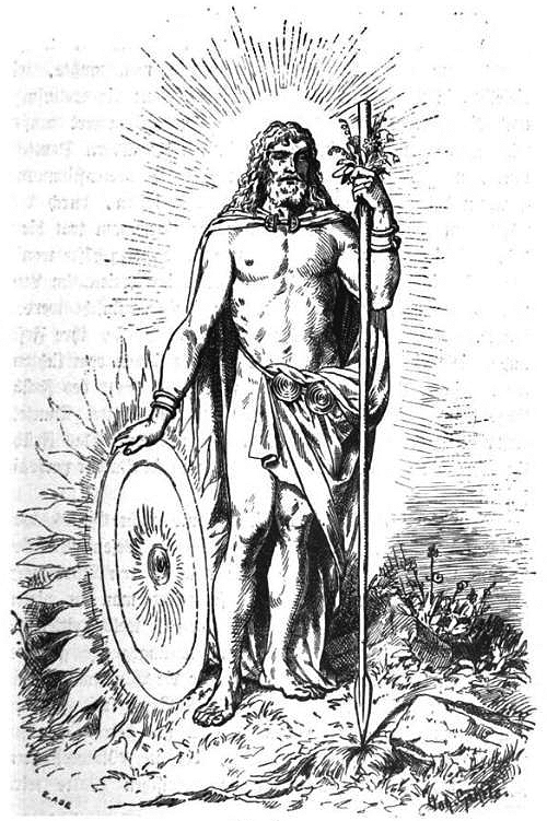
Baldr (also Balder, Baldur) is a god in Germanic mythology. In Norse mythology, Baldr (Old Norse: ) is a son of the god Odin and the goddess Frigg, and has numerous brothers, such as Thor and Váli. In wider Germanic mythology, the god was known in Old English as , and in Old High German as , all ultimately stemming from the Proto-Germanic theonym ('hero' or 'prince'). During the 12th century, Danish accounts by Saxo Grammaticus and other Danish Latin chroniclers recorded a euhemerized account of his story. Compiled in Iceland during the 13th century, but based on older Old Norse poetry, the ''Poetic Edda'' and the ''Prose Edda'' contain numerous references to the death of Baldr as both a great tragedy to the Æsir and a harbinger of Ragnarök. According to ''Gylfaginning'', a book of Snorri Sturluson's Prose Edda, Baldr's wife is Nanna and their son is Forseti. Baldr had the greatest ship ever built, Hringhorni, and there is no place more beautiful than his hall, Breidablik. ... [...More Info...] [...Related Items...] OR: [Wikipedia] [Google] [Baidu] |
Norwegian Polar Institute
The Norwegian Polar Institute (NPI; no, Norsk Polarinstitutt) is Norway's central governmental institution for scientific research, mapping and environmental monitoring in the Arctic and the Antarctic. The NPI is a directorate under Norway's Ministry of Climate and Environment. The institute advises Norwegian authorities on matters concerning polar environmental management and is the official environmental management body for Norwegian activities in Antarctica. Activities The institute's activities are focused on environmental research and management in the polar regions. The NPI's researchers investigate biodiversity, climate and environmental toxins in the Arctic and Antarctic, and in this context the institute equips and organizes large-scale expeditions to both polar regions. The institute contributes to national and international climate work, and is an active contact point for the international scientific community. The institute collects and analyses data on the environm ... [...More Info...] [...Related Items...] OR: [Wikipedia] [Google] [Baidu] |


