|
Baixo Alentejo Province
Baixo Alentejo was a Portuguese province. It was abolished with the Constitution of 1976. Districts * Beja District * Setúbal District (southern half) Subregions The area is equal to the area covered by Baixo Alentejo Subregion and Alentejo Litoral Subregion The Comunidade Intermunicipal do Alentejo Litoral () is an administrative division in Portugal. It was created in May 2009. It is also a NUTS3 subregion of the Alentejo Region. [...More Info...] [...Related Items...] OR: [Wikipedia] [Google] [Baidu] |
Administrative Divisions Of Portugal
Administratively, Portugal is ''de jure'' unitary and decentralized state. Nonetheless, operationally, it is a highly centralized system with administrative divisions organized into three tiers.Carlos Nuno Silva (2002), p.5 The State is organized under the principles of subsidiarity, local government autonomy, and democratic decentralization of the public service. The government structure is based on the 1976 Constitution, adopted after the 1974 Carnation Revolution. In addition to defining the status of the autonomous regions ( pt, regiões autónomas) Azores and Madeira (Articles 225-234), the Constitution specifically identifies the three tiers of government (Article 235-262): civil parishes (''freguesias''), municipalities (''municípios'') and administrative regions (). In addition, the Portuguese territory was redefined during European integration, under a system of statistical regions and subregions known as Nomenclature of Territorial Units for Statistics. These NUT ... [...More Info...] [...Related Items...] OR: [Wikipedia] [Google] [Baidu] |
Cuba Municipality
Cuba () is a town and municipality in the District of Beja in Portugal. The population in 2011 was 4,878, in an area of 172.09 km2. The current mayor (since 2013) is João Português. The municipal holiday is Monday after Easter. History The name "Cuba" is likely of Arabic origin, pertaining to the qubba, that is cupola or domed tombs of ascetic spiritual leaders. Such toponyms are frequent in Southern Portugal and likely related to the Sufi movements that flourished during the period of Almoravid decay, such as the one led by Ibn Qasi. In the 20th century a small number of scholars sought to make Columbus a Portuguese man. One of these attempts had him born in the town of Cuba, after which he would have named the Caribbean island (see possible birthplace of Christopher Columbus). A statue honouring the explorer can be seen in the city centre. Parishes Administratively, the municipality is divided into 4 civil parishes (''freguesias''): * Cuba * Faro do Alentejo * Vila ... [...More Info...] [...Related Items...] OR: [Wikipedia] [Google] [Baidu] |
Provinces Of Portugal (1936–1976)
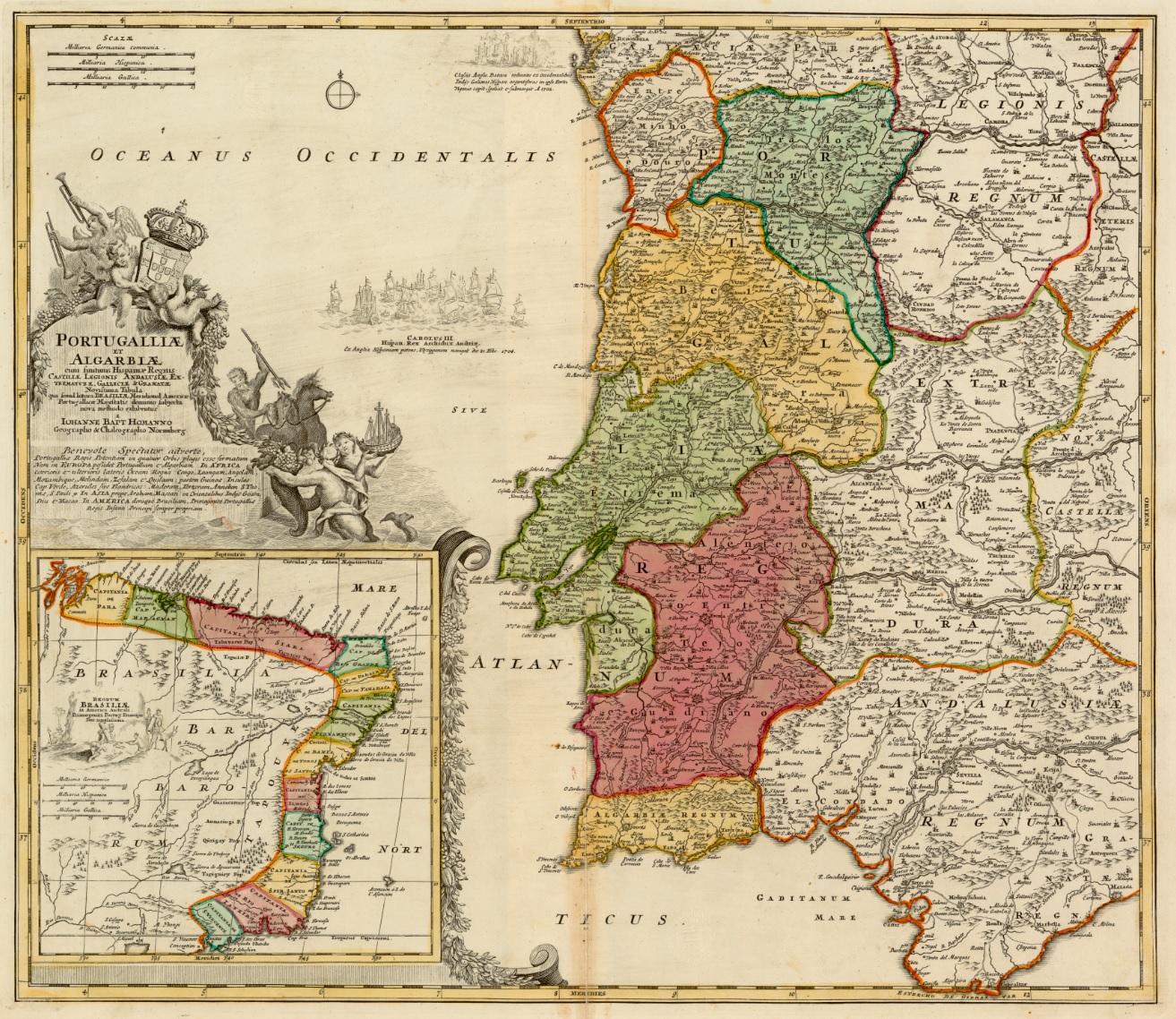
The term "provinces" ( pt, províncias) has been used throughout history to identify regions of continental Portugal. Current legal subdivisions of Portugal do not coincide with the provinces, but several provinces, in their 19th- and 20th-century versions, still correspond to culturally relevant, strongly self-identifying categories. They include: *Alentejo *Algarve * Beira *Douro Litoral * Estremadura * Minho *Ribatejo * Trás-os-Montes The islands of Azores and Madeira were never called "provinces". History The first provinces, instituted during the Roman occupation of the Iberian peninsula, divided the peninsula into three areas: Tarraconensis, Lusitania and Baetica, established by Roman Emperor Augustus between 27–13 B.C. Emperor Diocletian reordered these territories in the third century, dividing Tarraconesis into three separate territories: Tarraconensis, Carthaginensis and Gallaecia. At that time Tarraconesis included northern Portugal, Gallaecia and Asturias.José ... [...More Info...] [...Related Items...] OR: [Wikipedia] [Google] [Baidu] |
Alentejo
Alentejo ( , ) is a geographical, historical, and cultural region of south–central and southern Portugal. In Portuguese, its name means "beyond () the Tagus river" (''Tejo''). Alentejo includes the regions of Alto Alentejo and Baixo Alentejo. It corresponds to the districts of Beja, Évora, Portalegre, and Alentejo Litoral. Its main cities are Évora, Beja, Sines, Serpa, Estremoz, Elvas, and Portalegre. It has borders with Beira Baixa in the north, with Spain (Andalucia and Extremadura) in the east, Algarve in the south, and the Atlantic Ocean, Ribatejo, and Estremadura in the west. Alentejo is a region known for its traditional polyphonic singing groups, similar to those found in Tuscany, Corsica, and elsewhere. History The comarca of the Alentejo became the Alentejo Province, divided into upper (Alto Alentejo Province) and lower (Baixo Alentejo Province) designations. The modern NUTS statistical region, Alentejo Region, was expropriated from the medieval provi ... [...More Info...] [...Related Items...] OR: [Wikipedia] [Google] [Baidu] |
Vidigueira Municipality
Vidigueira ( or ) is a town and a municipality in the District of Beja in Portugal. The population in 2011 was 5,932, in an area of 316.61 km2. The present Mayor is Manuel Rosa Narra, elected by the Unitary Democratic Coalition. The municipal holiday is Ascension Day. The archaeological site of the Roman Ruins of Villa Áulica and Convent of São Cucufate are situated near Vidigueira. Parishes Administratively, the municipality is divided into 4 civil parishes (''freguesias''): * Pedrógão * Selmes * Vidigueira * Vila de Frades Notable people * Vasco da Gama (c.1460s – 1524) the Portuguese navigator, was made Count of Vidigueira by King Manuel I on the return from his discovery of the maritime route from Europe to India * Achilles Statius (1524 in Vidigueira – 1581) humanist poet and commentator * The father of Baruch Spinoza (1662-1677) the Dutch philosopher, lived in Vidigueira in the 17th century, before escaping from the Portuguese Inquisition to the Dutch Republi ... [...More Info...] [...Related Items...] OR: [Wikipedia] [Google] [Baidu] |
Sines Municipality
Sines () is a city and a municipality in Portugal. The municipality, divided into two parishes, has around 14,214 inhabitants (2021) in an area of . Sines holds an important oil refinery and several petrochemical industries. It is also a popular beach spot and the main fishing harbor of Alentejo region. The municipality is bordered to the north and east by the municipality of Santiago do Cacém, south by Odemira and west by the Atlantic Ocean. The coastline of the city, south of São Torpes, is part of the Southwest Alentejo and Vicentine Coast Natural Park. History Vestiges of a few settlements have today been discovered in archaeological sites, such as Palmeirinha and Quitéria, that attest to the age of human settlements in Sines. Arnaldo Soledade (1981) noted that these Visigoths, identified as ''Cinetos'', may have been the original civilization that gave rise to the community, suggesting the local toponymy may have derived from this; ''Cinetos'', to Cines and, finally, S ... [...More Info...] [...Related Items...] OR: [Wikipedia] [Google] [Baidu] |
Serpa Municipality
Serpa () is a city and a Concelho (municipality) in the central Portuguese region Alentejo. The population in 2011 was 15,623, in an area of . The Guadiana River flows close to the town of Serpa. History Serpa has its origins in early settlement that preceded the Roman occupation of the Iberian peninsula. The neighbouring town of Beja (known as ''Pax Julia'' by the Romans) became the capital of southern Lusitanian (''Pacensis''). Serpa grew through the settlement of Roman colonists, with proof coming from various archaeological remains within the Roman villa. Moorish settlement followed this period, and remained until the Reconquista (the Christian re-conquest of Iberia). As a result of Serpa's proximity to the Spanish border, the town has always been a defensive stronghold. In the 13th century, owing to its location on the left bank of the Guadiana, it was occupied by forces loyal to Castile. On 1281, King D. Alfonso X of Castile delimited the municipality, attributing a F ... [...More Info...] [...Related Items...] OR: [Wikipedia] [Google] [Baidu] |
Santiago Do Cacém Municipality
Santiago (, ; ), also known as Santiago de Chile, is the capital and largest city of Chile as well as one of the largest cities in the Americas. It is the center of Chile's most densely populated region, the Santiago Metropolitan Region, whose total population is 8 million which is nearly 40% of the country's population, of which more than 6 million live in the city's continuous urban area. The city is entirely in the country's central valley. Most of the city lies between above mean sea level. Founded in 1541 by the Spanish conquistador Pedro de Valdivia, Santiago has been the capital city of Chile since colonial times. The city has a downtown core of 19th-century neoclassical architecture and winding side-streets, dotted by art deco, neo-gothic, and other styles. Santiago's cityscape is shaped by several stand-alone hills and the fast-flowing Mapocho River, lined by parks such as Parque Forestal and Balmaceda Park. The Andes Mountains can be seen from most points i ... [...More Info...] [...Related Items...] OR: [Wikipedia] [Google] [Baidu] |
Ourique Municipality
Ourique () is a city in the District of Beja in Portugal. The population in 2011 was 5,389, in an area of 663.31 km2. This town is traditionally considered the site of the famous Battle of Ourique in 1139, which saw the forces of Portuguese Prince Afonso Henriques defeat a Muslim Almoravid force. The present Mayor is Marcelo Guerreiro, elected by the Socialist Party, who became the youngest Mayor in Portugal, aged 25, in 2015. The municipal holiday is September 8. Battle of Ourique There is no certainty about the exact location of the battle of Ourique, although it is typically said to have taken place in the countryside between the towns of Castro Verde and Ourique. Five Muslim kings allied their forces against the Portuguese army, but after a terrible and lengthy fight, the allied forces became scattered in the Alentejo plains. This would later be considered by the Portuguese to have been a divine miracle, forever forming part of the legend of Castro Verde. According to m ... [...More Info...] [...Related Items...] OR: [Wikipedia] [Google] [Baidu] |
Odemira Municipality
Odemira ( or ) is a town and a municipality in Beja District in the Portuguese region of Alentejo. The population in 2011 was 26,066, in an area of 1720.60 km2, making it the largest municipality of Portugal by area. It is famous for its wild beaches and for being home to a significant Dutch and German community. The village of Zambujeira do Mar is home to the Festival do Sudoeste, one of the biggest rock festivals in Europe. The municipality of Odemira has great agricultural potential, specially in the western area of the region, and is home to major operations of important agricultural companies like Vitacress, world leader in the salad market. The present Mayor is José Alberto Guerreiro, elected by the Socialist Party. The municipal holiday is 8 September. Geography The municipality of Odemira is located in southwestern Portugal, bordered by the municipalities of Sines and Santiago do Cacém to the north, Ourique to the east, and the Algarvian municipalities of Alj ... [...More Info...] [...Related Items...] OR: [Wikipedia] [Google] [Baidu] |
Moura Municipality
Moura () is a city and a municipality in the District of Beja in Portugal, subdivided into 5 ''freguesias''. The population in 2011 was 15,167, in an area of 958.46 km2. The city itself had a population of 8,459 in 2001. It has now around 11,000 inhabitants. The current Mayor is José Pós de Mina, elected by the Unitary Democratic Coalition. The municipal holiday is 24 June. It is home to Moura Photovoltaic Power Station, one of Europe's largest solar-power facilities. Parishes Administratively, the municipality is divided into 5 civil parishes (''freguesias''): * Amareleja * Moura (Santo Agostinho e São João Baptista) e Santo Amador * Póvoa de São Miguel * Safara e Santo Aleixo da Restauração * Sobral da Adiça Climate Moura has a Mediterranean climate with very hot, dry summers and mild winters. It is one of the driest areas in Portugal with just over of precipitation. Town Twinning Moura has cooperation agreements with the following cities: * Aroche, Sp ... [...More Info...] [...Related Items...] OR: [Wikipedia] [Google] [Baidu] |
Mértola Municipality
Mértola () is a municipality in southeastern Portuguese Alentejo near the Spanish border. In 2011, the population was 7,274, in an area of approximately : it is the sixth-largest municipality in Portugal. Meanwhile, it is the second-lowest population centre by density with approximately 5.62 persons/ (second to the adjacent Alcoutim). The seat of the municipality is the town of Mértola, which has around 2800 inhabitants (2011), located on a hill over the Guadiana River. Its strategic location made it an important fluvial commercial port in Classical Antiquity, through the period of Umayyad conquest of Hispania: Mértola's main church (the Church of Nossa Senhora da Anunciação) was the only medieval mosque to have survived the period in Portugal. In 2017 Mértola started the process to become a UNESCO World Heritage Site. History Romans Mértola was inhabited at least since the Iron Age at least by Conni and Cynetes settlements, was influenced by the Phoenicians and finally ... [...More Info...] [...Related Items...] OR: [Wikipedia] [Google] [Baidu] |


.jpg)
